
Japan · Summer · Self-Drive
The quickest way to escape a Japanese summer is not to head north — it is to gain altitude. Air cools by roughly 0.6°C for every 100 metres you climb, so on a like-for-like day a plateau at 1,000 m runs about 6°C cooler than the city below it, and a limestone cave stays at a steady 11–17°C while the surface swelters. Some of these 13 I have driven myself — Hiruzen, the Daisen area, Nikko, Aso — and the rest I have mapped from official sources; here they are, grouped by region from the Kanto plain down to Kyushu.
Quick facts: cool summer drives in Japan
I have reported on cooler-air escapes across Japan — the volcano grasslands of Kusasenri in Aso, the Jersey-cattle plateau at Hiruzen, the car-free valley of Kamikochi (which bans private cars, so it isn’t on this driving list; my Kamikochi access guide covers the shuttle buses from Sawando and Hirayu). This guide pulls the drivable ones into one place. For the wider picture of where the heat breaks in Japan, start with my 2026 coolcation guide and the cool day trips from Tokyo; this page is the road-trip version.
Why highlands (and caves) actually feel cooler
The number to remember is the lapse rate: as you climb, the air thins and cools by about 0.6°C per 100 metres — a rule of thumb, not a guarantee, since weather and exposure shift it. It still shows up in the normals: Oku-Nikko, near 1,300–1,500 m, has an August average high around 22.9°C against roughly 31°C in central Tokyo (JMA 1991–2020). Mt. Rokko’s tourism office puts the summit ridge at about 5°C cooler than downtown Kobe.
Caves are the other trick. Underground temperature holds close to the local year-round average, so Akiyoshido stays at a constant 17°C and the Nippara Limestone Cave near Tokyo sits around 11°C — cold enough that you want a light layer walking in from a 35°C afternoon. Water helps too: a waterfall gorge or a lakeshore adds spray, shade and a breeze that the temperature reading alone doesn’t capture.
Do you actually need a car for these?
Honestly, it depends on the spot. A few of these highlands are genuinely doable without a car: Oku-Nikko (Tobu buses up Iroha-zaka), Mt. Rokko (city bus plus cable car from Kobe), and Akiyoshido (direct bus from Shin-Yamaguchi Station). But the reason they are on a driving list is the roads themselves — the Aso Panorama Line, the Yamanami Highway, the Shiraito Highland Way — and the plateaus like Hirugano, Hiruzen and Taishakukyo where sights are spread out and buses run a few times a day. For those, a rental car is the difference between reaching them and not.
Plan a cool-summer drive
Renting and driving in Japan, briefly
Most visitors need an International Driving Permit (the 1949 Geneva Convention type) alongside their home licence, arranged before you fly — though a few countries (Germany, France, Switzerland, Belgium, Taiwan, Monaco) instead need an official Japanese translation of their licence, so check your case first. Cars drive on the left, most rentals are automatic, and an ETC card for the expressway tolls saves fumbling for cash at the gates. If highway tolls and expressway logic are new to you, I wrote a full walkthrough in how to use Japan’s highway system with a rental car. For the booking itself, DiscoverCars compares the Japanese agencies in English; Rakuten Travel’s rental arm is worth comparing for domestic pickups too. (Some links here are affiliate links — booking through them supports this site at no extra cost to you.)
Book the car before the hotel
Summer weekends and the Obon week (mid-August) clear out the cheap automatics first, especially at regional airports like Kumamoto, Yonago and Toyama. Compare across agencies early, then lock the highland lodging around it.
Kanto — closest to Tokyo
1. Nasu Highlands 那須高原 · Tochigi
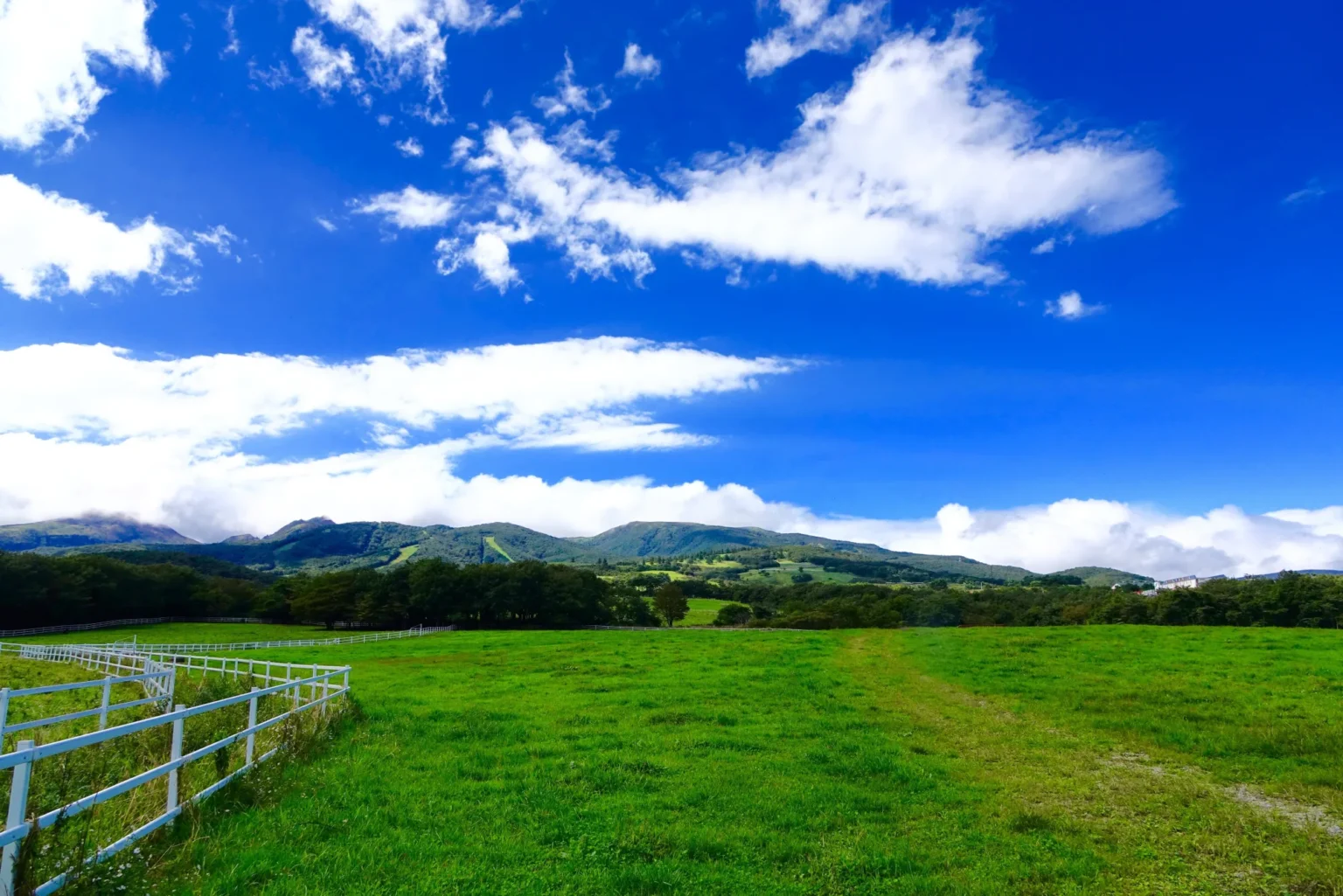
A volcanic resort belt where the pastures and pensions sit 600–1,000 m up, so summer days run clearly cooler than the Kanto plain. The Nasu Ropeway lifts you to about 1,684 m on the shoulder of Mt. Chausu (Nasudake), an active 1,915 m volcano, for open alpine air and long views before you loop back down past the farms.
Getting there: Tohoku Shinkansen to Nasushiobara (~70 min from Tokyo), then 40–60 min by car up into the highland. Kanto Bus runs from Nasushiobara to Nasu Yumoto Onsen and the ropeway, but it is seasonal and infrequent. Ropeway 2026: season Mar 20–Dec 13, 8:30–16:30, adult ¥2,000 round trip / ¥1,500 one way. Parking: free at the ropeway base. Stay: Nasu Yumoto Onsen.
2. Nippara Limestone Cave 日原鍾乳洞 · Okutama, Tokyo
Proof that you don’t have to leave Tokyo to find cold air: one of the Kanto region’s largest limestone caves sits up the Nippara valley in Okutama, and its lit passages hold a steady ~11°C all year — bring a light layer if you are coming in from a 35°C afternoon. The shaded gorge along the river is cool on its own.
Getting there: JR Ome Line to Okutama Station (~2 hr from Shinjuku), then a narrow mountain road to the cave — best by car outside peak times. Hours/fee 2026: 9:00–17:00 (to 16:30 Dec–Mar), adult ¥900, cash only, closed Dec 30–Jan 3. Parking: around 100 spaces; holiday waits of 1–3 hours are common on the single-lane approach. Stay: around Okutama Station or Lake Okutama.
3. Oku-Nikko: Senjogahara & Lake Chuzenji 奥日光・戦場ヶ原・中禅寺湖 · Tochigi
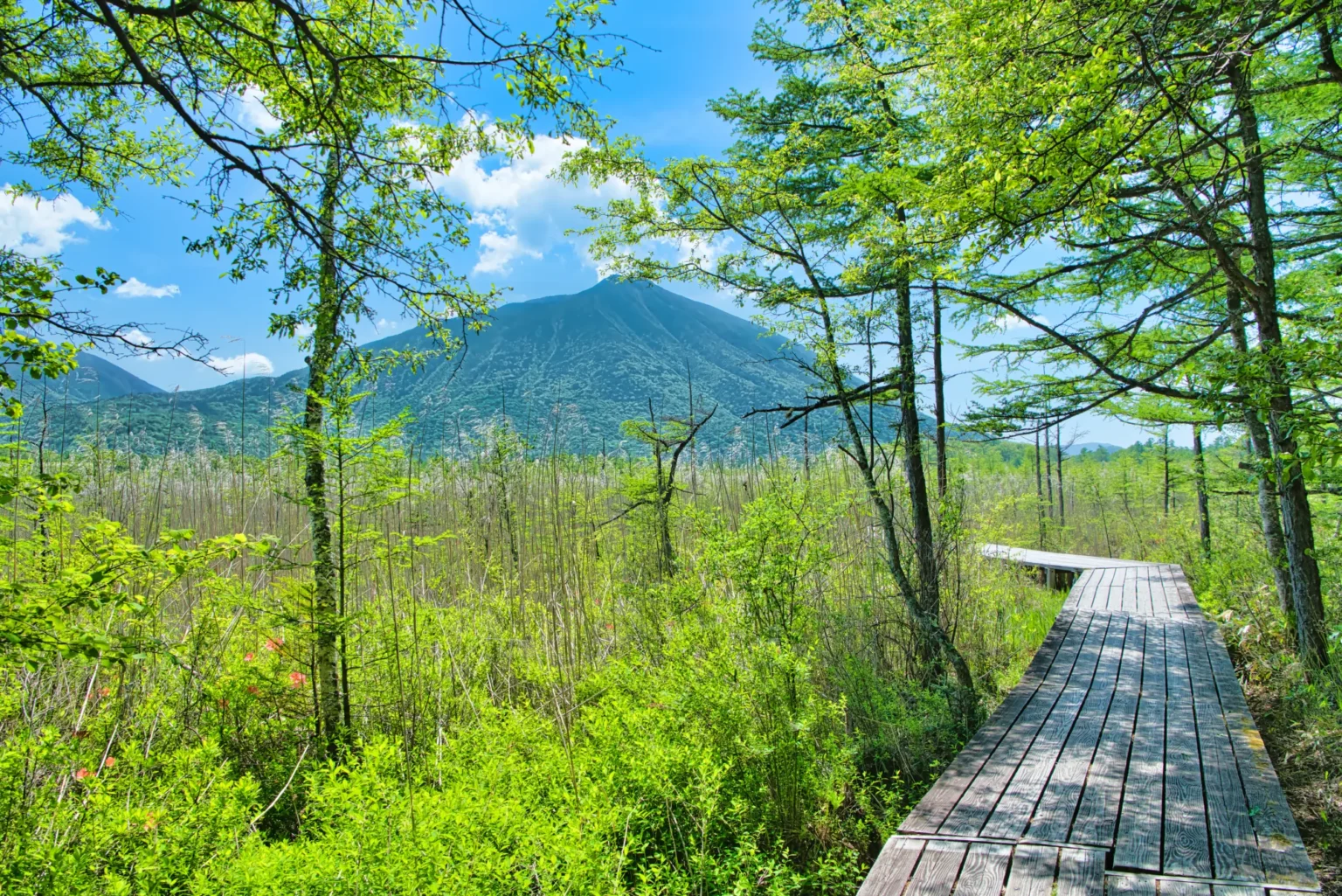
The strongest cool-air payoff near Tokyo. Above the Iroha-zaka switchbacks, Lake Chuzenji sits at 1,269 m — Japan’s highest large lake — and the Senjogahara marsh boardwalk crosses a 400-hectare plateau near 1,390 m. Oku-Nikko’s August average high is about 22.9°C, roughly 8°C below central Tokyo. The flat marsh loop stays cool and shaded even mid-afternoon.
Getting there: ~2–2.5 hr drive from Tokyo via the Nikko-Utsunomiya Expressway, then Iroha-zaka up to the lake. Or go car-free: Tobu buses run from Nikko stations up to Chuzenji Onsen, Ryuzu Falls and Senjogahara. Cost: the marsh and lakeshore are free; the cruise and the Kegon Falls elevator are paid. Stay: Chuzenji Onsen, or quieter Yumoto Onsen higher up.
Most people only know Nikko for Toshogu Shrine and its winter face; the summer highlands above it are a different trip. See my Tochigi waterfall guide for the falls you can string along the same drive.
Chubu & Hokuriku
4. Karuizawa & Shiraito Falls 軽井沢・白糸の滝 · Nagano
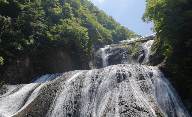
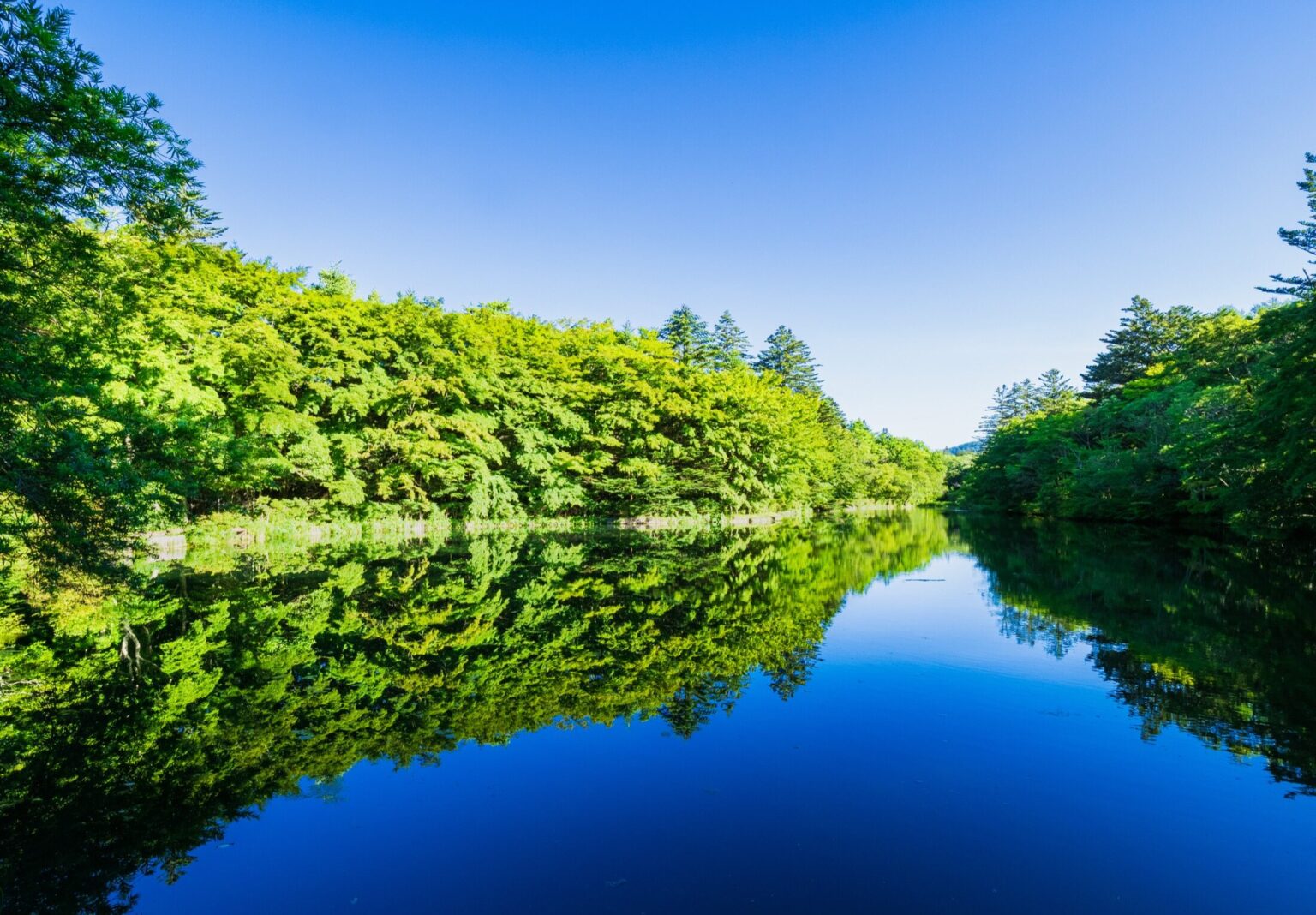
Karuizawa has been Japan’s original summer retreat since the Meiji era for one reason: it sits near 1,000 m, an hour and ten minutes from Tokyo by Shinkansen. Drive up the Shiraito Highland Way and you reach the fan-shaped Shiraito Falls — a ~70 m-wide curtain of pure groundwater dropping only about 3 m. Because rain on Mt. Asama is said to seep through for around six years before it emerges, the water arrives cold and near-constant, chilling the whole grotto.
Getting there: Hokuriku Shinkansen to Karuizawa (~1 hr 10 from Tokyo); the falls are ~20–25 min by car from Karuizawa Station (or ~50 min up from the Usui-Karuizawa IC) via the Shiraito Highland Way, a private toll road. A Kusakaru Kotsu bus toward Kusatsu also stops at Shiraito-no-taki (~25 min). Cost: the falls are free; the highland way charges a car toll. Stay: old Karuizawa (Kyu-Karuizawa) for cafes and forest.
5. Shomyo Falls 称名滝 · Tateyama, Toyama
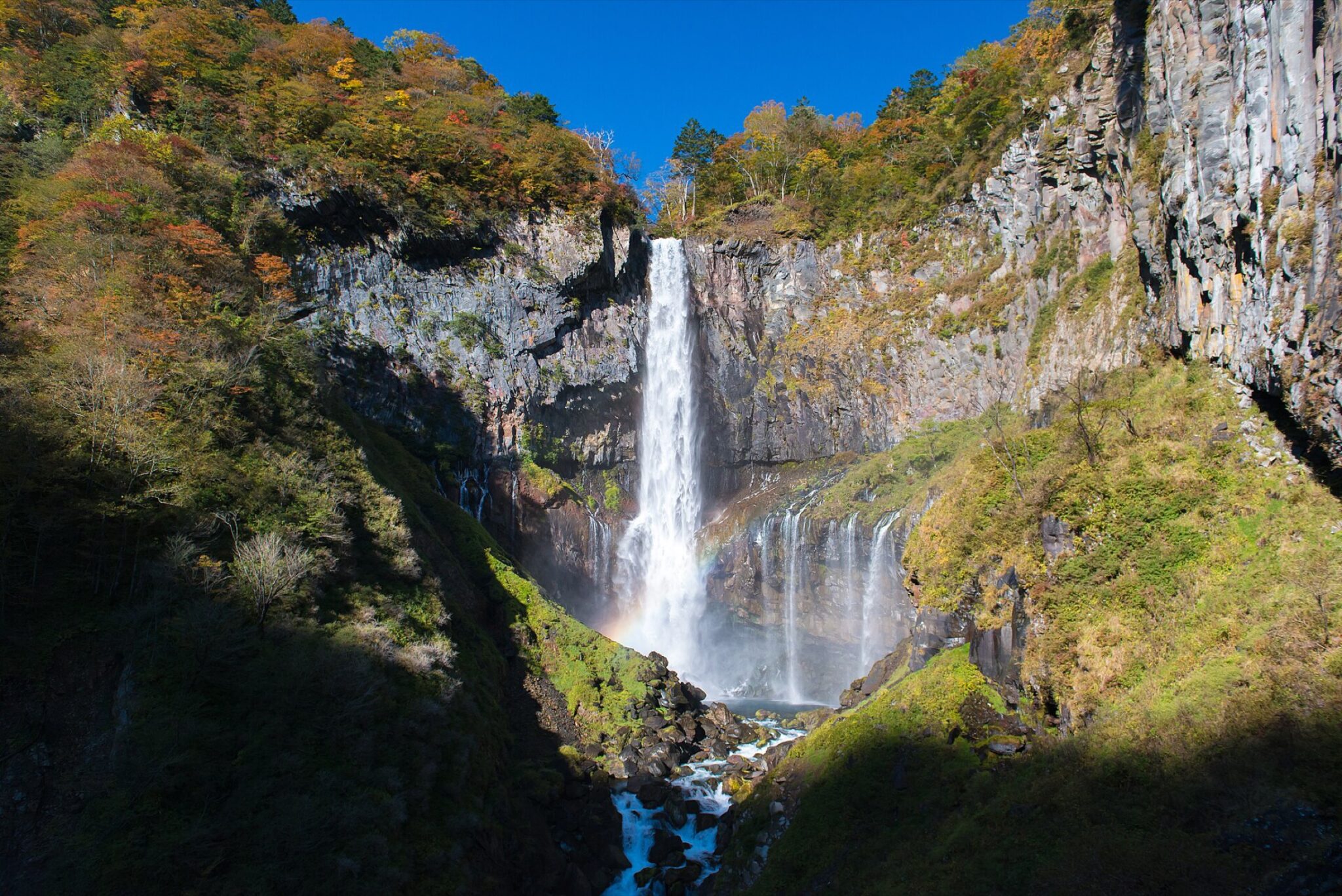
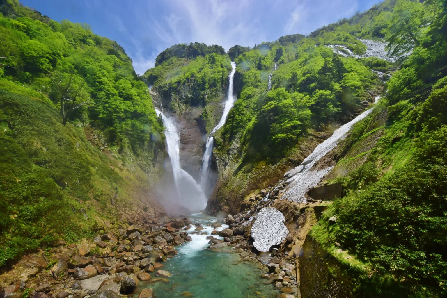
Japan’s tallest waterfall drops 350 m in four stages into a deep V-shaped gorge at around 1,000 m, at the mouth of the Tateyama mountains. The constant cold spray and dense forest shade keep the walk to the viewpoint cooler than the valley floor. In late spring and early summer the phantom Hannoki Falls (about 500 m) appears alongside it during heavy snowmelt.
Getting there: ~1 hr by car from Toyama city to the Tateyama Station area, then up the gorge road to the Shomyo-daira parking; you can drive it during gate hours, and a seasonal bus (~15 min, ~¥500) also runs from Tateyama Station. Hours 2026: gate open Jul–Aug 6:00–19:00 (7:00–18:00 other months). Cost: viewing is free. Parking: free at Shomyo-daira (~250 spaces) and at Tateyama Station. Stay: Tateyama/Ashikuraji, or Toyama city. See my full Shomyo Falls guide.
6. Hirugano Plateau ひるがの高原 · Gujo, Gifu
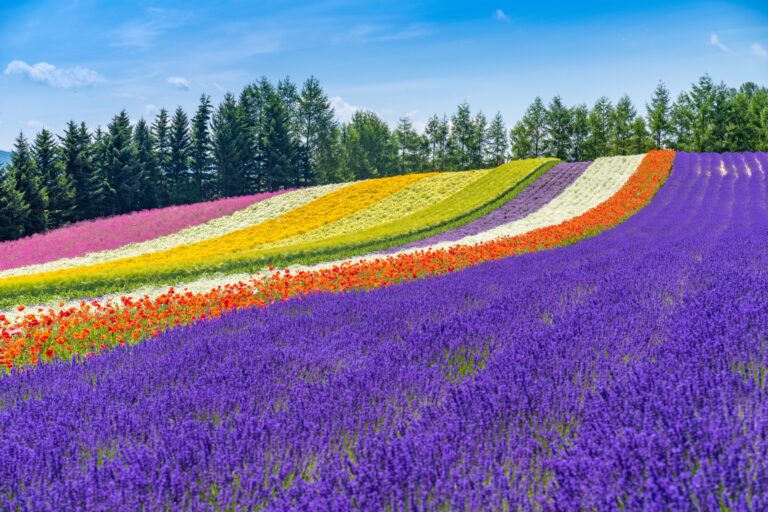
A breezy plateau near 900–1,000 m off the Tokai-Hokuriku Expressway, marketed frankly as “a cool summer at 1,000 metres.” The oddest stop is the Bunsuirei watershed park, where a single stream splits and sends water toward both the Sea of Japan and the Pacific. The Bokka no Sato farm park adds flower fields and animals, and the highland soft-serve is the reward at the top.
Getting there: ~2 hr by car from Nagoya via the Tokai-Hokuriku Expressway (Takasu IC, or the ETC-only Hirugano Kogen Smart IC). Highway buses run from Nagoya but the sights are spread out. Bokka no Sato 2026: green season 18 Apr–23 Nov; summer hours 9:00–17:00; adult ¥1,500. Bunsuirei Park is free. Stay: Hirugano pension area, or the castle town of Gujo Hachiman below.
It pairs naturally with a bigger Gifu highland loop — the same expressway carries on to the thatched-roof valley of Shirakawa-go.
Kansai & Chugoku
7. Mt. Rokko 六甲山 · Hyogo
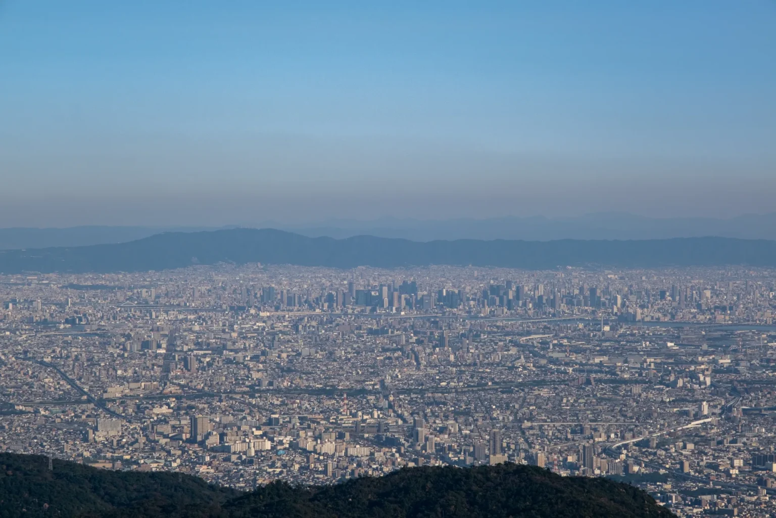
The easiest highland escape from a big city. Rokko rises 931 m directly above Kobe, and the tourism office states the ridge runs about 5°C cooler than downtown. Up top you get a botanical garden of cool-climate plants, a lattice “cold wind” observatory, and after dark the famous ten-million-dollar night view over the bay.
Getting there: ~40 min by car from Sannomiya, or car-free via Kobe City Bus #16 to Rokko Cable-shita, the Rokko Cable Car to the summit (2026: adult ¥800 one way / ¥1,550 round trip, ~every 20 min), then the summit loop bus. Cost: the mountain is free; each attraction charges separately. Stay: central Kobe, or Arima Onsen over the north ridge. See my full Mt. Rokko guide.
8. Hiruzen Highlands 蒜山高原 · Okayama
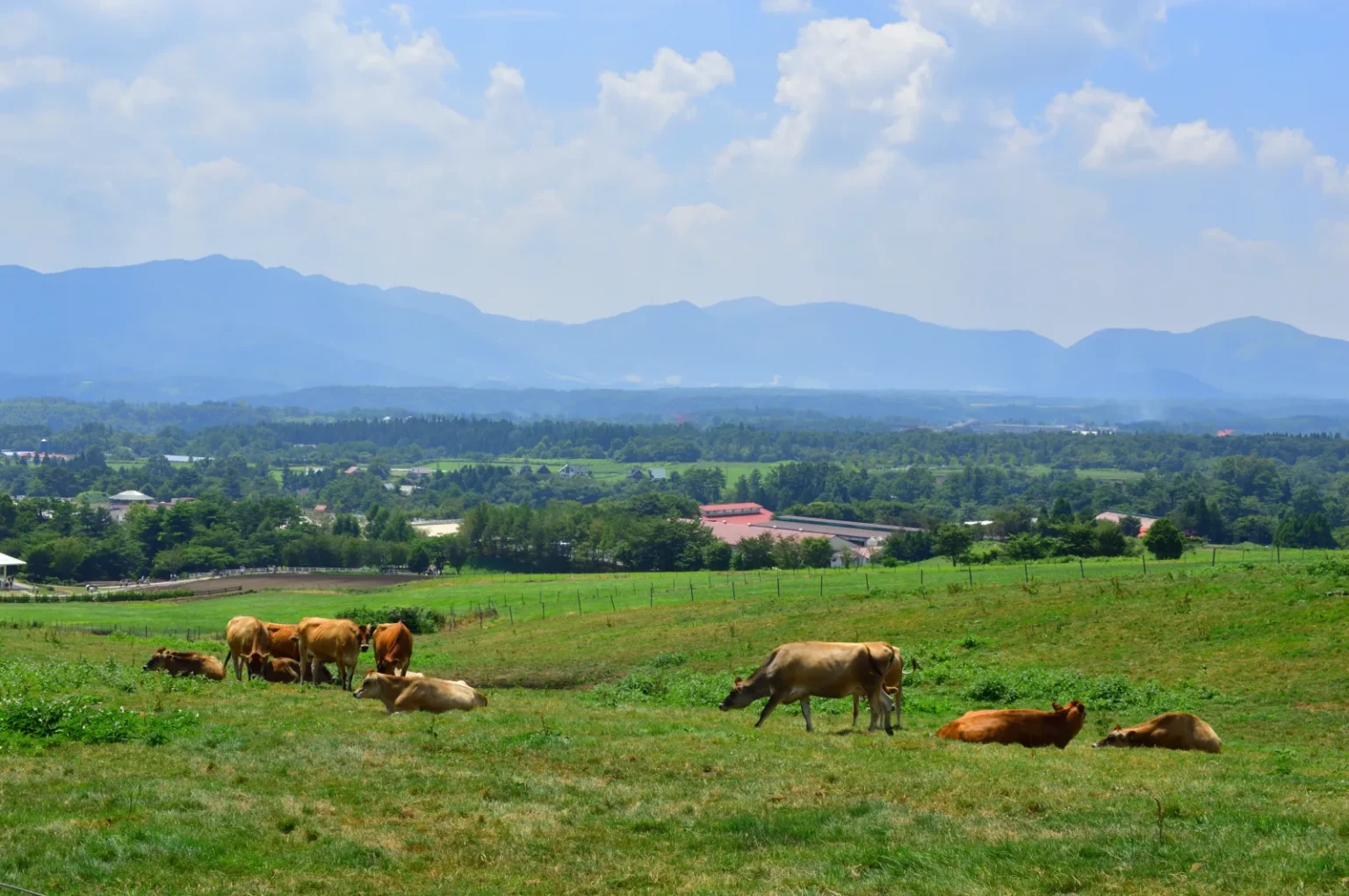
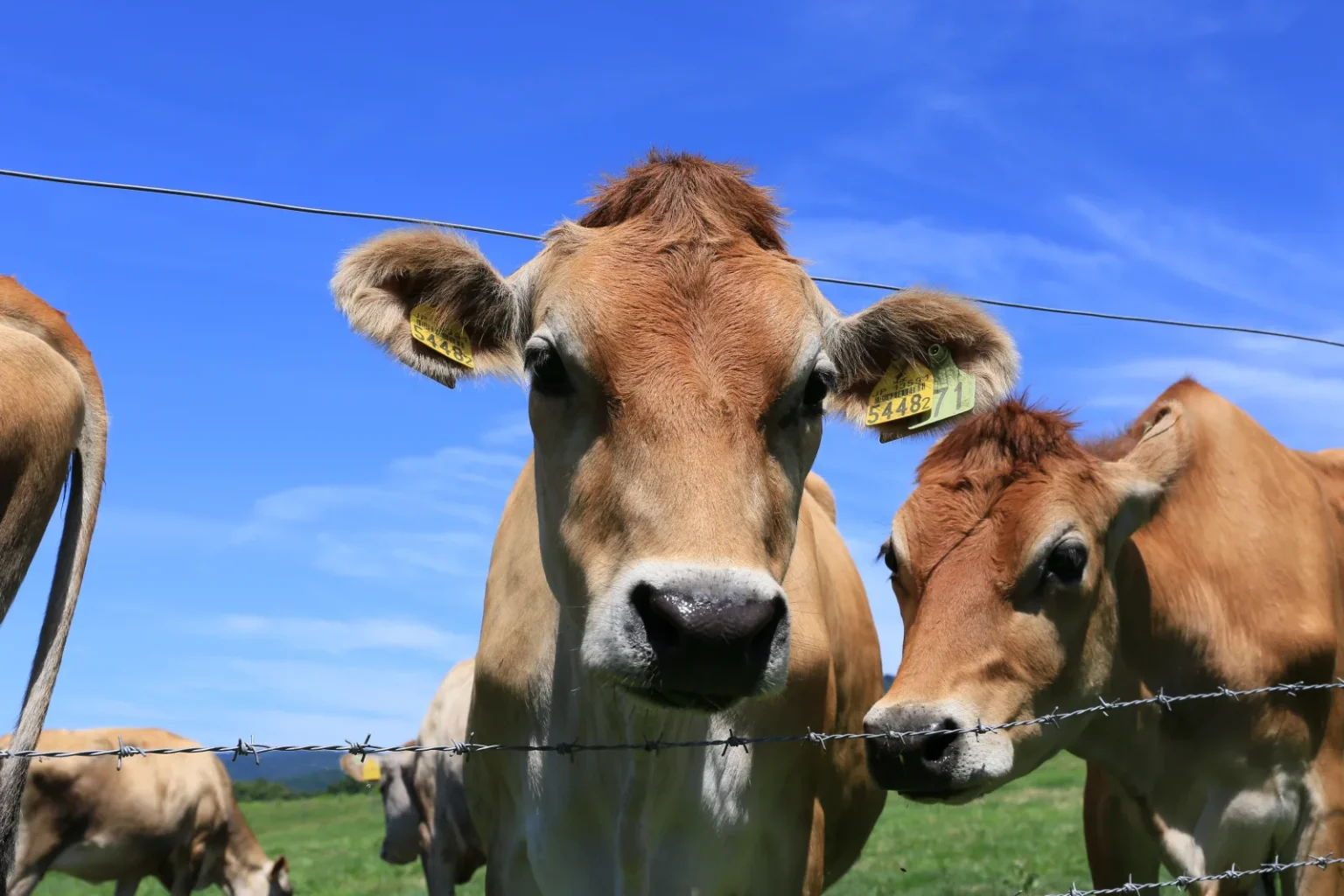
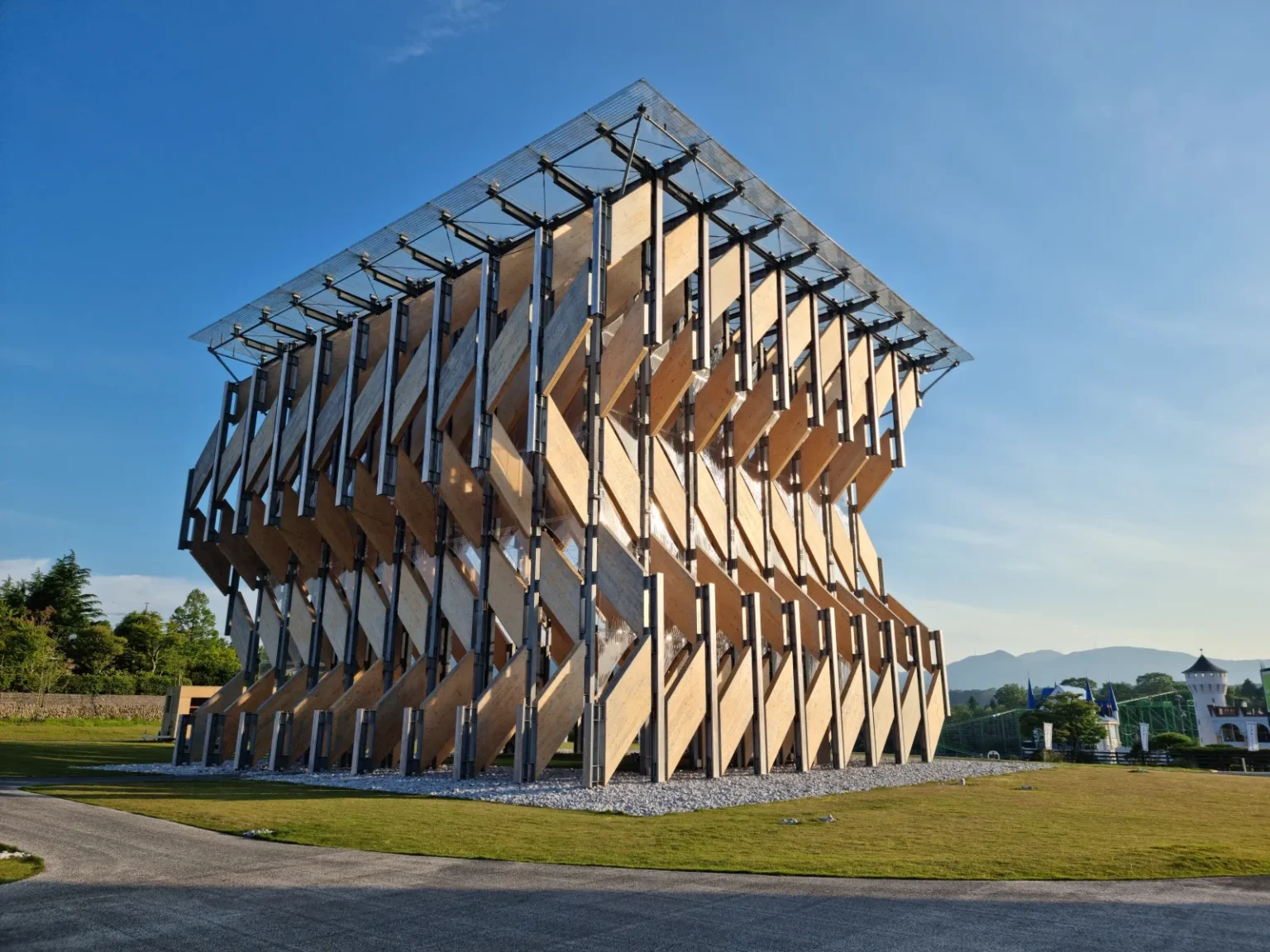
Locals call it “the Karuizawa of western Japan” — an open pastoral plateau at 500–600 m below three 1,100 m peaks, with Jersey cattle, a long cycling road across the meadows, and a highland wind that keeps summer mild. The Jersey milk soft-serve and the local Hiruzen yakisoba are worth the drive on their own, and Kengo Kuma’s cross-laminated-timber pavilion, GREENable Hiruzen, is worth the stop for the building alone.
Getting there: ~20 min from Hiruzen IC on the Yonago Expressway; ~1 hr 45 from Okayama city. Public transport is a sparse community bus, so a car is strongly recommended. Cost: the highland is free; facilities charge separately. Stay: Yubara Onsen (~30 min) or the plateau’s Kyukamura resort.
I’ve written this one up in full — see the Hiruzen Highlands guide and the piece on GREENable Hiruzen.
9. Mt. Daisen 大山 · Tottori
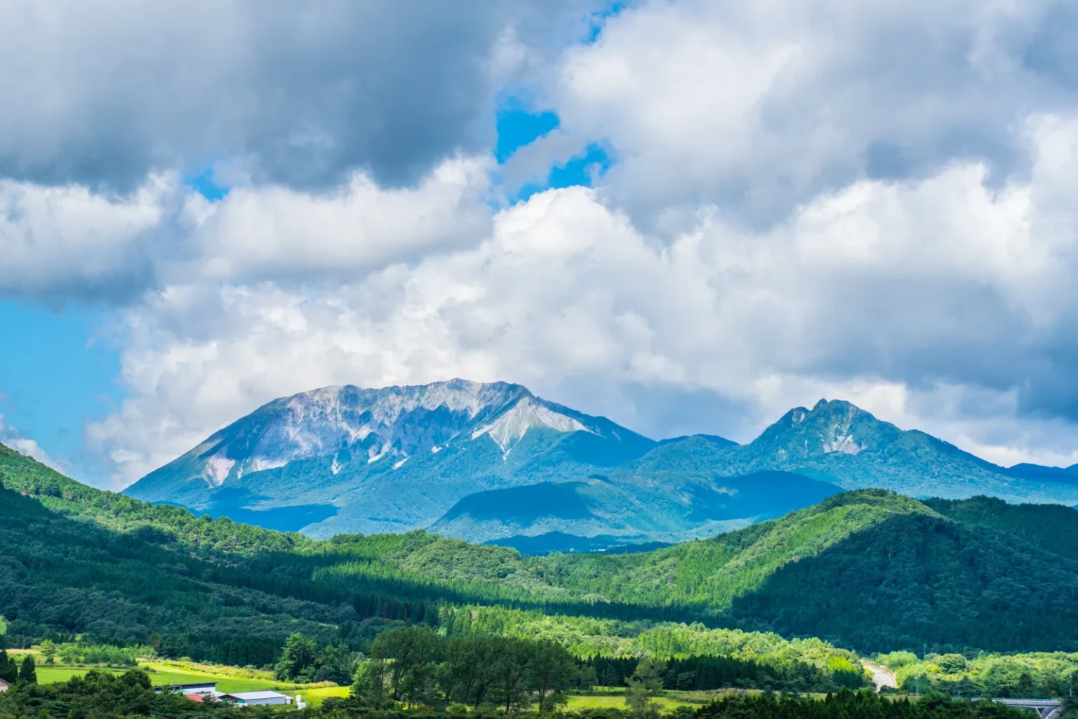
The highest mountain in western Japan’s Chugoku region, and its temple-town base sits high in cool beech forest well above the humid San’in coast. Summer here is shaded forest walks, mountain streams and one of Japan’s longest stone shrine approaches up to Daisenjinja Okumiya. Its true summit, Kengamine, is 1,729 m — the highest in the Chugoku region — while walkers top out on the boardwalk trail at Misen (1,709 m) for Sea-of-Japan views; green-season “shower climbing” tours make the most of the cold streams.
Getting there: ~40 min by car from Yonago (~10 km from Mizoguchi IC) to the Hakuroza parking area. A seasonal loop bus and the Daisenguchi–Daisenji bus make a car-free day possible but tight. Parking: Hakuroza has 600 spaces, free in the green season. Cost: the town and trails are free/outdoor. Stay: Daisenji temple-town lodges, or Kaike Onsen near Yonago.
On the plain below, the Shoji Ueda Museum frames Daisen in its reflecting pool — a good wet-weather or golden-hour add-on.
10. Taishakukyo Gorge & Shinryu Lake 帝釈峡・神龍湖 · Hiroshima
A deep limestone karst gorge in inland Hiroshima where the river, heavy shade and 200–300 m rock walls keep the trail cool through midsummer. The signature is a tatami-floored sightseeing boat that glides across Shinryu Lake in the shade; on foot, the gorge trail passes limestone cliffs and the natural rock bridge Onbashi.
Getting there: ~2 hr by car from Hiroshima city via the Chugoku Expressway; there is no convenient rail, so this is a driving (or tour) destination. Boat 2026: ~40 min cruise, adult ¥1,800 / child ¥900, roughly 9:30–16:00 (every 30 min on weekends), season ~Mar 20–Nov 30, closed Wednesdays — confirm the current calendar. Cost: the gorge trail is free. Stay: Jinsekikogen highland pensions, or Shobara city.
11. Akiyoshido Cave & Akiyoshidai 秋芳洞・秋吉台 · Yamaguchi
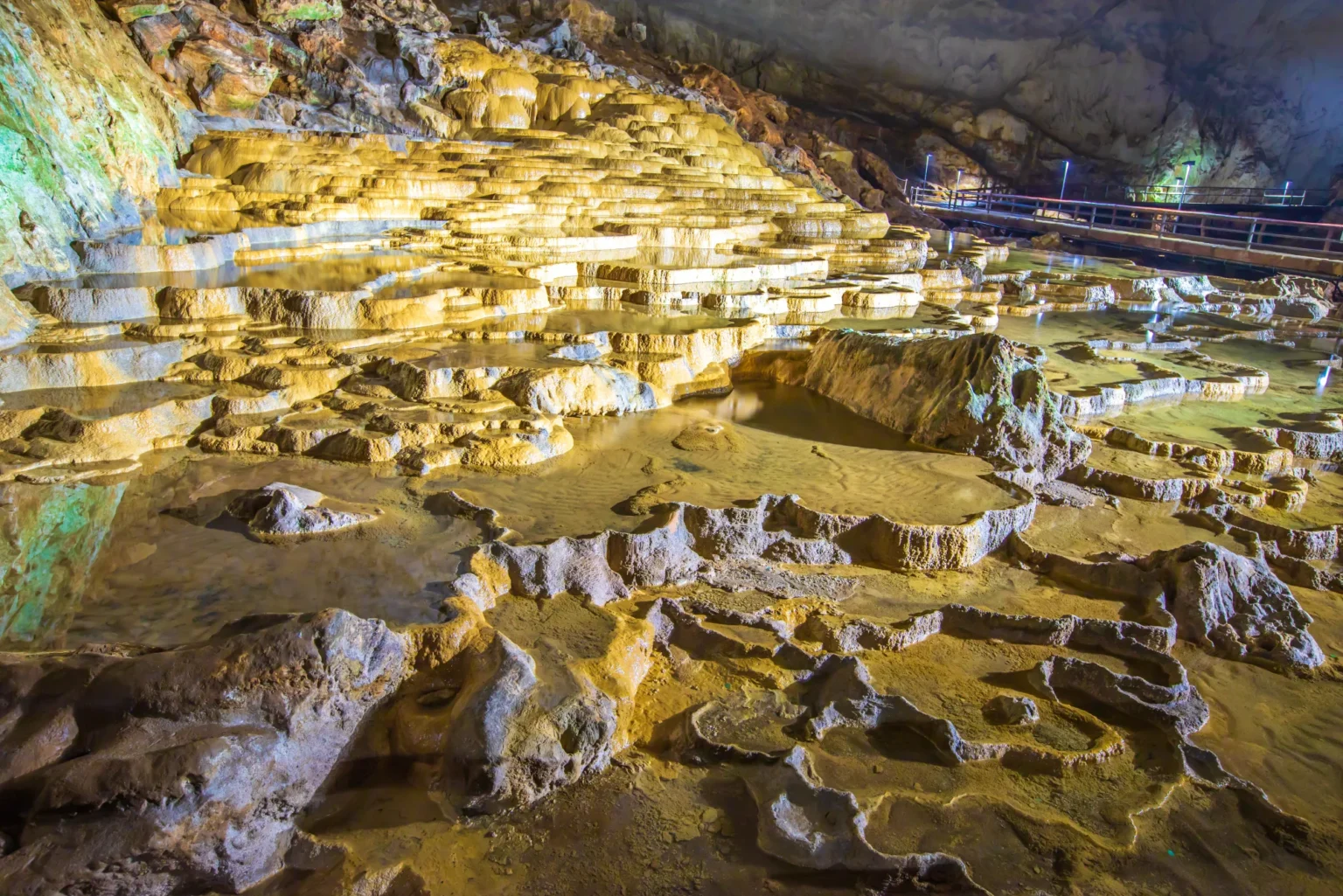
Japan’s largest limestone cavern holds a constant 17°C, so on a 35°C day walking in is like stepping into natural air-conditioning. You follow about a kilometre of lit path past terraced “Hundred Plates” pools and towering flowstone. Above it spreads Akiyoshidai, Japan’s largest karst plateau — open, breezy grassland dotted with white limestone pinnacles, far airier than the coastal cities.
Getting there: direct bus from JR Shin-Yamaguchi Station (~40 min) makes this one genuinely car-free; by car it is ~5 min from Akiyoshidai IC. Hours/fee 2026: 9:00–16:30, extended to 17:30 from Jul 1 through Sep 30. New 2026 variable pricing — adult ¥1,600 standard, ¥1,900 in peak summer (Jul 1–Aug 31), ¥1,350 in winter. Parking: main lots ¥500; the Kuroya and Elevator lots are free. Stay: the plateau area, or Yuda Onsen near Yamaguchi city.
If you’re driving western Yamaguchi anyway, pair it with the pale-blue water and bridge of Tsunoshima on the coast — and see my full Akiyoshido Cave & Akiyoshidai guide.
Kyushu
12. Kusasenri & the Aso Panorama Line 草千里ヶ浜・阿蘇パノラマライン · Kumamoto
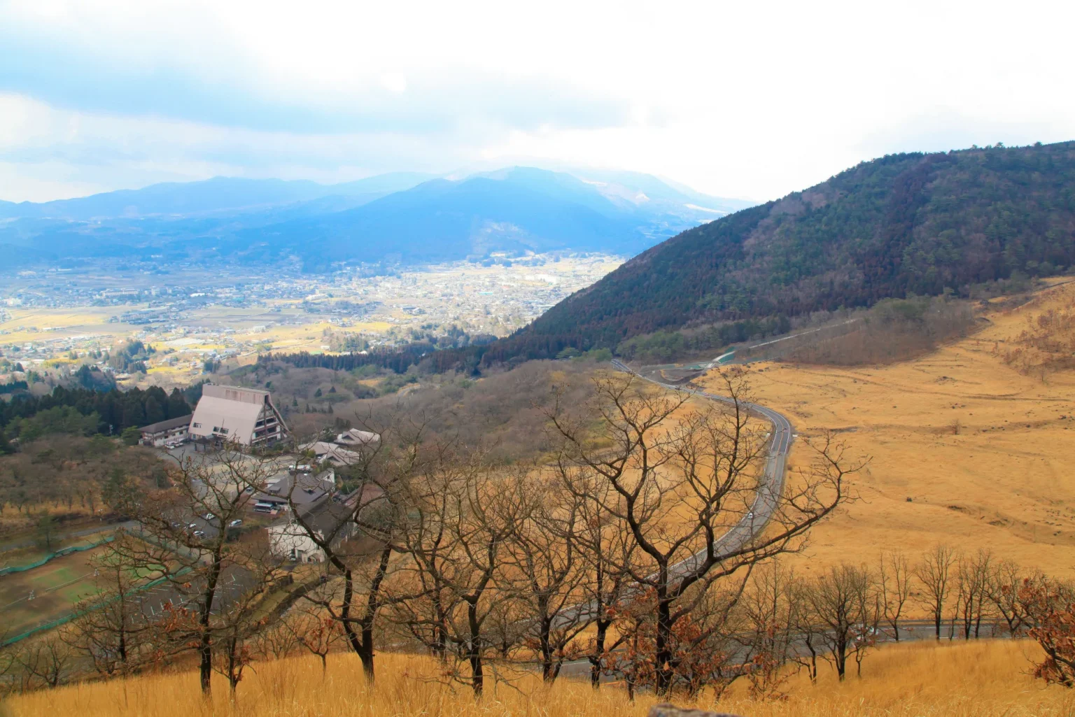
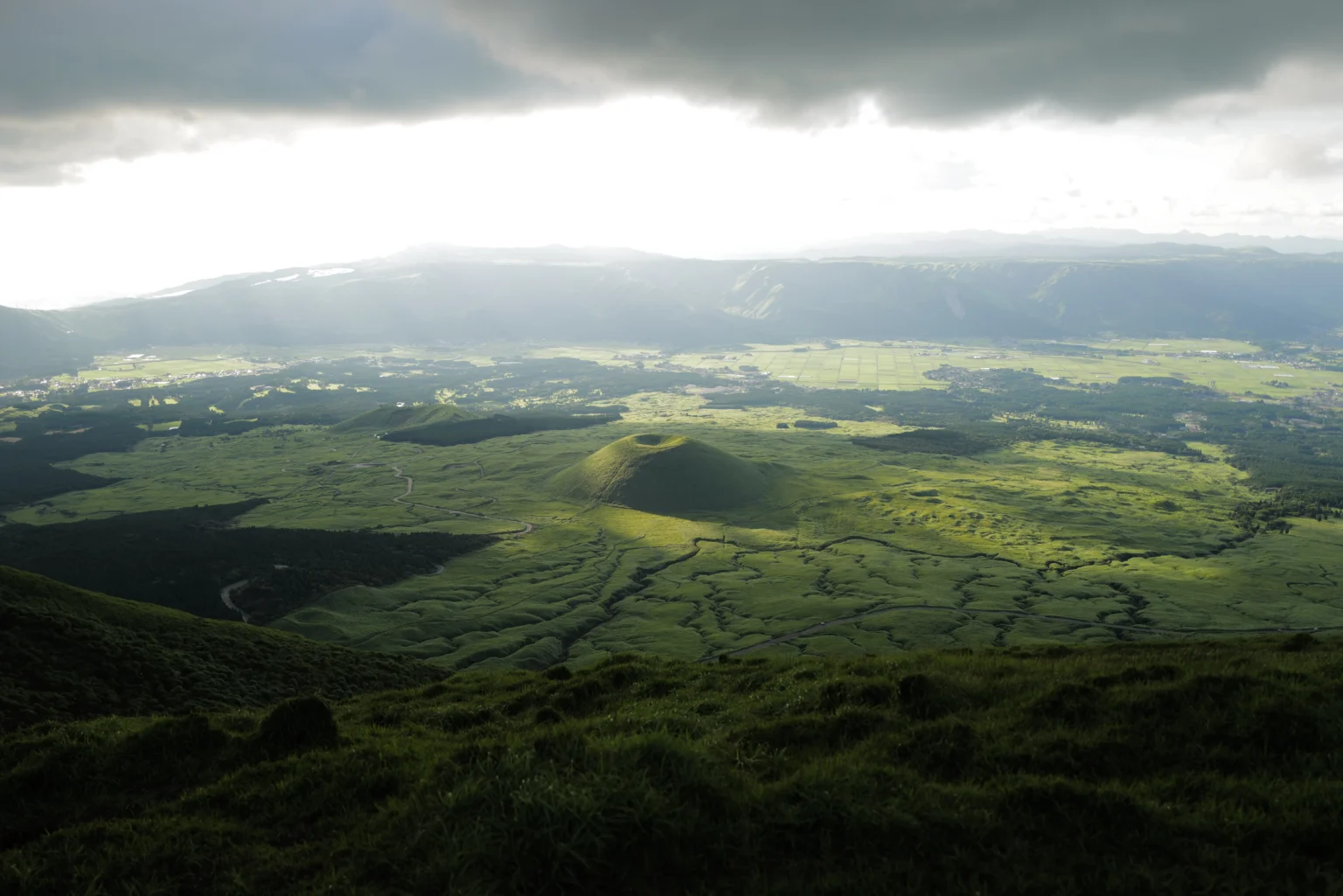
The drive that most feels like a highland escape. Kusasenri is a grassy former crater floor at about 1,100 m on the flank of an active volcano, with grazing horses, a pond and a 360° sweep to the smoking Nakadake crater. The road is half the reason to come: the Aso Panorama Line climbs across the outer-rim grasslands, one of Kyushu’s great scenic drives.
Getting there: ~80 min by car from Kumamoto city, ~50 min from Kumamoto Airport. A Kyushu Sanko bus from Aso Station reaches Kusasenri (~30 min) but can’t give you the road. Cost: Kusasenri and the Panorama Line are free; parking is ¥500 (unmanned plate-camera, pay later). Stay: Uchinomaki Onsen in Aso City.
More on the grassland in my Kusasenri guide, and the red-beef rice bowl I always stop for at Imakin Shokudo. For a cooler add-on, Nabegataki Falls lets you walk behind the water.
13. Yamanami Highway & Chojabaru やまなみハイウェイ・長者原 · Oita
The road trip that connects Aso to the Beppu/Yufuin side, climbing to Makinoto Pass at about 1,330 m. Its best pause is Chojabaru, a high plateau wetland near 1,000 m at the foot of the Kuju mountains: boardwalks cross a Ramsar-listed marsh of 100-plus wildflower species, with the smoking Iou-zan ahead. The cool, moist highland air keeps midsummer walking comfortable.
Getting there: ~30 min by car from Yufuin IC along the Yamanami Highway; a cross-Kyushu bus stops at Chojabaru but you need a car for the drive itself. Cost: the highway and the Tadewara Wetland boardwalk are free (the former toll is gone). Chojabaru Visitor Center: free, 9:00–17:00, ~450 free parking spaces. Stay: the Handa Kogen/Chojabaru lodges, or Yufuin Onsen further along.
When to go, and how to dodge the crowds
The heat that makes these worth it peaks from mid-July through early September, so that is the window. Two timing rules save the day. First, go in the morning — highland afternoons cloud over, gorge light flattens, and the parking lots at Nippara, Kusasenri and Shomyo fill fast. Second, avoid the Obon week in mid-August if you can, when domestic traffic and rental-car demand spike nationwide. For the wider seasonal picture — festivals, weather, what else is on — see summer in Japan 2026, and keep an eye on typhoon season, which can close mountain roads on short notice from late summer.
Where to stay near the cool country
Most of these reward an overnight: an onsen town at the foot of the highland lets you drive up early before the crowds and the cloud. Booking.com has the widest mainstream inventory in the resort towns (Nasu, Karuizawa, central Kobe, Aso City), while Rakuten Travel is stronger for the traditional ryokan and hot-spring inns — Nasu Yumoto, Yubara near Hiruzen, Uchinomaki at Aso, Yufuin along the Yamanami Highway.
Find a highland or onsen base
Book the town at the foot of your drive, not the nearest big city — you’ll be on the road before the day-trippers arrive. Booking covers the resort hotels; Rakuten Travel has the ryokan and onsen inns Booking often misses.
Three ready-made cool-summer drives
Kanto, two days: Tokyo → Oku-Nikko (Senjogahara boardwalk, Lake Chuzenji, Kegon Falls) → night at Chuzenji Onsen → Nasu Highlands and the ropeway on the way back. Both sit high enough to be cool at night.
Chugoku, two to three days: Okayama → Hiruzen Highlands (cycling, Jersey soft-serve, GREENable) → over to Mt. Daisen and the Shoji Ueda Museum → west to Akiyoshido’s 17°C cave and the Akiyoshidai plateau.
Kyushu, two days: Kumamoto → the Aso Panorama Line to Kusasenri → the Yamanami Highway over Makinoto Pass to Chojabaru’s wetland → finish at Yufuin Onsen. One of the best mountain drives in the country.
Tips for travelers flying in
Several of these are easiest reached through regional gateways rather than Tokyo. From Southeast Asia, fly into a major hub — Fukuoka works well for Aso and the Yamanami Highway, and Kansai (Osaka) for Rokko — then rent a car or connect domestically. The smaller Chugoku airports (Yonago, Okayama, Yamaguchi-Ube) run mostly domestic or short-haul Asian routes, so most inbound travelers reach Hiruzen, Daisen and Akiyoshido via Kansai or Fukuoka plus a drive. A few practicalities:
- Driving: confirm whether your country needs an International Driving Permit or a licence translation (see the rental note above), and arrange it before you fly. Most rental cars are automatic; all drive on the left.
- Cash: the mountain caves and some parking are cash-only (Nippara is cash-only outright), and rural machines can be sparse, so carry yen.
- Data: coverage drops in the mountains — download offline maps before you leave town, and use an eSIM for navigation and traffic where there is signal.
- Layers: an 11–17°C cave or a 22°C plateau evening feels cold after a coastal afternoon — pack a light jacket. My full list is in what I actually buy for a Japanese summer.
Common questions
Where can you actually escape the heat in Japan in summer?
Gain altitude. Air cools about 0.6°C per 100 m, so highlands near 1,000 m (Karuizawa, Hirugano, Kusasenri) run roughly 6°C cooler than the cities, and higher basins like Oku-Nikko (~1,300–1,500 m) average about 22.9°C in August against ~31°C in Tokyo. Limestone caves such as Akiyoshido (17°C) and Nippara (~11°C) stay cold year-round.
Do I need a car for these summer drives?
Not for all. Oku-Nikko, Mt. Rokko and Akiyoshido are reachable by bus or cable car. But the scenic roads themselves — the Aso Panorama Line, the Yamanami Highway, the Shiraito Highland Way — and spread-out plateaus like Hiruzen, Hirugano and Taishakukyo really need a car. You’ll want an International Driving Permit arranged before you arrive.
Which is the coolest spot on this list?
For raw air temperature, the Nippara Limestone Cave near Tokyo (~11°C) is the coldest, followed by Akiyoshido’s constant 17°C. Among the open highlands, Oku-Nikko is the strongest, averaging about 22.9°C in August — roughly 8°C below central Tokyo.
How much do the paid attractions cost in 2026?
Most highlands and scenic roads are free. Paid highlights: the Nasu Ropeway ¥2,000 round trip; Nippara Cave ¥900 (cash only); Akiyoshido ¥1,600 standard / ¥1,900 in peak summer; the Taishakukyo boat ¥1,800; and Bokka no Sato at Hirugano ¥1,500. Parking is free at many, ¥500 at Kusasenri and the main Akiyoshido lots.
Are there any 2026 closures or hazards to check?
Yes. A bear injured a hiker on the Shomyo Falls trail in May 2026 — carry a bell and don’t hike alone. The Aso crater toll road was closed on my August 2026 check and depends on the volcanic-gas alert. Nasu’s Mt. Chausu is an active volcano; check the JMA alert level. And Hirugano’s summit “sky” area has no flowers this season.
Can I combine several of these in one trip?
Within a region, yes. The Chugoku run links Hiruzen, Daisen and Akiyoshido over two to three days; Kyushu pairs the Aso Panorama Line with the Yamanami Highway in one long, memorable drive. Crossing regions (say Kanto to Kyushu) is a fly-or-Shinkansen-then-rent trip rather than a single road route.
Book a cool-summer drive
Three doors into the trip. Lock the car first — the cheap automatics go early in summer.
Keep reading
- Coolcation Japan 2026: where I escape the heat
- Cool day trips from Tokyo, ranked by actual August temperatures
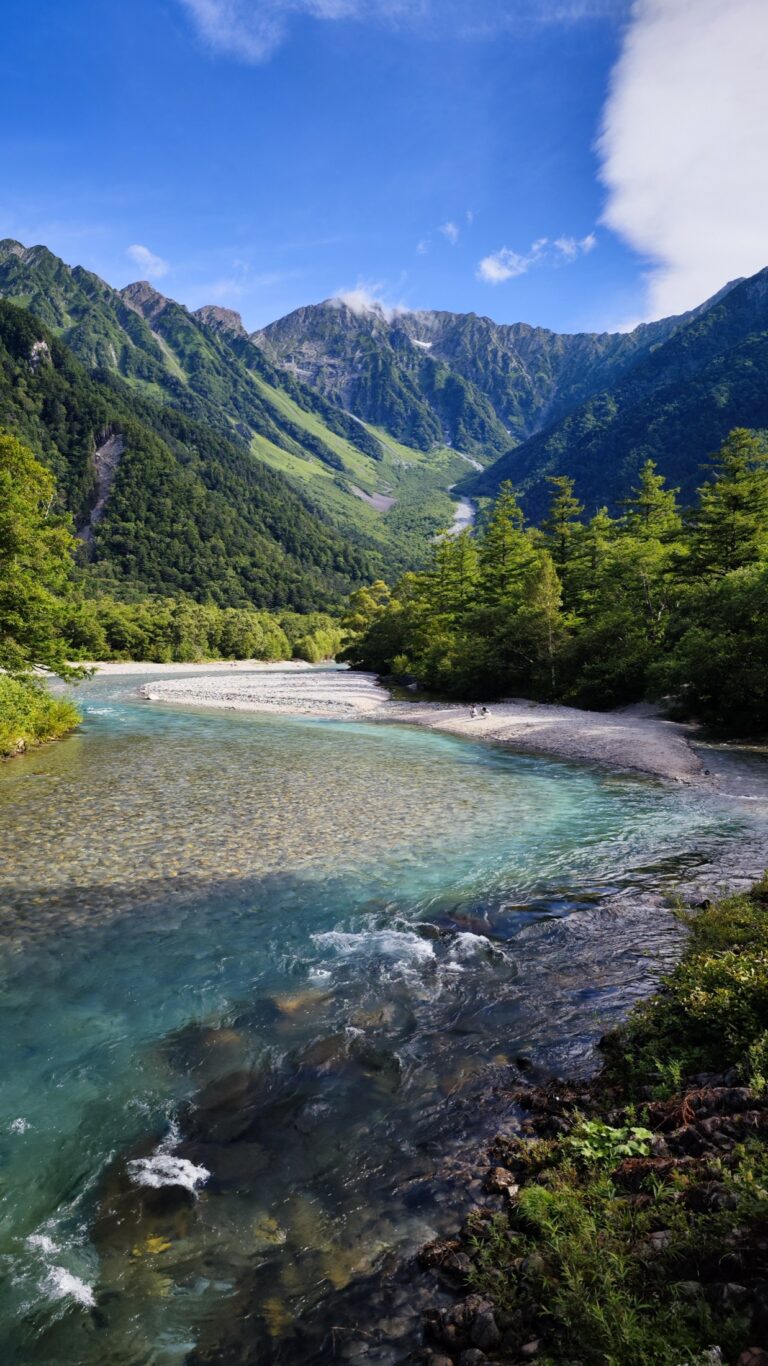
- Things to do in Kamikochi, the valley that stays cool all summer
- How to use Japan’s highway system with a rental car
Written by Nobu, hiddenjapan-gems.com. Last updated August 2026. Fares, opening seasons and 2026 road/closure notes checked against official tourism and facility sources (Nasu Ropeway, Okutama Town, Nikko/Tochigi tourism, Karuizawa Town, Tateyama Town, Gifu tourism, Feel Kobe, Maniwa tourism, Tottori/Daisen tourism, Taishakukyo boat operator, Yamaguchi tourism, Aso City, Kuju/Kokonoe). Mountain weather, volcanic alerts and bear advisories change quickly — check the official page for your date before you drive.
Join travelers discovering Japan's hidden side
Weekly dispatches from off-the-beaten-path Japan — spots and stories you won't find in guidebooks.
No spam. Unsubscribe anytime.
Welcome aboard!
You're in. See you in your inbox soon.