
Toyama · Tateyama · Waterfall
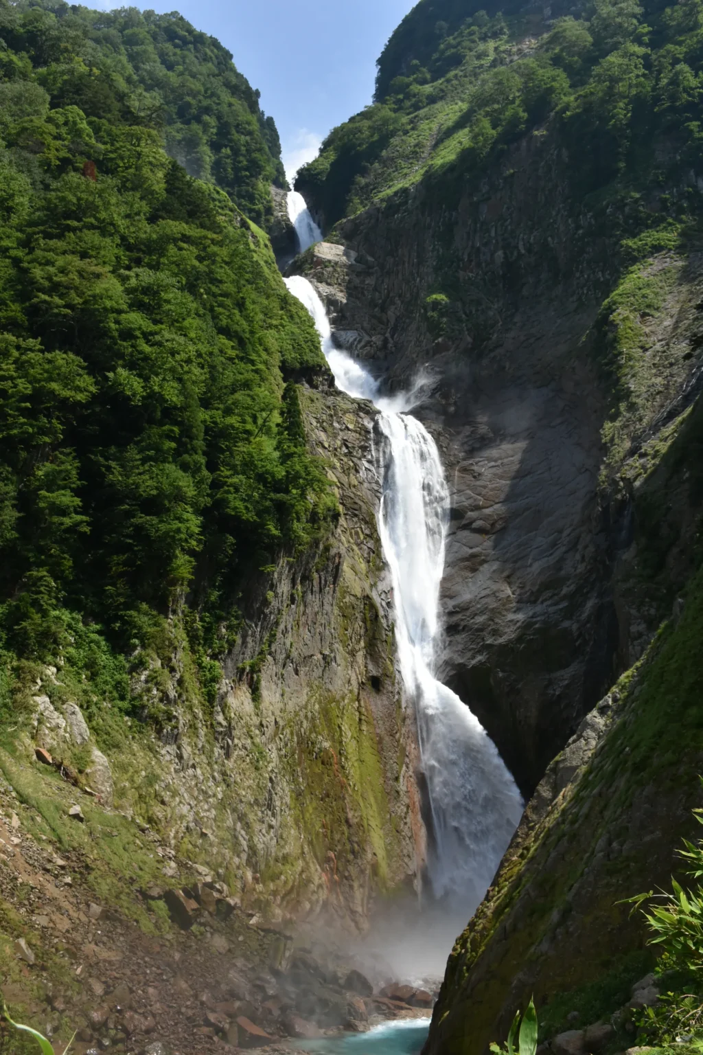
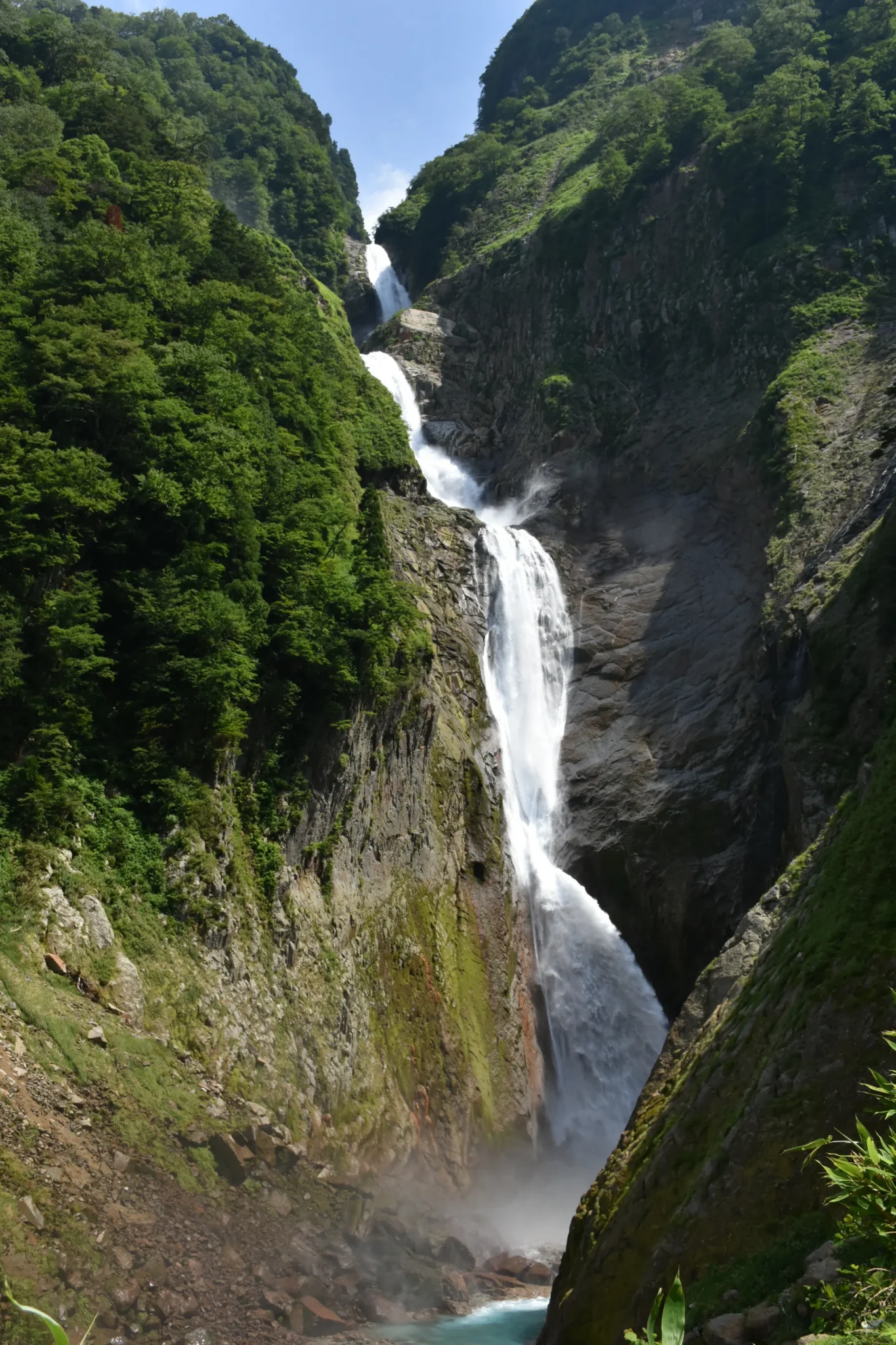
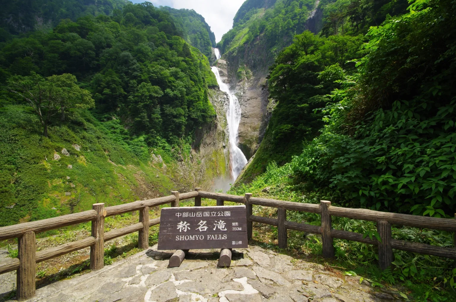
Shomyo Falls is Japan’s tallest waterfall, a 350-metre drop at the mouth of the Tateyama mountains in Toyama. It falls in four stages that read as one white line down the cliff, into a gorge that sits around 1,000 m, cool and shaded even in August. And for a few weeks each spring, a taller phantom appears right beside it. This is the guide to visiting: how tall it really is, when the water is at its best, and how to reach the viewpoint by bus or car in 2026.
Shomyo Falls: quick facts
How tall is Shomyo Falls, really?
Three hundred and fifty metres — the highest continuous drop of any waterfall in Japan. What looks like a single plume is actually four stages stacked on top of each other, and the water almost never stops, which is why it, and not its seasonal neighbour, holds the national record.
350 m, in four stages
From the top of the cliff to the plunge basin — the breakdown commonly given by local geopark sources (some cultural-property records use an older split, but the total is about 350 m either way).
Its flow is as dramatic as its height. In normal conditions the river pushes over roughly half a tonne to two tonnes of water a second; in the high-water snowmelt period that can surge toward a hundred tonnes a second. Shomyo is on Japan’s list of the Top 100 Waterfalls and, unusually, its list of the 100 Soundscapes of Japan — it is protected as a national Scenic Spot and Natural Monument, designated in 1973.
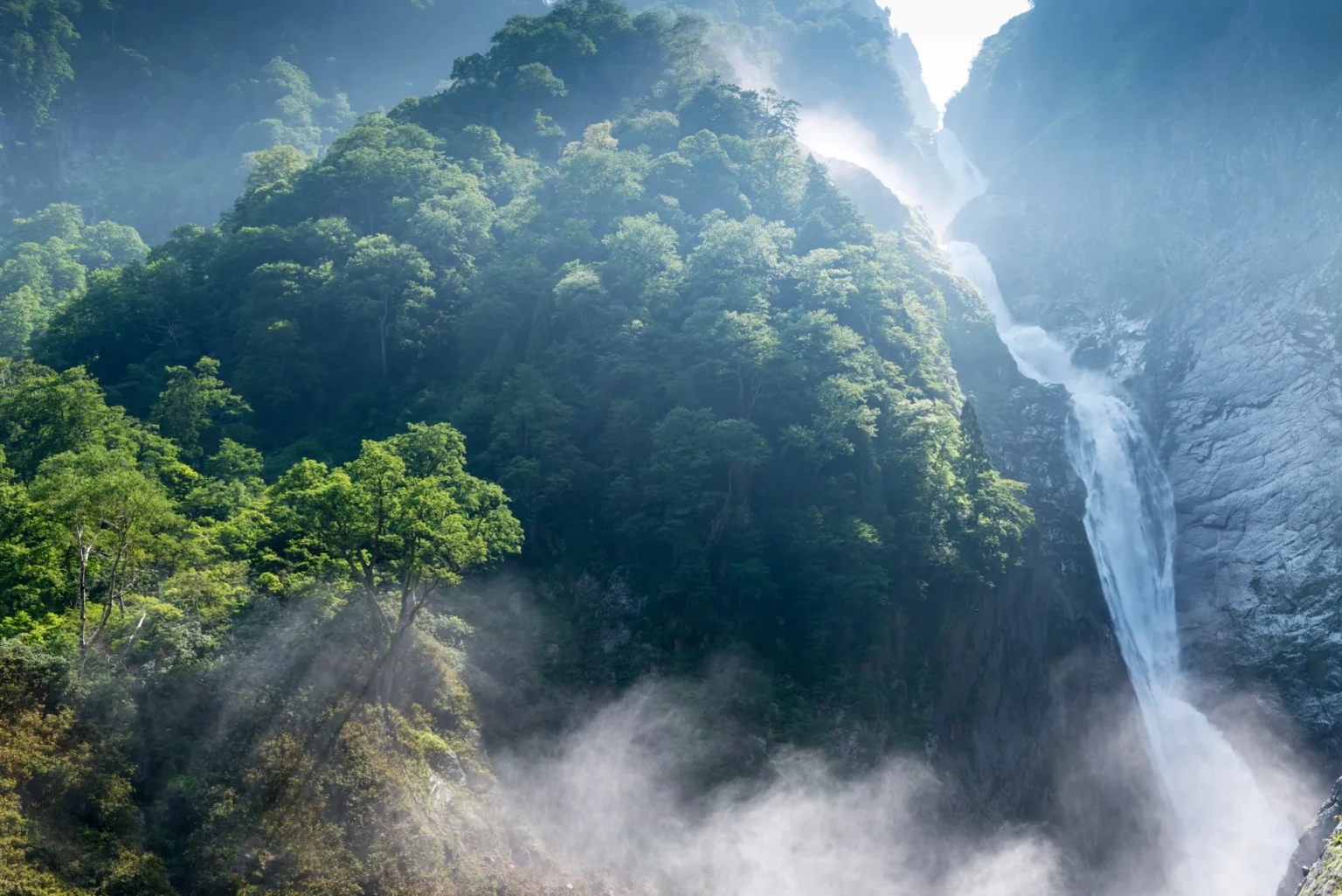
The phantom twin: Hannoki Falls
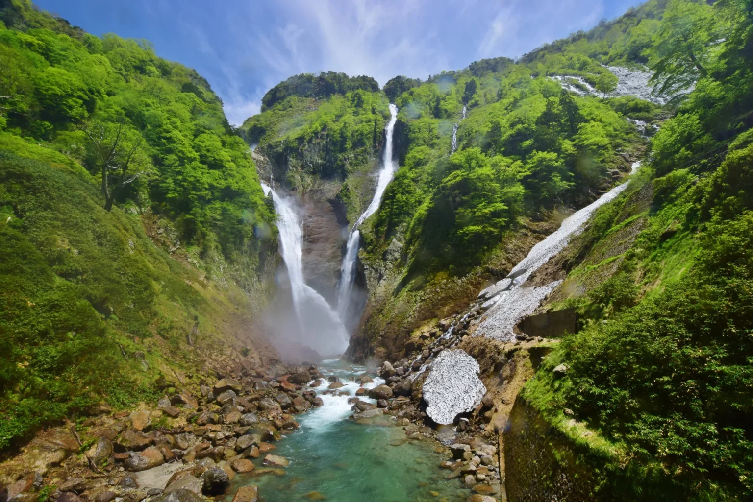
Here is the twist that makes Shomyo worth timing. For a few weeks each spring, a second waterfall appears on the cliff right beside it — Hannoki Falls, fed entirely by snowmelt. At a drop of about 500 metres it is actually taller than Shomyo, which would make it Japan’s highest by height alone. But it doesn’t count for the record: it dries up for most of the year, so it isn’t a permanent waterfall. Locals call it the “phantom falls.”
Two records, one cliff
Shomyo (350 m) flows year-round, so it keeps the title of Japan’s tallest permanent waterfall. Hannoki (~500 m) is taller but only appears when there’s enough meltwater — roughly May into early summer. Catch both in flow and you’re looking at one of the most dramatic stretches of cliff-water in Japan.
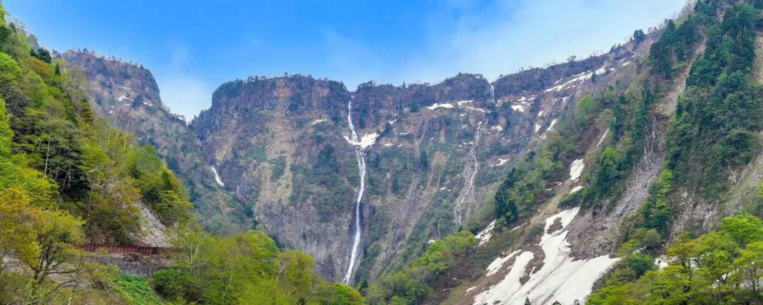
A waterfall that walked 15 km
The gorge below the falls is the record of a slow retreat. The Shomyo River has been cutting back through the soft volcanic rock of the old Tateyama caldera for roughly 100,000 years, and in that time the falls have migrated something like 10–15 kilometres upstream — on the order of 10 centimetres a year. What’s left downstream is the deep V-shaped canyon known as the Shomyo Gorge, and what’s left at the head of it is the tallest waterfall in the country, still slowly working its way back into the mountains.
When is the best time to visit?
It depends on what you want. For the falls at full power — and for a chance at the phantom Hannoki beside it — come in the snowmelt window, roughly May into July, when the water volume peaks. For the longest opening hours and the fullest bus schedule, come in midsummer, when the gorge stays cool and shaded on a hot day. Whichever you choose, go early: the small parking fills on peak days, and afternoon thunderstorms can trigger a road closure. Rainbows in the spray are most likely mid-afternoon on a sunny day.
How do I get to Shomyo Falls?
The falls sit up a gorge road from Tateyama Station — the same station that is the western gateway to the Tateyama-Kurobe Alpine Route, so the trip pairs naturally with it.
By train + scenic bus (car-free)
- Reach Toyama — the Hokuriku Shinkansen runs there from Tokyo in about 2 hours 10 minutes.
- From Dentetsu-Toyama Station, take the Toyama Chiho Railway to Tateyama Station: about 60 minutes, ¥1,420 (or ¥1,280 with Chitetsu’s own ecomyca IC card — note that Suica and ICOCA aren’t accepted on this line).
- Change to the seasonal Shomyo Falls scenic bus up to Shomyo-daira: about 15 minutes, around ¥500 one way. In 2026 it runs May 11 – November 10.
- Walk the paved riverside trail to the viewpoint — about 1.3 km, 30 minutes, with an elevated lookout over the plunge basin at the end.
By car
You can drive the gorge road up to the Shomyo-daira parking (set your navigation to “Shomyo-daira Parking / 称名平駐車場,” not the falls), then walk the same 1.3 km trail. Parking is free — about 247 spaces at Shomyo-daira, plus roughly 900 free spaces at Tateyama Station (one 110-space lot there asks a cooperation fee in 2026). The Katsura-dai gate controls the road, open 6:00–19:00 in July–August and 7:00–18:00 the rest of the season.
Some links below are affiliate links — booking through them supports this site at no extra cost to you.
Plan a Tateyama trip
Where to stay
To be at the gate when it opens, stay near Tateyama Station. Senjuso is the closest option — a hot-spring inn within a minute of the station serving local Toyama food (adult two-meal rates from around ¥8,200). The old faith-village hamlet of Ashikuraji nearby has traditional onsen ryokan and minshuku (from around ¥7,500), a good fit if you want the Tateyama mountain-worship character. For more hotel choice, English support and dining, base in Toyama city and day-trip out — about an hour by rail plus the scenic bus.
Base near Tateyama Station
Booking.com covers the Toyama city hotels; Rakuten Travel has the traditional onsen inns around Tateyama and Ashikuraji. Sleeping near the station lets you catch the first bus or drive the gorge road before it fills.
Make it a Tateyama trip
Tateyama Station is the western entrance to the Tateyama-Kurobe Alpine Route, the high mountain crossing up to Murodo at 2,450 m, so many people ride up to the falls in the morning and start the Alpine Route the same day. If you’re building a wider cool-weather itinerary, Shomyo is one of the stops in my guide to Japan’s coolest summer drives, and it fits the 2026 coolcation idea of trading the lowland heat for altitude and water. For another Northern Alps valley that stays cool all summer, see Kamikochi.
Practical tips
- Go early. The parking is small and fills on peak summer and autumn days; mornings also beat the afternoon storm risk.
- Bring a bear bell. After the May 2026 incident, the town asks visitors to carry a bell or spray and stay on the marked trail.
- Layer up. At ~1,000 m in spray and shade, the gorge is cool even in August.
- Time it for the water. For raw power and the phantom Hannoki, aim for the May–July snowmelt; for long hours and cool shade, come in midsummer.
- Check the road. The gorge road closes in heavy rain or wind — confirm status the morning of your visit.
Common questions
How tall is Shomyo Falls?
350 metres, in four stages (70, 58, 96 and 126 m from the top) — the tallest waterfall in Japan by continuous drop. It flows year-round, which is why it holds the record over the seasonal Hannoki Falls beside it.
What is the phantom Hannoki Falls?
A seasonal waterfall that appears on the same cliff during the snowmelt, roughly May into early summer. At about 500 m it is taller than Shomyo, but because it dries up for most of the year it isn’t counted as a permanent waterfall — so Shomyo keeps the national record.
When should I visit for the best water?
The snowmelt window, roughly May to July, when flow peaks and Hannoki is most likely to appear. Midsummer has the longest opening hours (the gate is open 6:00–19:00 in July–August) and a cool, shaded gorge. Go early either way.
Can I visit Shomyo Falls without a car?
Yes. Take the Hokuriku Shinkansen to Toyama, the Toyama Chiho Railway to Tateyama Station (~60 min, ¥1,420), then the seasonal scenic bus to Shomyo-daira (~15 min, ~¥500), which runs May 11 – November 10 in 2026. From the bus stop it’s a 1.3 km, 30-minute walk to the viewpoint.
How long is the walk to the falls?
About 1.3 km each way from the Shomyo-daira parking, roughly 30 minutes on a paved riverside trail, ending at an elevated lookout over the plunge basin. Bicycles aren’t allowed beyond the trail entrance.
Is it safe after the 2026 bear incident?
The trail reopened on 23 May 2026 after a bear injured two visitors on 14 May, and ultrasonic deterrent devices were installed at three points on 17 June. The town asks visitors to carry a bear bell or spray, stay on the marked trail, and avoid hiking alone — sensible bear-country practice anywhere in the Northern Alps.
Plan the trip
Three doors into a Tateyama visit. Book the base near the station first.
Keep reading
- Japan’s coolest summer drives 2026 — where Shomyo fits in a nationwide cool-weather list.
- Kamikochi — the Northern Alps valley that stays cool all summer.
- Coolcation Japan 2026 — trading the summer heat for altitude and water.
Written by Nobu, hiddenjapan-gems.com. Last updated August 2026. Height, four-stage breakdown, access, gate hours, parking and the 2026 bear-incident timeline checked against Tateyama Town, the Tateyama-Kurobe Alpine Route official site, Toyama Prefecture and the Ministry of the Environment. Bus fares and timetables, road status and parking arrangements can change — confirm the official Tateyama Town and Alpine Route pages, and the day’s road status, before you travel.
Join travelers discovering Japan's hidden side
Weekly dispatches from off-the-beaten-path Japan — spots and stories you won't find in guidebooks.
No spam. Unsubscribe anytime.
Welcome aboard!
You're in. See you in your inbox soon.