Japan · Yamanashi · Lake Yamanaka · Myojinyama
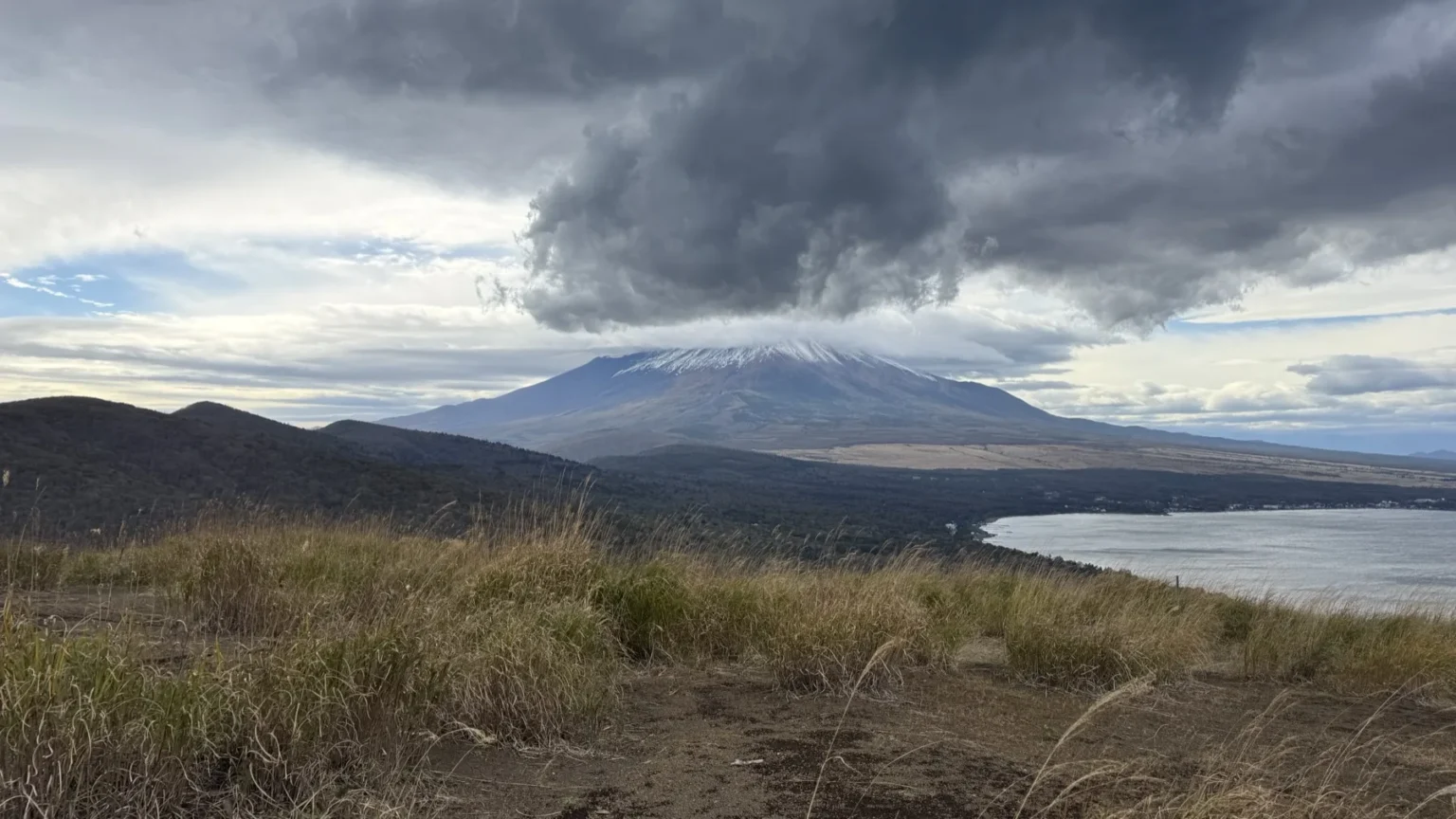
On 30 October 2026, the day the Japan Meteorological Agency listed Mount Fuji’s first snow of the season, I was on the summit of Myojinyama, a grassy 1,291 m top on the ridge path above Lake Yamanaka. From the top, Fuji stood across the lake with a white cap of new snow, and a heavy dark cloud hung above it.
I’m Nobu, and I live in Yamanakako village. Myojinyama is also called Teppogi-no-Atama; Yamanaka Suwa Shrine and the Yamanakako tourism association write it as Myojinyama (Teppogi-no-Atama). Below are my photos from the summit that afternoon, the small shrine at the top, how the tourism association times the walk from Panorama-dai and Mikuni Pass, where to park, and where to stay around the lake.
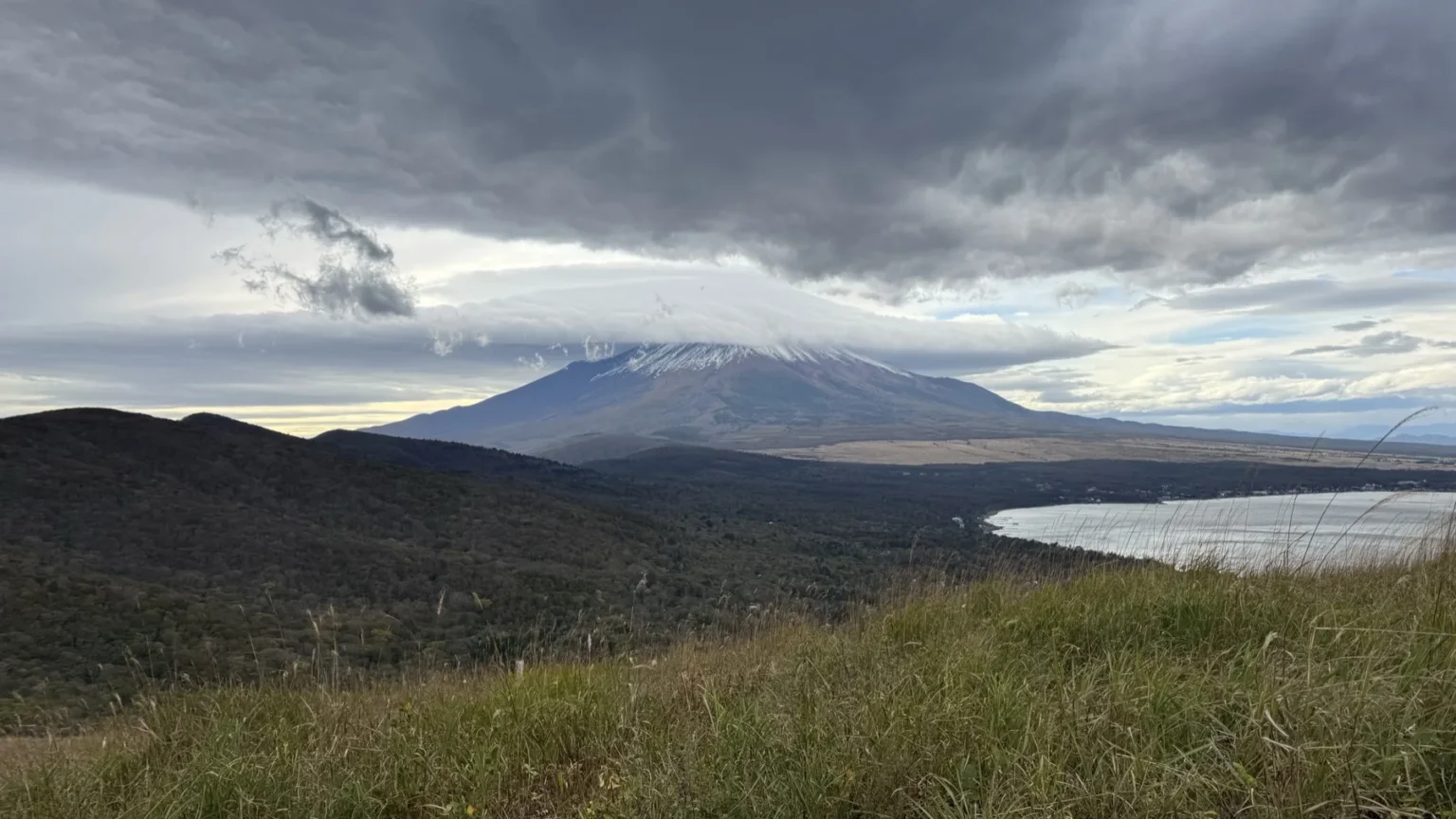
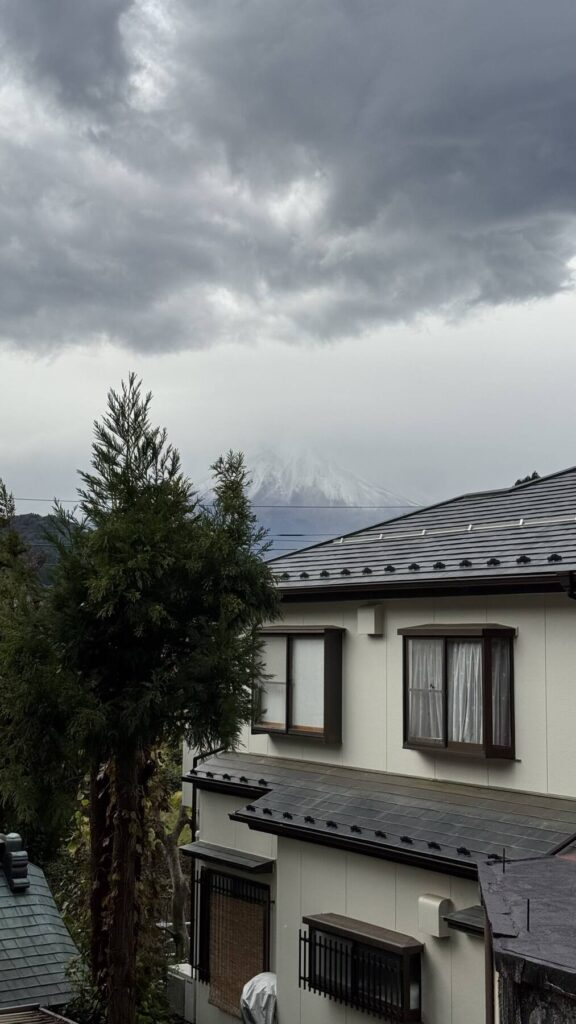
Mount Fuji’s first snow, seen from the top
The Japan Meteorological Agency’s first-snowcap page gives 30 October 2026 as the date of Mount Fuji’s first snow this season.
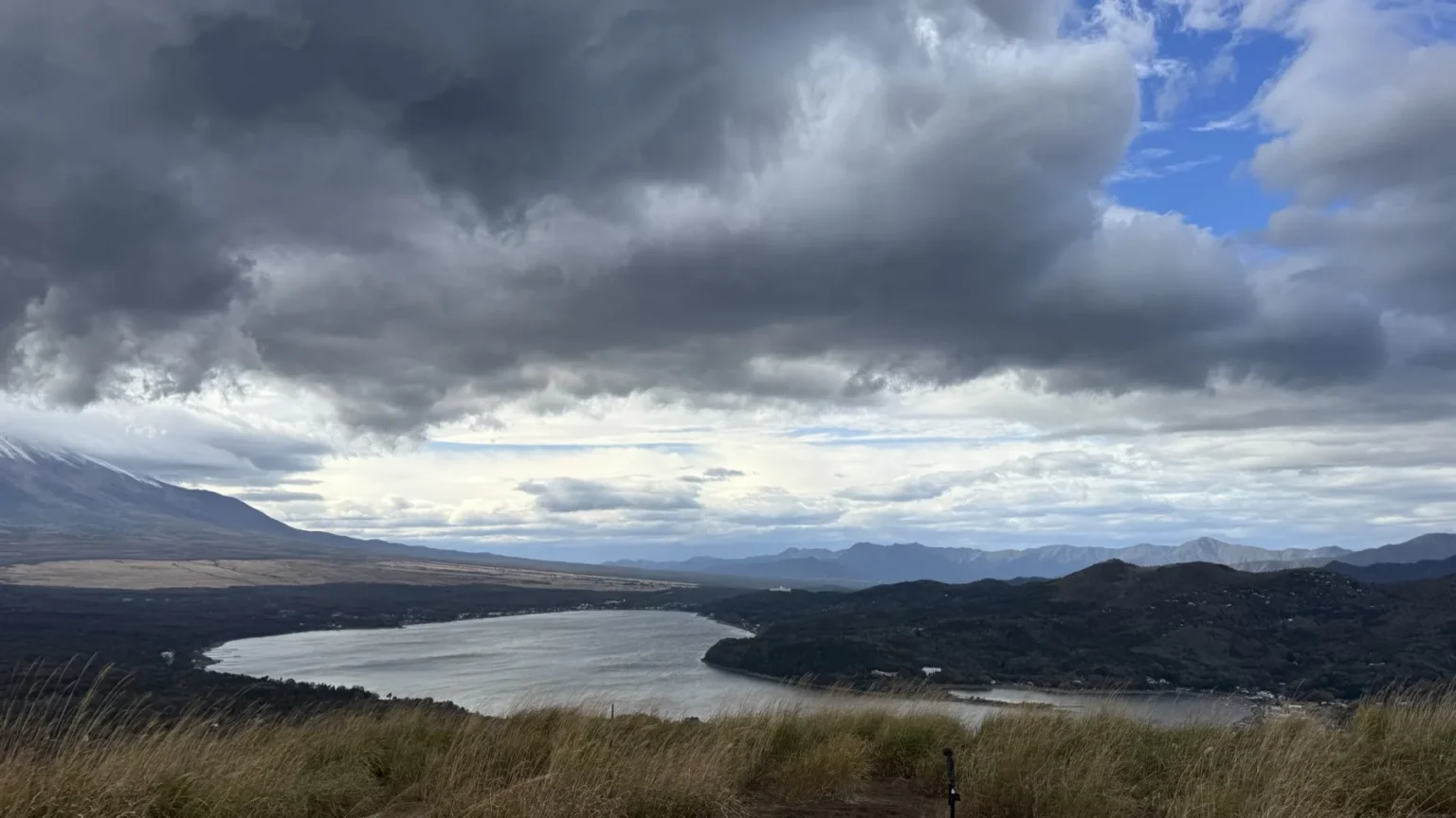
I photographed the snow that morning at 9:57, from the northern foot of the mountain. In the afternoon I was on the summit of Myojinyama, and my first photo there was taken at 13:24. From the top, the white was clear on Fuji’s upper slopes. At 13:35 a thick dark mass of cloud sat just above the summit, with Lake Yamanaka below.
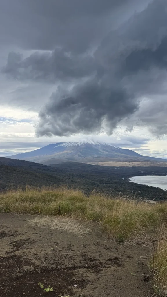
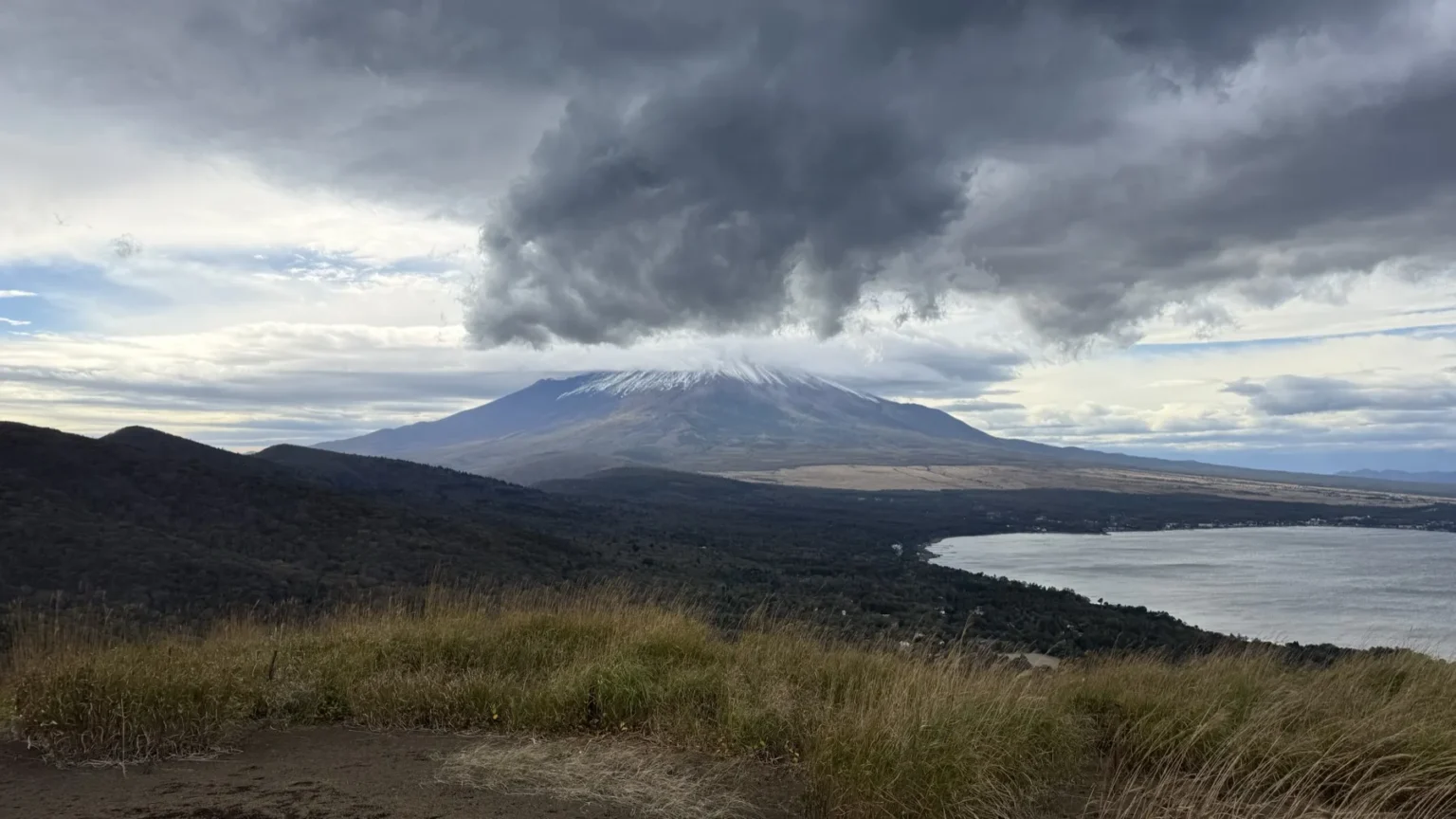
At 14:05 the cloud on the summit looked like a flat cap, with the snow showing below it. That is the photo at the top of this page. If you are checking whether Fuji will be out before you go, I keep a daily Mount Fuji visibility page, and my Mount Fuji snow and winter guide covers when the cap usually forms.
The view from the summit: Lake Yamanaka below you
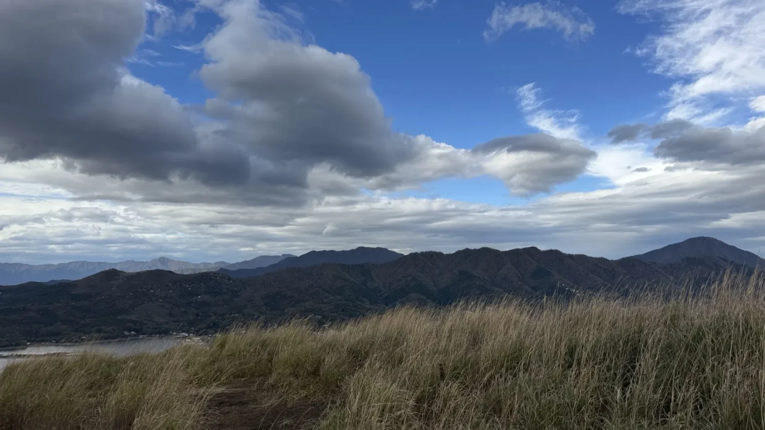
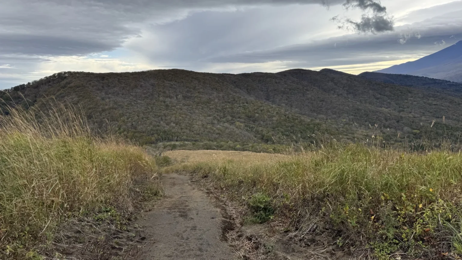
From the top you see almost all of Lake Yamanaka at once: the whole curve of the shore, the forest running down to the water, and a long line of mountains far away on the horizon. The tourism association says the Southern Alps can be seen from here in good weather, so check the forecast if that is what you came for. The summit itself is open grass with a bare earth path, and on 30 October the grass was dry.
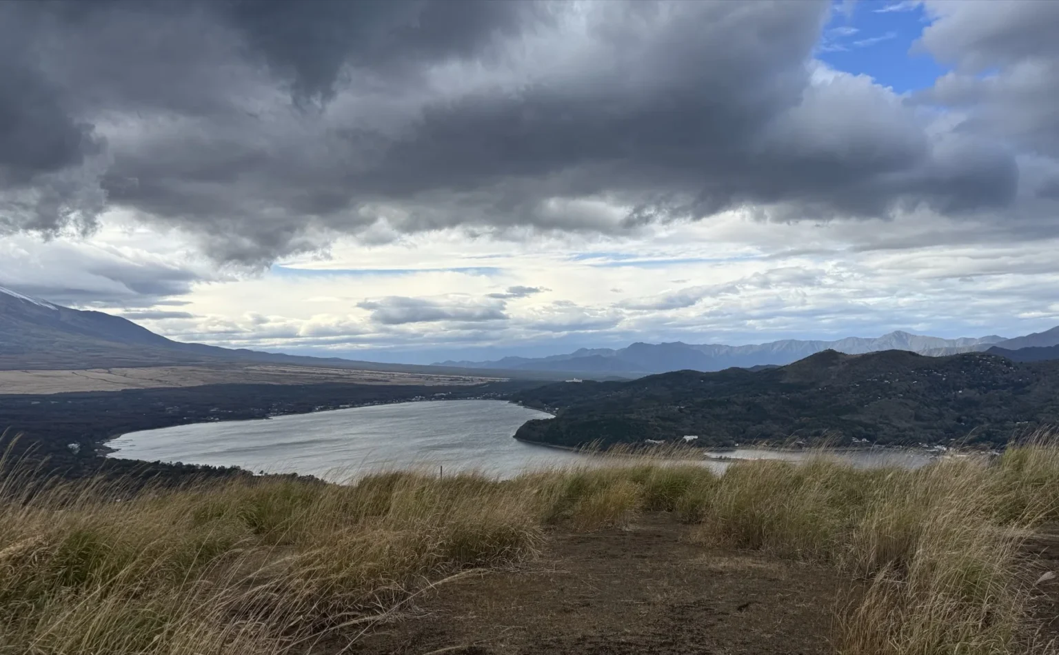
The shrine at the summit
Right at the top is a small stone shrine behind a stone fence, with a tall stone post in front of it. The post is carved 山中諏訪神社 奥宮: the okumiya, or inner shrine, of Yamanaka Suwa Shrine. The shrine’s own page confirms that its inner shrine stands on the summit of Myojinyama (Teppogi-no-Atama), and gives 1 September as the date of its annual festival.
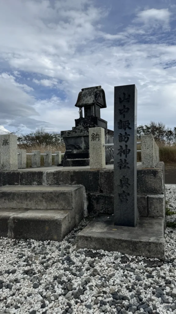
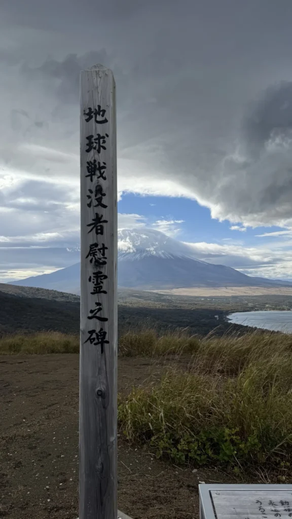
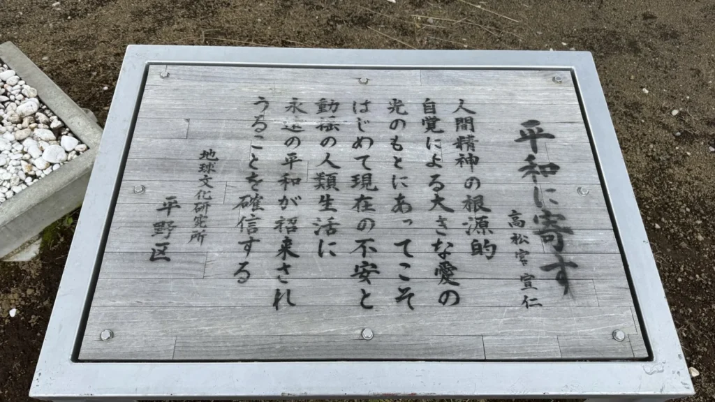
Nearby are two more markers. A tall wooden post reads 地球戦没者慰霊之碑, literally a memorial to the war dead of the Earth. At the foot of the post, at the edge of my 13:25 photo, is a board in a metal frame headed 平和に寄す, “For peace”, with the name Takamatsu-no-miya Nobuhito and a short text about lasting peace for humanity.
Getting up: Panorama-dai, Mikuni Pass or the long ridge
Myojinyama sits on a ridge path. The Yamanakako tourism association’s course guide lists it from Panorama-dai over the summit to Mikuni Pass, then on over Mount Mikuni, Mount Naraki, Mount Obora and Mount Azamidaira to Kagosaka Pass. The times below are from that guide.
| Section | Association’s time |
|---|---|
| Mt. Mikuni Hiking Course Ent. bus stop → Panorama-dai | About 15 minutes |
| Kirara (Yamanakako Communication Plaza) → Mt. Mikuni Hiking Course Ent. bus stop | About 5 minutes |
| Panorama-dai → Myojinyama summit | About 20 minutes |
| Myojinyama summit → Mikuni Pass | About 20 minutes |
| Whole course, from Kirara over Myojinyama and Mount Mikuni to Kagosaka Pass | About 10 km, about 4 hours |
By bus. The association’s course guide says you can reach its start point, Kirara, by route bus or by the Fujikko-go tour bus, and lists the Mt. Mikuni Hiking Course Ent. bus stop about 5 minutes on, with Panorama-dai about 15 minutes beyond it. My Lake Yamanaka access guide covers the trains and buses from Tokyo.
By car. Panorama-dai is on prefectural road 730, the road over Mikuni Pass. Panorama-dai’s own car park has only 7 spaces and 1 accessible space, so the association’s Panorama-dai page asks drivers to use the Mikuni Pass car park or the one at Kirara and walk, and not to stop on the road. If you are driving, you can compare rental cars around Mount Fuji on DiscoverCars (paid link) or search Japanese rental companies on Rakuten Travel (paid link).
Before you go
Winter road
The tourism association says the road freezes in winter and winter tyres are required. Yamanashi Prefecture posts closures and restrictions on its road information page; check it on the day.
Bears
Yamanakako village asks hikers to carry a bear bell or something similar, take food and rubbish home, and check the latest sightings before setting out. Oyama town also posts bear information.
Toilets
The tourism association’s course guide lists toilets at Panorama-dai, about 20 minutes below the summit.
In autumn there is more to do around the lake: see my guide to the Yamanakako autumn leaves festival, and my list of hot springs near Mount Fuji.
Where to stay near Myojinyama
Three options in Yamanakako village, by what you want after the walk: a hot bath with a Fuji view, a room with its own sauna, or private glamping.
For a hot bath with a Fuji view: Hotel Mt. Fuji
Its official site lists day-use hot spring plans, with baths that look towards Fuji, so you can bathe here even without staying. Check Hotel Mt. Fuji on Booking.com (paid link).
For a sauna in your room: Shizuku
Its official name describes a ryokan with a private sauna in every room and a view of Mount Fuji. Check Shizuku on Booking.com (paid link).
For glamping: VISION GLAMPING Resort & Spa Yamanakako
Private glamping. The Booking.com listing says each building has its own outdoor bath and tent sauna. Check VISION GLAMPING on Booking.com (paid link).
To compare more places around the lake and Kawaguchiko, see my Mount Fuji area hotels guide.
FAQ
Is Myojinyama the same as Teppogi-no-Atama?
Yes. Yamanaka Suwa Shrine and the Yamanakako tourism association write the name as Myojinyama (Teppogi-no-Atama). The summit is 1,291 m.
How long is the walk to the summit?
The tourism association gives about 20 minutes from Panorama-dai, and about 20 minutes from the summit down to Mikuni Pass.
Where do I park for Myojinyama?
Panorama-dai has only 7 spaces and 1 accessible space. The tourism association asks drivers to use the Mikuni Pass car park or the Kirara car park and walk, and not to park on the road.
Can I get there by bus?
The tourism association’s course guide says you can reach Kirara by route bus or the Fujikko-go tour bus. From the Mt. Mikuni Hiking Course Ent. bus stop it is about 15 minutes’ walk to Panorama-dai, then about 20 minutes to the summit.
Can you see Mount Fuji with snow from Myojinyama?
Yes. On 30 October 2026, the date the Japan Meteorological Agency lists for Fuji’s first snow this season, I could see the snow on Fuji from the summit, under a lot of cloud.
Is there anything at the summit?
The inner shrine of Yamanaka Suwa Shrine, whose annual festival is on 1 September, plus a wooden memorial post and a board headed “For peace”.
Sources (checked 30 October 2026)
- My own visit and photos, 30 October 2026, 9:57 and 13:24–14:05.
- Japan Meteorological Agency: first-snowcap records
- Yamanakako tourism association: Mt. Mikuni and Panorama-dai hiking course
- Yamanakako tourism association: Panorama-dai
- Yamanaka Suwa Shrine: inner shrine
- Fujikyu Bus: Fujikko-go
- Yamanakako village: bears · Oyama town: bear information
- Hotel Mt. Fuji: day-use hot spring · Shizuku · VISION GLAMPING Yamanakako
Some links above are affiliate links — they cost you nothing extra and help keep this site going.
Join travelers discovering Japan's hidden side
Weekly dispatches from off-the-beaten-path Japan — spots and stories you won't find in guidebooks.
No spam. Unsubscribe anytime.
Welcome aboard!
You're in. See you in your inbox soon.