

Mt. Fuji · Visibility · Live
Is Mt. Fuji Visible Today? A 2026 Forecast Guide by a Fujiyoshida Local
December: 86% of mornings clear. July: 14%. Most travellers don’t realise the gap. The 33-year monthly data, the live tools that work, and the seven viewpoints worth planning your day around.

Today, July 20, 2026 — Mt. Fuji is clearly visible from Fujiyoshida this morning.
- Wind (morning)North · per JMA Kawaguchiko AMeDAS
- Best viewpoint nowFujiyoshida
Updated each morning from Fujiyoshida by Nobu, a long-time resident. See how this compares to algorithmic forecasts ↓
Not up at 6am? I’ll email you the next clear-Fuji morning.
I’m Nobu, and I watch the mountain from Fujiyoshida. Leave your email and I’ll send a short note when Fuji clears, something blooms, or a hut opens bookings — no noise, unsubscribe anytime.
Part of the full Mt. Fuji travel guide.
How this page complements isfujivisible.com — May 26, 2026
There is a popular separate website — isfujivisible.com — that gives you a model-driven “Is Mt. Fuji visible today?” prediction built on global weather data. It’s a useful tool for trip-planning a week or two out. This page is a different kind of resource: a Fujiyoshida resident’s photographic check, posted every morning from the base of the mountain — for the morning-of question of “is it actually visible right now?”. The two signals are complementary, and on a microclimate mountain like Fuji, they can disagree.
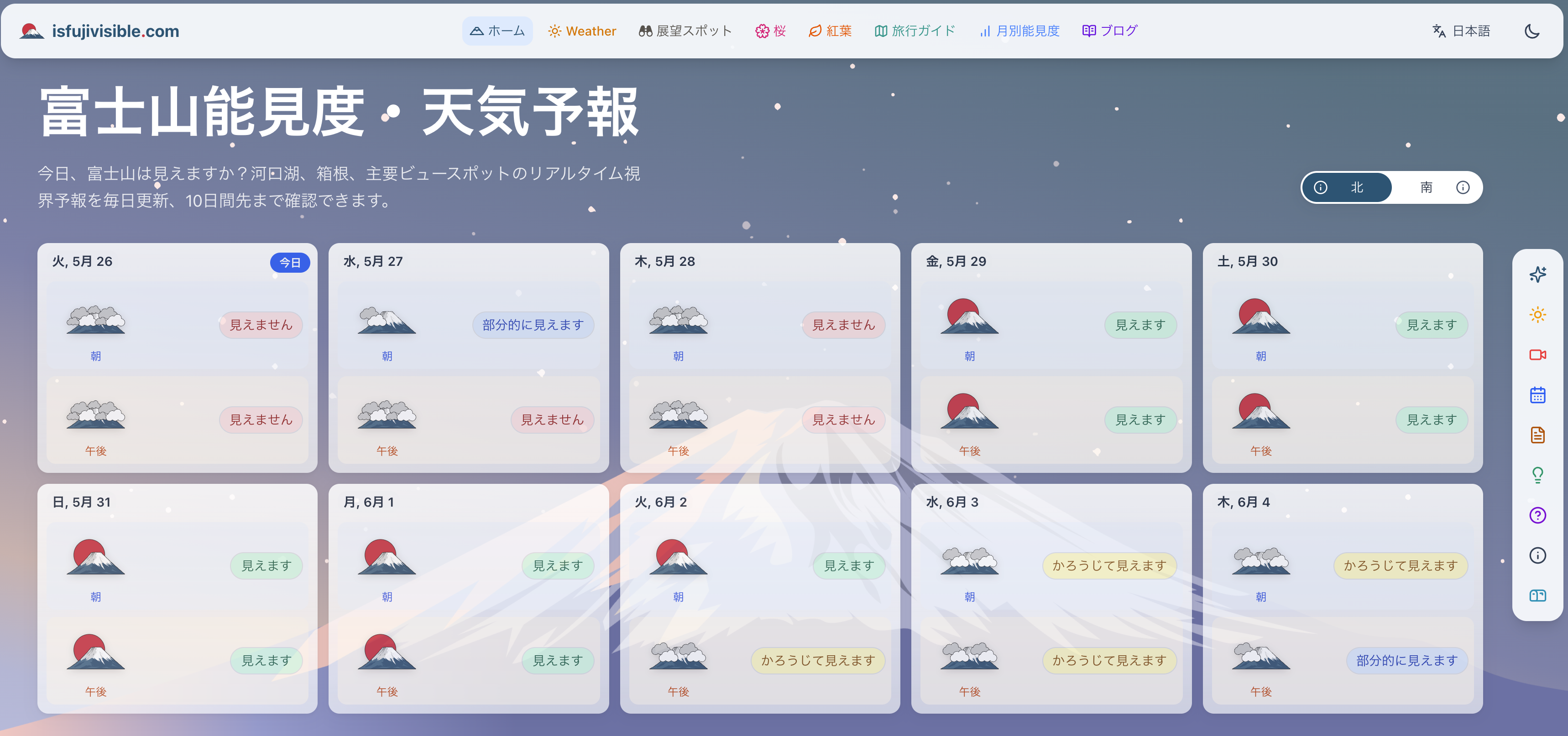
Underlying data: Yr.no — a global synoptic-scale weather model. Excellent for weekly planning, with no on-site verification step.
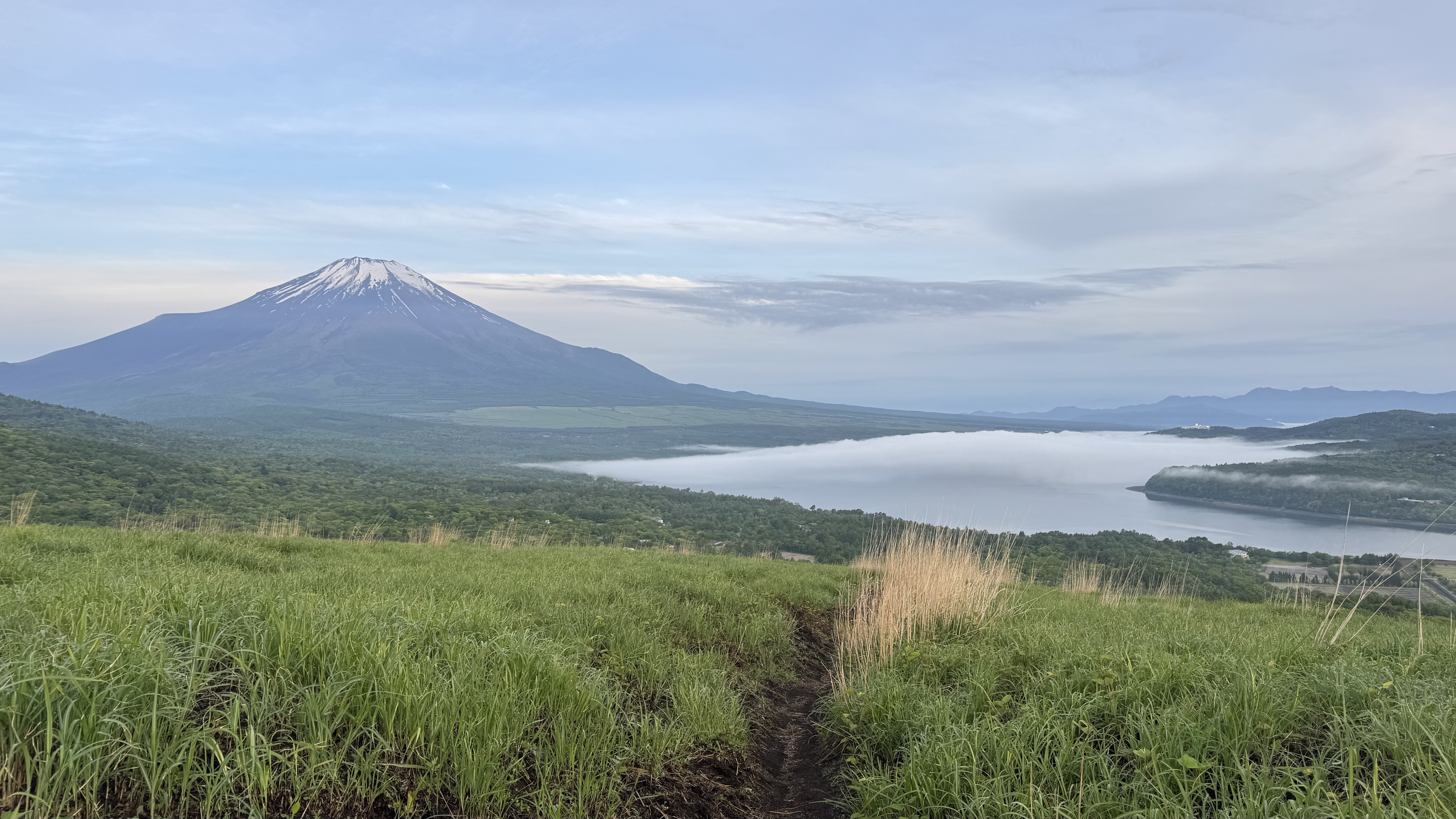
Photographed first from Lake Yamanaka (04:54), then Fujiyoshida (05:25). May 26, 2026 — Nobu, this page’s author.
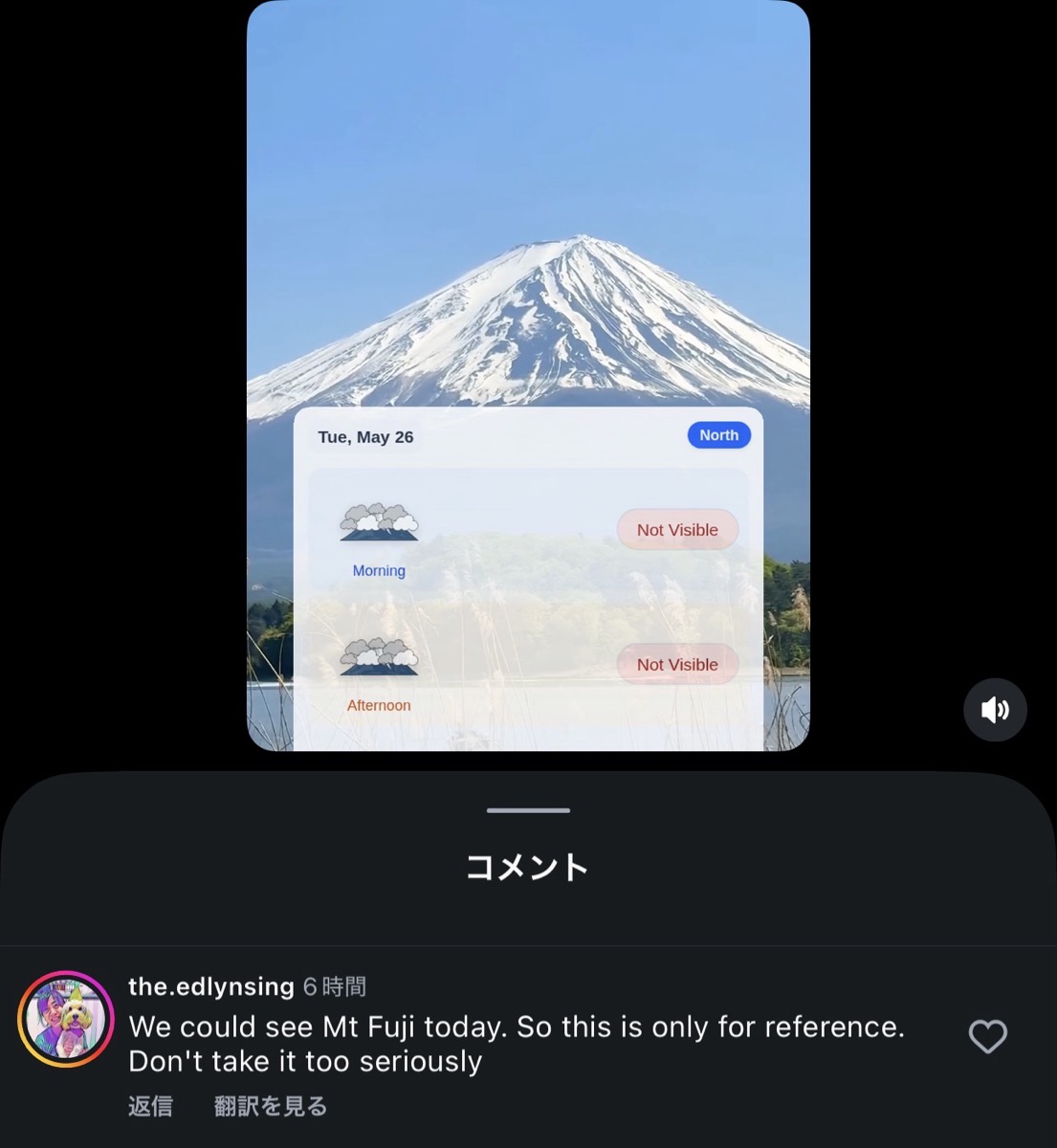
It wasn’t only us who saw it. On isfujivisible.com‘s own Instagram Reel posted that same morning, one of their viewers replied to say they had actually seen Mt. Fuji — and suggested taking the model prediction as reference only.
“We could see Mt Fuji today. So this is only for reference. Don’t take it too seriously.”
— Instagram reader comment on isfujivisible.com’s May 26, 2026 Reel
Both signals matter. isfujivisible.com‘s global-model forecast gives you a 7-day outlook for choosing your trip dates. This page — a photographic morning check from a resident — gives you the truth at 7 AM, when you’re deciding whether to drive out to the lake. We’re adding the verification layer, not replacing their forecast — and our accuracy log below shows the days we got it right alongside the days we didn’t, because Mt. Fuji’s microclimate sometimes catches everyone, including us.
Last 14 mornings — verified from Fujiyoshida
Every morning, a photographed verdict on whether Mt. Fuji is visible from the base. No algorithm, no model — just the mountain.
JMA prediction vs reality — last 30 days
Days the algorithm got it wrong (14)
- 2026-07-20 — algorithm score 6/10, but Nobu's photo verdict was visible.
- 2026-07-19 — algorithm score 7/10, but Nobu's photo verdict was hidden.
- 2026-07-18 — algorithm score 5/10, but Nobu's photo verdict was hidden.
- 2026-07-17 — algorithm score 5/10, but Nobu's photo verdict was hidden.
- 2026-07-16 — algorithm score 6/10, but Nobu's photo verdict was hidden.
- 2026-07-13 — algorithm score 4/10, but Nobu's photo verdict was visible.
- 2026-07-12 — algorithm score 5/10, but Nobu's photo verdict was visible.
- 2026-07-08 — algorithm score 5/10, but Nobu's photo verdict was hidden.
- 2026-07-07 — algorithm score 5/10, but Nobu's photo verdict was hidden.
- 2026-07-04 — algorithm score 5/10, but Nobu's photo verdict was hidden.
- 2026-06-30 — algorithm score 5/10, but Nobu's photo verdict was visible.
- 2026-06-24 — algorithm score 5/10, but Nobu's photo verdict was hidden.
- 2026-06-23 — algorithm score 6/10, but Nobu's photo verdict was hidden.
- 2026-06-22 — algorithm score 5/10, but Nobu's photo verdict was visible.
Our Mt. Fuji visibility record — last 55 days
A growing record of what was actually visible from Fujiyoshida. Eventually we hope to compare this year-over-year alongside the City of Fuji's 35-year baseline (1990–present) shown elsewhere on this page.
Month-by-month — our observed record
| Month | Days observed | Visible | Partial | Hidden | Visible % |
|---|---|---|---|---|---|
| May 2026 | 6 | 5 | 0 | 1 | 83% |
| Jun 2026 | 30 | 6 | 3 | 21 | 20% |
| Jul 2026 | 19 | 7 | 0 | 12 | 37% |
There is a single question that defines the Mt. Fuji portion of any Japan trip: will the mountain actually be visible the day I’m there? Most online answers are vague — “depends on weather.” The honest answer is sharper than that. Mt. Fuji has 33 years of recorded morning-visibility data, and the variance between months is enormous. December clears 86% of mornings; July clears 14%. If you understand the seasonal arithmetic, the time-of-day pattern, and the live tools that actually work, you can stack the odds. This is the version of the visibility guide I’d give a friend planning their first Fuji trip.
33-year monthly morning visibility — Fujinomiya station data
% of mornings (10 AM observation) Mt. Fuji was fully or partially visible from Fuji City, Shizuoka — a 33-year average drawn from the city’s official daily observation record (1991–2023). Source: City of Fuji — Mt. Fuji daily visibility record · methodology.
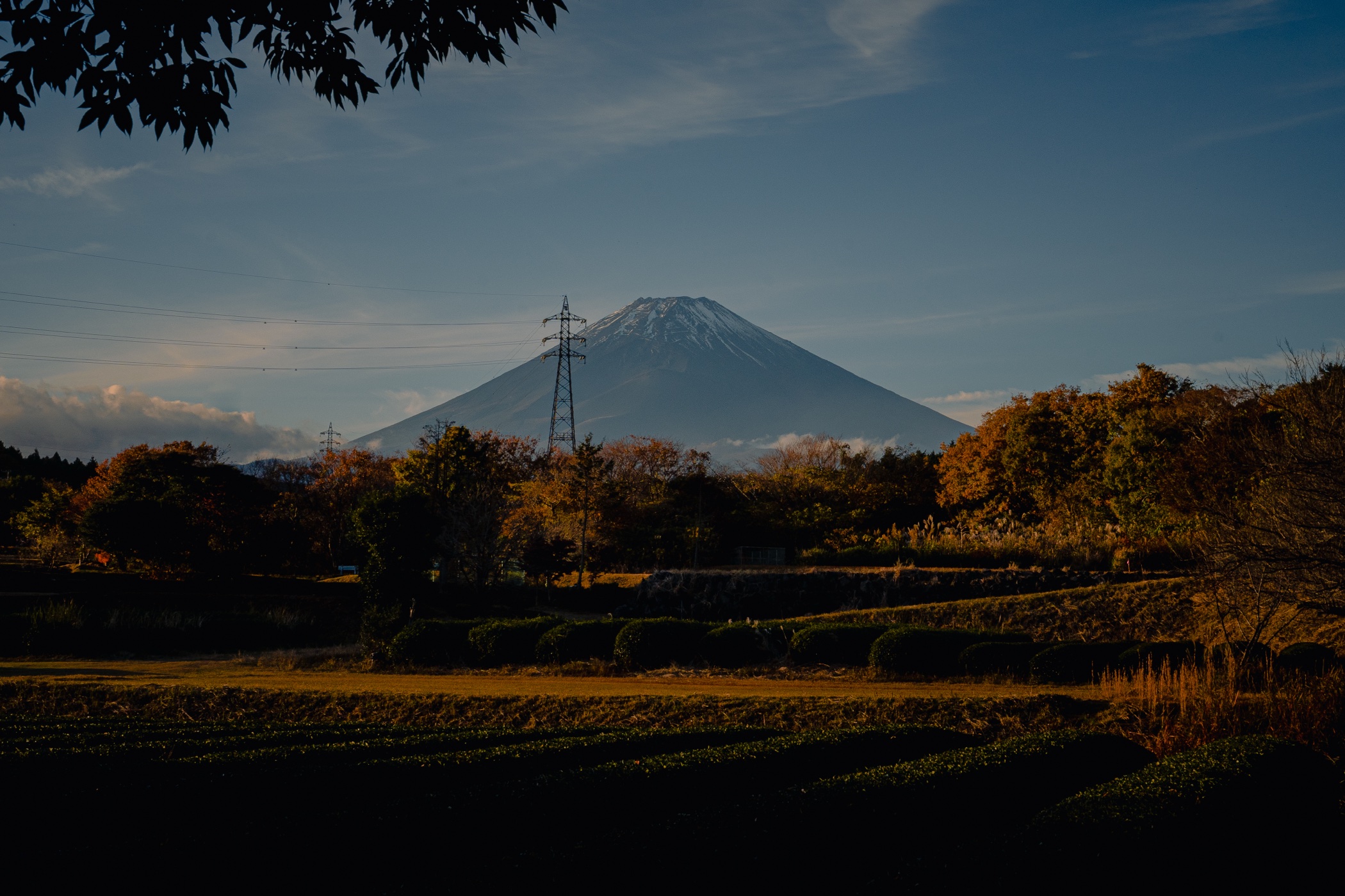
The pattern is climatic, not random. Summer is dominated by warm, moist Pacific air rising up the mountain’s flanks, condensing into cloud bands that sit on the peak through the day. Winter brings dry continental high pressure from Siberia — clear, cold, photographer’s weather. The shoulder months (March–April, October–November) are transitional and unpredictable. October is the inflection point: roughly half of mornings clear.
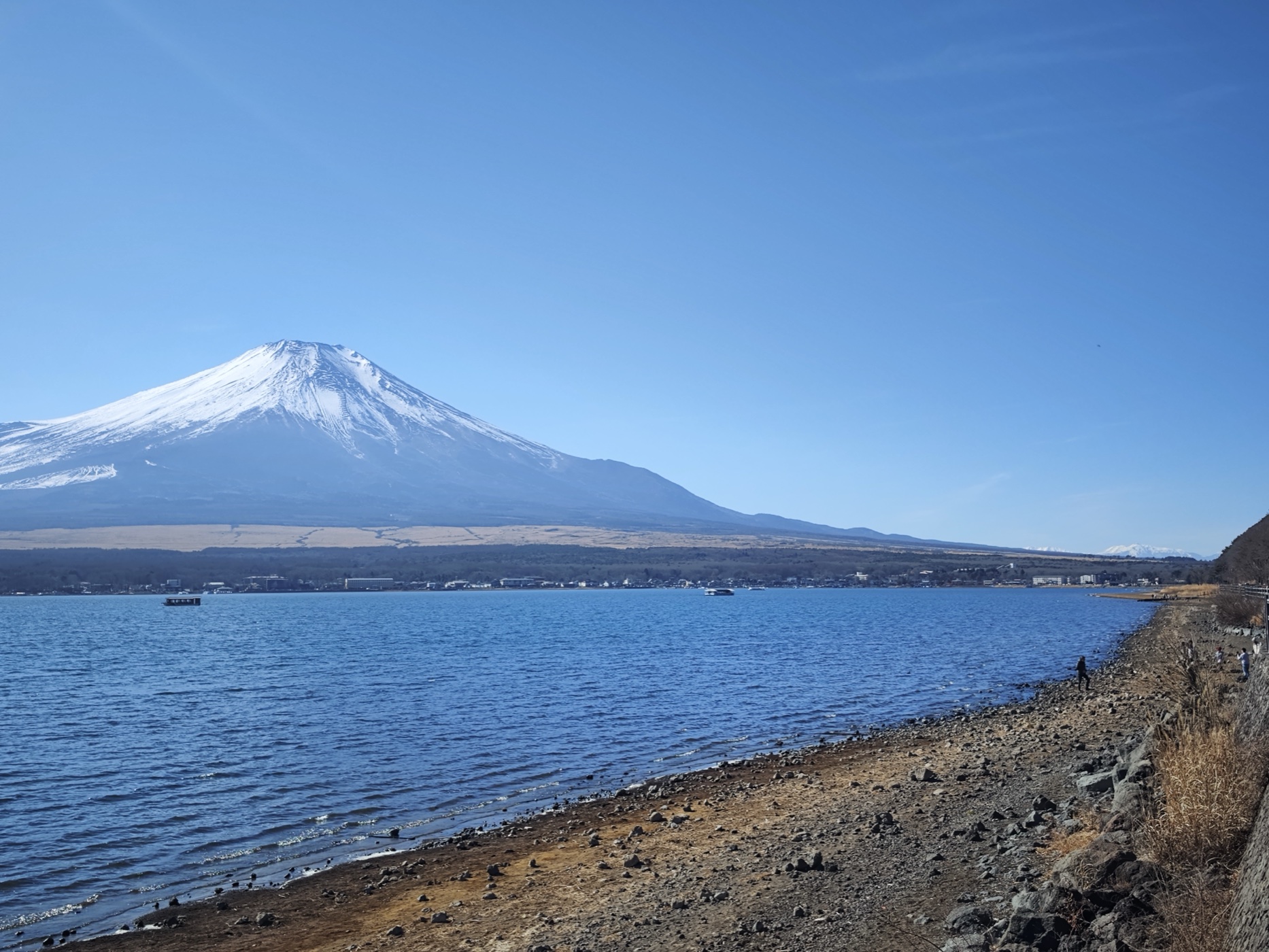
Lake Kawaguchi, late December morning. The classic photo.
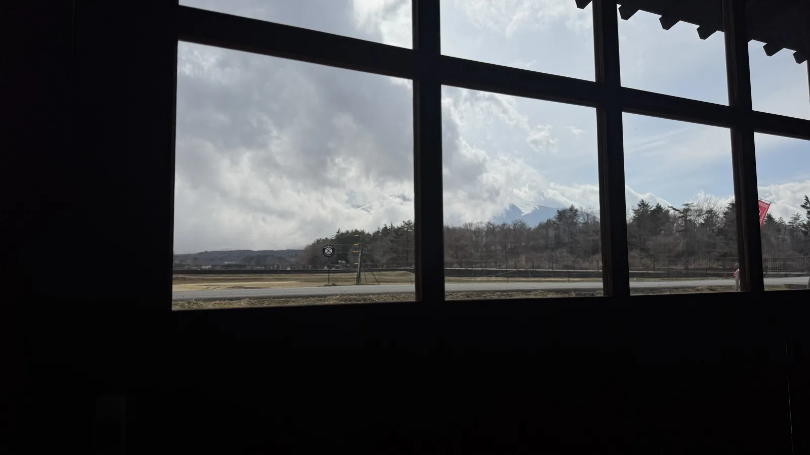
Same area on a cap-cloud day, from the Hanaan restaurant window near Yamanakako. This summit-wrapping pattern is most common June–September, but forms whenever the upper slopes warm faster than the surrounding air.
Tools that actually tell you “is it visible today?”
Three live tools are worth bookmarking. None is perfect, but used together they give you a reliable read by 7 AM most mornings.
1. @is_fuji_visible_today on Instagram
Run by a Fujiyoshida photographer who posts a single image at 7 AM JST every day, captioned with whether the mountain is visible from Fujiyoshida. The most reliable single source for “what does Fuji look like right now.” The IG widget at the top of this page pulls the latest post automatically — refresh in the morning.
2. FujisanWatcher live cameras
Yamanashi Tourism Organization’s live-camera grid covers Lake Kawaguchi, Lake Yamanaka, the Chureito Pagoda area, and the Fuji-Subaru Line. Updated every 60 seconds. Use this from your hotel breakfast table — if Kawaguchi is clear, drive immediately.
3. Tenki.jp / JMA detailed forecast
Skip the “sunny / cloudy” icon. Look at the cloud-cover percentage by altitude — the Mt. Fuji summit sits at 3,776 m, well above most cloud layers. A “sunny” valley forecast can still mean a cloud-wrapped peak; conversely, an overcast valley with high-altitude clarity gives you the rare “Fuji floating above the clouds” shot.
Seven viewpoints worth planning your day around
Each of these has a different optimal season, time of day, and access pattern. Pick one or two for a single trip; trying to chase all seven dilutes the experience.
| Viewpoint | Best season | Best time | Why go |
|---|---|---|---|
| Kawaguchiko Ohashi Lake Kawaguchi bridge |
Dec – Feb | Sunrise – 9 AM | The most accessible classic shot. Mountain reflects in the lake on still mornings. |
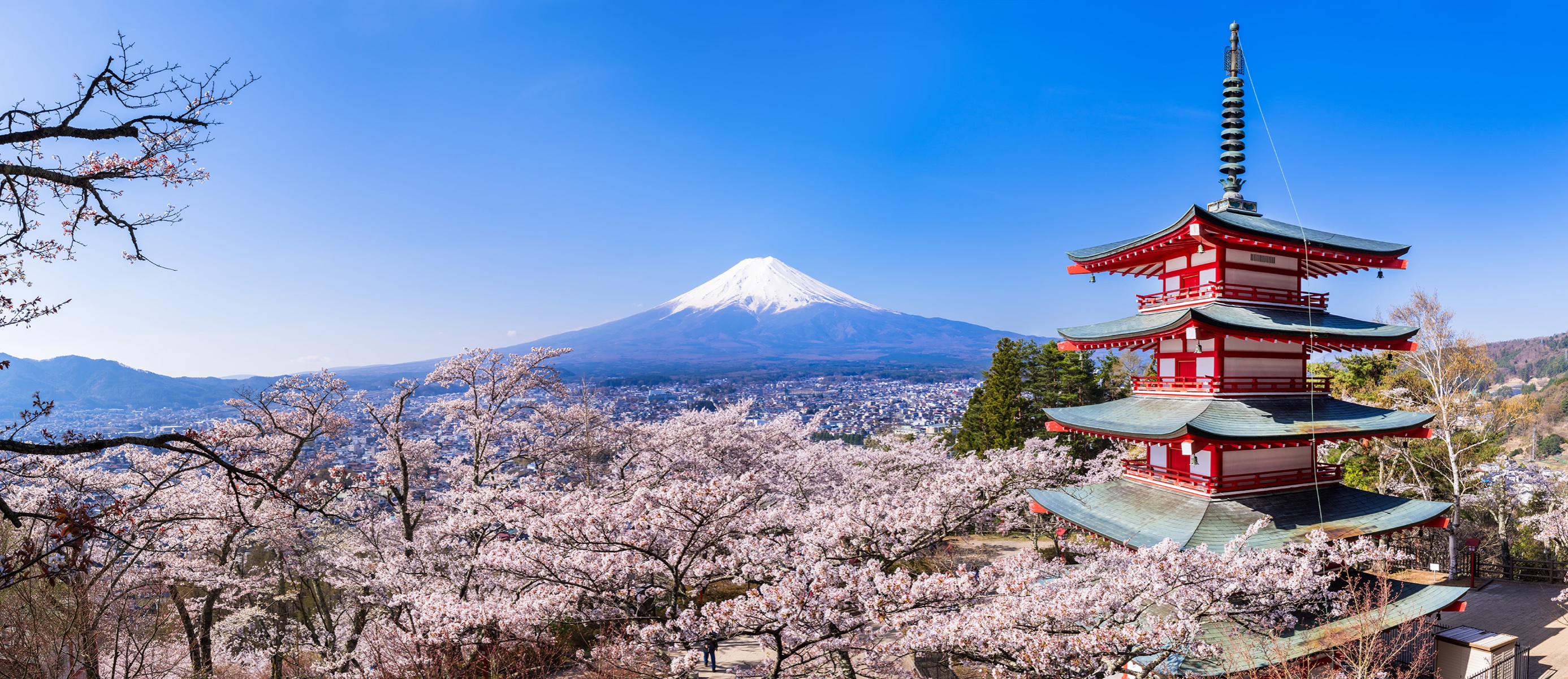
| Chureito Pagoda Arakurayama Sengen Shrine |
Apr (sakura) Oct–Nov (autumn) |
Dawn (before tour buses) | The five-storey pagoda + Fuji + cherry blossoms shot. Heavily photographed; arrive at 5:30 AM in season. |
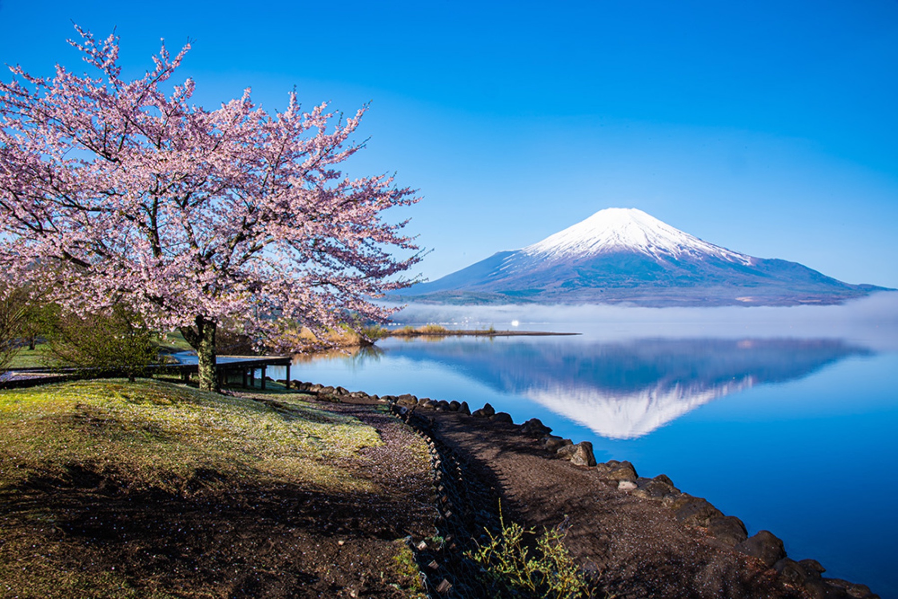
| Lake Yamanaka Yamanakako |
Nov – Feb | Sunrise (still water) | Larger lake than Kawaguchi, fewer crowds, better mirror reflections in winter. |
| Shichirigahama Beach Kamakura, Sagami Bay |
Dec – Feb | Sunset (Fuji + Pacific) | Fuji from the Pacific side, framed by the ocean and Enoshima island. 1 hour from Tokyo. |
| Oishi Park | May (nemophila) Jul–Aug (lavender) |
Morning | Seasonal flowers in foreground, Fuji across Lake Kawaguchi behind. The best summer Fuji-with-flowers viewpoint. |
| Lake Saiko (Iyashi-no-Sato) Nenba thatched village |
Year-round | Mid-morning | Reconstructed thatched-roof village + Fuji in the background. Quiet alternative to the main lakes. |
| Tenku no Torii Kawaguchiko sky gate |
Year-round (best Nov–Feb) | Sunrise | A torii gate on a mountain ridge looking down on Kawaguchi, with Fuji directly behind. Recent viral spot — book the timed ticket online. |

“December clears 86% of mornings. July clears 14%. The variance between months is enormous, and most online guides skip past it.”
Shooting Fuji from these viewpoints?
If you are planning your day around a clear Fuji, a few small things make the photos worth the early start — and my full camera kit is here. Everything below is on Amazon Japan, so you can have it delivered to your hotel before you go.
Tatsumi Shokudo (Susono)
A Showa truck-stop diner for lunch at the foot of Fuji.
Should You Climb Mt Fuji — or Just See It?
Climb it, or just see it? A 2026 decision guide.
Travel tripod
For the blue-hour and dawn shots when Fuji is sharpest and the light is too low to shoot handheld.
Fast SD card
So you are not deleting frames at the viewpoint when the cloud finally lifts.
Spare battery
Cold mornings drain batteries; a charged spare saves the shot you waited for.
Why morning matters more than season
Even within a “good” month like December, time of day matters more than most travellers realise. The mountain warms during the morning, drives convection, and pulls valley moisture upward into cumulus clouds that wreathe the summit by mid-afternoon. The same peak that’s perfectly visible at 6 AM is often hidden by 2 PM.
- Sunrise – 8:30 AM: highest probability of a clean view, year-round. Air is coldest, atmosphere is most stable.
- 8:30 AM – 11 AM: still good in winter; visibility starts dropping in summer.
- 11 AM – 4 PM: lowest visibility window, especially May–September.
- Late afternoon – sunset: occasionally clears as convection dies down. Worth checking again at 4–5 PM.
For trip planning: book a ryokan in Kawaguchiko or Yamanakako so you wake up at the lake. Walking to the shore at 6 AM and seeing the mountain is a different experience from driving up at 11 AM and finding it gone. See Best Time to See Mt. Fuji for a longer monthly breakdown.
If Mt. Fuji is hidden — Plan B that’s worth your trip
Statistically, you may arrive on a day when Fuji is fully cloud-wrapped. The Fuji Five Lakes region is dense with worthwhile alternatives, especially within the Kawaguchiko–Yamanakako–Saiko area. Three I’d build a half-day around:
Yamanashi’s signature dish: flat udon, miso broth, pumpkin and root vegetables. Hoto Fudo has multiple Kawaguchiko locations; the building near the lake is a Kengo Kuma design. Hanaan at Hana no Miyako Park is the under-the-radar pick — Fuji-view garden seating included.
Kimono-dyeing master Itchiku Kubota’s lifework, displayed in a Gaudí-inspired building on the north shore of Lake Kawaguchi. Even on a fogged-out day, this is one of the most quietly extraordinary museums in Japan.
Fuji Chōbō no Yu Yurari near Saiko offers day-use baths with potential summit views when the cloud breaks. Kuku-Na in Kawaguchiko is the upscale option (rooms with private outdoor baths). Even hidden, the soak is the soak.
For a longer “what to do regardless of weather” Kawaguchi–Saiko itinerary, our Oishi Park flower-park guide and Lake Saiko guide cover the alternatives in depth.
Book the right base
Fuji visibility is morning-dependent, and the difference between staying in Tokyo vs. Kawaguchiko is the difference between catching it and missing it. The drive from Tokyo to Kawaguchiko is 2–2.5 hours; if you leave Tokyo at 6 AM you’ve already lost the best window.
FAQ
Is Mt. Fuji visible from Tokyo?
On clear winter mornings, yes — from elevated viewpoints (Tokyo Skytree, Roppongi Hills, Bunkyo Civic Center) and from west-facing high-rise hotels. Visibility from Tokyo is roughly proportional to the figures in the heatmap above; December and January are reliable, summer is rare.
Is Mt. Fuji visible from the Shinkansen?
Yes, on clear days, between Mishima and Shin-Fuji stations on the Tokaido Shinkansen (about 25–35 minutes after leaving Shinagawa westbound). Sit on the right side of the train going Tokyo→Kyoto, left side going Kyoto→Tokyo. The view lasts about 4–5 minutes.
What’s the best month overall?
December if you only care about clear-mountain probability (86% of mornings). November if you also want autumn leaves at Chureito and the Fuji Five Lakes. April for cherry blossoms with Fuji, but visibility drops to 35%.
What if I’m visiting in summer?
Manage expectations down. Plan to wake at sunrise for the best chance, expect cloud by mid-morning, and treat any clear summit as a bonus rather than the planned shot. The summer climbing season (July–September) is also when visibility from below is statistically worst.
Is there a Mt. Fuji webcam app?
FujisanWatcher (Yamanashi Tourism) is the most reliable web-based live-camera grid; it works on mobile browsers without an app install. SkylineWebcams has a single live feed of the lake/mountain. For social-media context, follow @is_fuji_visible_today for daily morning calls.
Can I climb Mt. Fuji to “see it”?
You can climb it (July 1 – September 10 depending on trail) but you can’t see it from itself — once on the mountain you’re inside the cloud. To photograph Fuji as a shape, you have to be elsewhere. See our Climbing Mt. Fuji 2026 guide for the climbing logistics including the new ¥4,000 fee.
Is there a fee to view Mt. Fuji?
No. All viewpoints listed above are free or have a small access fee for the platform/shrine itself (e.g., the Tenku no Torii ridge has a ~¥800 access fee to enforce visitor caps, but the view itself is just looking up at the sky). The only paid Fuji-related event is climbing the mountain.
How do I time a trip around the cherry blossom + Fuji combination?
The Chureito Pagoda + sakura + Fuji shot peaks roughly April 7–14 in a typical year, depending on bloom timing. Visibility in April is statistically poor (35%), but the combined sakura + Fuji morning at Chureito is one of the most photographed scenes in Japan when it lands. Check the live IG account in the days before to plan around the weather.
How many days a year is Mt. Fuji visible?
Per the City of Fuji’s official daily observation (1990–2025, 35 continuous years), Mt. Fuji is fully or partially visible on roughly 230 days per year from the Pacific (southern) side — about 63% of all days. Winter peaks at 86% of mornings clear; July drops to 14%. The 2025 record: 136 days fully visible, 95 partially, 134 not visible at all.
Visibility is best in December and January (dry continental high pressure from Siberia), worst in June and July (Pacific monsoon humidity). Within any month, time of day matters more than the season average — see the morning vs. afternoon section above.
Is Mt. Fuji visible tomorrow?
Check the Tomorrow’s outlook block at the top of this page. We post a next-day forecast each evening from Fujiyoshida, combining JMA pressure data, cloud-cover trend, and what the mountain has been doing all day. For trip-planning more than 24 hours ahead, the JMA 7-day forecast at the top of this page is more reliable than any single-day guess.
One rule of thumb: if today is clear and the surface high-pressure pattern is stable, tomorrow morning is usually clear too. A passing low or front collapses visibility within 6–12 hours.
How long does Mt. Fuji stay visible each morning?
On a clear day, the typical morning window runs from sunrise to about 9 AM, sometimes extending to 11 AM in winter. After that, daytime heating drives convection on the slopes and cumulus cloud builds over the summit — first as a thin lenticular cap, then thickening through the early afternoon.
The window closes fastest in summer (often by 7 AM in July and August) and lasts longest in December and January, when the mountain can stay clear well past noon. If you only have one day for photos, arriving at the lake before 6 AM is the single highest-impact decision.
How can I check if Mt. Fuji is visible right now?
Three real-time tools, used together:
- This page’s morning verdict — a Fujiyoshida resident photographs the mountain and posts the result each morning (and intra-day when conditions change). The latest entry is at the top of this page.
- FujisanWatcher — Yamanashi Tourism’s live camera grid, refreshing every 60 seconds from seven points around the Fuji Five Lakes.
- JMA Kawaguchiko AMeDAS — cloud cover, humidity, and wind from the official observation station. If cloud cover at altitude is under 30% and wind is light, Fuji is almost certainly visible.
All three agreeing = near-certain visibility. Two of three agreeing = high confidence. The single-source forecast can be wrong; the combined check almost never is.
What does “partial visibility” mean for Mt. Fuji?
Partial visibility usually means the lower slopes show clearly but the summit is wrapped in cap cloud (kasa-gumo, 笠雲) — a lenticular cloud that forms when moist air rises over the peak and condenses at altitude. Locally it is also called tsumami-gasa (“pinch hat”) because of its disk-like shape.
Cap cloud can clear within 30 minutes or persist all day, depending on the high-altitude wind. Photographs taken in this state often have a “mountain in mist” aesthetic and are considered beautiful in their own right — Hokusai painted Fuji wrapped in cap cloud more than once. If you see partial visibility in this page’s morning verdict, do not assume the day is lost; wait an hour and check again.
How we make today’s call — sources and methodology
Every morning verdict on this page combines a single ground-truth human observation (a Fujiyoshida-based photographer) with cross-references from Japanese government meteorological data. We do not rely on foreign weather models for Mt. Fuji — Japanese national agency data is significantly more accurate for this terrain because the observation stations are physically located on and around the mountain.
Primary data sources
- Daily ground observation from Fujiyoshida. Mt. Fuji is photographed at sunrise from the base by Nobu, a long-time Fujiyoshida resident. The morning verdict on this page is based on what is actually visible, not modeled. Daily updates are posted to @is_fuji_visible_today on Instagram.
- JMA Kawaguchiko AMeDAS station (47640). Cloud cover, wind direction, humidity, temperature, sunshine duration, and precipitation from the Japan Meteorological Agency’s official observation station at Lake Kawaguchi, continuous data since 1872. JMA Kawaguchiko archive →
- JMA Mt. Fuji summit AMeDAS (47639). Temperature, pressure, humidity, sunshine duration recorded hourly at the 3,776 m summit. Used as a high-altitude cross-check for cloud-cap likelihood.
- City of Fuji 35-year visibility record (1990–2025). The City of Fuji, Shizuoka has officially observed Mt. Fuji’s visibility three times a day (08:00, 12:00, 16:00) from the city hall 8th floor since May 1990. This is the longest continuous published record of Mt. Fuji visibility, and is the source of the 33-year monthly probabilities in the heatmap above. City of Fuji methodology →
- FujisanWatcher live cameras (山梨県観光部). Real-time imagery from seven public cameras around the Fuji Five Lakes (Shintōge, Lake Kawaguchi, Fujiyoshida, Sen’en, Lake Shōji, Fujigamine, Lake Yamanaka), used as live cross-reference. Yamanashi prefecture cameras →
- Shizuoka Mt. Fuji View cameras (静岡県). South-side live cameras for cross-confirmation of visibility from the Pacific-facing slopes. Shizuoka prefecture cameras →
- tenki.jp summit-altitude forecast (日本気象協会). High-altitude weather forecast issued in six-hour blocks for four days ahead. Used as a tomorrow-and-after look-ahead. tenki.jp Mt. Fuji →
- imafuji.earth. Live JMA-summit data normalised for climbers and lay readers, plus contemporaneous mountain-hut observations. Cross-referenced for current summit conditions. imafuji.earth live data →
Why we don’t rely on foreign weather models
Global weather models such as ECMWF or Yr.no — the latter is the source for some competing visibility sites — are excellent at synoptic-scale forecasting but underperform around isolated stratovolcanoes. Mt. Fuji generates its own microclimate; the upslope convection cycle, the diurnal cap-cloud pattern, and the way summer Pacific moisture interacts with the lower flanks are best read from on-site observation backed by Japanese station data. We default to JMA-grounded inputs because the observation points are physically located on and around the mountain.
What this page does not predict
This page does not publish a numeric atmospheric-visibility forecast (km) for distant viewpoints — that calculation requires aerosol-optical-depth data the JMA does not publish openly. If you need precise visibility ranges (for example, to photograph Mt. Fuji from Tokyo Skytree or Enoshima), check the JMA visibility (視程) bulletin on the day. Our morning call answers the practical question: from a Five Lakes base or nearby viewpoint, would you see the mountain in a recognisable, photographable form?
Today’s visibility verified May 26, 2026 at 05:25 JST from Fujiyoshida by Nobu. 33-year monthly visibility data via the City of Fuji official observation record (1991–2023). Page last structurally updated May 26, 2026.
Stack the Odds For a Clear-Fuji Morning
If your dates are in the unstable months (April–September), the single biggest move is staying within 2 km of a Fuji-view bridge. Three booking paths:
Related reading: Fuji is still an active volcano, and experts keep warning about how a future ashfall could disrupt Tokyo.
Where to stay near Mt Fuji: compare hotels and prices on Booking.com or Trip.com — booking early pays off in peak season.
Join 1,000+ travelers discovering Japan's hidden side
Weekly dispatches from off-the-beaten-path Japan — spots and stories you won't find in guidebooks.
No spam. Unsubscribe anytime.
Welcome aboard!
You're in. See you in your inbox soon.