
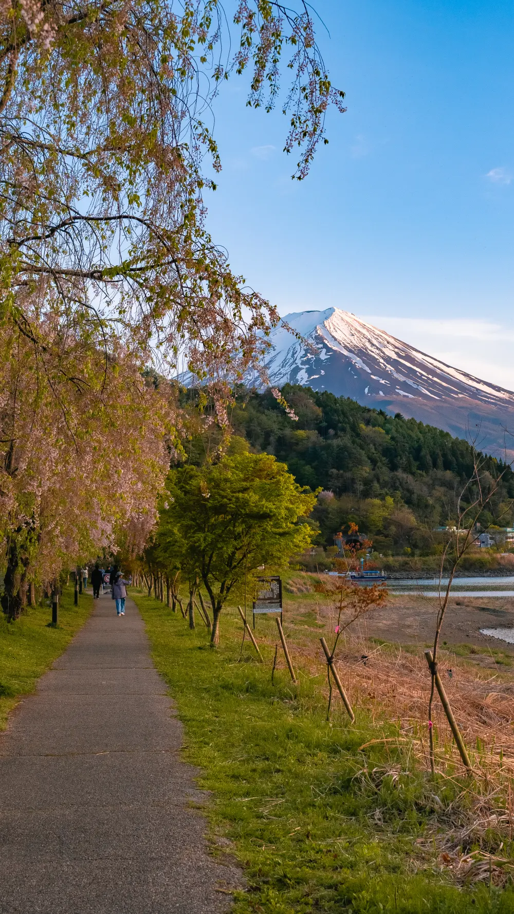
There is a stretch of the Kawaguchiko walking trail — maybe 300 meters long, on the northeast shore where the Misaka-michi road meets the lake — where the path passes under a row of weeping cherries that bloom a week or two after everything else in central Japan has finished. You could walk the entire lakeshore loop and not specifically know this stretch exists. Online, there’s almost nothing written about it. At peak bloom on a weekday afternoon, you’ll share the path with maybe six people.
Almost no English sources document this specific part of the trail. Most guides cover the main lakeshore path — which is about 3.5 km from the Kawaguchiko Music Forest Museum area to Oishi Park. The weeping cherry row this article is actually about sits on the northeast edge, on a smaller section the main guides skip.
Everything below comes from a visit I made on April 21, 2026 — confirmed on the ground, with photos — plus what is documented on the main trail’s official sources. Where I can’t confirm a specific fact, I say so.
Where It Is, Exactly
The row runs along a walking path parallel to the Misaka-michi (御坂みち) section of the Kawaguchiko lakeshore — on the northeast side, not the more touristy north or south shores. There are a few small pull-off parking areas within a short walk. No signage calls out this particular stretch. If you’re driving the Lake North View Line and you see weeping cherries leaning over the path, you’re in the right place.
The Basics
length
& trail access
stroller-friendly
Kawaguchiko IC
Those stats are for the shidare section itself. The broader Kawaguchiko walking trail runs the length of the northern lakeshore — documented at roughly 3.5 kilometers from the Kawaguchiko Museum area to Oishi Park, taking 1 to 2 hours end-to-end at an honest pace. You can walk just the cherry section in 15 minutes, or tack it onto the longer lakeshore walk.
When It Blooms
Shidare-zakura at Kawaguchiko — 2026 Season
First buds Apr 14
Peak bloom Apr 21
Tail end Apr 28
Finished
The useful quirk: this row blooms about two weeks after Tokyo’s Somei Yoshino. If you’ve missed every cherry blossom below 500 m, this trail is one of the places you can still catch them. Local conditions vary year-to-year — check the Kawaguchiko tourism board’s bloom forecast in early April.
The Walk, Step by Step
Park at one of the lakeside pull-offs
The road along the lake’s northeast edge has several small paved pull-offs, free to use, each with room for 4–8 cars. None of them are gated or ticketed. Arrive before 10:00 AM on a bloom weekend or after 15:00 — the row gets busier around midday when bus-tour stopovers peak.
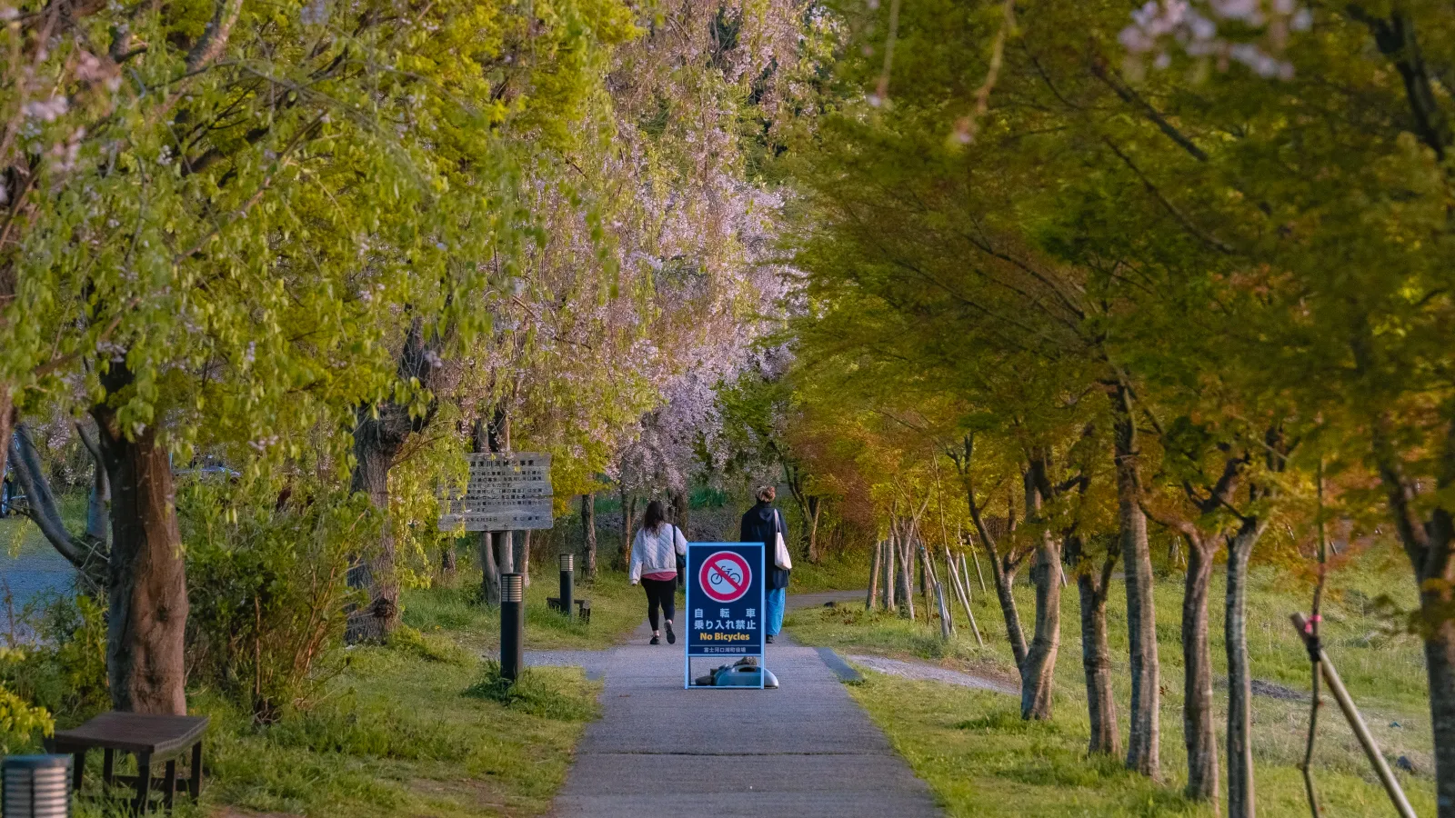
Cross onto the paved walking path
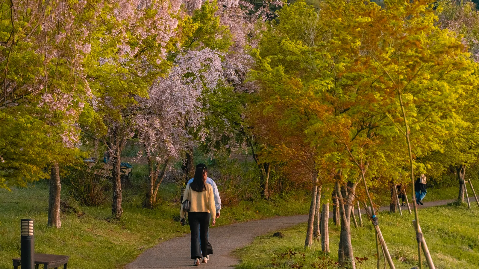
The path sits just below the road, a few meters above the waterline. It’s paved, flat, and wide enough for two people abreast. Bike-sharing users pass through here but at walking speeds.
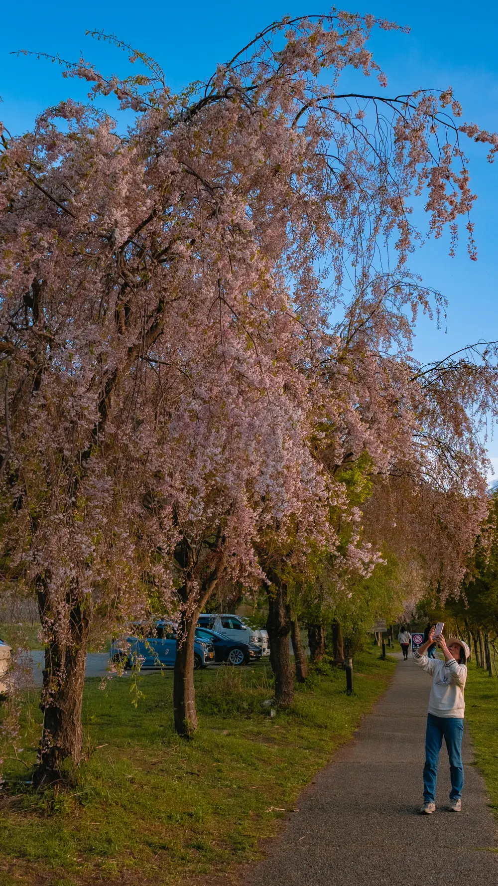
Walk east — the shidare row starts almost immediately
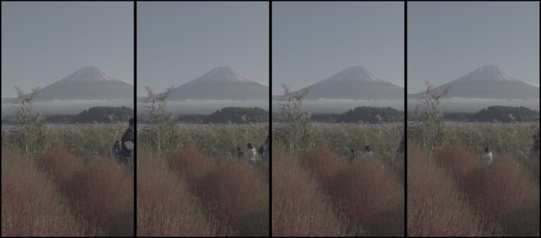
The weeping cherries line the lake-facing side of the path for a stretch of maybe 300 meters, with Mt. Fuji directly south across the water. The trees are young enough that the branches still drape close to head-height, which is why the photos feel so tunnel-like.
Optional — continue toward Oishi Park
Keep walking another 20–30 minutes along the lakeshore and you’ll reach Oishi Park — the more famous viewpoint with the lavender fields in summer. Same path, no transfers. Roughly 2 km from the shidare row.
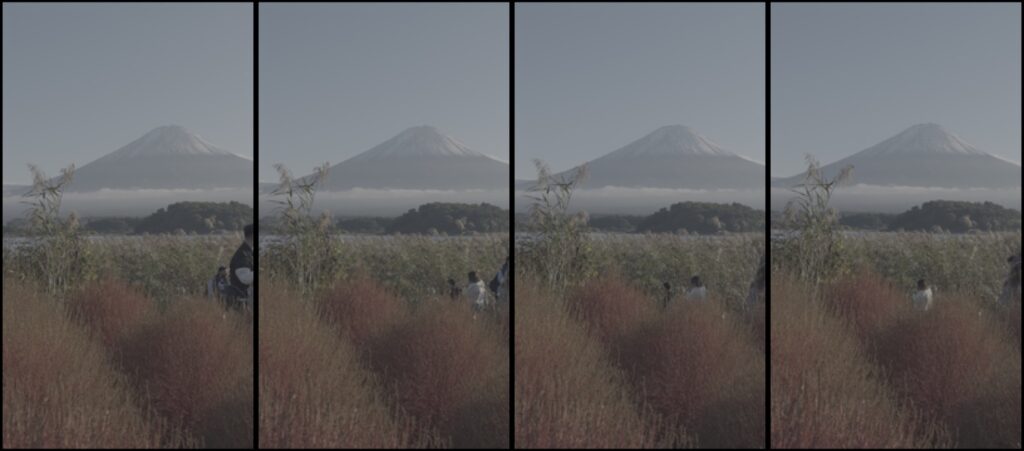
A Photo Walk
The photos below were shot in a single afternoon between 16:00 and 17:30 on April 21, 2026 — late light, blossoms about 60% remaining on the branches:
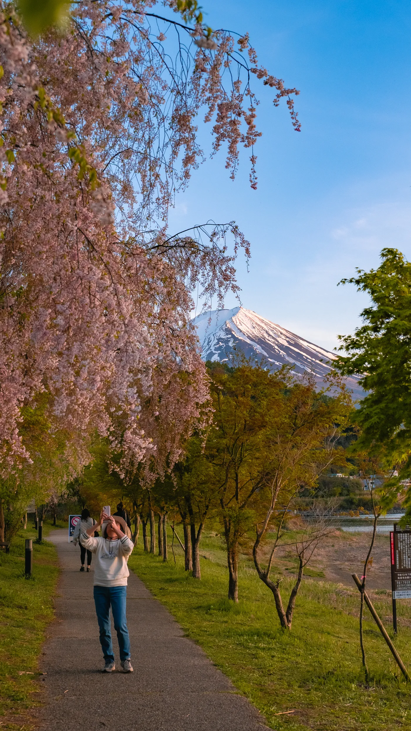
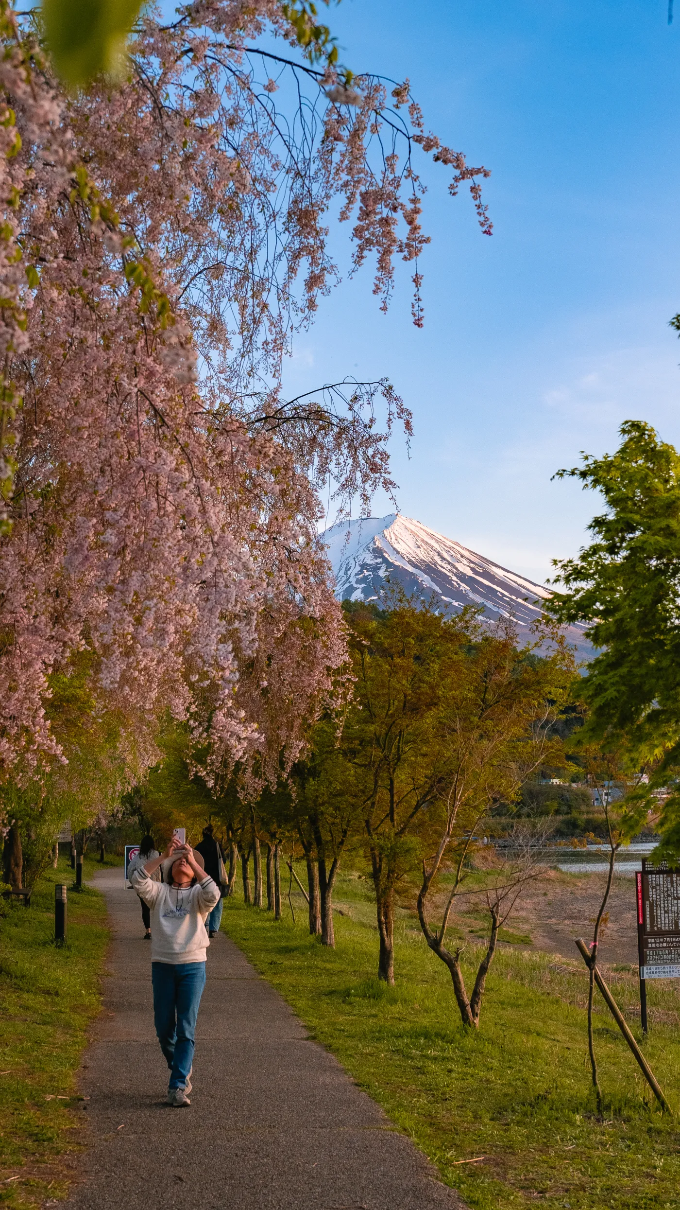
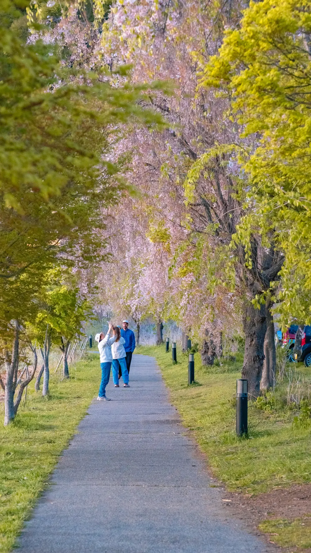
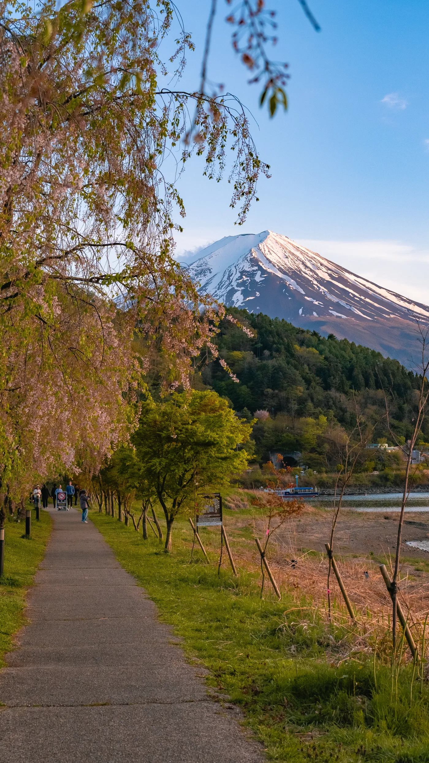
Left to right: close-up bloom with Fuji, visitor in frame, couple walking the lane, the wider path view.
The 60% bloom you see in the strip above is what you get a week past peak. It’s actually the best time for photographs — fewer people, softer light, petals on the ground. If you’re chasing the pristine 100% bloom shot, plan for the Tuesday/Wednesday closest to April 14. If you want the “empty path with a few blossoms left” feel, aim for April 21–24.
Practical Observations
- No ticket window. No gate. No fee. The shidare row is along a public walking trail on public land.
- Benches are few. If you want to sit with the view, bring a camping chair. Plenty of people do.
- Toilet facilities: the nearest public restrooms are back at the main Kawaguchiko parks — about 10 minutes by car. Plan accordingly.
- The path is bike-shared. You’ll pass cyclists. They’re courteous at walking speeds but be aware on blind corners.
- No food or vending machines on this specific stretch. Bring coffee from Kawaguchiko town.
- Dogs on leash: common and welcome on the path.
Why It’s Not On Every Tourist List
A few honest reasons:
- The main Kawaguchiko cherry sightings — the north shore from Oishi Park to Nagasaki Park — have bigger, more photogenic Somei Yoshino rows that peak a week earlier. Tour buses go there. They don’t detour east to the smaller shidare line.
- The weeping cherry variety is newer. These trees are younger than the famous ones at, say, Kajiroji temple or Rikugien. They don’t have the dramatic drooping canopy the oldest shidare in Japan have.
- Japanese-language tourism info exists — barely. The trail is indexed by a few Yamanashi tourism sites, but not called out as a headline attraction.
- Most travelers come to Kawaguchiko for the headline Fuji view. They park at Oishi, they shoot, they leave. They don’t walk the full lakeshore.
The shidare row on the northeast walking trail is the kind of place that rewards mid-April mornings without a plan. Park at a small pull-off, walk east for ten minutes, stand under the canopy, photograph as much or as little as you want, walk back. It’s a 45-minute visit. It’s free. Most people staying at Kawaguchiko don’t know about it.
Pair It With
- Saiko Iyashi no Sato Nenba — the thatched-roof village with its own shidare row. 25 minutes by car. Peak cherry overlaps exactly.
- Lake Saiko — the quieter Fuji lake with campgrounds and paddling. 20 minutes by car.
- Oishi Park — the more famous viewpoint at the end of the main trail. 30 minutes walking from the shidare row.
- Hana no Miyako Koen — the tulip + shidare field 30 minutes east. If you’re chasing late cherries, do both in one day.
- Chureito Pagoda — the five-story pagoda Fuji composition. 25 minutes by car.
- Mt. Fuji hub — complete guide to all the viewpoints, routes, and where to stay.
Getting Here
By car
From Tokyo: about 2 hours via the Chuo Expressway to Kawaguchiko IC, then 15–20 minutes around the lake to the northeast shore. Park at any of the small pull-offs along the lake road. Car rental from Kawaguchiko Station is the right call — compare on DiscoverCars.
By public transit
From Kawaguchiko Station, the Kawaguchiko Shuyu (loop) Bus — Green Line or Red Line depending on direction — stops at multiple points along the lakeshore. Get off at “Kawaguchiko Kouchi-mae” or nearby; walk 5–10 minutes. A day pass is ¥1,500 adult.
Where to Stay
The walking trail doesn’t need an overnight, but it pairs well with a Kawaguchiko ryokan or hotel. See our Mt. Fuji hub for Kukuna, Fufu Kawaguchiko, and Kozantei Ubuya — all within 10 minutes of the trail by car. Compare rates on Agoda, Booking.com, or Expedia.
Frequently Asked Questions
Where exactly is the shidare row?
On the northeast shore of Lake Kawaguchi, along the walking path running parallel to the Misaka-michi (Route 137) section. Coordinates above: approximately 35.5109° N, 138.7744° E. No official signage calls out this specific stretch.
When is the peak bloom?
Typically the second week of April at Kawaguchiko’s elevation. In 2026, peak was around April 14–17. Weeping cherries open roughly a week later than Somei Yoshino at the same altitude.
Is the trail paved?
Yes. The Kawaguchiko walking trail is paved, flat, and suitable for strollers and wheelchairs. The shidare section is on the same paved surface.
Do I need a ticket?
No. The path is public and free. Parking is also free at the lakeside pull-offs.
How long should I spend here?
45 minutes for the shidare row alone, with photos. Extend to 2 hours if you continue walking to Oishi Park and back.
Is this the same as the Kawaguchiko Museum Trail?
Partially. The main Kawaguchiko walking trail runs from the Music Forest Museum area to Oishi Park, about 3.5 km along the northern shore. The shidare section this article focuses on is a specific stretch on the northeast edge of that broader trail network.
Can I bike the trail?
Yes. The trail is shared with cyclists. Bike rentals are available at Kawaguchiko Station and several lakeside rental shops — roughly ¥1,500 for a half-day.
Final Take
There’s a version of a travel spot that only works because it’s barely documented. This trail is one of them. Too big to be called a secret, too specific to show up on Japan guide lists. If you’re in Kawaguchiko in the third or fourth week of April, drive ten minutes past the famous shore, park anywhere there’s space, and walk east. The weeping cherries will be there. So will Mt. Fuji. And most of the time, you’ll have it nearly to yourself.
Last updated: April 2026, with ground visit on April 21. The main trail facts (length, access, paving) are corroborated by the Fuji-net tourism report (original source). The shidare section specifics come from direct observation and coordinates from the Google Maps embed above. If bloom timing matters for your trip, confirm via the Kawaguchiko tourism board’s annual sakura forecast in early April.
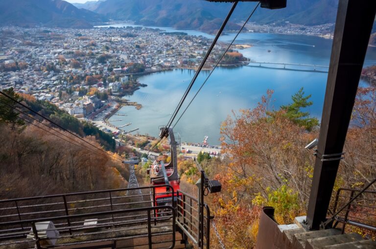
- Mt. Fuji Panoramic Ropeway 2026: New Fortune Terrace, Views & Set Tickets
 The Mt. Fuji Panoramic Ropeway climbs from Lake Kawaguchi to Mt. Tenjo in three minutes. Its new July 2026 Fuji Fortune Terrace, fares, hours, the smart set ticket, and how to get there without a car.
 - Lake Kawaguchi’s New Oishi Park Ferry: Skip the Bus to the Best Fuji View
 Lake Kawaguchi’s new Oishi Park ferry (from 17 July 2026) crosses straight to the postcard Mt Fuji viewpoint, skipping the crowded bus. Route, set ticket and tips.
 - Hanoi to Mt Fuji on Vietjet: Is Shizuoka Airport a Good Gateway to Kawaguchiko?
 Vietjet’s new Hanoi–Mt Fuji Shizuoka Airport flight (2026): how far the airport really is from Fuji, getting to Kawaguchiko, and where Shizuoka Airport actually shines.
 - Why Is Mt Fuji a World Heritage Site? Faith, Art & the 25 Component Parts (2026)
 Mt Fuji is a UNESCO cultural — not natural — World Heritage Site. A Fujiyoshida local explains the 2013 listing, its faith-and-art story, and the 25 component parts.
 - How to Reserve & Pay the Mt Fuji Climbing Permit (2026, Yoshida Trail)
 Step-by-step English guide to reserving and paying the 4,000 yen Mt Fuji Yoshida-trail permit via Asoview, with real screenshots of the booking flow.
2026 cafe cherry blossom cherry blossoms day trip from tokyo flower festival fuji five lakes fujiyoshida Fukuoka fushimi hanami hiking japan japanese culture japanese food japan travel kamakura kanagawa kawagoe kawaguchiko Kumamoto kyoto Kyushu Mount Fuji Mt.Fuji mt fuji Nagano Nara Onsen post town ryokan Saga saitama sakura Shizuoka shrine spring spring in japan summer Tokyo travel travel guide winter winter travel Yamanashi
Join 1,000+ travelers discovering Japan's hidden side
Weekly dispatches from off-the-beaten-path Japan — spots and stories you won't find in guidebooks.
No spam. Unsubscribe anytime.
Welcome aboard!
You're in. See you in your inbox soon.