Kyushu · Kumamoto · Mount Aso
Mount Aso is the active volcano at the centre of Kumamoto’s Aso caldera, and on open days you can look into its Nakadake crater from the rim. On 7 October 2026 the rim is closed: Asosan is at Volcanic Alert Level 2, with no entry within about 1 km. Kusasenri, the volcano museum and Kishimadake, where I have watched Nakadake steam, are open, and this is what to do instead.
Mount Aso crater status today
As of 01:55 JST on 7 October 2026, Asosan is at Volcanic Alert Level 2, and entry within about 1 km of Nakadake’s first crater is prohibited. Aso City says crater viewing is unavailable for now because the park road is closed, and the crater shuttle is suspended. The museum’s 2 September guidance says Kusasenri and Aso-sanjo Terminal remain accessible at Level 2. The terminal is normally open 09:00–16:30 and has free parking for 65 cars; check the latest notices before setting out.
Is the crater open today?
CLOSEDVolcanic Alert Level 2 · checked 01:55 JST, Wednesday 7 October 2026
The crater page of the Aso Volcano Disaster Prevention Council reads: “Level 2 Eruption Warning. The area within 1km from the crater is off-limits.” Aso City says crater viewing is not possible for the time being because the toll road is closed, and Sanko Bus has suspended the crater shuttle (notice of 2 September 2026).
How to check on the morning you go
- Open the council’s Aso volcano crater restriction page. The line at the top, in Japanese and then English, is the current restriction, with the time it was posted.
- Check the level itself on the JMA volcanic warnings page in English, or on JMA’s Asosan page (Japanese), which also carries the weekly commentary.
- Check again before you drive up. Gas and fog closures are announced just before opening time, Sanko Bus says, so whether the shuttle runs is not known until then.
Data for the morning check
On 21 June 2026, a Level 2 warning was announced, prohibiting entry within about 1 km of the crater. JMA raised the level to 3 on 14 August, when the council closed about 2 km around the crater, then lowered it to 2 at 16:00 on 1 September. From 09:00 the next day, access was allowed as far as Aso-sanjo Plaza. JMA’s weekly commentary of 2 October recorded a white plume up to 800 m above the rim and sulphur dioxide at about 1,000 tonnes a day, and said the volcano remains in an elevated state. Summer closures are not unusual here: Level 2 was lifted on 19 July 2024 and again on 25 July 2025, and both times the crater reopened at 13:00 the same day.
What each level means on the ground at Aso, from JMA’s level table for the volcano and the council’s notices:
| Level (JMA keyword) | What it means for a visitor at Aso |
|---|---|
| 1 · Potential for increased activity | The crater can be visited from the viewing zones (the crater floor is always off-limits), unless gas, weather or a zone closure stops it on the day. |
| 2 · Restriction on proximity to the crater (today) | No entry within about 1 km of the first crater. The rim, the toll road and the shuttle are closed; Kusasenri and Aso-sanjo Terminal can be reached. |
| 3 · Restriction on proximity to the volcano | Restrictions normally cover roughly 2 km around the crater, but may extend towards nearby residential areas, as far as about 4 km, depending on volcanic activity. Trails to Nakadake and Takadake close. Follow the current local restriction map. |
| 4 · Evacuation of the elderly, etc. 5 · Evacuation | Warnings for residential areas. JMA’s table lists no case in Aso’s recorded history. |
Level 1 does not guarantee a view. JMA’s table notes that the alert level is separate from the restrictions for volcanic gas, which are set on the day.
The gas rule: who may not go to the crater at all
If you have asthma, a lung or heart condition or a pacemaker, or you feel unwell, you are not allowed into the crater area at all, on any day. That is the council’s rule, not advice.
The official wording. The council’s gas leaflet says, in its own English: “Mount Aso Nakadake is an active volcano. Due to the presence of toxic volcanic gases around the crater, access to the viewing area is restricted. The following individuals are prohibited from visiting the crater:” people who have a respiratory (lung) disease, a heart disease, a pacemaker or asthma, and anyone who is unwell. Its Japanese warning page is blunter: for people with these conditions the gas can be fatal (死に至る恐れ), so climbing is prohibited for them at all times (登山を常時禁止).
The same leaflet explains the smell to watch for. A sharp, nose-stinging smell is sulphur dioxide, and if your throat or eyes start to hurt or you begin to cough, that is a danger sign. A rotten-egg smell is hydrogen sulphide. Both gases are heavier than air, so keep out of hollows where gas collects. Sanko Bus asks crater visitors to carry a wet tissue, cover their mouth and nose and go down as soon as they smell gas. When gas rises, the monitors close viewing zones and make announcements; follow them.
When the crater is open: how you reach the rim
On an open day you drive or ride a shuttle bus the last stretch from Aso-sanjo Terminal to the crater car park, then walk to the viewing zones at the rim. The operator cancelled the planned replacement of the Aso-san Ropeway on 24 December 2019, after the April 2016 earthquake and the October 2016 eruption had badly damaged it. The current crater service is a shuttle bus from Aso-sanjo Terminal, operating only when restrictions allow.
Crater open (Level 1, no gas closure)
By car: park free at Aso-sanjo Terminal (65 spaces), or pay the Aso-san Koen Doro toll, ¥1,000 per car, to drive on to the crater. Viewing the crater itself is free.
By bus: Aso Station to Aso-sanjo Terminal, 35 min, ¥1,000; then the crater shuttle, about 5 min and ¥800 one way for adults (timetable from 14 March 2026, about ten runs a day).
On foot: walkers are asked to start up at least an hour before the gate shuts.
At the rim: zone B-2 looks into the crater. Zone E, opened in August 2023, sees almost all of it. Zone E may open when volcanic gas closes Zone B, subject to permission from the crater monitors and a dedicated shuttle service.
Crater closed (as on 7 October 2026)
By car or bus: go as far as Kusasenri and Aso-sanjo Terminal, or drive over to Minami-Aso; the museum says these roads are open at Level 2.
See the crater: the Aso Volcano Museum shows a real-time projection of it.
See Nakadake from outside the zone: if the trail is open and the sky is clear, walk up Kishimadake from the Kusasenri car park, about 35 minutes.
Nakadake and Takadake summits: Level 2 does not automatically close them. Aso City describes the Sarayama and Suzumeiwa detours around the restricted area, but these routes can still close when conditions are unsafe, and the museum’s 2 September notice said the peaks could not be climbed. Confirm the specific route with the visitor centre before setting out.
The toll road is open 08:30–18:00 from 20 March to 31 October (the entrance gate shuts at 17:30), 08:30–17:30 in November (gate 17:00) and 09:00–17:00 from 1 December to 19 March (gate 16:30), every day, and it is closed at night. Even at Level 1, a day can close for gas, heavy rain, fog or ice, and Sanko Bus does not refund the shuttle if you get off and the viewing area is shut. Drones are banned within 1 km of the crater and over the whole of Sunasenri-ga-hama.
Plan B: what to see when the crater is closed
Without a car, start with Kusasenri and the museum; add Kishimadake if the trail is open and the weather is suitable. With a car, consider Daikanbo or Aso Shrine as another stop. At Level 2 the 1 km zone covers the rim and the crater car park, and these places are outside it. If Level 3 widens the zone towards 4 km, Kusasenri and Kishimadake, about 3 km out by my map measurement, would be inside it too.
Kusasenri-ga-hama
No car needed: the bus stops at the museum. Grassland, ponds and grazing horses; car park ¥500.
Aso Volcano Museum
Same bus stop. A live projection of the crater, conditions permitting; 09:00–17:00, adults ¥1,300.
Kishimadake
On foot from the Kusasenri car park, 35 minutes up, when the trail is open. Clear days only.
Komezuka
Seen from above on Kishimadake, or a short drive down from the crater area. Climbing it is banned.
Daikanbo and the Milk Road
Best by car: the northern rim, the Five Peaks view and about 45 km of grassland road.
Aso Shrine
By train to JR Miyaji and a 15-minute walk. The gate rebuilt after 2016.
Shirakawa Suigen
Minami-Aso, by car or the Asochiho bus. A large spring; ¥100 contribution.
Uchinomaki and Kurokawa
Onsen to end the day: Uchinomaki on the caldera floor, Kurokawa further north.
On the map, Kusasenri is the pin; Kishimadake rises just north of it, and the Nakadake crater lies about 3 km to the east.
Kishimadake: where I watched Nakadake steam
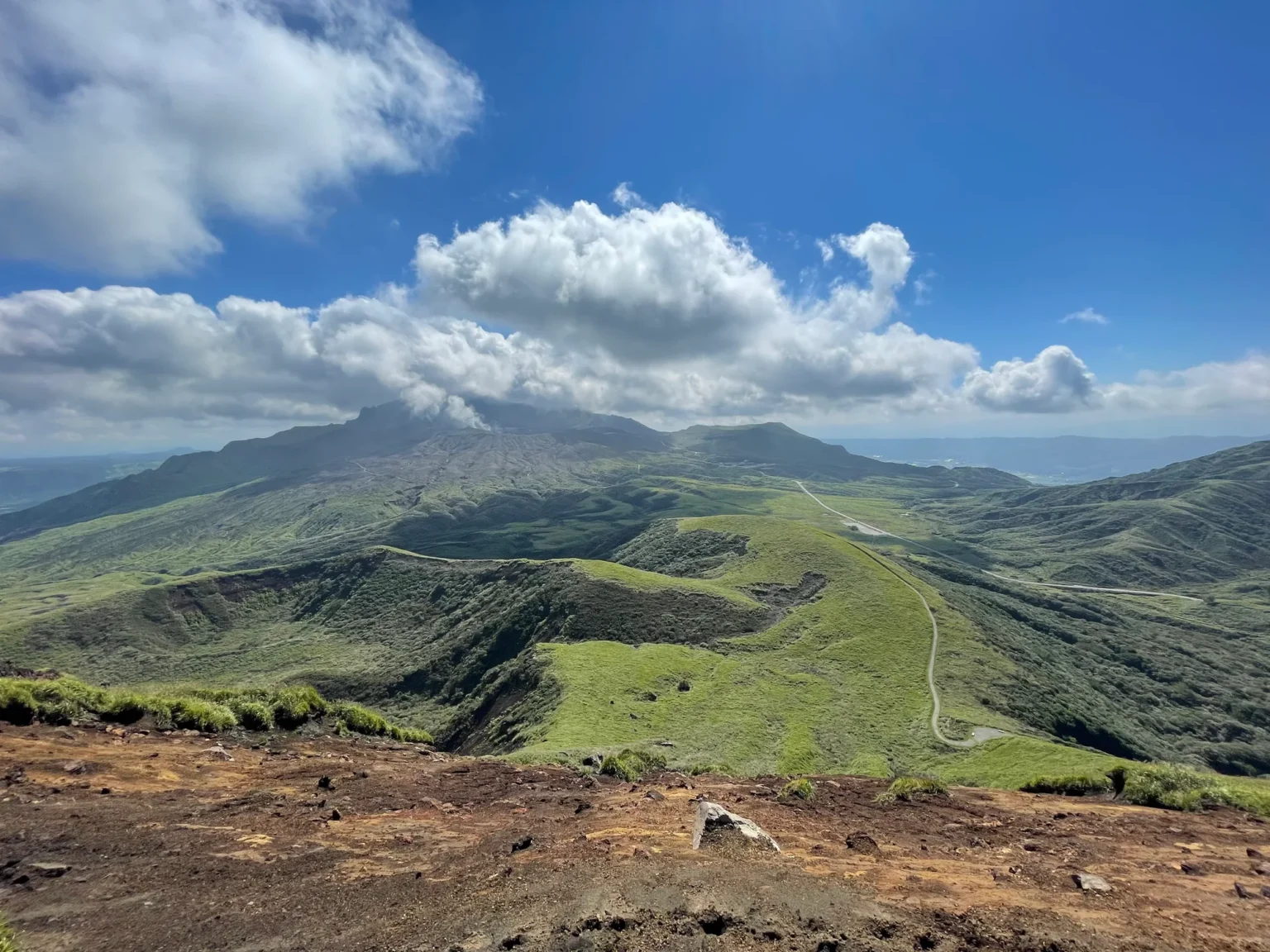
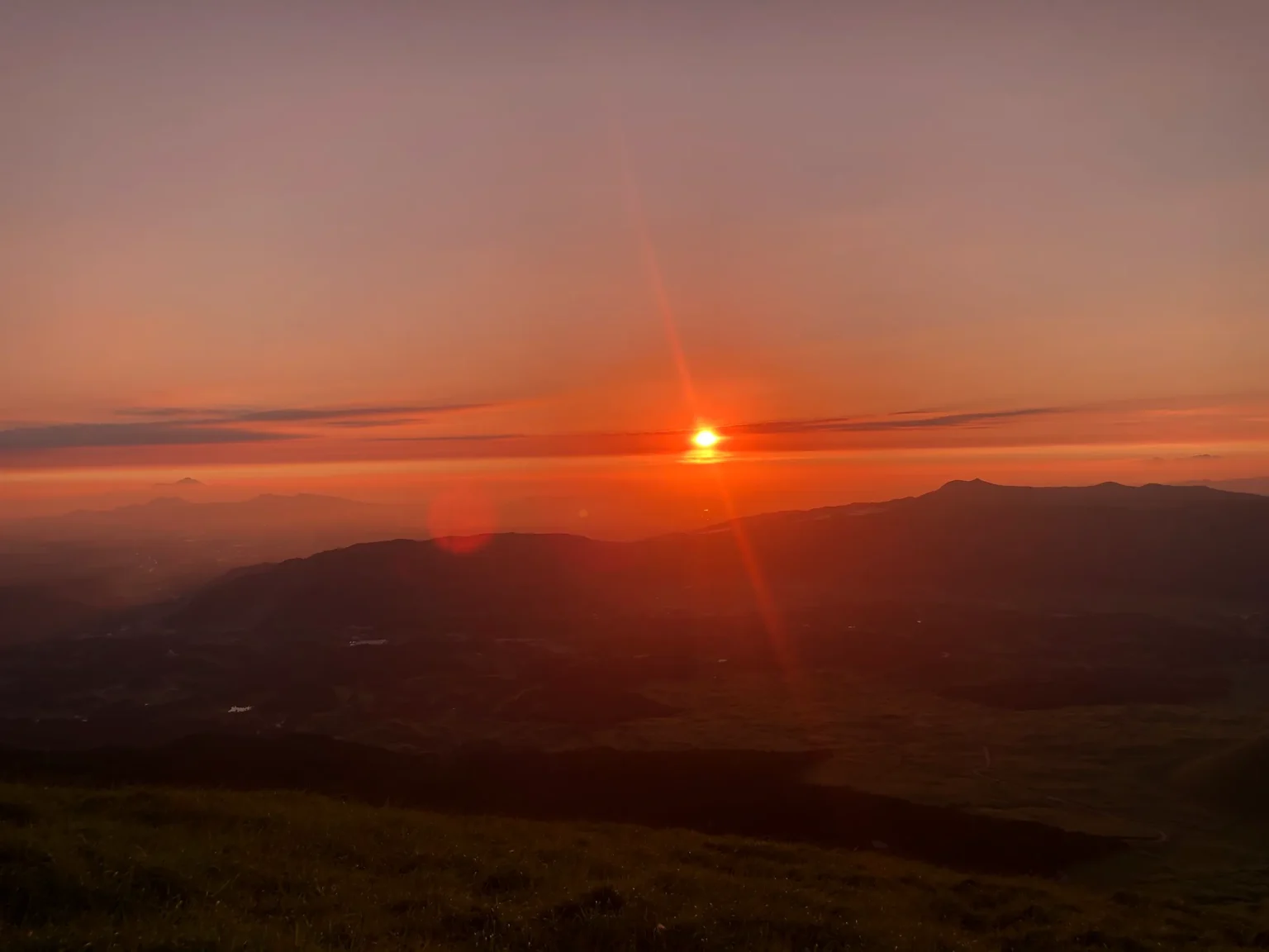
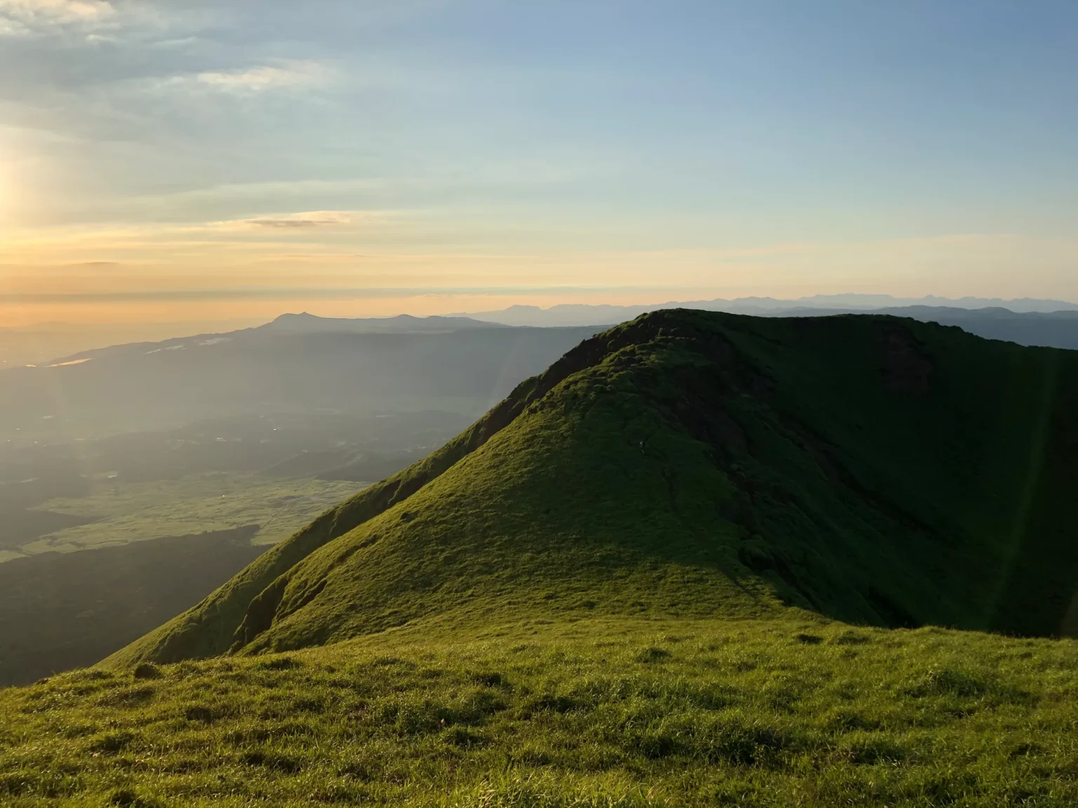
I have been up Kishimadake three times. On the evening of 16 August 2020 the summit crater was a green bowl going into shadow while the sun set over the western rim of the caldera. On the morning of 20 September 2021, looking east, Nakadake was sending up a white plume that ran into the cumulus over the summit: the photo at the top of this page. On the evening of 8 August 2022 the same ridge was in fog, and I could see no further than the next rise.
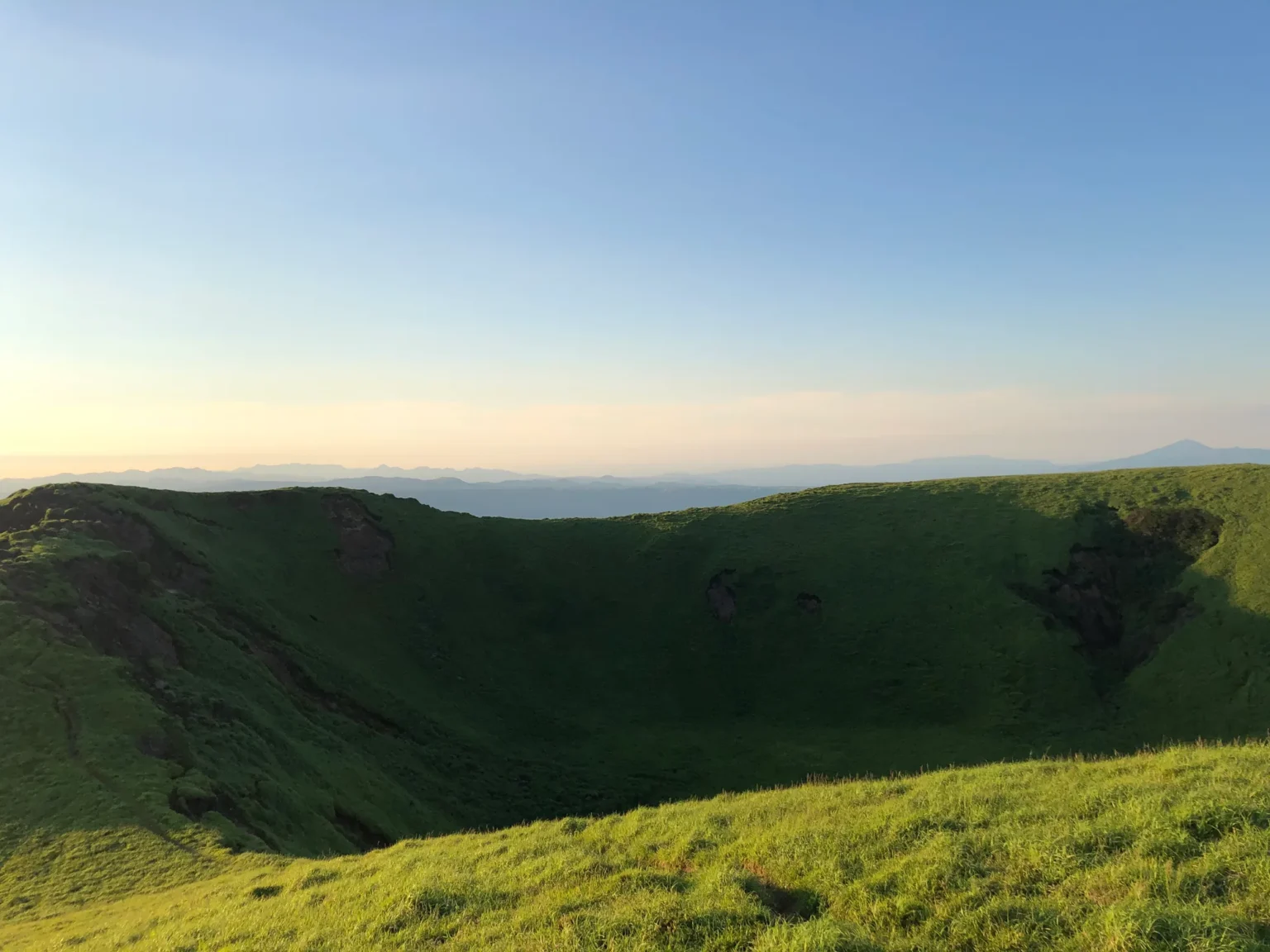
The visitor centre calls it the introductory route for climbing at Aso. Its route notes start it at the Kusasenri car park east trailhead, 1,137 m, and finish at the 1,326 m summit: 35 minutes up and 25 down, a gentle paved path to halfway, then short paved steps, with a path round the rim of the summit crater at the top. Trainers are fine on the paved section. Aso City’s tourism association gives about 40 minutes from the museum. The summit is outside the closed zone, nearly 3 km from the first crater by my own map measurement, and the visitor centre listed Kishimadake as open for trekking on 17 September 2026.
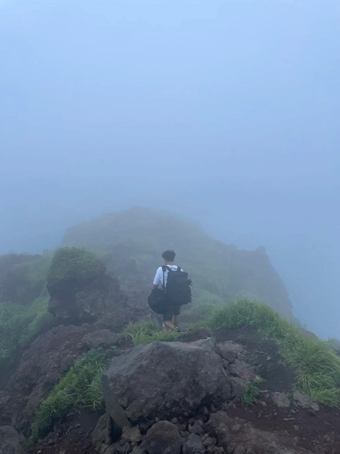
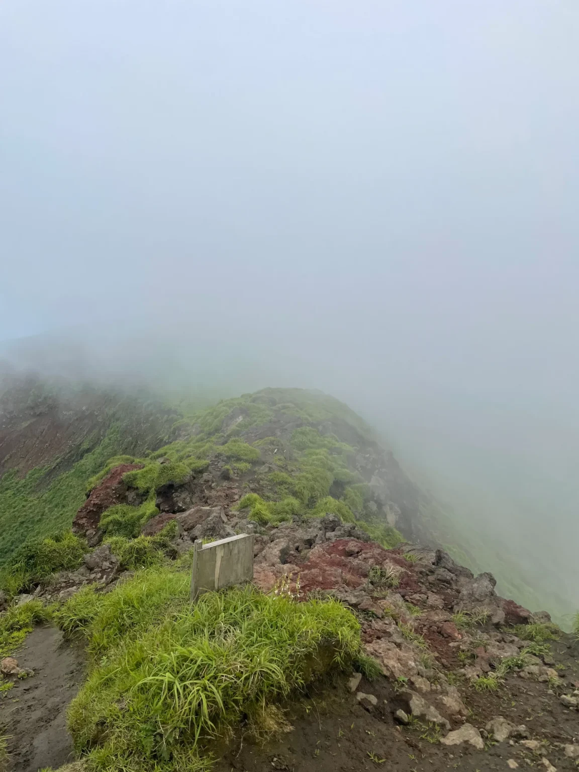
The view depends on the weather more than on the volcano. If the morning is clear, go early. If the peaks are clouded in, the museum offers indoor exhibits and a live crater feed; the camera view also depends on conditions. In winter the visitor centre warns of snow and ice and suggests light crampons or chain spikes.
Kusasenri-ga-hama and the Aso Volcano Museum
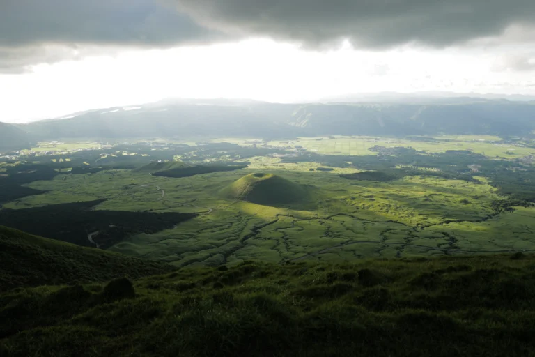
Kusasenri-ga-hama is a grassland about 1 km across in an old double crater, formed by eruptions some 30,000 years ago, with a low hill in the middle and ponds on either side that can dry up; horses come down to drink at them, Aso City says. Keep your distance from the horses, as the city asks. The car park is ¥500, and both Sanko routes up the mountain stop at the museum, 26 minutes from Aso Station. More on the horses and the walk round the grassland is in our Kusasenri guide.
The Aso Volcano Museum stands at the edge of the grassland, and on a closed day it is where you can still see the crater on a screen, conditions permitting. First on the museum’s own list of things to do there is a real-time projection of the Nakadake crater, which it describes as a valuable way to see the crater while it is restricted. There is also a large crater diorama by the special-effects art director Inoue Yasuyuki, and a five-screen theatre showing two films of about 17 and 18 minutes with English subtitles.
Open 09:00–17:00, last entry 16:30. Adults ¥1,300, elementary-school children ¥650, 65 and over ¥1,100, from the museum’s own price list on 7 October 2026.
Aso City’s museum page still shows an older adult price of ¥880, so go by the museum’s figure. The museum closes for maintenance on 14 January and 14 July each year. The Aso-sanjo Visitor Centre on its ground floor is free and open every day, 09:00–17:00, and is the place to ask which trails are open.
Komezuka from above
From the north side of Kishimadake you look down on Komezuka, a 954 m cone shaped like an upturned bowl with a hollow in its top. Aso City tells the legend that Takeiwatatsu-no-mikoto, the main deity of Aso Shrine, piled up his harvested rice to make it. The Aso Geopark describes it as a scoria cone about 3,000 years old and about 80 m high, and says climbing it is now banned after slopes worn by climbers were repaired. The 2016 earthquake left parts of it sunken and cracked, Aso City notes.
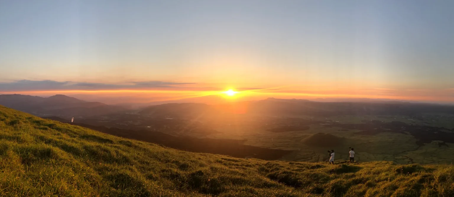
That evening the sun was sitting on the western rim of the caldera just before seven. If you stay for sunset, you will walk the paved path down in the dusk, so carry a torch.
Daikanbo and the Milk Road
Daikanbo is the place to see the whole volcano at once. It stands at about 936 m on the northern outer rim, about 400 m above the Aso valley, according to the Kumamoto Prefecture Tourism Federation, and has shops and places to eat. Aso City calls it the best viewpoint for the Five Peaks, whose outline is compared to a reclining Buddha, the Nehan-zo. The peaks are Takadake (1,592 m), Nakadake (1,506 m), Nekodake (1,433 m), Eboshidake (1,337 m) and Kishimadake (1,326 m).
お釈迦様が仰向けに寝ている姿
“The Buddha lying on his back”: how the Ministry of the Environment’s visitor centre describes the Five Peaks seen from the northern outer rim, known as the Nehan-zo of Aso.
The Milk Road is the grassland drive along that northern rim: Prefectural Road 339 and on via Roads 12 and 45 towards the Yamanami Highway, about 45 km in all. The prefecture’s tourism site reported in September 2026 that Daikanbo had no damage from the July earthquake and that Route 57 and the Milk Road were open as normal. The Aso hot-spring cooperative puts Daikanbo about 30 minutes from Aso Station; it is easiest by car.
Aso Shrine, rebuilt after 2016
Aso Shrine in Ichinomiya, a 15-minute walk from JR Miyaji Station, lost its two-storey gate, the Romon, and its worship hall in the 2016 Kumamoto earthquake. The shrine says the restoration work was completed in December 2023. The shrine describes the Romon as the largest in Kyushu and says it is also counted among the three great shrine gates of Japan. The shrine is open every day from 06:00 to 18:00, and the prefecture’s tourism site reported no new damage from the July 2026 earthquake. Its upper shrine by the crater, Aso-sanjo Jinja, is a different matter: its worship hall is being rebuilt from 12 September 2026 to the end of March 2028, and visitors are asked to stay out of the grounds.
Shirakawa Suigen in Minami-Aso
On the south side of the caldera, Shirakawa Suigen is the spring that feeds the Shirakawa River: about 60 tonnes of water a minute, according to Minami-Aso’s tourism office, at about 14°C, according to the prefecture’s tourism site. It was chosen in 1985 as one of Japan’s 100 best waters. Minami-Aso village asks for a conservation contribution of ¥100 from high-school age up, and the car park is free. Without a car, the Asochiho bus stops at Shirakawa Suigen Iriguchi, an hour from Aso Station (¥1,500); ask locally about the walk from the stop.
Onsen: Uchinomaki, and Kurokawa further north
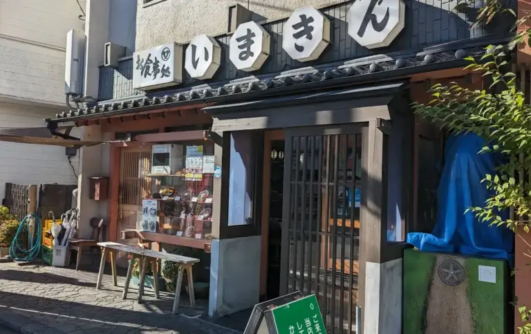
Uchinomaki is the onsen town on the caldera floor, about 15 minutes from Aso Station by car, by the Aso hot-spring cooperative’s count; Aso City’s local buses (the loop line and the Tsuetate line) reach the Uchinomaki stop in about 17 minutes. The prefecture’s tourism site counts more than 130 hot-spring sources in a walkable area, seven public baths and about 17 inns and hotels. For lunch nearby, our Imakin Shokudo guide covers the aka-ushi beef bowl and its queue.
Kurokawa Onsen, in Minamioguni to the north, is a village of open-air baths.
Kurokawa’s bath pass. The nyuto tegata, sold at the inns, costs ¥1,500 for an adult and buys three baths out of 25; one of the three can be swapped for food or a souvenir. It is valid for six months, bathing hours are 08:30 to 21:00, and the pass cannot be shared (Kurokawa Onsen Ryokan Association, checked 7 October 2026).
From Aso Station the Kyushu Odan Bus reaches Kurokawa Onsen in about 50 minutes (¥1,600). Nearby, Pizzeria Tre Passo near Kurokawa has a terrace facing the Aso and Kuju mountains, and Nabegataki Falls in Oguni is a waterfall you can walk behind.
How do I get to Mount Aso without a car?
Take the train or a bus to JR Aso Station, then the Sanko bus up the mountain. From Kumamoto Station the limited express Aso Boy takes about 1 h 30 min to Aso. Two Sanko services connect Aso Station with Kusasenri and Aso-sanjo Terminal: the Aso Tozan Line and the Asochiho bus. Under the 1 October 2026 timetable, Asochiho departures from Aso Station are 09:05, 12:23 and 16:00; its last return leaves Kusasenri at 17:13. Check the timetable and booking rules for your chosen service. The table gives each leg; all were checked on 7 October 2026.
| Leg | Train or bus, time and fare |
|---|---|
| Kumamoto → Aso Station | Limited express Aso Boy, 09:57 or 13:36. About 1 hour 30 minutes; ¥3,080 one way for an adult in the standard season, including the reserved-seat limited-express charge. The total varies by travel date. All seats reserved; daily in October 2026 (timetable from 14 March 2026). |
| Kumamoto → Aso Station | Limited express Kyushu Odan Tokkyu, for example 08:25 from Kumamoto, at Aso 09:54. |
| Kumamoto Airport → Aso Station | Yamabiko or Kyushu Odan bus from stop 3, about 1 hour, ¥1,500. Or the Airport Liner to JR Higo-Ozu (15 min, ¥200) and the Hohi Line from there. |
| Aso Station → Kusasenri, Aso-sanjo: Aso Tozan Line | No booking: 26 min to Kusasenri, 35 min to the terminal, ¥1,000. Up at 09:40, 10:25, 11:50, 12:45, 13:25, 14:10 and 14:35; last bus down 16:30 from the terminal, 16:35 from Kusasenri (timetable as of 11 May 2026). |
| Aso Station → Kusasenri, Aso-sanjo: Asochiho bus | The Aso–Takachiho bus, three a day: 09:05, 12:23 and 16:00 from Aso Station, 26 min to Kusasenri, 35 min to the terminal, ¥1,000. This short section cannot be reserved; you board if there are seats. Back from Kusasenri at 10:58, 14:08 and 17:13 (timetable revised 1 October 2026). |
| Kumamoto → Kurokawa, Yufuin | Kyushu Odan Bus, three a day, booked from two months before up to the day before. The 07:23 from Kumamoto Station is at Aso 09:14, Kurokawa 10:15 and Yufuin 11:48. |
In November 2026 the Aso Boy runs only its afternoon pair on 14 November, and on 24–27 November the Kawasemi Yamasemi runs instead with the same stops (JR Kyushu’s calendar, information as of 21 August 2026). The Hohi Line between Kumamoto and Aso runs through Higo-Ozu and Tateno; its Higo-Ozu–Aso section, cut by the 2016 earthquake, reopened on 8 August 2020, JR Kyushu’s history records.
Buses on the mountain. Between them the two routes leave Aso Station from 09:05 to 16:00, with no departure between 14:35 and 16:00. The 16:00 reaches Kusasenri at 16:26, and the last bus back is the Asochiho at 17:13: 47 minutes there, less than Kishimadake’s published 35 minutes up and 25 down, so take an earlier bus if you plan to hike; the Aso Tozan Line’s last one passes at 16:35. When the crater reopens, the shuttle from the terminal to the rim also needs its own ticket and stops whenever a restriction is issued. With a car you can be at Kusasenri for the morning light, add Daikanbo and the Milk Road, and finish at an onsen without watching the clock. On Sunday 11 October 2026 the Tour de Kyushu closes its course roads in Aso City from 10:30 to 13:15.
At Kumamoto Airport, rental cars are picked up from a counter in the Sorayoka Visitor Center; Toyota, Nissan, Nippon, ORIX and Times are among the firms the airport lists.
After the July 2026 earthquake. An earthquake of magnitude 7.1 struck the Kumamoto region at 16:27 on 28 July 2026. The strongest shaking, intensity 7, was in Uki and Hikawa, south of Kumamoto city; Aso City, Takamori and Minami-Aso recorded 5-lower. On 31 July the Aso City Tourism Association reported no major damage to sights, inns, roads or rivers in the city. As of 5 October, MLIT listed no earthquake-related closures on non-expressway national roads. A section of the E3A expressway near Yatsushiro and two railway sections south of Kumamoto remained closed. For what to do if the ground shakes while you are travelling, see our earthquake and typhoon guide.
No car? You can compare guided Mount Aso tours on Viator; check the crater’s status first, because the access rules above decide what a tour can include.
Where to stay: Uchinomaki, Kurokawa or Minami-Aso
Uchinomaki is about 15 minutes from Aso Station by car, and you can walk between its public baths. If you are travelling without a car, check the bus, taxi or your inn’s transfer arrangements before booking, including your connection back to the station for the mountain bus. Kurokawa suits a slower night among open-air baths but puts you about 50 minutes further from the mountain. Minami-Aso, on the south side of the caldera, is closest to Shirakawa Suigen and quieter, and is easiest with a car.
A night inside the caldera
With a car, staying overnight in Aso makes an early start at Kusasenri or Daikanbo easier. Check which meals your room rate includes.
When is the best time to visit Mount Aso?
Autumn is the easiest season: October to November is the usual silver-grass viewing season, and the chance of a morning sea of clouds starts. Each season changes the grassland more than the volcano.
Late February to March: burning
The grassland is burned each year to keep it open. The Ministry of the Environment says it turns black straight afterwards and sprouts again within a month. In 2026 Kusasenri was burned on 21 February. Roads close nearby on burning days.
April to August: green
Grazing runs from mid-April to late October, says the Ministry of the Environment. August and September are the peak of the typhoon season, and the last three summers also brought Level 2.
October to November: silver grass
Aso City lists October–November as the usual viewing season for susuki; its 24 September 2026 update indicated that the viewing season had not yet begun. Toll-road hours shorten from 1 November.
December to March: ice
Snow and ice on the mountain. On 22 December 2024 the crater road stayed shut until about 10:30 because of ice, the visitor centre reported.
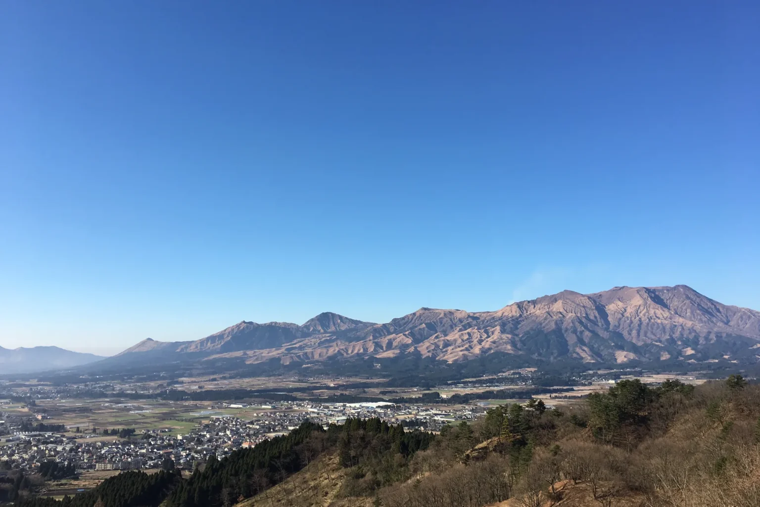
The sea of clouds is an early-morning event. The prefecture’s tourism site gives early mornings from autumn to winter at Daikanbo, and Aso City’s tourism association adds early summer. The tourism association’s Daikanbo page links a live camera if you want to look before you set off.
Winter driving. Between December and March, fit winter tyres and carry chains: that is step one of the winter checklist from the transport ministry’s Kumamoto office, which warns that snow can settle and temperatures drop below freezing on the Aso mountains. The toll road keeps winter hours, 09:00–17:00 with the gate shutting at 16:30, from 1 December to 19 March, and ice can keep the crater road shut into the morning.
Clouds below Daikanbo mean being there in the early morning, which is far easier if you stay the night in Aso.
See places to stay around AsoNext stops: Takachiho, Yufuin and the rest of Kyushu
Aso sits in the middle of Kyushu, so it joins naturally with the places either side. To the south-east, Takachiho Gorge was cut through rock laid down by Aso’s own pyroclastic flows. The Asochiho bus runs three times daily from Aso Station to Takachiho Bus Center, taking about 2 hours 10 minutes via Kusasenri and Aso-sanjo Terminal (¥3,000; seats can be booked from two months ahead). To the north-east, the Kyushu Odan Bus from Aso Station reaches Yufuin in about two and a half hours (¥4,000), and our walk through Yufuin is a gentle place to arrive. For a week that strings the volcanoes together, see the Ruby Route through Kyushu.
If only the crater area is closed, check the current trail notices and weather before choosing Kishimadake. When the trail is open and visibility is good, its summit offers a view towards Nakadake from outside the restricted area, as it did for me in September 2021.
Mount Aso: short answers
Is the Mount Aso crater open today?
Not as of 01:55 JST on 7 October 2026. Asosan is at Volcanic Alert Level 2, and the area within about 1 km of the crater is off-limits, so the rim, the toll road and the crater shuttle are closed. Check the Aso Volcano Disaster Prevention Council’s crater page on the morning you go.
Can you see the crater when it is closed?
Possibly on a screen: the Aso Volcano Museum at Kusasenri offers a live crater projection, but what the feed shows depends on conditions. You cannot look into it in person, but when the Kishimadake trail is open and the sky is clear, its summit, 35 minutes up from the Kusasenri car park, looks across to Nakadake from outside the closed zone.
Is there a ropeway up Mount Aso?
No. The operator cancelled the planned replacement of the Aso-san Ropeway on 24 December 2019. The current crater service is a shuttle bus from Aso-sanjo Terminal, about 5 minutes and ¥800 one way for adults, operating only when restrictions allow.
Who is not allowed to visit the Aso crater?
People with asthma, a respiratory (lung) disease, a heart disease or a pacemaker, and anyone who feels unwell. The Aso Volcano Disaster Prevention Council prohibits them from visiting the crater because of the volcanic gas.
How do I get to Mount Aso from Kumamoto without a car?
Take the limited express Aso Boy or Kyushu Odan Tokkyu from Kumamoto to Aso Station, about 1 h 30 min, then a Sanko bus, the Aso Tozan Line or the Asochiho: 26 minutes to Kusasenri, ¥1,000. Departures from Aso Station run from 09:05 to 16:00 (timetables of 11 May and 1 October 2026).
How long does it take to climb Kishimadake?
About 35 minutes up and 25 minutes down from the Kusasenri car park east trailhead, on a paved path and paved steps, according to the Aso-sanjo Visitor Centre. The summit is 1,326 m.
When is the best time to visit Mount Aso?
October and November, the usual silver-grass season, with the chance of a morning sea of clouds at Daikanbo. In late February and March the grassland is burned black; in winter, expect ice and shorter toll-road hours.
Was Aso damaged in the July 2026 Kumamoto earthquake?
Not seriously, according to the Aso City Tourism Association, which reported on 31 July 2026 no major damage to sights, inns or roads in Aso City. Aso City recorded intensity 5-lower; the strongest shaking was south of Kumamoto city.
Sources
The official pages behind the crater status, the gas rule, the times and the prices, checked 7 October 2026
- Aso Volcano Disaster Prevention Council — crater restriction information, notices, precautions, toll-road hours and the volcanic gas leaflet (PDF, Japanese and English)
- Japan Meteorological Agency — Asosan activity, warnings and weekly commentary (Japanese), Asosan alert-level table (PDF), eruption history, Volcanic Alert Levels (English) and volcanic warnings (English)
- Aso City — crater viewing and toll road: fees and hours, Takadake and Nakadake detour routes, local bus timetable (PDF), sights around the crater, viewpoints, Komezuka and Kusasenri, flower and silver grass status 2026 and Tour de Kyushu 2026 road closures (Japanese)
- Sanko Bus — Aso crater shuttle: fares and timetable, volcano restrictions, Aso Tozan Line timetable (PDF), Asochiho bus timetable with its fares (PDF), Kyushu Odan Bus with its timetable and fares (PDFs), and Aso-sanjo Terminal (Japanese)
- JR Kyushu — limited express Aso Boy: timetable, calendar and fare, Kyushu Odan Tokkyu No. 1 and company history (Hohi Line reopening, 2020) (Japanese)
- Kumamoto Airport — access, buses and rental cars (Japanese)
- Aso Volcano Museum — hours and admission, exhibits and the notice of 2 September 2026 on Level 2 (Japanese)
- Aso-sanjo Visitor Centre (established by the Ministry of the Environment) — trail information and trekking notice of 17 September 2026; Ministry of the Environment — the grassland year and burning
- Aso Geopark — Komezuka geosite; Aso City Tourism Association — Daikanbo, Kishimadake and notice after the July 2026 earthquake
- Kumamoto Prefecture Tourism Federation (kumamoto.guide) — Daikanbo, Milk Road, Uchinomaki Onsen, Shirakawa Suigen and Aso after the July 2026 earthquake
- Aso Shrine — about the shrine and Aso-sanjo Jinja rebuilding notice (PDF, 12 September 2026)
- Minami-Aso Village — Shirakawa Suigen; Minami-Aso tourism — Shirakawa Suigen and 2026 grassland burning dates
- Aso hot-spring cooperative — access and times from Aso Station; Kurokawa Onsen Ryokan Association — nyuto tegata (Japanese)
- Ministry of Land, Infrastructure, Transport and Tourism — damage reports on the 2026 Kumamoto earthquake (report No. 53, 5 October 2026; Japanese)
- Kyushu Sanko Tourism — notice cancelling the Aso-san Ropeway rebuild, 24 December 2019 (PDF, Japanese)
Join travelers discovering Japan's hidden side
Weekly dispatches from off-the-beaten-path Japan — spots and stories you won't find in guidebooks.
No spam. Unsubscribe anytime.
Welcome aboard!
You're in. See you in your inbox soon.