
Nagano · Kamikochi · 2026
Kamikochi Walking Guide 2026
Kamikochi opened for the 2026 season on April 17. The tunnel gate lifted, the first buses rolled through, and within a week the opening festival will bring 3,500 people to the foot of Kappa Bridge. I’m Nobutoshi from Hidden Japan Gems. I’ve walked this valley four times across different seasons — twice in summer, once in early autumn, once in late April when snow still clung to the peaks. The walk from Taisho Pond to Myojin Bridge is 7 kilometers of flat riverside trail at 1,500 meters elevation, and you don’t need hiking boots or mountain experience. This guide covers the full route, updated costs, and every practical detail for 2026.
Part of my full Things to Do in Kamikochi valley guide.
Part of my Calmcation in Japan guide to the country’s quietest escapes.
Quick Facts
Plan This Trip
Why Kamikochi Matters
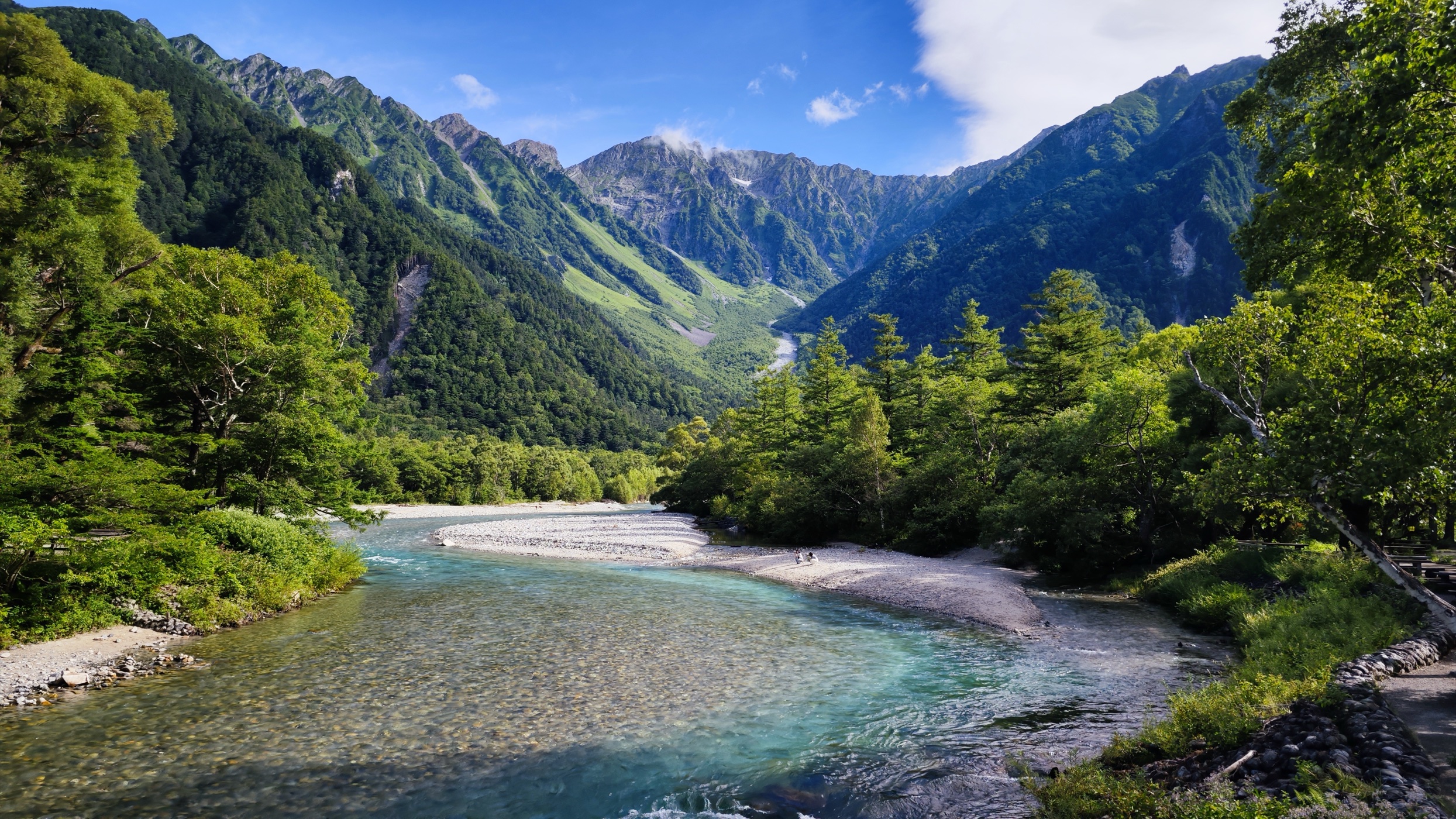
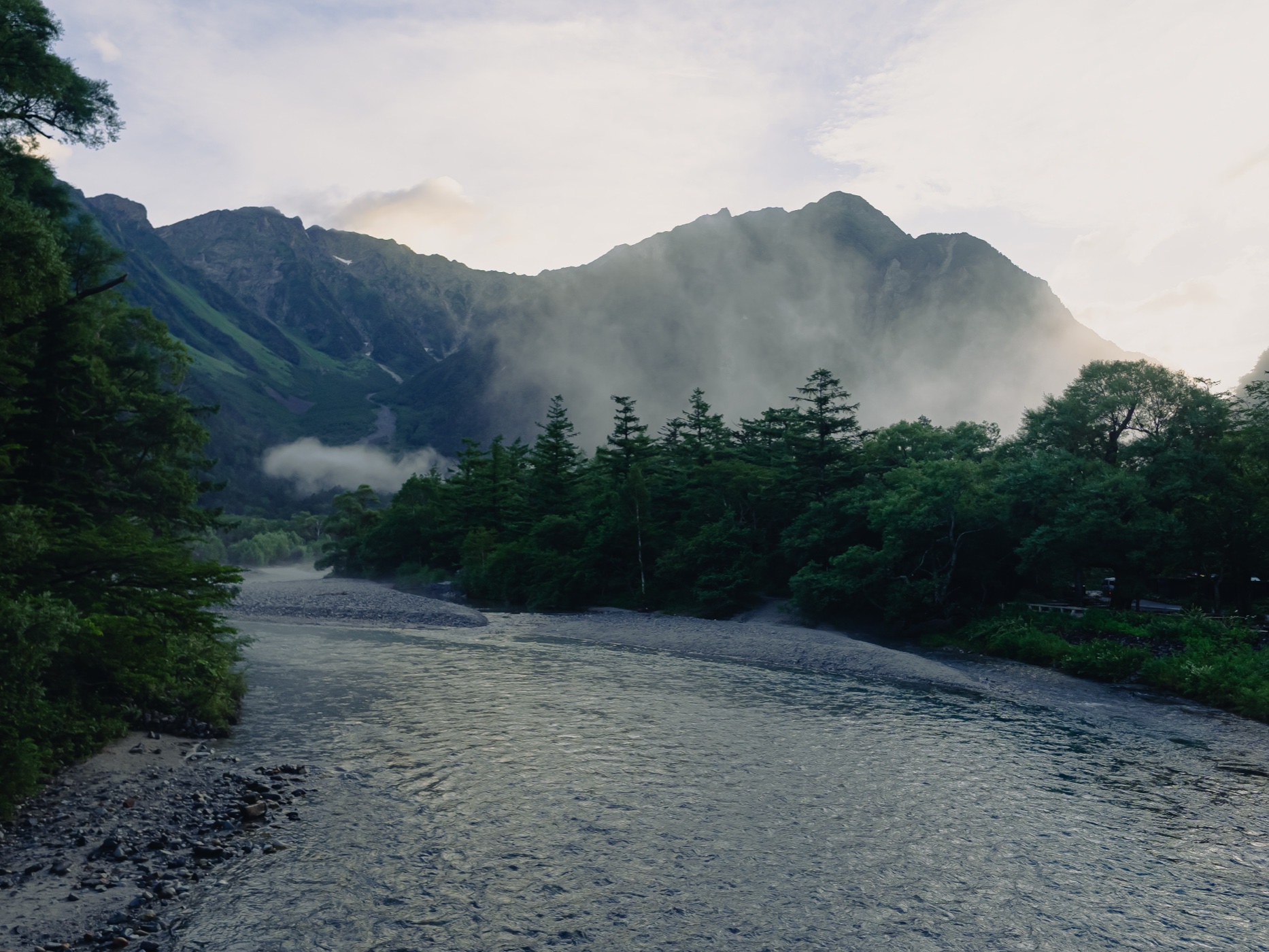
Kamikochi is a 15-kilometer valley cut by the Azusa River at the base of the Hotaka mountain range — the highest peaks in the Northern Japanese Alps. The river runs a shade of blue-green that changes with the weather, the angle of the sun, and the season. The mountains behind it rise to 3,190 meters. You see them from the valley floor without climbing anything.
The valley sits inside Chubu Sangaku National Park and has been closed to private vehicles since 1975. No houses. No permanent residents. No convenience stores. The few hotels that operate here shut down every November and reopen in spring. This level of protection is why the water stays clear and the forest stays quiet.
Walter Weston, the British missionary who introduced recreational mountaineering to Japan in the 1890s, called Kamikochi “the most beautiful highland in all of Japan.” His relief portrait is still embedded in a rock by the river, near Kappa Bridge.
The 2026 Season: What’s New
The Kama Tunnel gate opened on April 17, and the first shuttle buses entered the valley. The official opening festival (開山祭) takes place on April 27 at Kappa Bridge — a Shinto ceremony with tamagushi offerings, a sake barrel opening, and an alphorn echoing off the Hotaka peaks.
Nagano accommodation tax starts June 1
A new ¥200/person/night tax applies to all lodging in Nagano Prefecture costing ¥6,000 or more. Expect this added to your bill at any Kamikochi hotel from June onward.
All Matsumoto–Kamikochi buses require reservations
This started in 2025 and continues. No more showing up and hoping for a seat. Book through japanbusonline.com, one month in advance.
Sawando parking: ¥800/day
Up from previous years. If you’re driving and taking the shuttle, budget accordingly.
The Nature Trail boardwalk (forest course) between Taisho Pond and Tashiro Pond remains closed due to deteriorating wooden paths.
How to Get There
Kamikochi has no train station and no road access for private vehicles. You get there by bus.
Most commonFrom Matsumoto
Matsumoto Electric Railway from Matsumoto Station to Shin-Shimashima Station (30 min, ¥710 — cash only at JR Matsumoto, no IC cards). Transfer to the Alpico bus to Kamikochi Bus Terminal (65 min, ¥3,100). Buses run 7–17 times daily depending on the season.
A direct bus from Matsumoto Bus Terminal also operates: 5:30 AM (¥5,000) and 10:15 AM (¥4,600). Reservation required.
Via Hirayu OnsenFrom Takayama
Nohi Bus from Takayama Station to Hirayu Onsen (60 min, ¥1,570), then shuttle bus to Kamikochi (25 min, ¥1,160). The Hirayu shuttle runs roughly every 30 minutes and doesn’t require a reservation.
Direct highway busFrom Tokyo (Shinjuku)
Departures at 7:15 AM and 10:25 PM overnight. About 4 hours 47 minutes. Fares range ¥8,000 to ¥14,000 depending on date and bus type. Reservation required.
Park & rideBy Car
Drive to Sawando Parking Area (¥800/day) or Hirayu Parking Area (~¥600/day) and take the shuttle bus into the valley. Sawando to Kamikochi is about 30 minutes.
Kamikochi Day Plan Checklist 2026
One-sheet PDF with bus times, km splits, the lunch stops, and what most first-timers miss. Free for subscribers.
No spam. Unsubscribe anytime.
You're in. Here's your checklist:
Click the button below to open the printable checklist (use Cmd+P to save as PDF). A copy of the link is also on its way to your inbox.
Open the checklist →The Walking Route: Taisho Pond to Kappa Bridge to Myojin
The standard Kamikochi day walk follows the Azusa River upstream. The full route from Taisho Pond to Myojin Bridge covers roughly 7 kilometers of flat terrain along the valley floor. No elevation gain worth mentioning. The paths are a mix of paved walkways, gravel trails, and wooden boardwalks.
Most visitors take the bus to Kamikochi Bus Terminal and walk to Kappa Bridge (6 minutes). That’s as far as most people go. The ones who walk to Myojin find a different valley — quieter, less trafficked, with better mountain views.
The strongest approach: get off the bus at Taisho Pond (one stop before the terminal), walk the full route to Myojin, and catch the bus back from the terminal. One direction, no backtracking, and the landscape unfolds chronologically — from the wide, misty pond to the narrow, forested gorge.
Taisho Pond — Where the Walk Begins
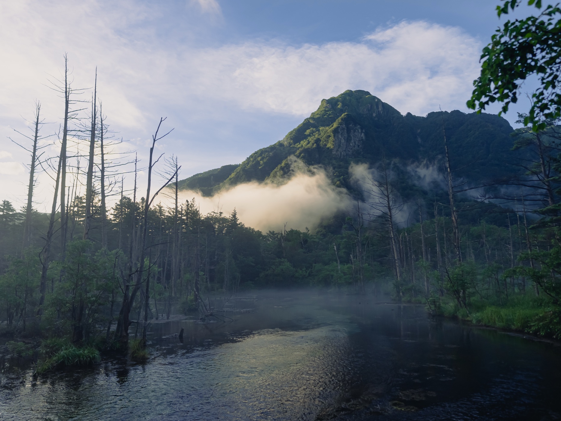
Taisho Pond formed in 1915 when a volcanic eruption from nearby Yake-dake dammed the Azusa River. The dead trees still standing in the water are remnants of the forest that drowned. Over a century later, the standing deadwood is slowly disappearing — erosion and decay take a few more each year.
The pond is at its most striking in the early morning, when mist rises off the water and wraps around the base of Yake-dake. The dead trees become silhouettes against white fog and gray mountain. By 10:00 AM, the mist clears and the scene shifts from haunted to pastoral.
If you’re staying overnight in Kamikochi, the early morning walk to Taisho Pond is the single strongest reason to book a hotel rather than day-tripping. No bus reaches the valley early enough to catch the mist.
From the pond, the trail follows the right bank of the Azusa River northeast toward Kappa Bridge. The walk takes about an hour.
The Forest Trail to Tashiro Wetland
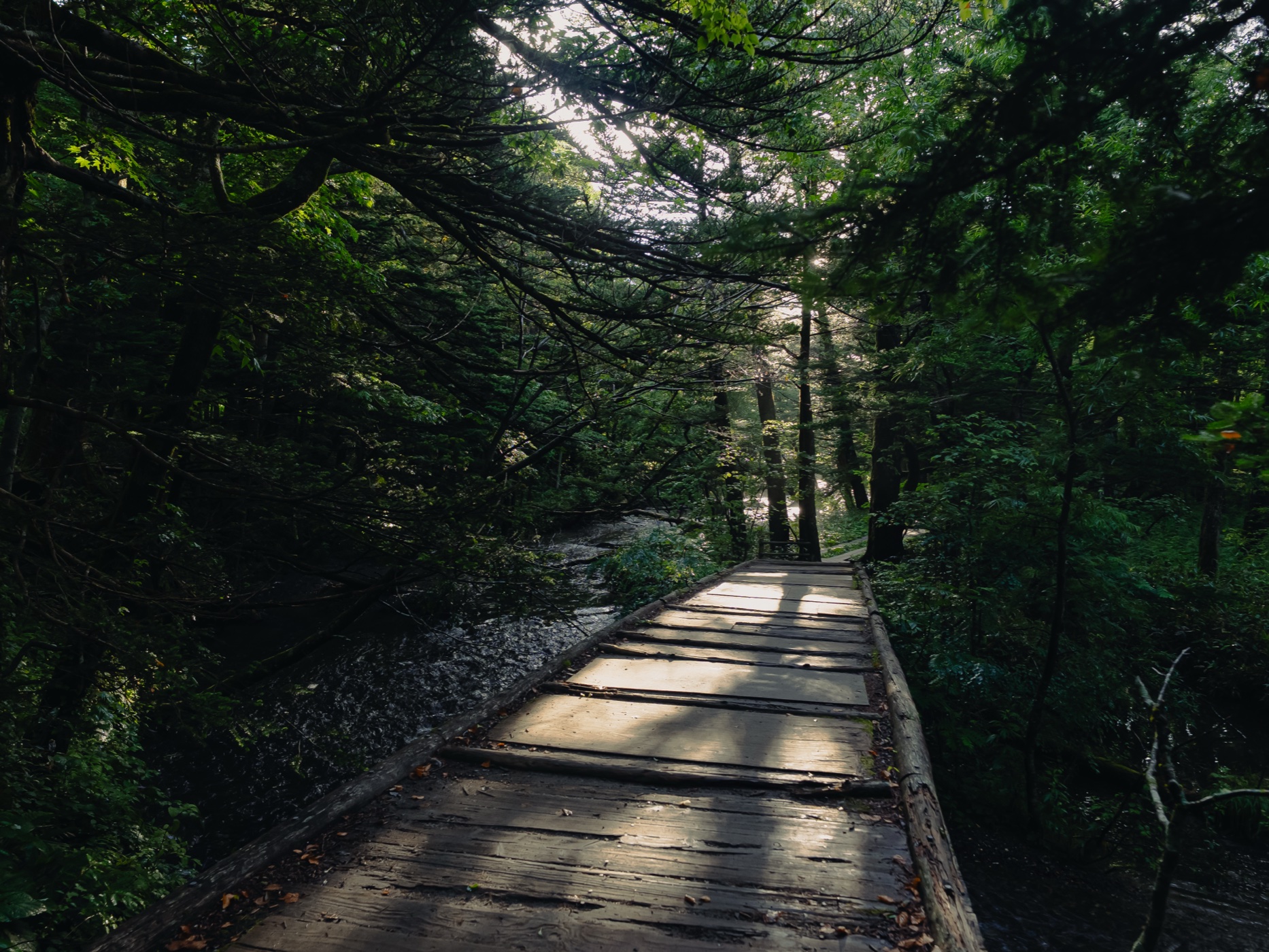
Between Taisho Pond and Kappa Bridge, the trail passes through dense forest — moss-covered boardwalks, fern undergrowth, stands of Japanese larch and white birch. The canopy closes overhead. The light filters green.
Tashiro Wetland, about 25 minutes from Taisho Pond, opens into a wide marshy clearing with mountain views. In June, cotton-grass and azaleas bloom here. In autumn, the marsh grasses turn amber against the dark conifers.
The forest section is the part of Kamikochi that gets overlooked. People come for the bridge and the mountains. But the forest floor — the moss patterns, the sound of water under boardwalks, the way the air drops five degrees under the canopy — is where the valley feels most alive.
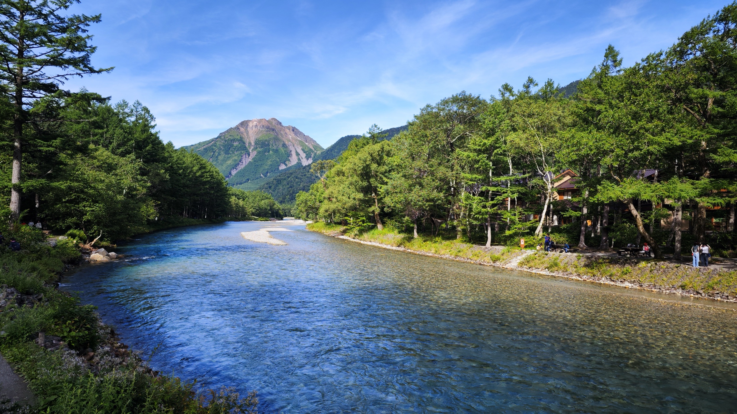
Kappa Bridge — The Center of Everything
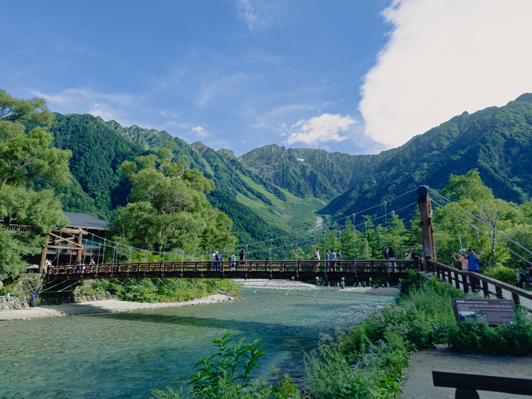
Kappa Bridge (河童橋) is a 36-meter wooden suspension bridge spanning the Azusa River, with the Hotaka peaks framing the upstream view and Yake-dake downstream. It’s the most photographed spot in Kamikochi and the most crowded.
The bridge is named after the kappa — a water creature from Japanese folklore. The original bridge was built in 1891; the current structure dates from 1997.
From the bridge, looking upstream: the Hotaka ridge line — Oku-Hotaka (3,190m), Mae-Hotaka (3,090m), Nishi-Hotaka (2,909m) — fills the frame. The Azusa River runs wide and shallow beneath, turquoise in sunlight, gray-green on overcast days. This is the view that appears on every Kamikochi brochure, and it earns it.
The Kamikochi Bus Terminal is a 6-minute walk from the bridge. The visitor center (free, open 8:00–17:00) sits nearby, along with Gosenjaku Hotel, souvenir shops, and the main cluster of dining options.
Kappa Bridge to Myojin — Into the Quiet
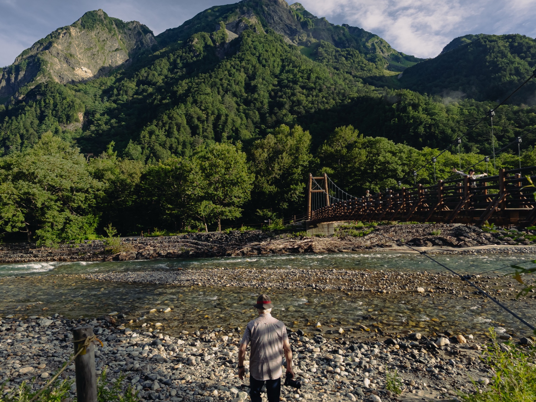
Walking upstream from Kappa Bridge, the crowds thin within 10 minutes. The trail enters forest again — the right-bank path is shaded, soft underfoot, lined with ferns and wildflowers depending on the season. The Azusa River stays visible through gaps in the trees.
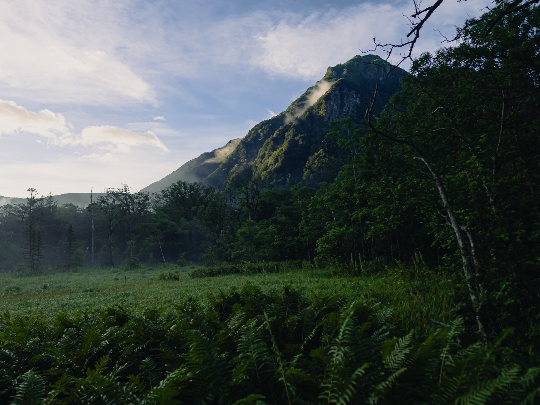
This section takes about 60 minutes at a walking pace. Along the way, the river narrows and the valley walls close in. The Hotaka peaks shift angle as you move deeper into the valley, and Myojin-dake — a sharp, triangular peak with exposed rock faces — begins to dominate the skyline.
Halfway to Myojin, you cross a stretch of open riverbed where the gravel bars spread wide and the full mountain panorama opens up. This is a good place to stop, sit on the rocks, and let the scale of the place settle.
Myojin Bridge and Myojin Pond
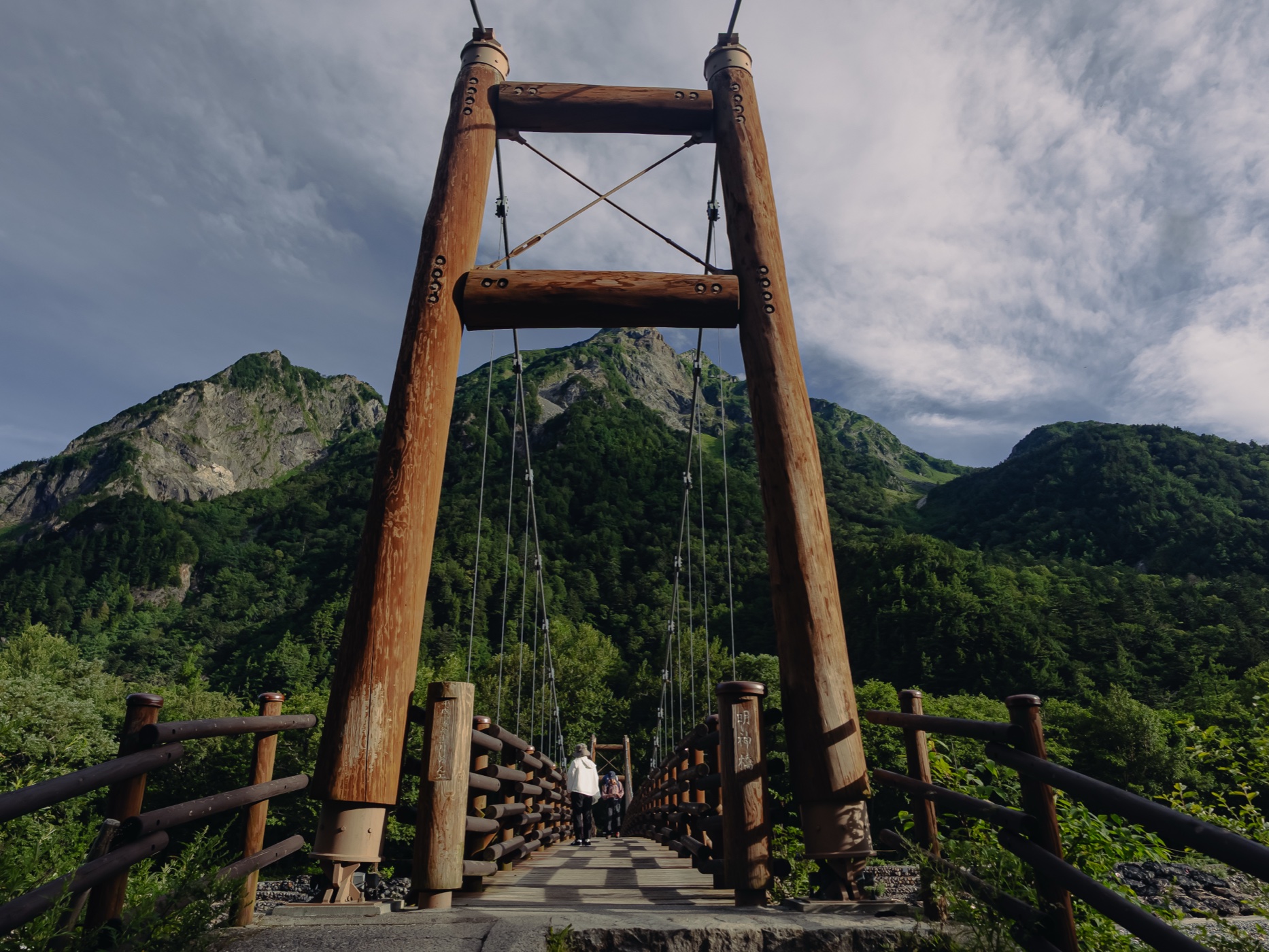
Myojin Bridge (明神橋) is a wooden suspension bridge about 60 minutes upstream from Kappa Bridge. It’s smaller and simpler than Kappa Bridge — rough-hewn logs, steel cables, a slight sway underfoot. The view through its A-frame pylons frames Myojin-dake perfectly.
Across the bridge, a short walk leads to Hotaka Shrine’s inner sanctuary (穂高神社奥宮) and Myojin Pond (明神池, ¥500 admission). The pond is fed by underground springs, keeping the water clear year-round. In autumn, the reflection of Myojin-dake in the still water is one of Kamikochi’s defining images.
Myojin is where most day-walkers turn around. Beyond Myojin, the trail continues another 6 kilometers to Tokusawa — a former alpine pasture with lodges and wildflowers in May — but that extends the walk to a full day and is better suited to those staying overnight in the valley.
What the Mountains Look Like from Below
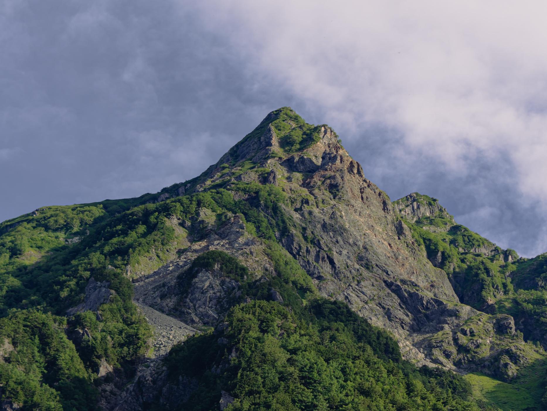
One of the unusual things about Kamikochi is the proximity of serious alpine terrain to a flat, walkable valley floor. The Hotaka ridge rises 1,700 meters directly above you. From the valley trail, you look up at rock walls, snow patches in early season, and the sharp ridge lines that mountaineers rope up to climb.
Myojin-dake is the most visually dramatic peak from the trail — a near-vertical rock face that catches the afternoon light and holds shadow in the crevices. In morning mist, only the summit appears above the clouds.
The Hotaka peaks (穂高連峰) include some of Japan’s most technically demanding climbs. But from the valley floor, they’re just scenery — massive, close, and freely available to anyone who walks the trail.
When to Walk This Route
Best window: Late April for drama and solitude. October for color. Weekdays in any season for fewer people.
What to carry into the valley
Kamikochi is a flat riverside walk, not a climb — but it sits at 1,500 m, the weather turns, and there are no shops past Kappa Bridge. A light kit makes the day. All on Amazon Japan, so you can have it sent to your hotel before you go.
Daypack (20–30L)
Room for water, a layer, lunch and a camera — and it folds into a suitcase for the rest of your trip.
Rain shell
Mountain weather flips fast here. A packable shell beats getting caught out past Myojin.
Cushioned socks
It is a long, easy walk — the kind where thin socks quietly give you blisters.
Trekking poles
Optional on the flat trail, but a help if you push on to Myojin or Tokusawa.
Dry bag
Keeps your camera and phone dry by the river and in a sudden shower.
Insect repellent
Summer brings bugs to the wetlands. A quick spray keeps the walk pleasant.
Practical Tips
Where to Stay
Staying inside Kamikochi lets you catch the early morning mist at Taisho Pond and the evening light on the Hotaka peaks — two things day-trippers never see.
Kamikochi Imperial Hotel
Built in 1933, the most prestigious address in the valley. Classic mountain lodge architecture. From ~¥35,000/night.
Gosenjaku Hotel
Right next to Kappa Bridge, founded 1918. Central location, river views. The restaurant serves Shinshu soba and local trout.
Kamikochi Taishoike Hotel
Near Taisho Pond. Good for catching the morning mist without a long walk. Hot tub available.
Myojinkan
Lodge near Myojin. Quieter than the Kappa Bridge area. Good for those walking the full route.
Konashidaira Campsite
Budget option, ¥800/night for your own tent. Fixed tents available for ¥6,000/night.
Find a hotel inside the valley
Kamikochi has fewer than 10 hotels and they sell out months ahead — especially Imperial Hotel, Gosenjaku, and Taishoike for late April and the October foliage week. Book direct on Booking.com or compare on Agoda.
The Nagano Prefecture accommodation tax (¥200/person/night) applies from June 1 to all stays costing ¥6,000 or more.
FAQ
Is Kamikochi open now in 2026?
Yes. The Kama Tunnel opened on April 17, 2026. Buses are running. The official opening festival is April 27. Most hotels open by late April. The season runs through November 15.
Can I drive to Kamikochi?
No. Private vehicles have been banned since 1975. Park at Sawando (¥800/day) or Hirayu (~¥600/day) and take the shuttle bus.
How long does the Kamikochi walk take?
The full Taisho Pond to Myojin Bridge route is about 7 km one-way, taking 2.5–3 hours. A round trip with photo stops and a visit to Myojin Pond takes 5–6 hours.
Do I need hiking boots for Kamikochi?
Not for the Kappa Bridge area — sneakers are fine. For the full Taisho–Myojin route, trail shoes or light hiking boots are recommended due to uneven terrain.
Is there an entry fee for Kamikochi?
No. Kamikochi itself is free to enter. Myojin Pond charges ¥500 admission. Konashidaira Campsite is ¥800/night.
How do I get from Tokyo to Kamikochi?
The most direct option is the highway bus from Shinjuku (about 4h 47min, ¥8,000–14,000, reservation required). Alternatively, take the Shinkansen to Matsumoto, then local train and bus (total ~3.5 hours, ~¥10,000+).
When is the best time to visit Kamikochi?
Late April for snow-capped peaks and solitude. Mid-October for peak autumn foliage. May–June for wildflowers. Avoid weekends in July–August when the valley is at peak capacity.
Are there bears in Kamikochi?
Yes, Japanese black bears live in the area. Stay on marked trails, make noise while walking, and store food securely. Bear encounters are rare on the main trails but possible.
Can I camp in Kamikochi?
Only at Konashidaira Campsite, about 20 minutes’ walk from Kappa Bridge. ¥800/night for your own tent. No reservation needed, but facilities are basic.
What festivals and events happen in Kamikochi in 2026?
Four set-piece events bracket the 2026 season. The Opening Festival (Kaizan-sai) is held April 27 at Kappa Bridge. The Weston Festival, honouring the British missionary who first promoted these mountains, falls on the first Sunday of June — June 7, 2026 — up at Tokugo Pass. The Hotaka Shrine Boat Festival (Ofune Matsuri) takes place October 8 on Myojin Pond, with the ceremony performed from boats on the water. The season closes with a Shinto ceremony at Kappa Bridge on November 15. Beyond the festivals, the “activity” most people come for is simply the walk — plus seasonal blooms (cotton-grass and azaleas at Tashiro in June) and autumn foliage peaking mid-October. For getting in and out, see my Kamikochi access guide for 2026 bus times and fares.
Kamikochi is one of those places that lives up to its reputation without any asterisks. The river is that clear. The mountains are that close. The trail is that easy.
What surprised me most was how fast the crowds disappear once you walk past Kappa Bridge. Ten minutes upstream and you’re alone with the river and the peaks. An hour further and Myojin Bridge feels like a different national park entirely.
The valley opens April 17 and closes November 15. Seven months. After that, the tunnel gate drops, the buses stop, and the mountains belong to the snow again.
Booking Kamikochi
Three ways to lock the trip in. Book the rooms first — they go fastest.
Sources checked: kamikochi.or.jp (official), kamikochi.org (English official), Alpico Transportation 2026 timetable, Gosenjaku Hotel 2026 opening info, Nohi Bus Kamikochi line, Nagano Prefecture accommodation tax announcement.
Join 1,000+ travelers discovering Japan's hidden side
Weekly dispatches from off-the-beaten-path Japan — spots and stories you won't find in guidebooks.
No spam. Unsubscribe anytime.
Welcome aboard!
You're in. See you in your inbox soon.