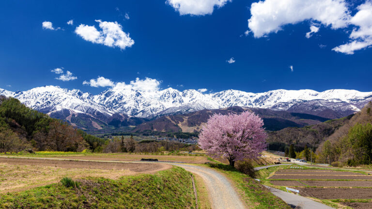
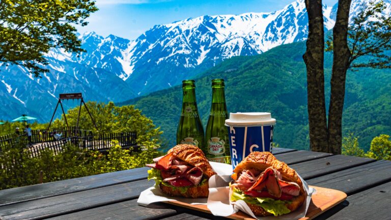
Nagano · Hakuba · Year-Round
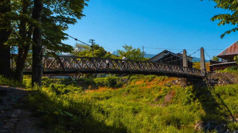
Hakuba Ohashi is a 100-meter pedestrian-and-vehicle bridge over the Matsugawa river in Hakuba Village, selected as one of Japan’s Top 100 Roads in 1987, offering a free, year-round view of the Hakuba Sanzan peaks and the glacial-melt river — no admission, no opening hours, no parking lot, no signage in any language. The only Hakuba viewpoint accessible without a hike, a ticket, or a season pass.
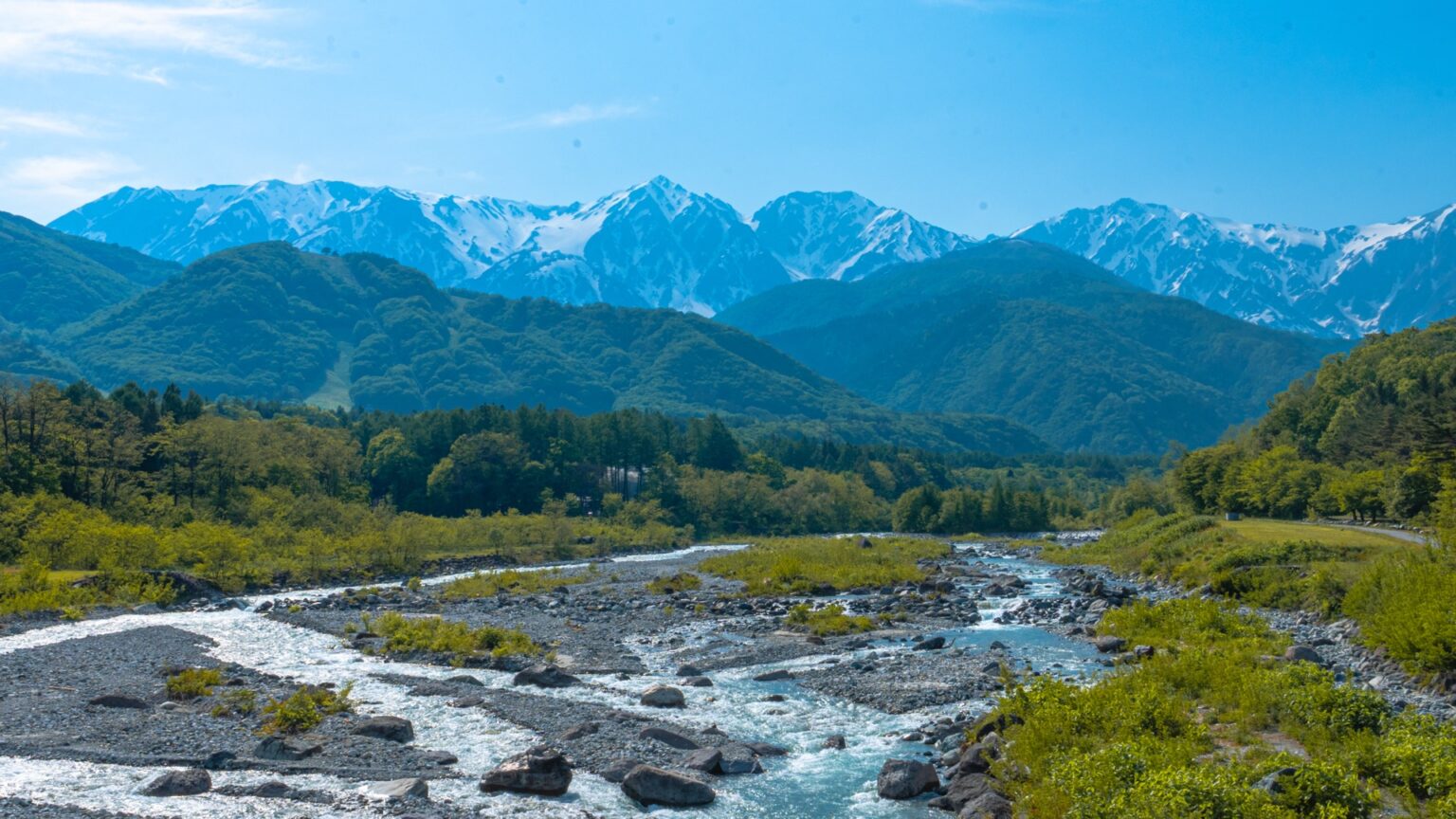
The first time I walked across this bridge was on a Sunday afternoon in May 2024, on the way back from a meal at Kurashita-no-yu onsen down the road. I was not expecting much — most bridges named “ohashi” in Japan are functional river crossings, not viewpoints. I stopped halfway, looked left, and the entire Hakuba Sanzan — Shirouma, Yarigatake, Goryu — were directly in front of me with the snow line still high, water in the river the milky-blue colour you only get from glacial melt, and absolutely nobody else on the bridge. The second time I came back specifically for the view, brought a tripod, and stayed an hour. This is the case for treating Hakuba Ohashi as a destination, not a shortcut.
30-second summary
What it is: A 100-meter road bridge over the Matsugawa river on the south side of Hakuba Village, designated one of Japan’s Top 100 Roads (日本の道100選) in 1987.
What you see: Hakuba Sanzan (the Three Peaks of Hakuba) and the Matsugawa flowing west to east, all from a railed sidewalk you can set a tripod on.
Cost / access: Free. No parking lot — use roadside, Kurashita-no-yu onsen, or Hakuba Alps Auto Camp. 10-minute drive from Hakuba Station.
Quick Facts
Location
Hokujō, Hakuba Village, Kitaazumi District, Nagano. The bridge crosses the Matsugawa river on the south side of the village.
Designation
Japan’s Top 100 Roads (日本の道100選), selected in 1987 by the Japan Highway Public Corporation and the Construction Ministry.
Length
About 100 meters with continuous railed sidewalk on both sides. Tripod-friendly from any point.
Cost / Hours
Free. No gate, no fee, accessible 24/7 — the only Hakuba viewpoint with zero restrictions.
Parking
No dedicated lot. Use roadside at the bridge ends, Kurashita-no-yu onsen (3-min walk), or Hakuba Alps Auto Camp on the south bank.
From Hakuba Station
~10 min by car, ~30 min by bike, ~50 min on foot via the Misorano riverside path.
What You’re Looking At: the Three Peaks of Hakuba
The view from Hakuba Ohashi is precisely framed by the Matsugawa valley to put the three highest summits of the Hakuba massif directly in the centre of the bridge sight-line. If you do not know the peaks, the view is gorgeous but anonymous. If you do, it becomes a map.
Shirouma-dake
2,932 m
The northern summit, the one with the Daisekkei (great snow valley) still visible in May–June. The mountain Hakuba is named after.
Shakushi-dake
2,812 m
The middle summit (literally “ladle peak”), shaped like an upside-down soup spoon when seen from the bridge.
Yari-ga-take
2,903 m
The southern summit, sharper and more triangular. Not to be confused with the famous Yari-ga-take in the Yarigatake-Hotaka area further south.
Together these three are called the Hakuba Sanzan (白馬三山). From the bridge they appear as a continuous ridge with three obvious peaks separated by saddles. The Daisekkei — the longest snow valley in Japan, ~3.5 km of permanent snow tucked into the eastern flank of Shirouma — is visible as a white tongue on the left from late spring through October. More on Hakuba’s year-round visual rhythm in our Hakuba Village Year-Round Guide.
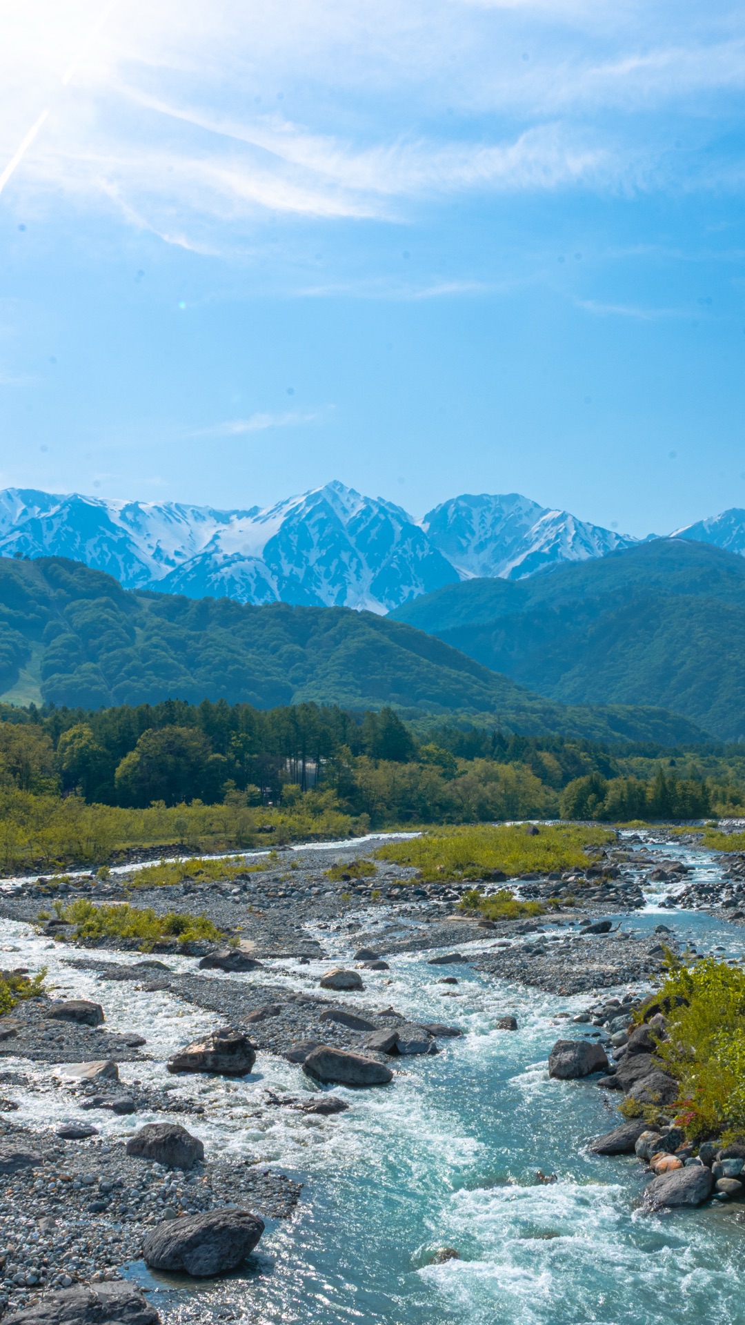
The Bridge Itself
The structure is a 100-meter reinforced-concrete arch — utilitarian, not architecturally interesting. What matters is the engineering decision someone made decades ago: the sidewalks on both sides are wide enough for a tripod and a person walking past in the same plane. You can plant a camera, frame the shot, and stay there for 30 minutes without obstructing traffic. The railing height is about chest-high on a 170 cm person, low enough to clear a 24mm or 35mm lens looking straight ahead.
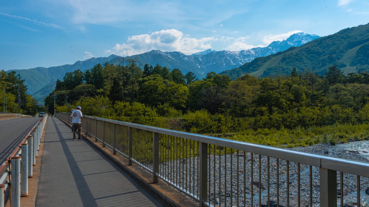
Traffic on the bridge is light — maybe one car a minute during the day, slightly more on weekends. The road is part of Prefectural Route 322, which goes from Otari town up to the Sanno-sawa hot spring area. It is not a tourist road. Locals use it. The fact that it is also one of Japan’s Top 100 Roads is, in practice, completely under-advertised — there is a single tiny commemorative plaque at the south end of the bridge and that is the entire signage budget.
“100 meters of railed sidewalk, three permanent peaks at eye level, no ticket, no closing time.”
Best Time and Lighting
The bridge works in every season but for different reasons. Choose by what you want to see rather than picking a generic “best time.”
| Season | What you get | Light strategy |
|---|---|---|
| Late April – mid May | Heavy snow on all three peaks + glacial-melt blue river at peak flow. The strongest contrast window of the year. | 09:00–11:00 east-facing light on the snow. Avoid noon (flat). |
| Mid May – June | Snow line retreating, river volume still high, green starting at low elevation. The “two-tone” window. | Same morning window; afternoon side-light works mid-June onward. |
| July – August | Daisekkei snow valley still visible, full green at low elevation. Clearest atmospheric visibility of the year if there’s no monsoon. | Early morning before 09:00 to beat heat haze; otherwise late afternoon. |
| September – October | Autumn foliage in the lower valley, first snow on summits late October. The colour-stack window. | Mid-morning, low sun angle helps colour saturation. |
| November – early December | Full snow returning, larch (karamatsu) yellow at mid-elevation. Cold but clearest air of the year. | Sunrise window if you can stand the cold (-5 to 0°C). |
| December – March | Full winter, road usually plowed but icy. Bridge accessible if you’re driving with snow tires. | Mid-morning for warmth; dramatic clouds common. |
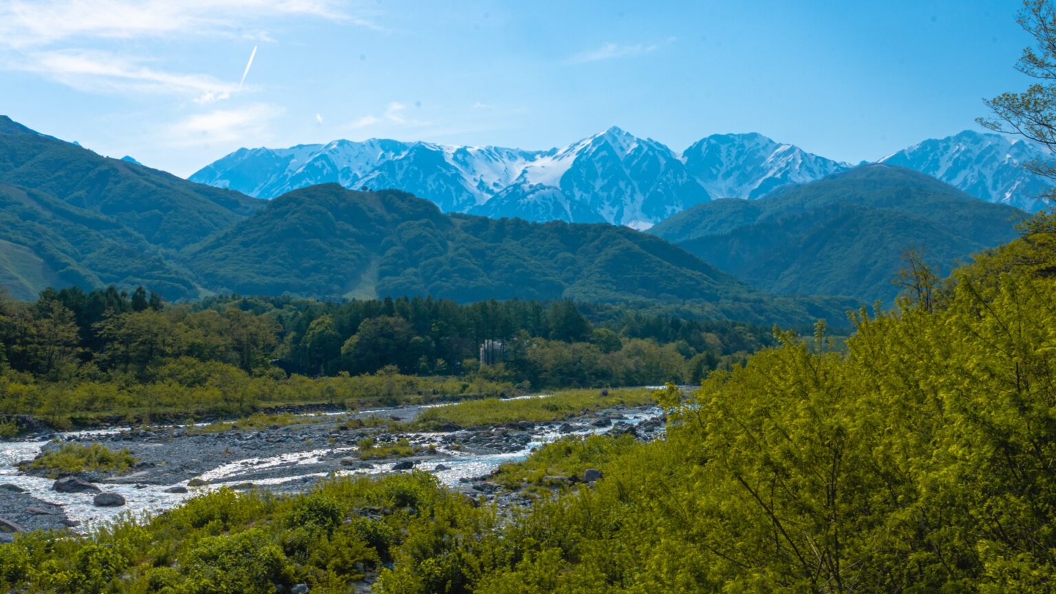
The single best date I have shot here was around May 15 — Daisekkei still extends low, river is at maximum melt flow (loudest sound), low-elevation green is just starting. The two horizontal-format photos in this article are both from that window. Mid-October for autumn is the second best date.
How to Get There
Hakuba Ohashi is on Prefectural Route 322 on the south side of Hakuba Village, about 10 minutes by car from Hakuba Station. There is no public bus that stops at the bridge itself. The realistic options:
| Method | Time / Cost | Notes |
|---|---|---|
| Rental car | 10 min from Hakuba Stn | Easiest. Park roadside or at Kurashita-no-yu onsen (¥800 day pass also gives you a soak). |
| Taxi from Hakuba Stn | ~10 min, ¥1,500–2,000 | Works for a single visit. Ask the driver to wait 20 min for round trip (~¥3,000 total). |
| Bicycle rental | ~30 min from Hakuba Stn | Several rental shops near the station, ¥1,500–2,500/day. Mostly downhill on the way out, more effort on return. |
| On foot | ~50 min from Hakuba Stn | Via the Misorano-side riverside path. Pleasant in summer, brutal in winter snow. |
| From Happo Bus Terminal | ~15 min by car | If you’re already at Happo for skiing or trekking, the bridge is a short detour south. |
For broader transport context — including the express bus options from Tokyo, Osaka, and Nagoya, and the Shinano-Omachi vs Hakuba station decision — see our Hakuba Station Access Guide 2026.
Pair it With
The bridge takes 20–40 minutes for a thorough photographic visit. Realistically you want to combine it with one of these to make the trip out worthwhile.
Same hour: Kurashita-no-yu Onsen (3-min walk)
An open-air hot spring directly south of the bridge, source temperature 47°C, ¥800 day pass. The outdoor bath looks toward the same mountain ridge as the bridge — you get the view a second time, sitting in hot water, with no tripod. Towel rental ¥200. This is the most-recommended pairing.
Same morning: Hakuba Oide Park (20-min drive north)
The other signature Hakuba viewpoint — a wooden suspension bridge over the Himekawa river framing the same Hakuba Sanzan, but from a closer and more vertical angle. The two viewpoints together give you both ends of Hakuba’s photo geography. Full Oide Park guide here.
Same afternoon: Iwatake Mountain Resort gondola (15-min drive)
If you want to see the back side of these peaks, the Iwatake gondola goes up the opposite ridge in about 8 minutes and gives you a panorama from the east side. ¥2,200 return in summer, free with a ski pass in winter. Pair with a meal at the summit restaurant.
Plan This Trip
Plan This Trip
For Southeast Asian Visitors
Hakuba in May–October is a much easier climate adjustment for travellers from Singapore, KL, Bangkok, Jakarta or Manila than the rest of the Japan Alps. Daytime temperatures sit between 15–25°C through the green season, with low humidity at this elevation (700–800 m) compared to lowland Japan. No specific clothing change beyond a light layer for early mornings. The bridge is paved and the road is car-friendly, so mobility issues are minimal. What is different from a city visit: cash is more necessary in Hakuba than in Tokyo — Kurashita-no-yu onsen, vending machines, and most small village restaurants are cash-only. Bring ¥10,000 in mixed notes per person per day. Mobile signal at the bridge is full 5G on Docomo and SoftBank; au is slightly weaker.
FAQ
Is Hakuba Ohashi worth visiting in winter?
Yes if you have winter driving experience and snow tires. The bridge itself is plowed, the view of the snow-loaded peaks is at its most dramatic, and you’ll usually have the bridge to yourself — most ski tourists never come south of the village. If you don’t drive in winter, skip it; the bus and bike options become impractical from December through March.
Can I see Mt. Fuji from here?
No. Mt. Fuji is roughly 230 km south, and the entire view from the bridge is dominated by the Northern Alps. People sometimes confuse Hakuba’s Yari-ga-take with the more famous Yari-ga-take near Mt. Fuji — different mountains, both called Yari (“spear”).
Are drones allowed?
Hakuba Village does not have a blanket drone ban, but the bridge sits within 5 km of Hakuba Iwatake Heliport. Drone flights within that radius technically require advance permission from the Civil Aviation Bureau. In practice, low-altitude photography drones flown briefly from the bridge are tolerated by locals but not formally legal. If you’re serious about drone work, file the standard MLIT permission ahead of your trip.
Is the bridge accessible for wheelchair users?
The sidewalks are level and continuous on both sides, so a wheelchair can roll the full 100 meters without obstruction. The challenge is getting to the bridge — there’s no curb cut from the parking spots, and the approach involves a slight slope. Kurashita-no-yu onsen has accessible parking and the 3-minute path from there is the smoothest route.
What time of day is the river loudest?
From late afternoon (~16:00) onward in May–June. Snow melt is driven by daytime temperature, so the river volume peaks 4–6 hours after the warmest part of the day. If you want the sound of a glacial river as much as the view of one, come at sunset, not sunrise.
Is there food or coffee at the bridge?
No. The nearest vending machine is at Kurashita-no-yu onsen (3-min walk south); the nearest convenience store is in central Hakuba (10-min drive north). If you want to combine the view with a coffee, bring a thermos and a low folding chair — there’s a flat grass strip on the north bank by the road that works as a small picnic spot.
How does the view here compare to Hakuba Oide Park?
Different angles, different compositions. Hakuba Ohashi gives you a low, wide view across the Matsugawa with the peaks at eye level — best for landscape format. Oide Park gives you a higher, more vertical view with the Himekawa river closer in the foreground and a wooden suspension bridge as a built focal point — best for portrait format and human-scale composition. Both are worth visiting; if you have only one morning, choose by your camera’s strongest format.
Booking the Trip
Booking the Trip
Three doors into a Hakuba trip. The rental car is what makes the difference between seeing the bridge and seeing all of Hakuba.
Related Reading
- Hakuba Ōide Park 2026: The Suspension Bridge + Hakuba Sanzan Frame — The other signature Hakuba viewpoint, 20-min drive north. Pair both for a full Hakuba photo day.
- Hakuba Station 2026: How to Get There from Tokyo, Osaka & Nagoya — All the bus, train, and drive routes into Hakuba.
- Hakuba Village 2026: A Year-Round Guide — What Hakuba looks like in each season, with the cherry / alps / foliage / powder windows.
Join travelers discovering Japan's hidden side
Weekly dispatches from off-the-beaten-path Japan — spots and stories you won't find in guidebooks.
No spam. Unsubscribe anytime.
Welcome aboard!
You're in. See you in your inbox soon.