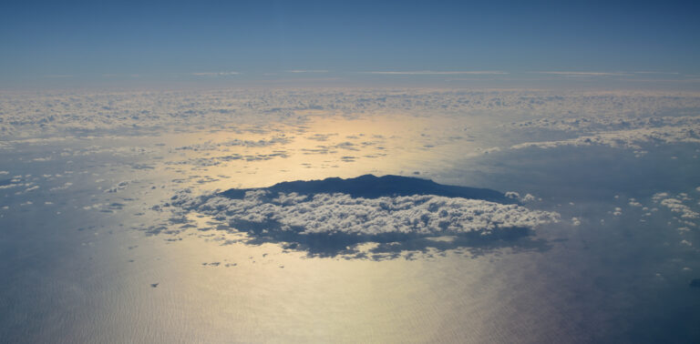


Most travelers who fly into Kagoshima look at one island — Yakushima — and stop there. They miss the part of the prefecture that fans south for 600 kilometers across the Pacific, ending closer to Taiwan than to Tokyo. Eight of those islands are worth flying out to for a few days. Two of them are UNESCO. One has a rocket-launching pad. One was the place a wrecked Portuguese ship introduced firearms to Japan. One is so close to Okinawa that the train-station-style sign on its harbor reads YORON-TŌ · Okinawa · Kagoshima.
This guide is the meta-map: which Kagoshima island is which, what each is for, how to get there, and which are worth chaining together on the same trip. If you came here looking for Yakushima, the rest is below it on the page. If you came here because you saw a photo of an empty white-sand beach and wanted to know where, this guide names every island in the photo.
Quick Facts · 2026
| Total islands in Kagoshima Prefecture | About 605, of which 26 are inhabited |
|---|---|
| Worth a dedicated trip | Yakushima, Tanegashima, Amami Oshima, Tokunoshima, Okinoerabu, Yoron, Iojima, plus the Tokara group for adventurers |
| Geographic span | Roughly 30°N (Yakushima) to 27°N (Yoron) — 600 km north–south |
| Two main ferry corridors | Kagoshima → Yakushima/Tanegashima (Toppy/Rocket + Yakushima Ferry 2) Kagoshima → Amami → Yoron → Okinawa (Marix Line + A-Line) |
| Cheapest island-hop strategy | The Marix Line ferry from Kagoshima to Okinawa stops at Amami → Tokunoshima → Okinoerabu → Yoron in succession; one ticket can cover all four |
| Best season overall | April–June and October. July–September is peak heat plus typhoons. |
Where each island sits on the map
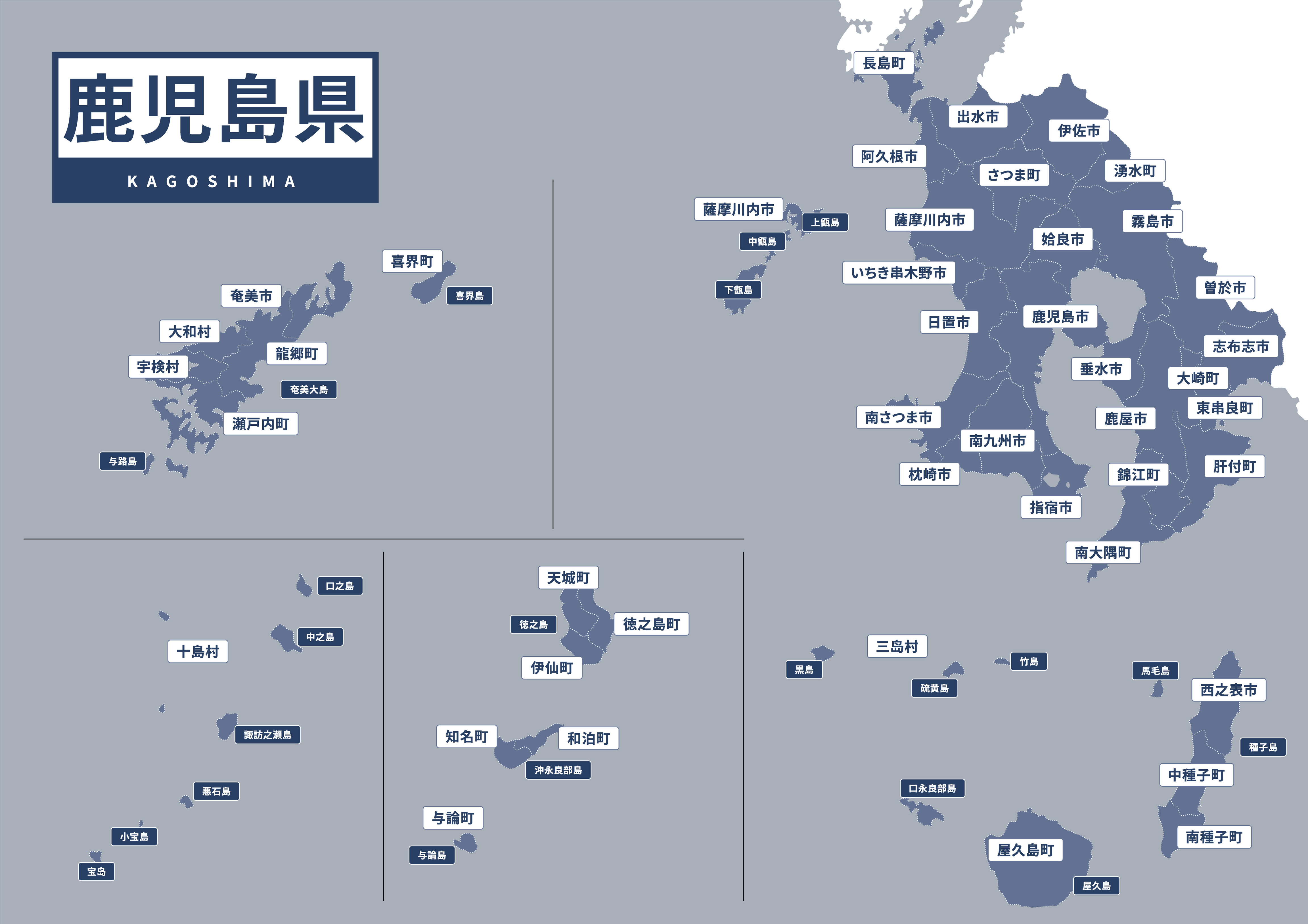
Kagoshima Prefecture is the bottom-left tip of Kyushu plus a chain of islands stretched to the south-west. The mainland part is around the bay where the volcano Sakurajima sits. The island half — what we’re here for — is the cluster you can see in the lower section of the map.
From north to south, the order is roughly: Yakushima · Tanegashima · Tokara islands · Amami Oshima · Tokunoshima · Okinoerabu · Yoron. Then you cross into Okinawa Prefecture. The Tokara islands — nine small ones between Yakushima and Amami — are reached only by once-a-week ferry, and we’re going to skip them in this guide for everyone except true island-completionists.
The eight islands worth a trip, in order
Yakushima — the cedar island
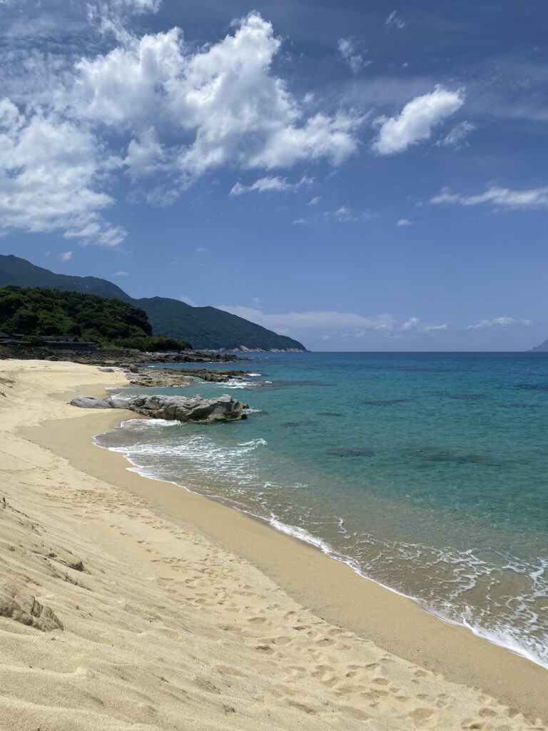
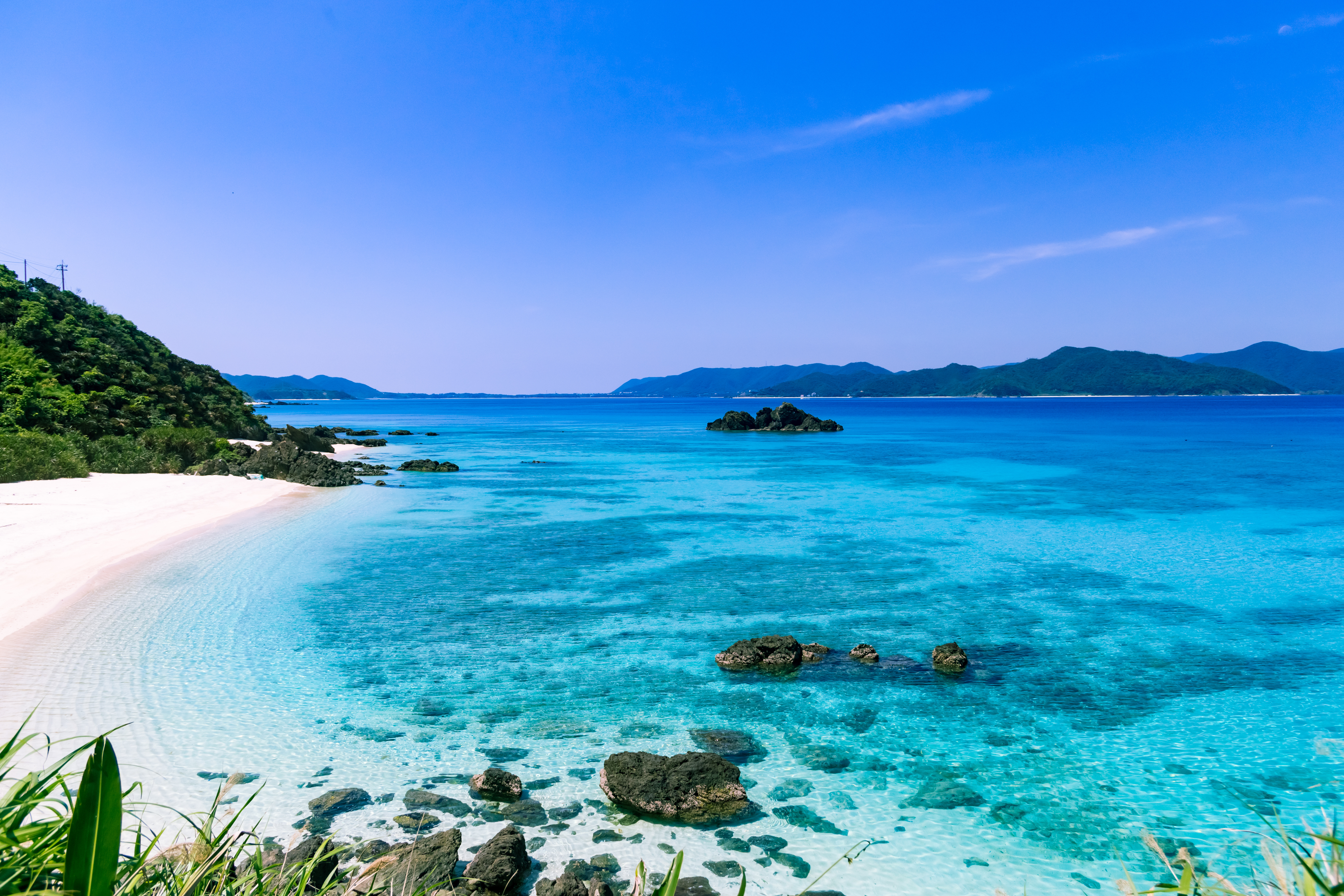
Round, mountainous, ringed by black volcanic rock and 7,000-year-old cedars. Yakushima is the most-visited Kagoshima island and the one most international travelers come for. The interior is one of the wettest forests in Japan; the coast has waterfalls, swimming pools cut into granite, and a beach where loggerhead turtles still nest.
How to get to Yakushima → · Jomon Sugi trek 2026 → · West drive →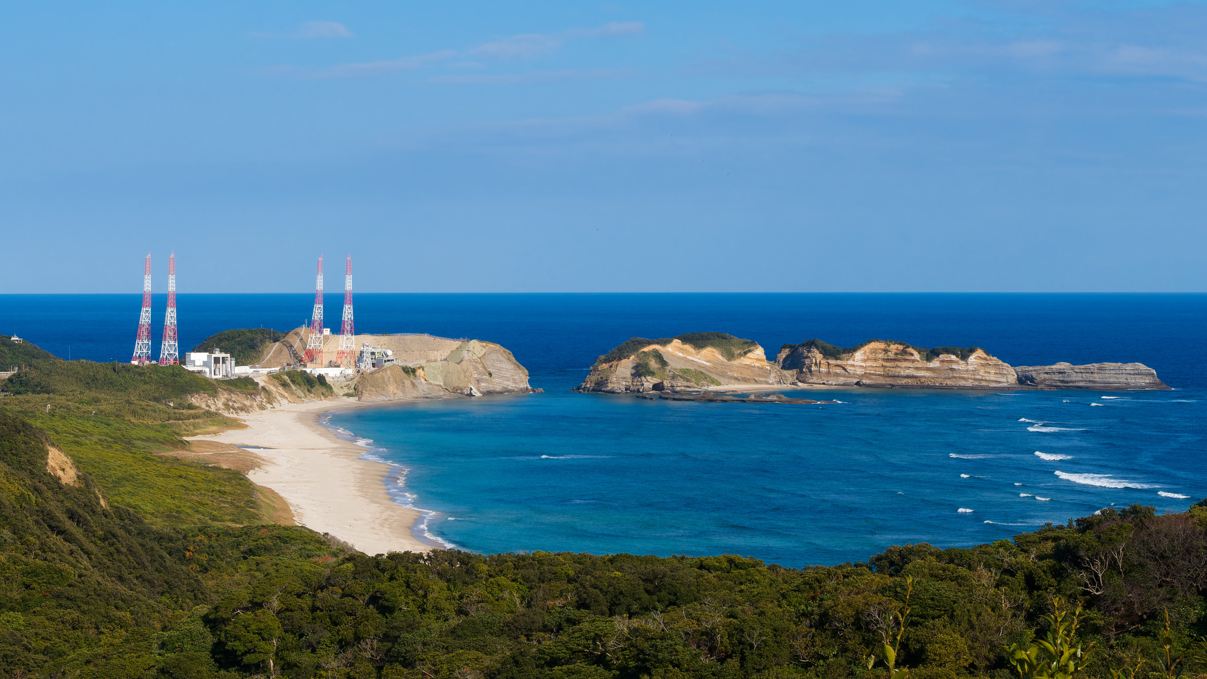
Tanegashima — rockets and the first firearm
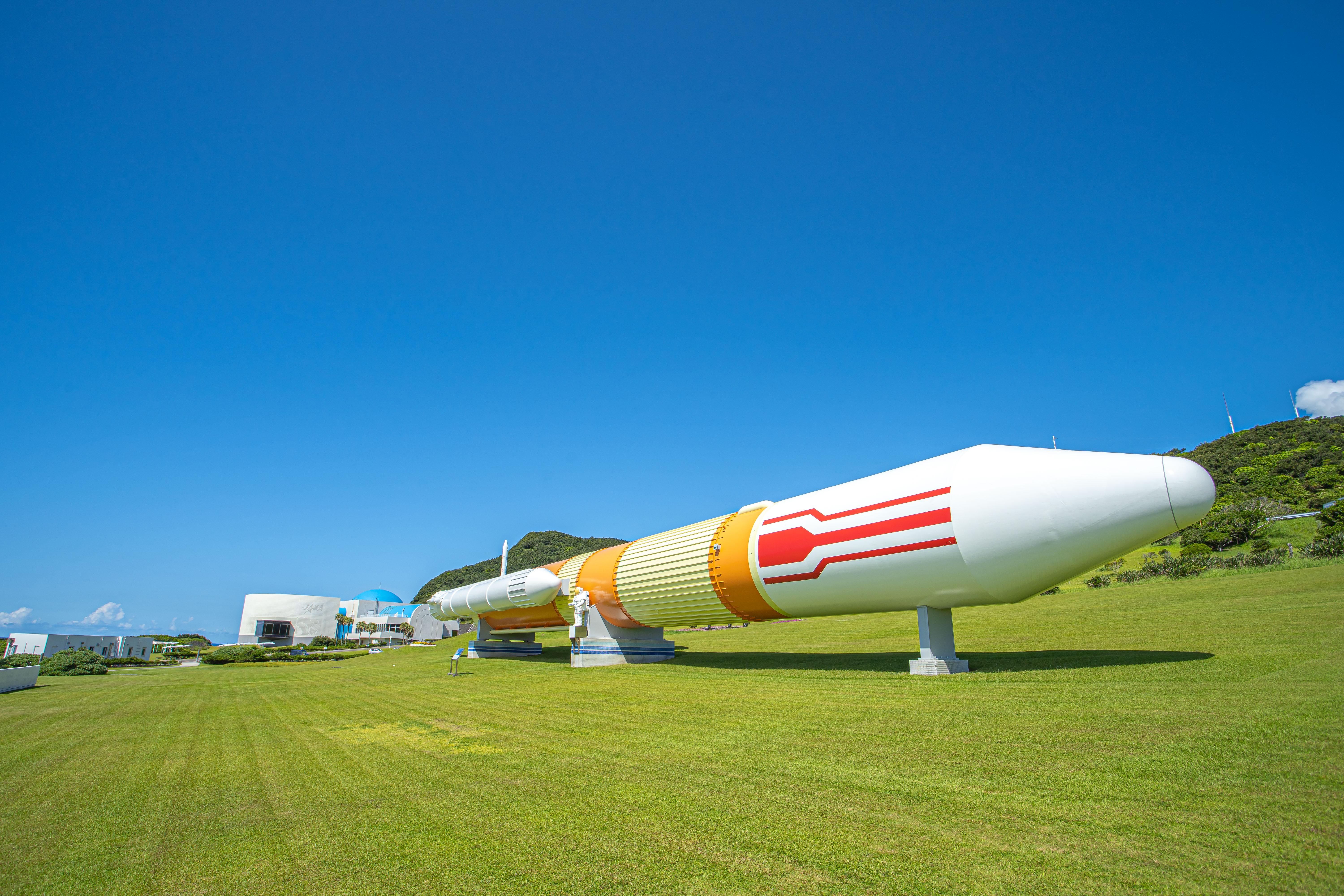
Tanegashima is long and flat, the opposite of Yakushima’s round mountain. Two reasons it’s on this list: it’s where Portuguese sailors landed in 1543 and introduced matchlock firearms to Japan (the word for rifle in Japanese, tanegashima, comes from the island), and it’s the launch site for JAXA, the Japanese space agency.
You can visit the Tanegashima Space Center — the most southern launch site in Japan, regularly used for H-IIA and H3 rockets — and walk through the Space Science Museum and the rocket display fields. The east-coast beaches (Kumano-kaihin, Chikura-no-iwaya) are some of Japan’s best surf points.
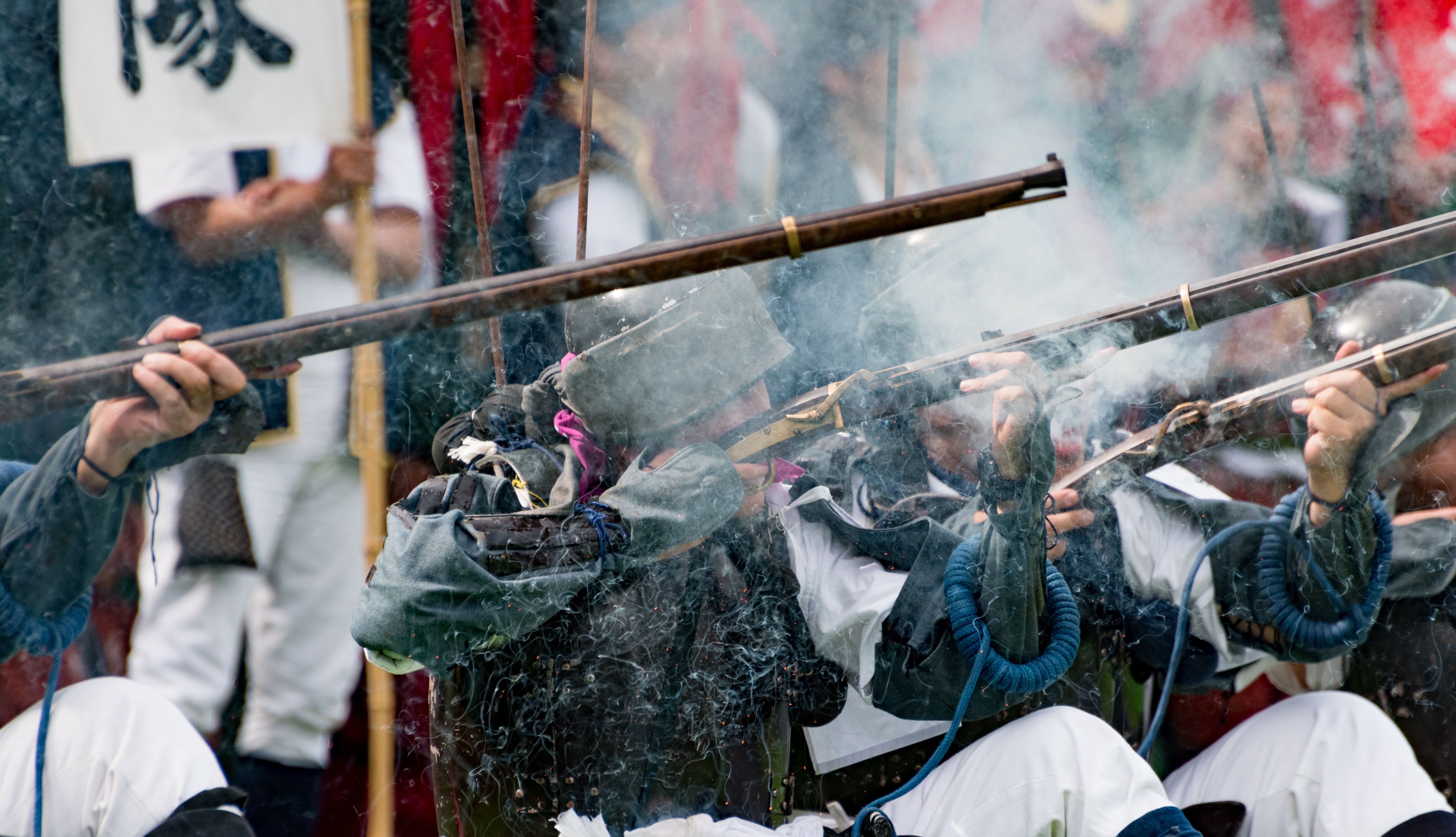
One specific event: the Tanegashima Teppo-Tai (matchlock corps) does live-fire reenactments of the 1543 firearms encounter several times a year, in period costume, with original-style matchlock muskets. If your trip lines up with one, it’s loud, smoky, and unforgettable.
How to combine: most travelers do Tanegashima as a 1-night side trip from Yakushima. The same Toppy that runs Kagoshima → Yakushima makes a Tanegashima stop on certain departures, and there’s a 35-minute inter-island ferry between Yakushima and Tanegashima.
Amami Oshima — mangroves and brown sugar
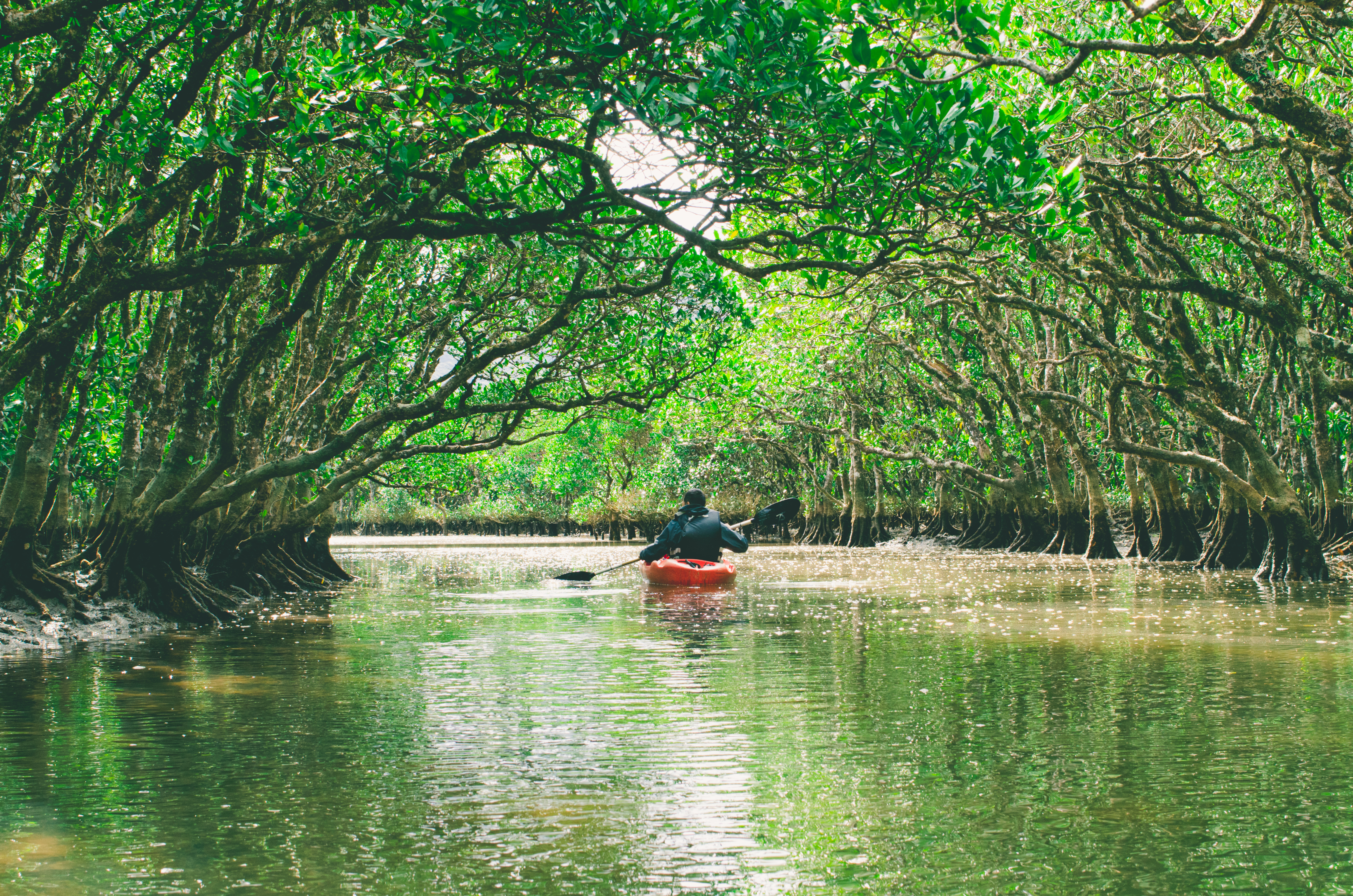
The biggest of the southern islands and the warmest by a margin. Amami sits 380 km south of Kagoshima city, in subtropical climate that grows mangroves — the only mangrove forest in Japan you can paddle through, the Amami Mangrove Park on the south coast. The interior has the kind of dense low-altitude jungle you don’t see anywhere else in Japan; the 2021 UNESCO designation specifically protects the lowland forest and the Amami black rabbit (Pentalagus furnessi), an endemic species found only here and on Tokunoshima.
The other reason to come: kokuto shochu, the brown-sugar shochu that’s legally allowed to be made only on Amami and a handful of nearby islands. Most distilleries open their doors for tasting; Asahi Brewery in Naze is a good first stop.
Amami has the best balance of beaches and forest of any Kagoshima island. Snorkeling at Tomori Beach and Ohama-kaihin; sea kayaking through the mangroves; hiking the central Yuwan-dake trail; and one of Japan’s few easy access points to a coral reef from shore.
Three to four nights is the right length. From Kagoshima it’s a 1-hour JAL/Solaseed flight to Amami Airport, or an 11-hour overnight ferry on the Marix Line.
Tokunoshima — the longevity island
Tokunoshima is the next island south. Smaller, drier, with a long tradition of togyu — sumo-style bullfighting where two bulls push each other; matches still run several times a year. It’s also the island that produces the highest concentration of centenarians per capita in Japan; both of the world’s longest-confirmed-lived men were from Tokunoshima.
For a traveler, the experience is sugarcane fields running to white-sand cliffs, two long-and-quiet beaches (Mushiroze, Inushinohama), and a slower pace than Amami. Combine with Amami for a 5-6 day southern trip.
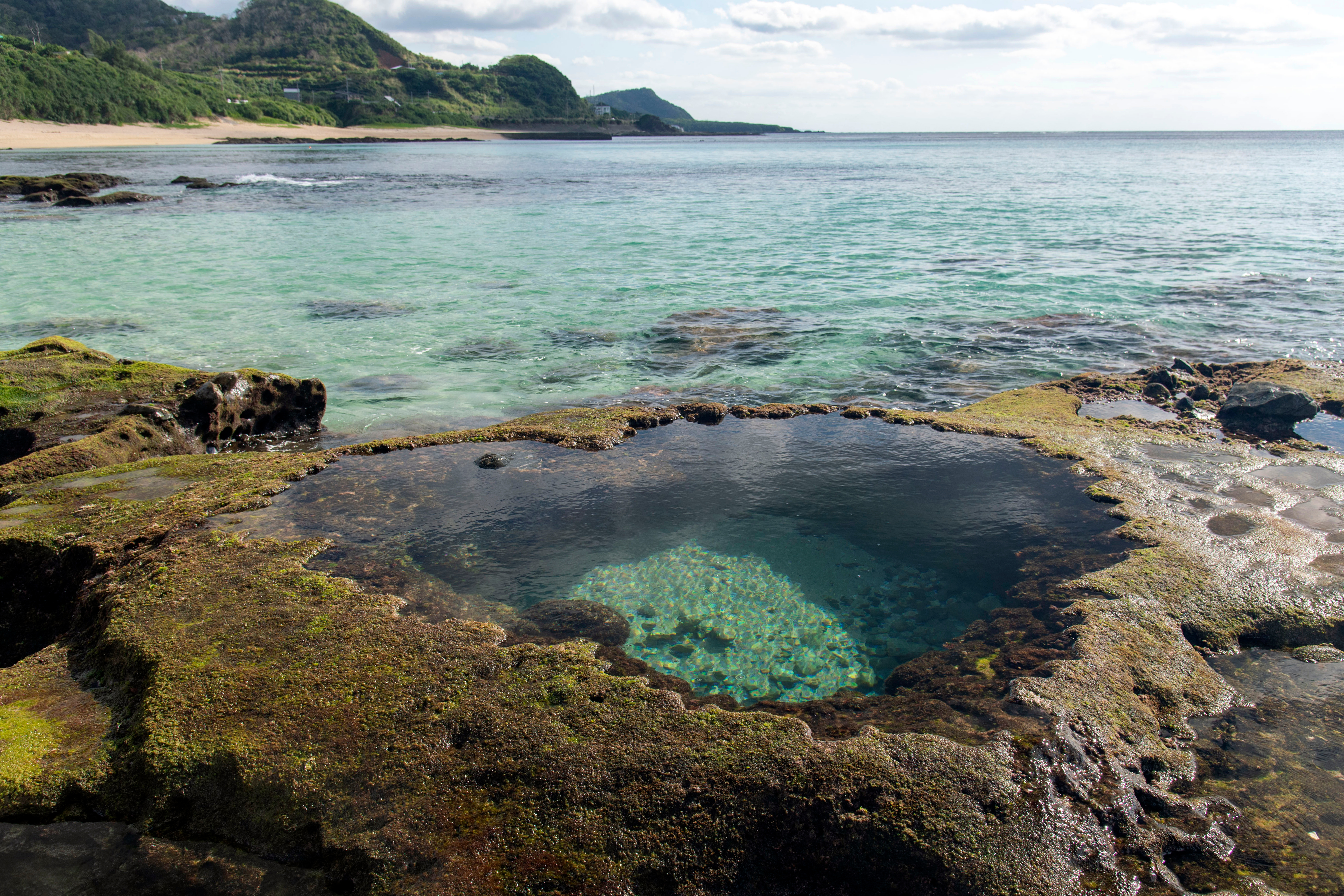
Okinoerabu — caves and Easter lilies
Okinoerabu is the limestone island. Made of uplifted coral reef, it’s riddled with underground rivers and over 200 caves — Shoryudo Cave is the famous one, with stalactites and a freshwater pool you can wade through with a guide. Above ground, in March and April the southern slopes turn into Easter-lily fields, the source of most of Japan’s domestic Easter-lily bulbs.
This is a 2-night island. Stay in Wadomari (the main town) or China (the southern fishing village). Limited rental cars; book ahead.
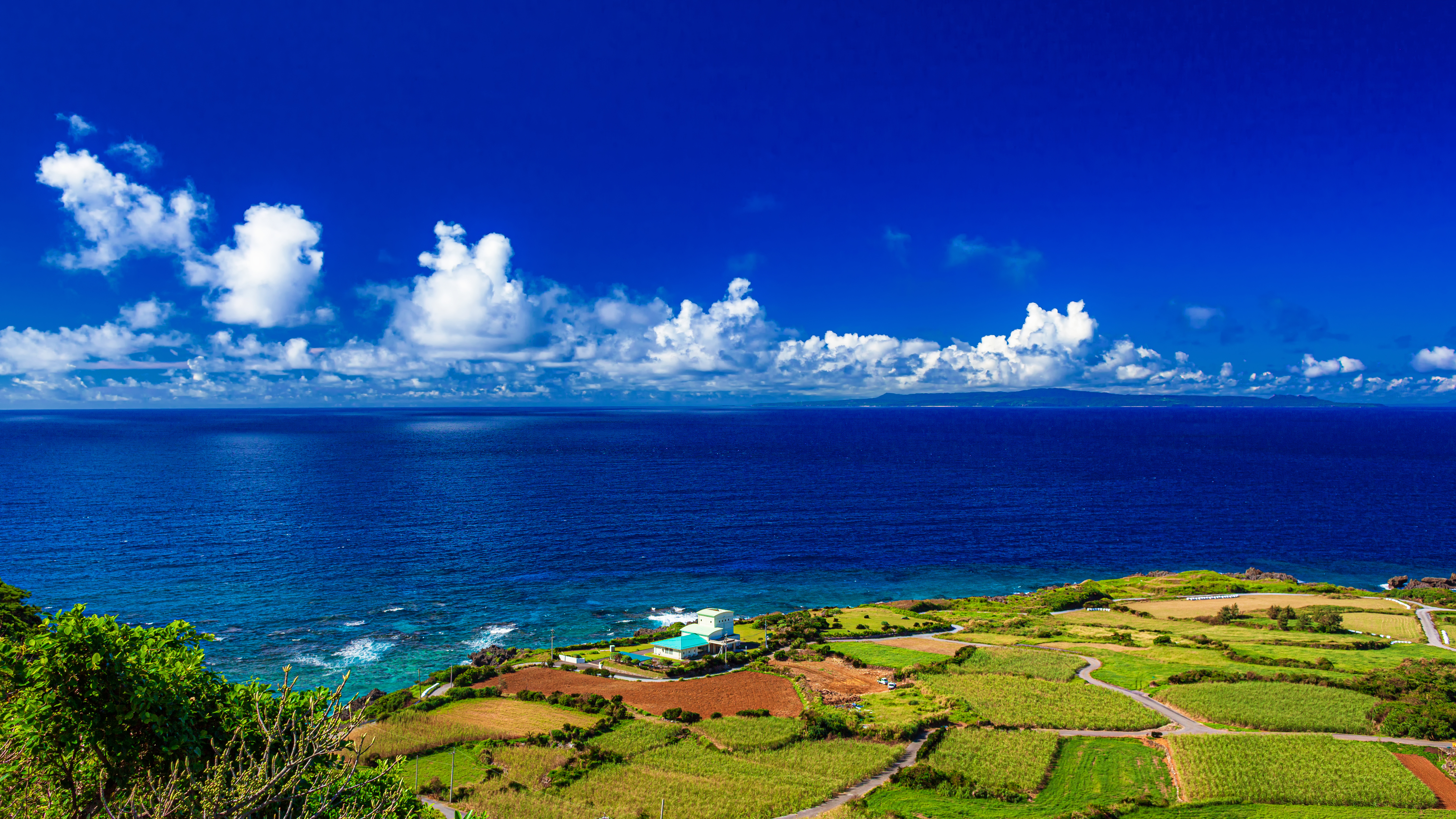
Yoron — the Greek-flag-shaped sandbar
Yoron is the southernmost Kagoshima island, geographically closer to Okinawa (22 km) than to most of its own prefecture. It’s 24 km in circumference, surrounded by a coral reef, and has one of the best beach landscapes in Japan: the Hyakkajima — a long crescent of white sand that emerges from the sea only at low tide, on certain days each month.
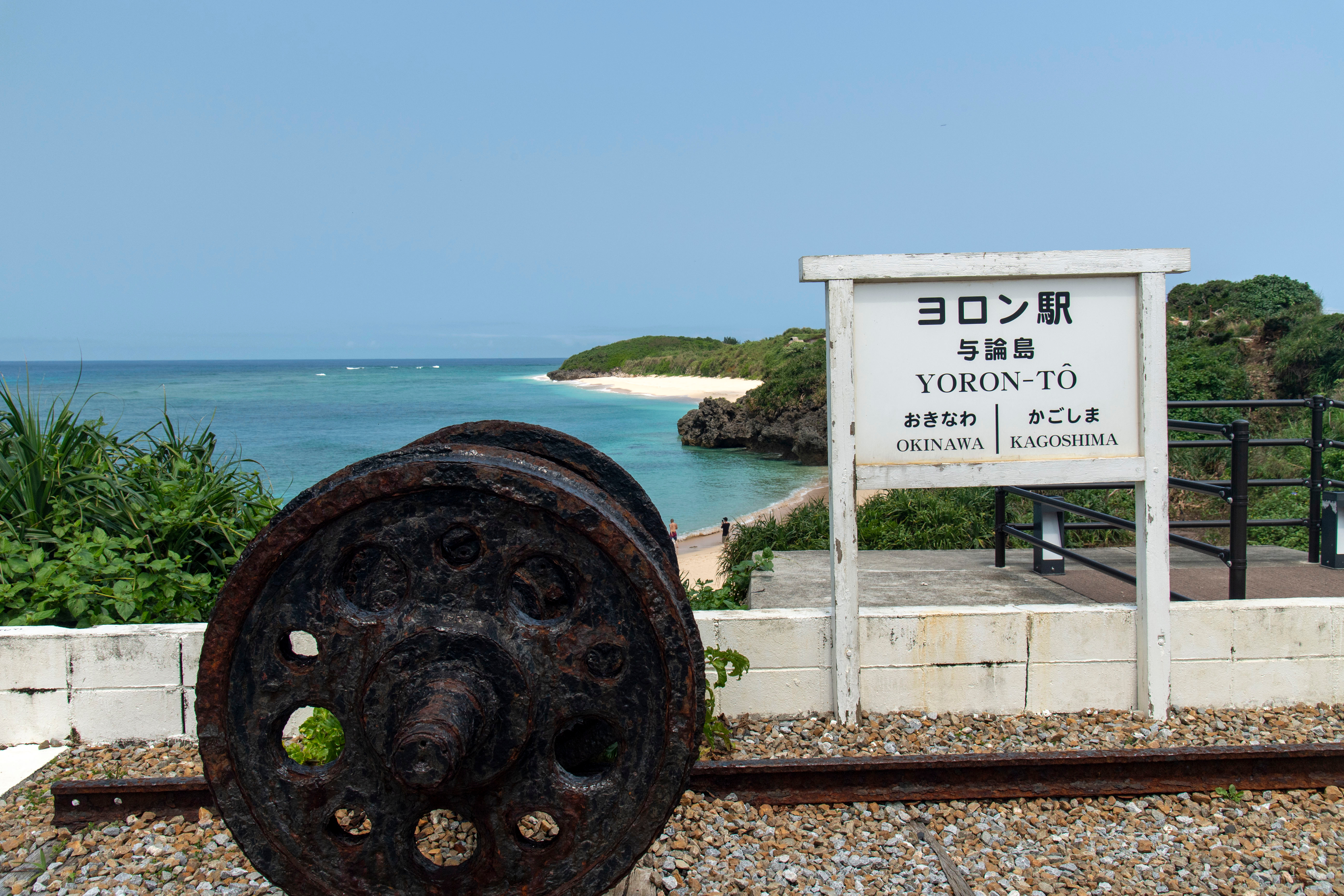
The Yoron-tō Station sign on the cliff above the harbor is a monument, not a real station — the island has no railway. It marks the prefectural boundary, with Okinawa pointing one way and Kagoshima the other. Locally a tradition called yoron-kenpo exists: when locals greet outsiders, they share otorism (the local distilled drink), say “yoron-kenpo,” and the visitor is now an honorary islander.
Iojima — the volcanic onsen island
The shortest-stay Kagoshima island on this list: Iojima (硫黄島, “sulfur island”) is part of the volcanic Mishima group, west of Tanegashima. The harbor water is yellow-orange from sulfur leaching out of the active volcano above the village. There’s a free outdoor onsen on the rocks (Higashi-onsen) where the seawater itself is naturally heated by the volcano. Population about 100.
Practical: this is for travelers who want a single overnight on a hyper-quiet active-volcano island and don’t mind a small ferry. Mishima village ferry runs 4 days a week from Kagoshima Port.
Tokara islands — the deeply remote ones
The Tokara group — Kuchinoshima, Nakanoshima, Suwanose, Akusekijima, Tairajima, Kodakara, Takarajima — is the least-visited part of Kagoshima. The only way in is the weekly Toshima Sonchocho municipal ferry from Kagoshima Port. Population is about 660 across all seven islands. There are no hotels, only minshuku (family-run inns); no convenience stores; one elementary school per island. Lurking in the background: an active submarine volcano that earned Suwanose a permanent eruption-warning status.
Visit if: you’ve done all the others above, you read Japanese well enough to handle the minshuku booking process, and you’re willing to commit to a 7-day round trip rhythm dictated by the ferry.
How to chain visits: the Marix Line strategy
The single most useful piece of trip-planning information for the southern Kagoshima islands is the Marix Line ferry route. One ferry leaves Kagoshima in the early evening, runs overnight south, and the next morning calls at Naze (Amami) → Kametoku (Tokunoshima) → Wadomari (Okinoerabu) → Yoron-tō → Motobu (Okinawa) in succession before terminating at Naha Port. The reverse runs the other direction.
If you book individual segments, the same ferry counts as separate tickets — you can get off at any stop and reboard a later sailing. The strategic move is to use the Marix Line as your inter-island connector and skip flights between the southern islands entirely.
Pairings — how to combine islands in one trip
| Trip length | Suggested combination |
|---|---|
| 3-4 days | Yakushima only — full Jomon Sugi + west drive + one rest day |
| 5-6 days | Yakushima + Tanegashima — add 1-2 nights for the rocket center and a beach |
| 7-8 days | Yakushima + Amami — fly direct or use a Kagoshima connection |
| 10-12 days | Yakushima → Amami → Tokunoshima → Okinoerabu → Yoron, ending in Okinawa |
| 14+ days | All of the above plus Tanegashima rocket day; option to add Iojima or one Tokara island for solo travelers |
Search flights and ferries
Flights from Tokyo or Osaka all connect through Kagoshima Airport. From there, JAL/JAC handles inter-island flights to all major islands; the Marix Line covers the southern ferry chain.
Search Tokyo → Kagoshima flights →Frequently asked questions
Which Kagoshima island is best for first-timers?
Yakushima for forest and hiking, Amami Oshima for tropical beaches and easier infrastructure, Yoron for the smallest-island feel. If it’s your first trip to a Japanese outer island and you want a balanced experience, Amami is probably the easiest entry: 1-hour flight from Kagoshima, a real airport, English signage at the major sights, and enough variety in beaches and forest for 4-5 days.
Are these islands part of Okinawa?
No — they’re Kagoshima Prefecture, even though geographically they sit between Kagoshima city and Okinawa. The prefectural boundary is between Yoron and Iheya (Okinawa), about halfway in the chain. Culture, language (the Amami dialects), and food do show Okinawan influence the further south you go, but administratively, climate-zone-wise, and historically, these are Kagoshima.
Can I use my JR Pass on the ferries?
No. JR Pass is for JR-operated trains and a handful of JR ferries (the JR Miyajima ferry in Hiroshima is the famous one). Marix Line, Toppy, and Yakushima Ferry 2 are all private operators outside JR.
Are there any English tours for the islands?
Some — Amami has a few English-language nature tours (kayaking, night-tour for the Amami black rabbit, snorkeling). Tokunoshima and Okinoerabu have very little English support; book through the local tourism office and expect Japanese-only. Yakushima has the most English options of any island in the chain.
What about typhoons?
August through early October is peak typhoon season. The southern islands (Yoron, Okinoerabu) take a direct hit roughly 2-3 times per year; Yakushima and Amami also get heavy rain even from glancing systems. Don’t plan a tight multi-island itinerary in this window unless you have buffer days. Late April–June and October–November are the safest weather windows.
Last updated: May 2026 · Sources checked: Kagoshima Prefecture tourism, Marix Line schedules, JAC inter-island timetables, individual island town offices.
Photos by Nobutoshi (Yakushima) and licensed stock (other islands).
Join 1,000+ travelers discovering Japan's hidden side
Weekly dispatches from off-the-beaten-path Japan — spots and stories you won't find in guidebooks.
No spam. Unsubscribe anytime.
Welcome aboard!
You're in. See you in your inbox soon.