
Most Yakushima travel writing focuses on Jomon Sugi. The week I spent on the island, I learned that the better story is what happens when you turn the steering wheel the other way — west, away from Anbo, around the unmarked curves where the road becomes single-lane and the forest meets the sea without a buffer. There is one waterfall most tour groups stop at, one beach where loggerhead turtles still nest, and ten or fifteen kilometers of road where you have to stop the car because monkeys are sitting on it.
This is a guide to that drive: how to plan it, what to actually stop for, where the photos in your head are versus where they aren’t. About 120 km of road if you do the full loop, 5–6 hours of driving with stops, and the only place on Yakushima where you’re likely to spend an entire afternoon without seeing another tour bus.
Quick Facts · 2026
| Loop length | About 120 km if you start and end in Anbo |
|---|---|
| Driving time | 5–6 hours including all the stops below; 4 hours if you only do Ohko Falls + Seibu Rindo |
| Best season | May–October for the swimming spots; year-round for the drive itself |
| Type of road | Two-lane until Kurio; single-lane (Seibu Rindo) for 12 km between Kurio and Nagata |
| Fuel | Fill up in Anbo or Miyanoura before you leave; no gas stations on the west loop |
| Cell coverage | Spotty past Kurio; download offline maps |
| Wildlife you’ll see | Yakushima macaques (yakuzaru), Yakushima sika deer (yakushika); turtles in season |
| Wildlife rules | Do not feed, do not approach, do not exit the car. Drive at 30 km/h on Seibu Rindo |
Part of my Calmcation in Japan guide to the country’s quietest escapes.
Why almost nobody does this drive
Yakushima’s tour-bus rhythm is built around two things: the Jomon Sugi shuttle from Yakusugi-shizen-kan, and the Shiratani Unsuikyo trail outside Miyanoura. Both are in the eastern half of the island. Most tour groups don’t come west of Kurio because the road narrows, the bus drivers don’t want to deal with it, and there are no big-name attractions east of Yakushima Lighthouse to justify the detour.
The result, if you have a rental car, is that you can drive most of an afternoon on Seibu Rindo, the UNESCO World Natural Heritage buffer zone, and pass three other cars total. I drove the loop on a Saturday in late August. Between Kurio and Nagata I saw two cars, one cyclist, six monkeys, and a deer that didn’t move out of the road for thirty seconds. This is the unhurried Yakushima.
Renting a car: where, when, how much
You need a rental car. There’s no other practical way to do this loop — the public bus loops the southeast half of the island and stops well before Kurio. Rental options:
- Yakushima Airport — Toyota Rent-a-Car, Times Car Rental, and a couple of local agencies. The airport agencies are cheaper than Anbo agencies. Around ¥6,000–8,000 per day for a compact in 2026.
- Miyanoura Port — Several agencies are in walking distance of the ferry terminal; useful if you arrive by Toppy/Rocket from Kagoshima.
- Anbo — Limited options, slightly higher prices, but convenient if you’re staying there.
Reserve before you arrive, especially in Golden Week, August, and the cherry-blossom shoulder. The island has only about 250 rental cars total. International driving permits work; an English-speaking agent at Toyota Rent-a-Car at the airport speaks the basics. ETC cards are not needed; there are no toll roads on the island.
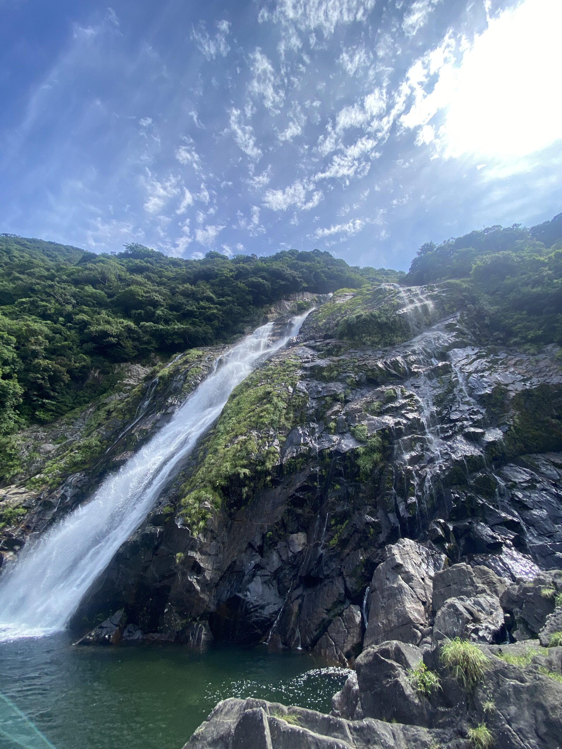
Stop 1 · Ohko Falls
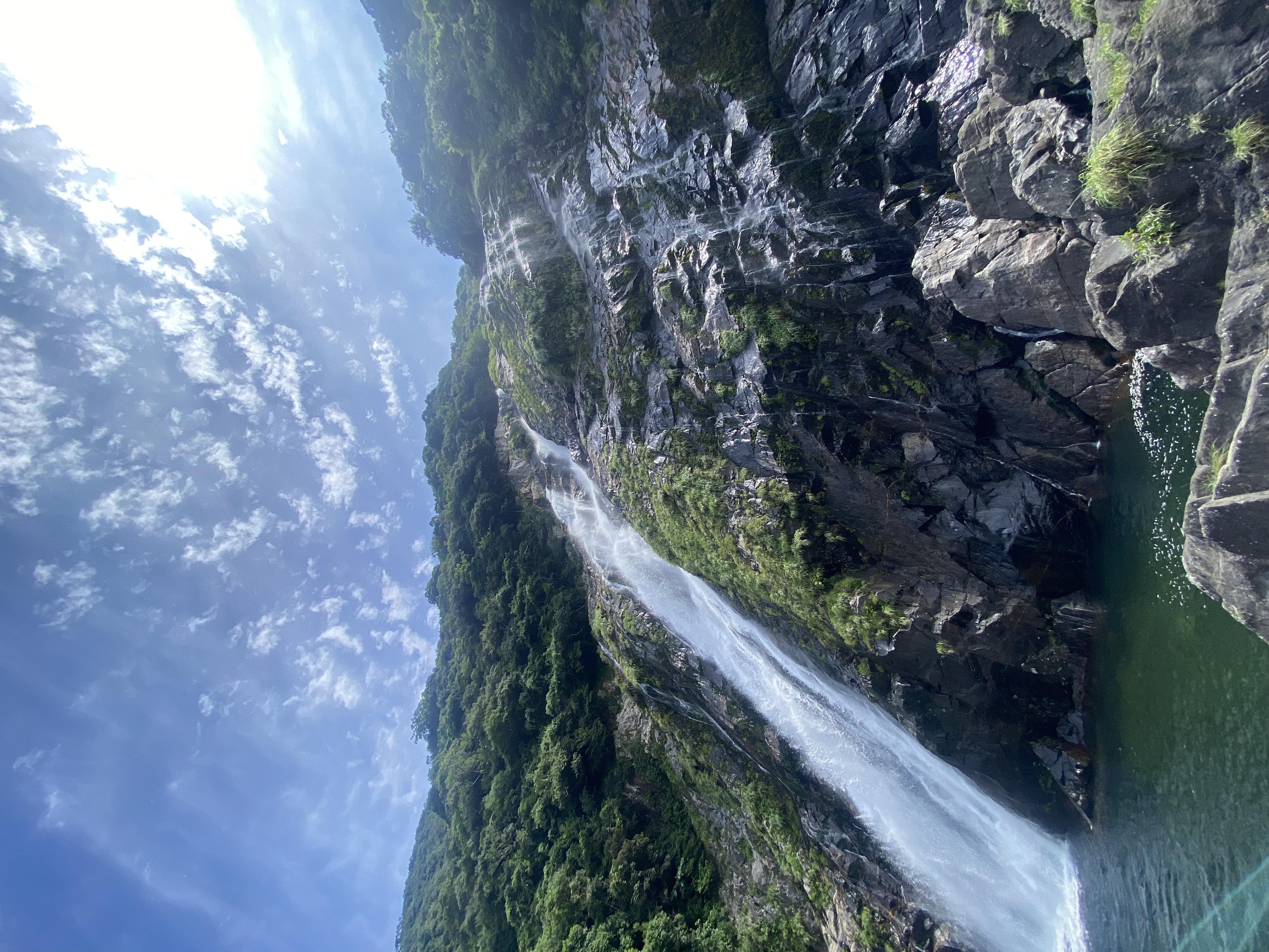
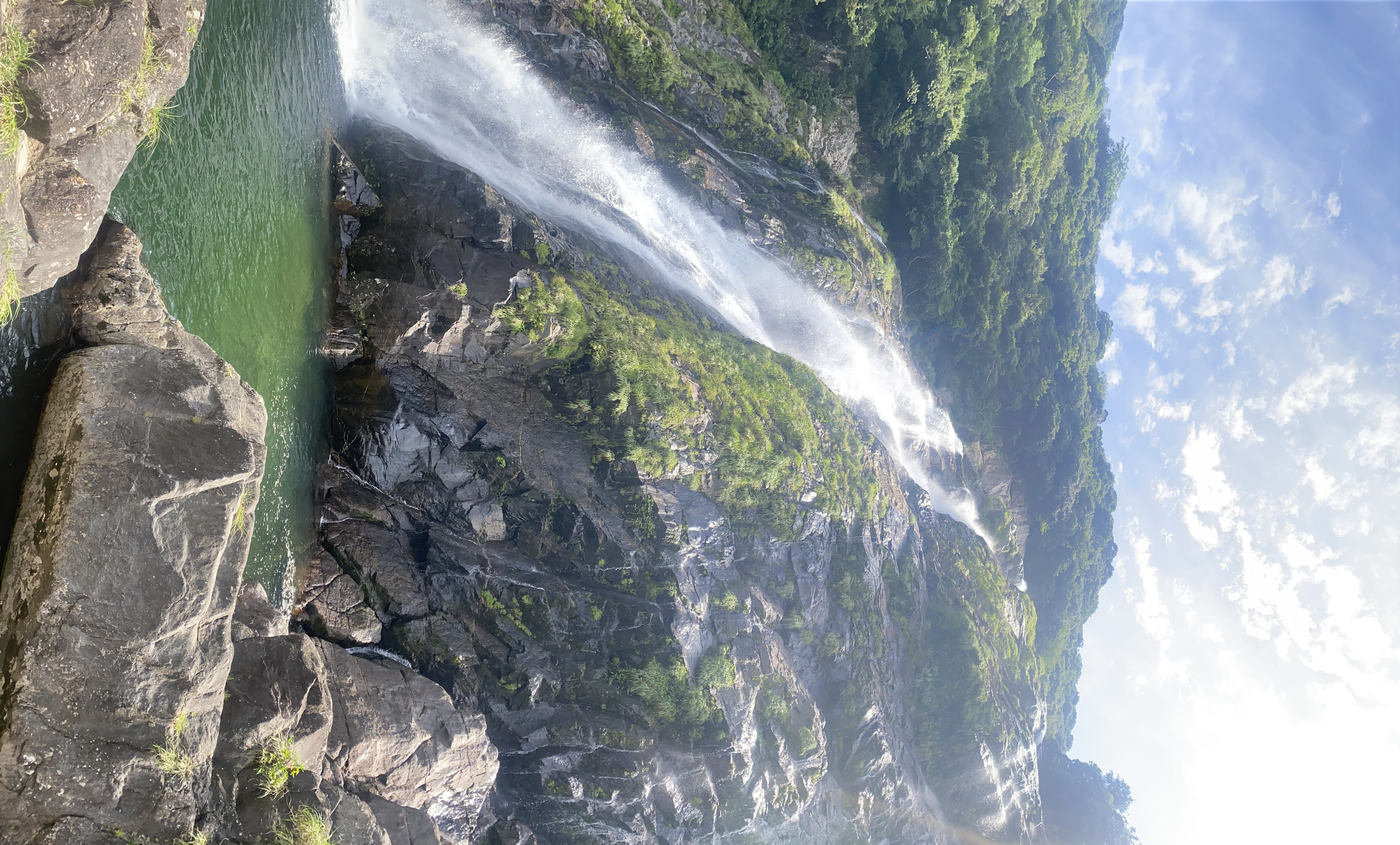
Ohko Falls (大川の滝)
The biggest set-piece on the west loop is Ohko Falls — an 88-meter waterfall that drops straight off a cliff into a clear pool, with a paved path that lets you walk to the base and (if the river is low enough) actually walk behind the falling water. It’s on Japan’s official Top 100 Waterfalls list, and it’s the only Yakushima stop where you’ll meet other tourists.
The walk from the parking lot to the base is about ten minutes on a flat stone path, with handrails on the steep parts. After heavy rain — which on Yakushima is most days — the spray reaches the parking lot. In summer, the pool is shallow enough to stand in; locals come here with kids in inflatable rings. There’s a small shop near the parking selling shaved ice and tankan oranges, the local citrus.
Practical note: the “walk behind the falls” experience exists at Ohko in a half-true sense. There’s a rocky overhang you can scramble onto where you’re technically behind the column of water. It’s slippery, marked unofficial, and people do it all the time. Only attempt this if the water level is low; if the river looks brown after rain, stay on the main viewing path.
Stop 2 · Yokogawa Valley
Yokogawa-keikoku (横河渓谷)
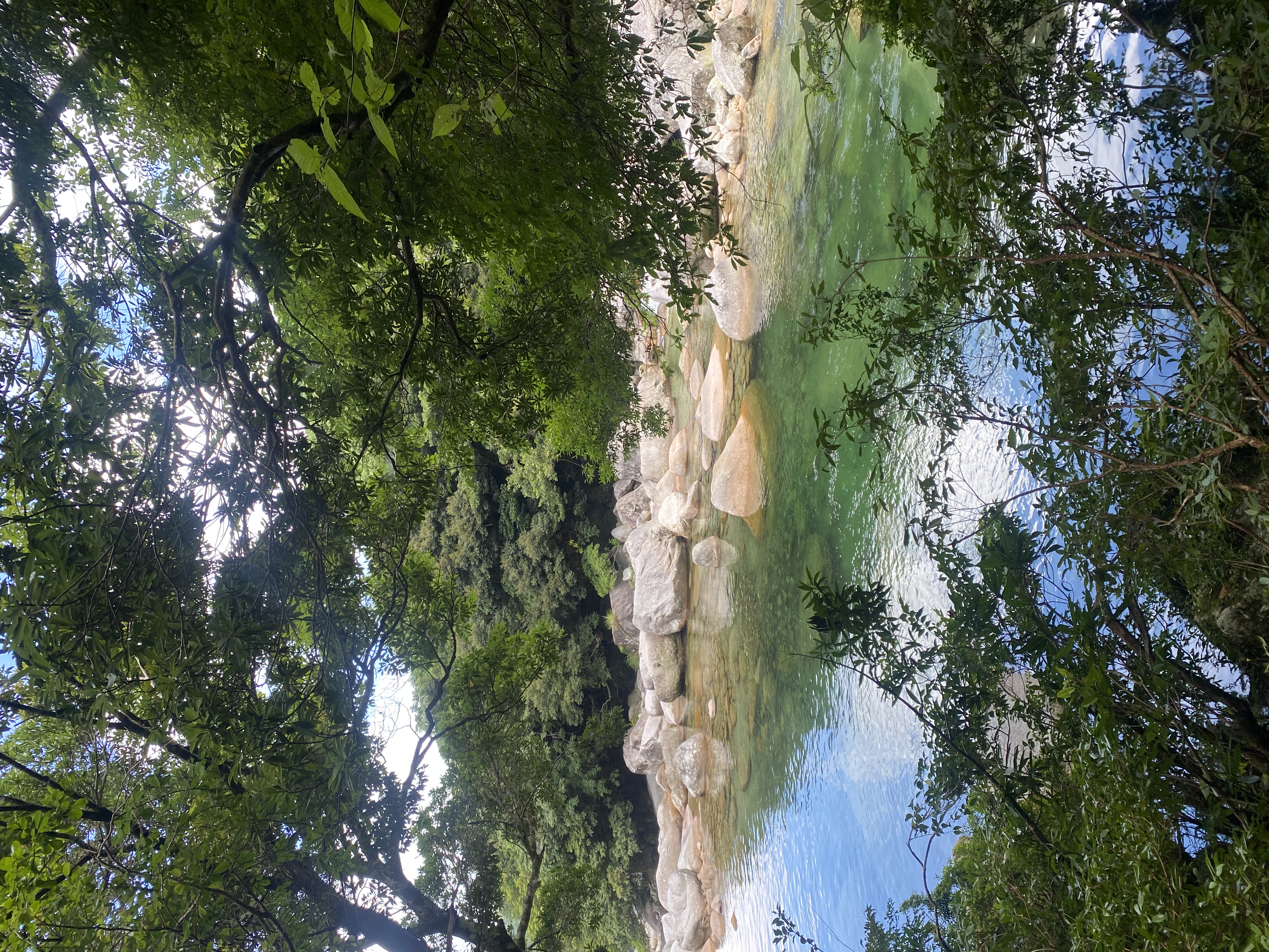
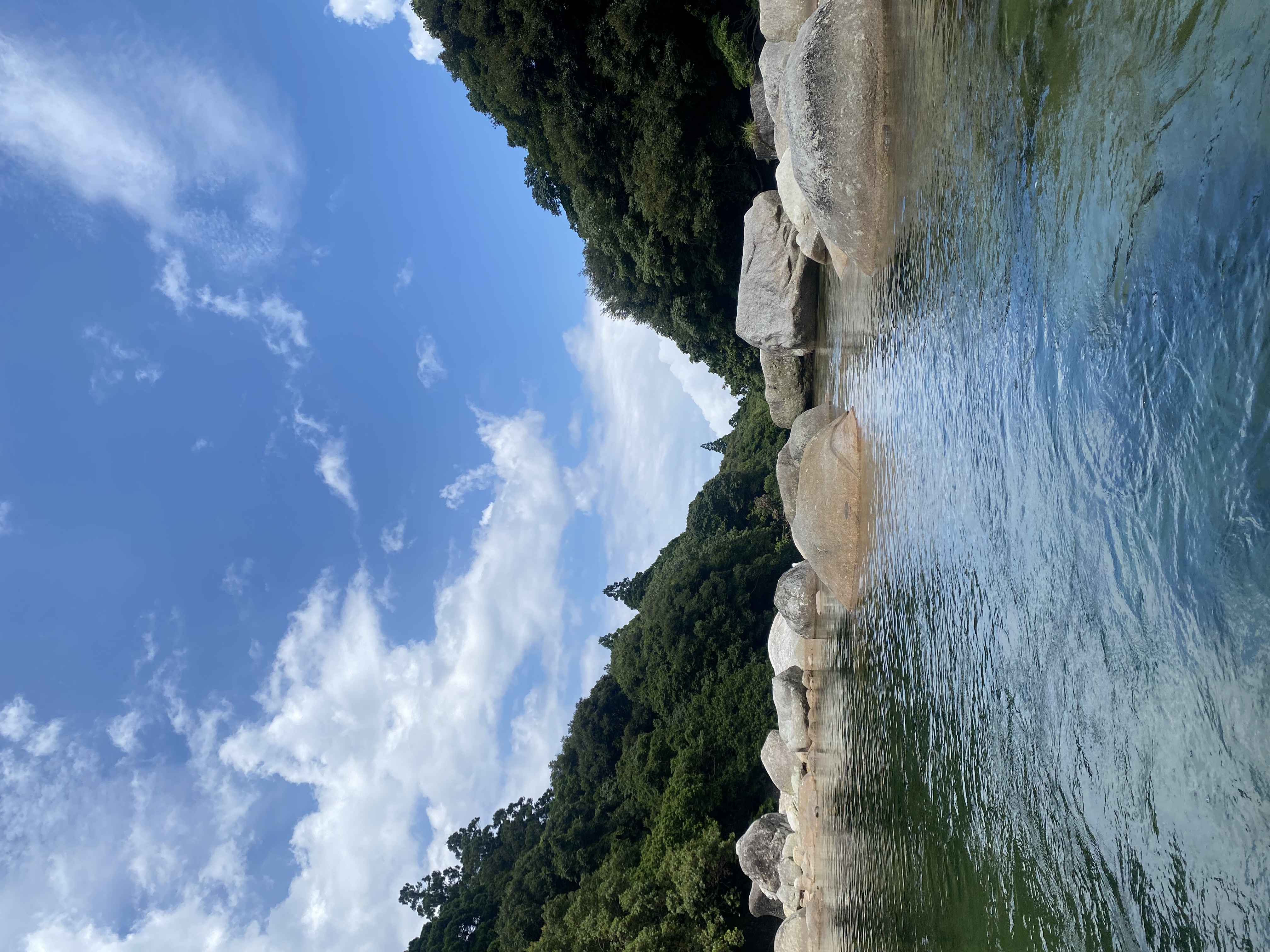
This is the swimming hole the locals would rather not be in any guidebook. Yokogawa-keikoku is a stretch of the Yokogawa River where the water has carved a series of smooth granite chutes and pools, the deepest about three meters. The rocks are so smooth you can lie on them like a beach. The water is cold enough at any time of year that you need to commit to going in.
To find it: a small dirt pull-off on the inland road south of Kurio, with a hand-painted sign. The path down to the river is a five-minute scramble — no railing, mossy roots, easier than it sounds in dry weather and harder than it sounds after rain. Bring water shoes; the river bottom is granite gravel between the smooth slabs.
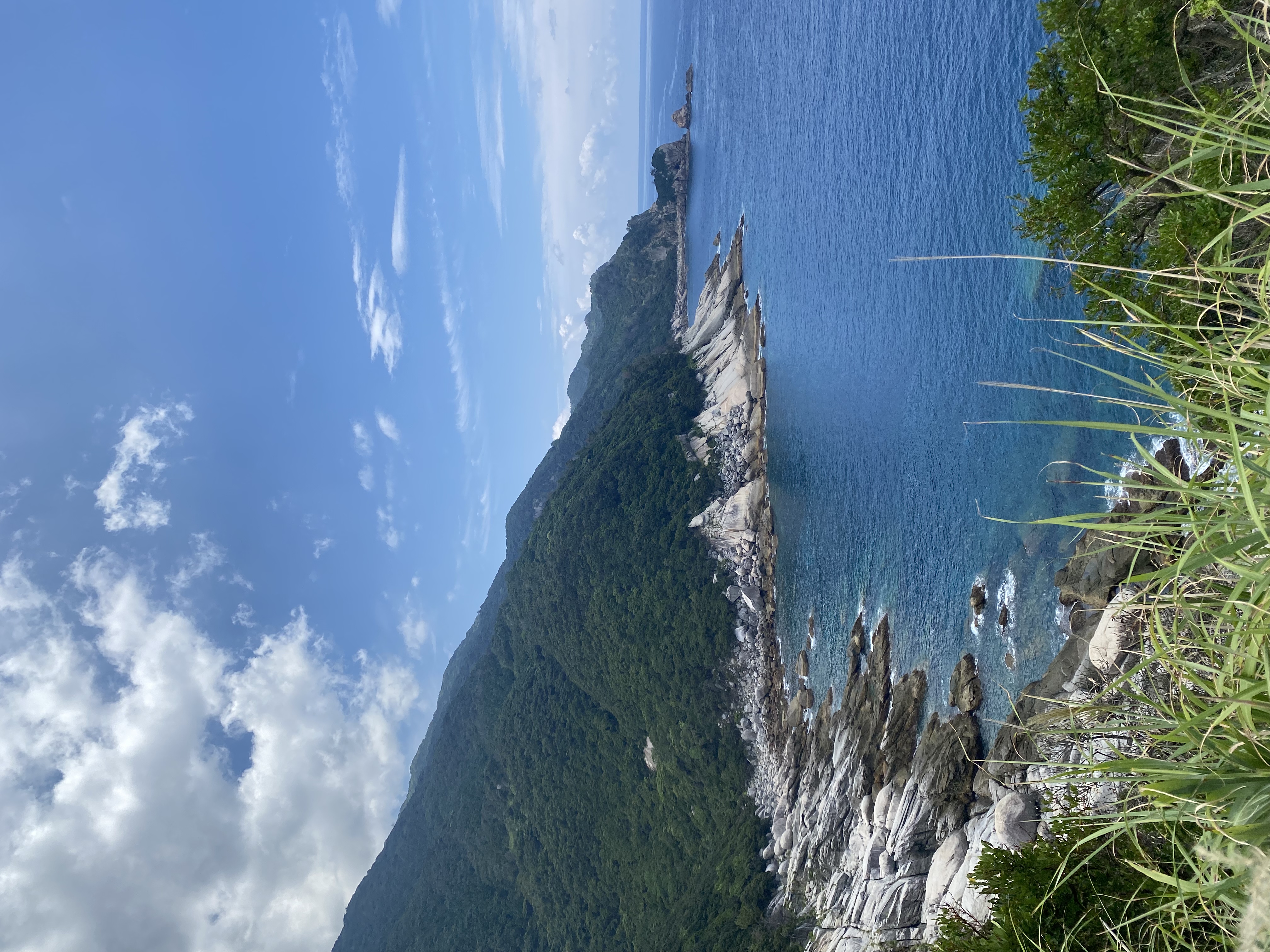
Stop 3 · Seibu Rindo, the UNESCO buffer road
Seibu Rindo (西部林道)
Seibu Rindo — literally “West Forest Road” — is the 12-kilometer single-lane road that connects Kurio with Nagata along the west side of the island. It runs through the only stretch of Yakushima’s lowland coastal forest still intact, and it’s the part of the island designated as a UNESCO World Natural Heritage site.
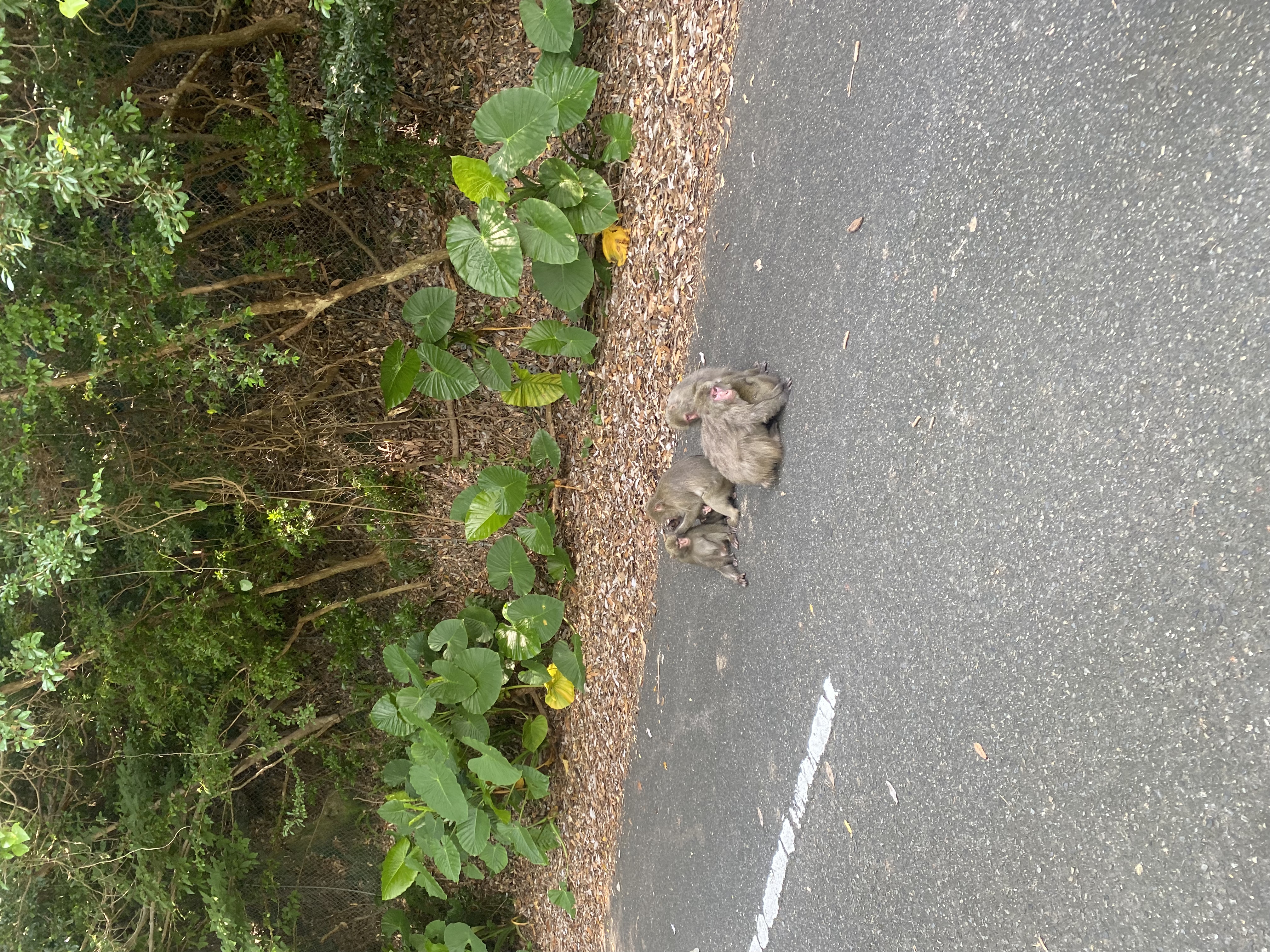
You drive at 30 km/h. There are no shoulders, no places to legally pull off and walk into the forest, no exits. The point of the road is to be in the forest with the wildlife — not to stop and start fragmenting their habitat further. You can stop the car briefly if there are monkeys on the road, but you don’t get out. This rule sounds restrictive until you understand the alternative: hundreds of cars per day, hours of monkey-feeding photos, and a habitat broken in two.
What you will see: yakuzaru (Yakushima macaques, a small endemic subspecies of the Japanese macaque) sitting on the road in family groups; yakushika (Yakushima sika deer, also smaller than the mainland version) crossing in front of you; and a forest canopy so close on both sides that the road feels like a tunnel.
One detail people miss: there’s no cellular signal for most of Seibu Rindo. If you break down, you walk to the next car. Plan accordingly — full tank of fuel, water in the car, and don’t do this drive after sunset.
Stop 4 · Nagata Lighthouse and Inakahama Beach
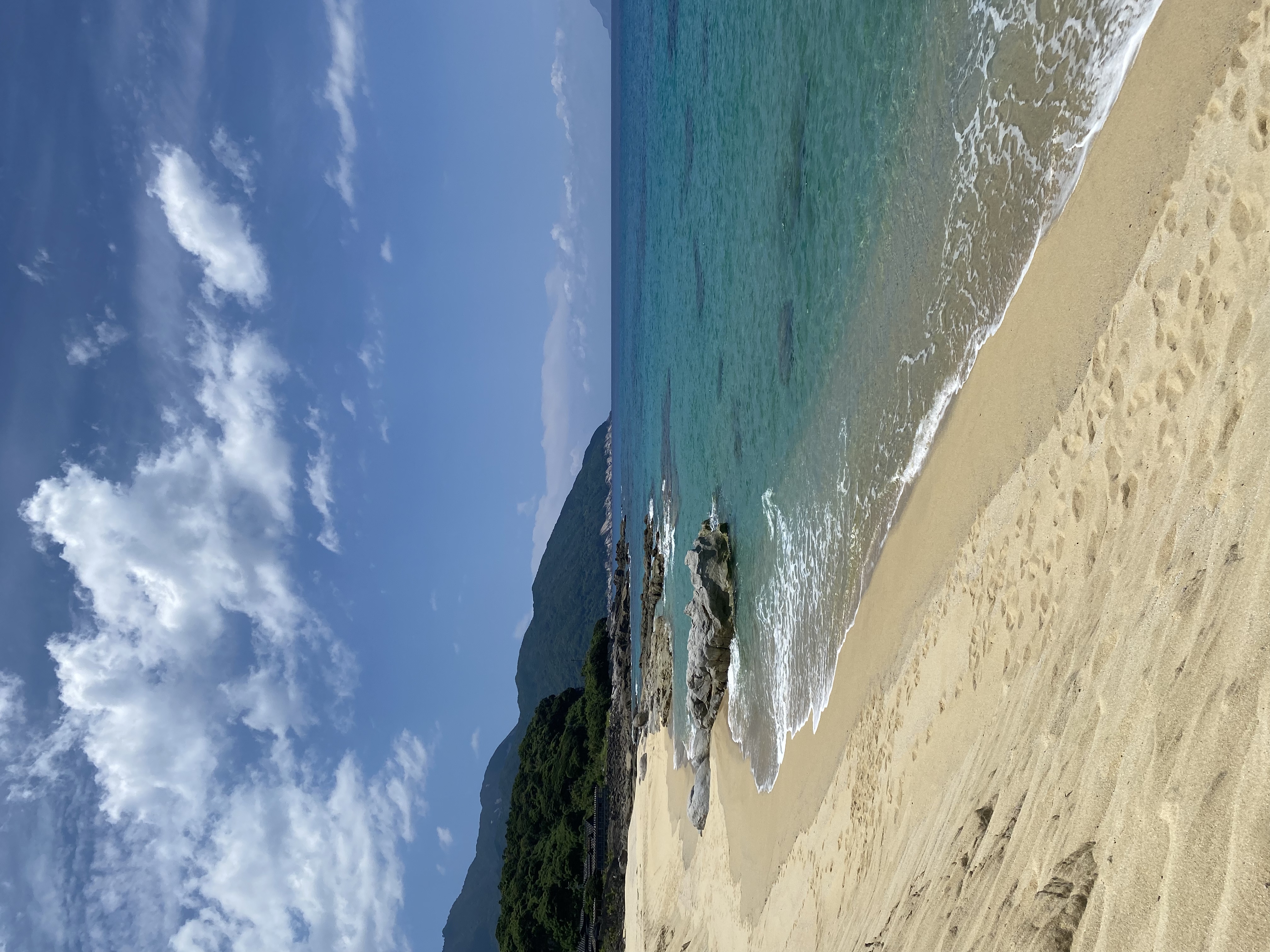
Nagata Lighthouse + Inakahama Beach
Coming out of Seibu Rindo at Nagata feels like emerging into a different island. The forest peels back, the road widens, and you’re suddenly looking at one of the prettiest stretches of beach in southern Japan.
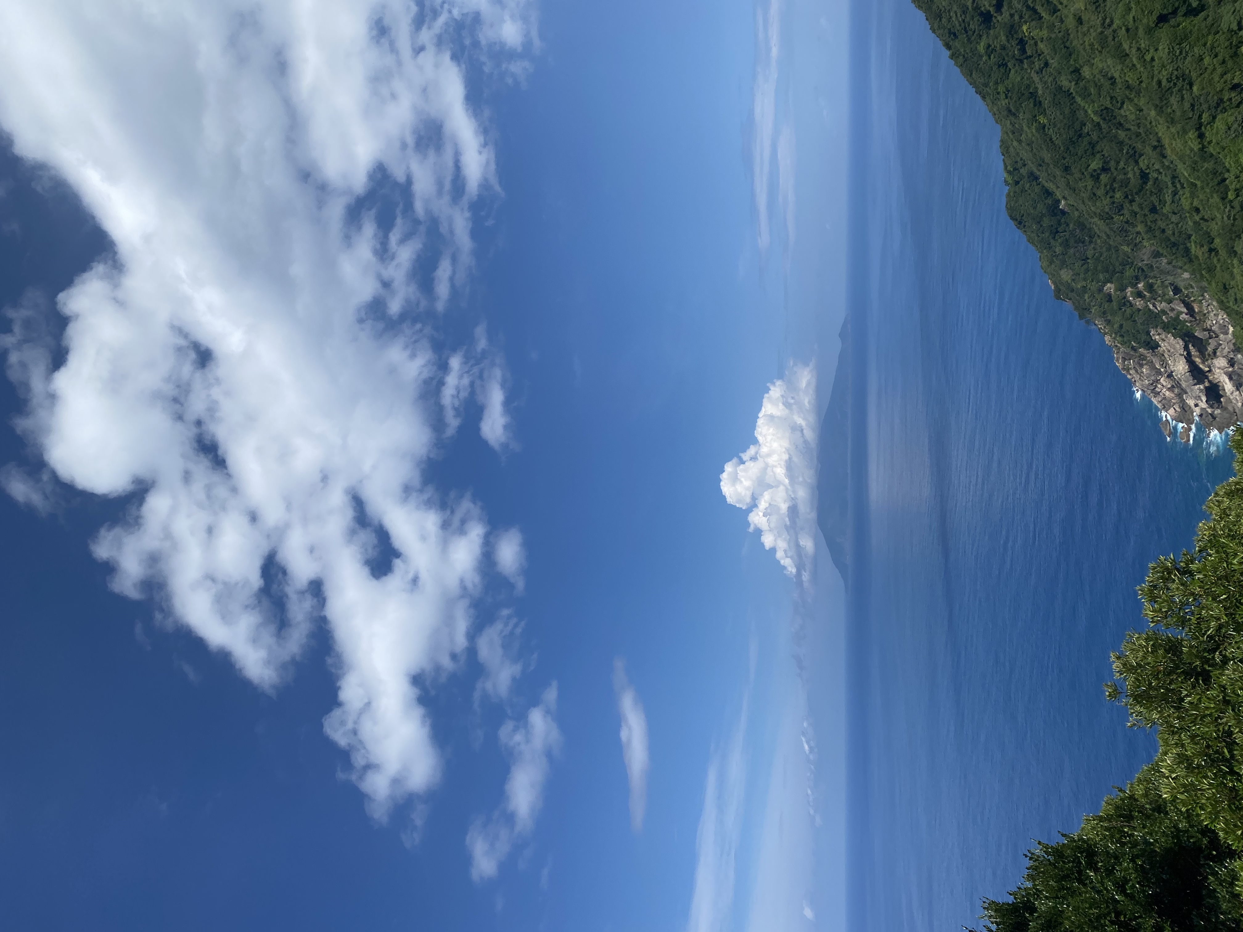
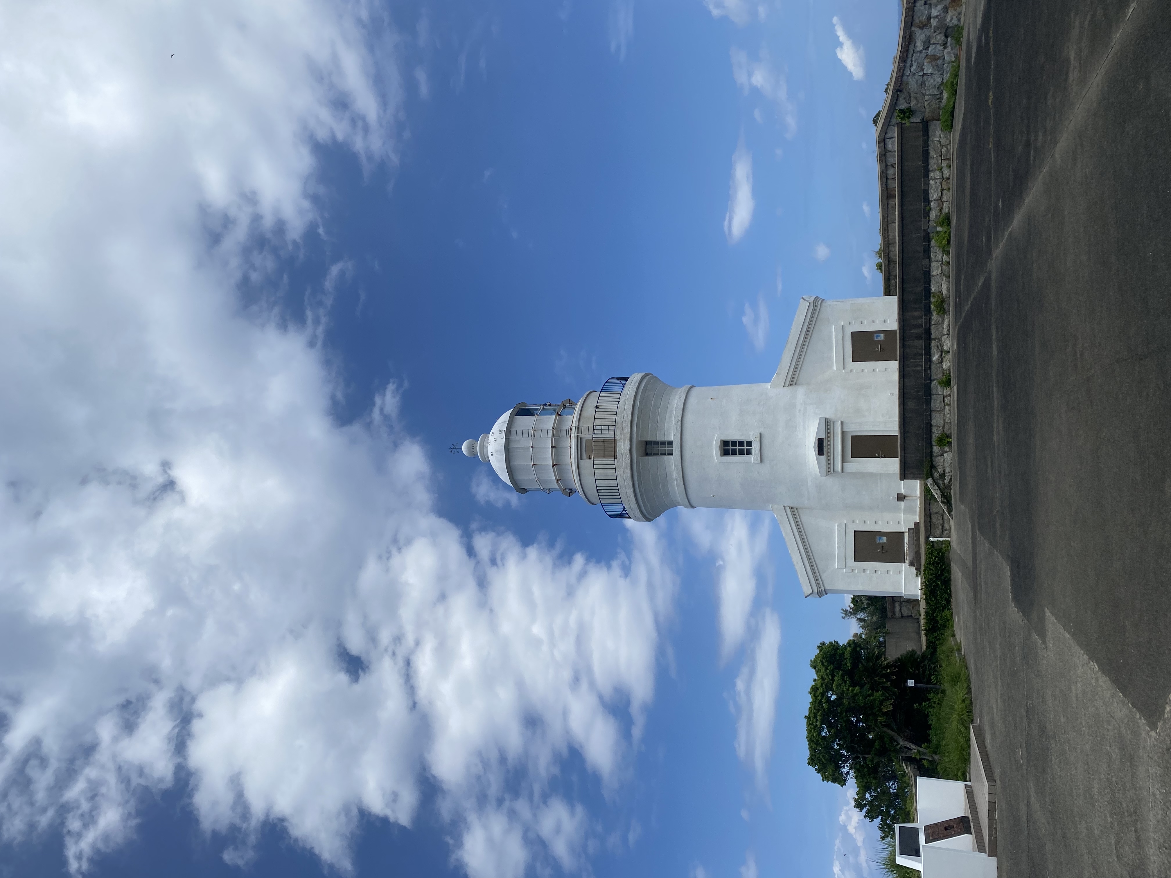
The lighthouse first — Nagata-misaki Toudai, built in 1897, white-painted brick, perched on a cliff with a 270-degree view over the East China Sea. There’s a small parking lot, a 200-meter walk to the lighthouse, and a viewpoint where on a clear day you can see the active volcano on Kuchinoerabu-jima 12 km offshore. It’s a five-minute stop.
Then a few kilometers down the road: Inakahama Beach (永田いなか浜). About 800 meters of fine pale sand, walled by green mountains, with water that turns turquoise in the afternoon sun. It’s the largest sea-turtle nesting site in the northern Pacific — loggerhead turtles come ashore between May and August, in some years more than 6,000 nests in a single season. The beach is open to walk on during the day; from May through August it’s closed at night except via guided turtle-watching tours, run by the local conservation NGO.
The water at Inakahama looks like a Caribbean tourist photo and isn’t. There’s a strong rip current most of the year, no lifeguard, and swimming is officially discouraged outside the marked area near the river mouth. If you’re looking for an actual swim, do that at the smaller Issou-kaisuiyokujou further around the coast.
The full driving order, as I’d do it again
| Time | Where |
|---|---|
| 07:30 | Leave Anbo or Miyanoura. Fill the tank. |
| 09:00 | Arrive at Ohko Falls. 30-minute walk to the base, photos, shaved ice. |
| 10:30 | Drive 25 minutes north to Yokogawa-keikoku. |
| 11:00 | Yokogawa swimming. Bring lunch from Anbo (no shops). |
| 13:00 | Onto Seibu Rindo. 12 km, 45 minutes if monkeys make you stop. |
| 14:00 | Nagata Lighthouse + viewpoint, 30 minutes. |
| 14:45 | Inakahama Beach. Walk, photos, watch the light. |
| 16:00 | Drive back along the north coast (paved, fast) toward Miyanoura. |
| 17:30 | Back in Anbo or your hotel. Hot bath. Beer. |
Reserve in advance, pick up at the airport
The west loop is built around having your own car. The island only has about 250 rentals total — in peak season they’re booked weeks ahead. International driving permit is accepted at all major chains.
Compare Yakushima rental cars →What to bring in the car
- Full tank of fuel (no stations west of Anbo on this loop)
- Bottled water, 1.5 L per person
- Lunch packed in Anbo or Miyanoura (no convenience stores after Kurio)
- Swimwear + microfiber towel + water shoes (Yokogawa or Inakahama)
- Mosquito repellent in summer (Yokogawa is buggy in July-August)
- Offline map (Maps.me or Google Maps offline pack of Yakushima)
- Cash for the parking and shaved-ice shop at Ohko (¥500 + ¥400)
- Light rain shell (the west coast has its own micro-weather)
- Plastic bag for any wet swimwear on the way back
Frequently asked questions
Can I do the west drive plus Jomon Sugi in the same day?
No. Jomon Sugi is a 9–12 hour effort starting at 5 a.m. By the time you’re back at the trailhead at 16:30, the rental return cut-off makes a meaningful drive impossible. Plan one full day for Jomon Sugi and a separate full day for the west loop.
Is Seibu Rindo passable in a small car?
Yes. The road is single-lane but paved end-to-end and clear of obstacles. A kei-class rental (the smallest box-shaped Japanese cars) is actually ideal because the curves are tight. The only hazard is wildlife — drive at 30 km/h, especially in low light.
Can I see baby sea turtles?
Hatchings happen August–September at Inakahama, mostly at night. The local conservation NGO runs guided night tours that follow strict no-flash rules; book ahead through the Yakushima town tourism office. Spotting a hatch on your own without a guide is unreliable and can disturb the nest.
Should I tip the staff at Ohko Falls or the lighthouse?
No. Tipping isn’t a thing in Yakushima or anywhere in Japan. Buy something small at the shaved-ice stand, or buy a tankan orange in season — that goes directly to the family that runs it.
Is the drive too much for non-confident drivers?
Probably not. The roads are well-paved and traffic is light. The single-lane sections have widening pull-offs every 200 meters; etiquette is that the car closer to a pull-off backs up. If you’ve driven any narrow Japanese country road, this is the same. If you’ve only driven highways and city streets, give yourself an extra hour and don’t do it after dark.
Last updated: May 2026 · Visit: August 2024, full west-loop drive on a single afternoon.
All photos by Nobutoshi.
Join 1,000+ travelers discovering Japan's hidden side
Weekly dispatches from off-the-beaten-path Japan — spots and stories you won't find in guidebooks.
No spam. Unsubscribe anytime.
Welcome aboard!
You're in. See you in your inbox soon.