

The bus to the Arakawa Trailhead leaves Anbo at 4:40 in the morning. I’ve been on Yakushima for two days and barely seen the mountain — it’s been wrapped in low cloud since I landed. Today is the day I find out if a 7,200-year-old cedar will let me near it.
This is what the Jomon Sugi trek is — a 22-kilometer, 9-to-12-hour round trip through Japan’s most primeval forest, ending in front of a tree that was already 5,000 years old when the Pyramids were built. It is not a hike. It’s a long, wet, beautiful test of patience that ends in 30 minutes of standing on a small wooden platform looking up.
This guide is what I wish I’d had before I went: 2026 shuttle bus and forest fee numbers (they changed in 2024), an honest hour-by-hour breakdown, what actually goes wrong on the trail, and what to bring. Every photo here is mine, taken on August 30, 2024 over 11 hours on the Arakawa Trail.
Quick Facts · 2026
| Trail | Arakawa Trailhead → Jomon Sugi → return (same trail) |
|---|---|
| Distance | 11 km one way · 22 km round trip |
| Elevation gain | about 700 m |
| Time on the trail | 9-12 hours including the 30-minute viewing platform |
| Difficulty | Long, not technical. The first 8 km are flat boardwalk; the last 3 km are stairs and roots. |
| Best season | April–November (the trailhead is closed to private cars in this window; shuttle bus required) |
| Shuttle bus | ¥2,000 round trip (sold round-trip only) |
| Forest cooperation fund | ¥1,000 day-trip · ¥2,000 if staying in a mountain hut |
| What gets you turned away | No light source, no rain gear, late arrival. Rangers check. |
4 a.m. at Anbo, before the shuttle
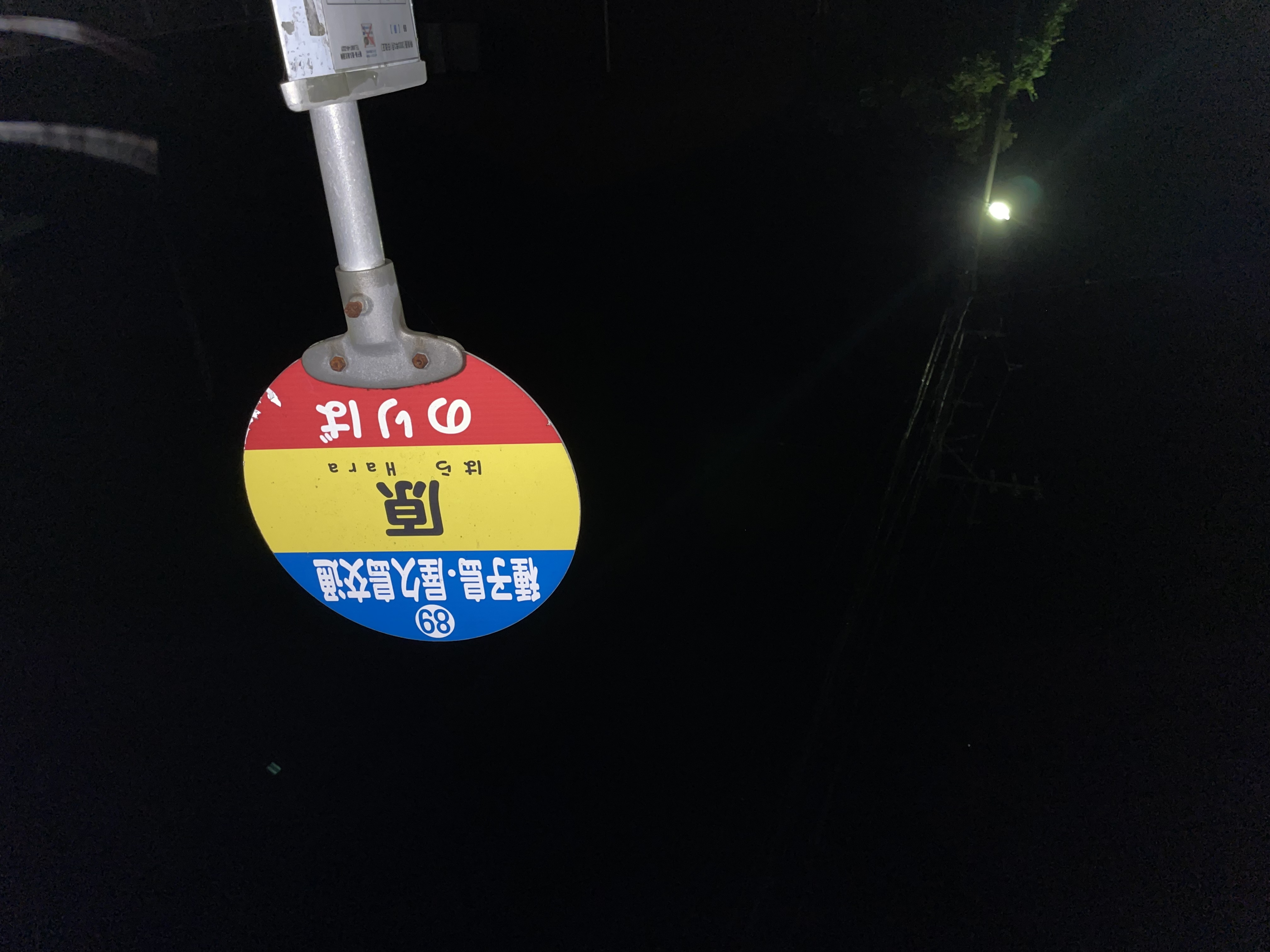
Anbo is one of the two main towns on Yakushima, and it’s where most Jomon Sugi hikers stay. At 4:00 a.m. on a hike day the place is silent except for the cicadas and a single streetlight buzzing over the bus stop sign. The early bus to Yakusugi-shizen-kan (the trailhead shuttle hub) leaves Anbo around 4:40 a.m. and Miyanoura a few minutes earlier. Miss it and your day collapses; the next bus runs more than two hours later and the trail closes its return cut-off at 14:30 regardless.
Most Anbo guesthouses prepare a tozan bento (climbing lunch box) the night before and leave it on a shelf with your name on it. Mine was two large onigiri, a piece of fried chicken, a small thermos of tea, and a salt tablet. You don’t want to be looking for breakfast at this hour.
The trailhead: 2026 fees and how the shuttle works
Private cars cannot drive to the Arakawa Trailhead from March through November. The forest road is too narrow, and trying to manage 200 cars a day on it would destroy the road and the forest. So everyone — locals, hotel guests, tour groups — takes the shuttle bus from Yakusugi-shizen-kan, the trailhead shuttle hub above Anbo.
The shuttle is ¥2,000 round trip (cash, sold round-trip only), and you also pay a ¥1,000 forest cooperation fee for a day-trip. Both are charged at the shuttle hub. You get a small charm in return for the forest fee — mine had a moss pattern stitched into it and I still have it on my pack. The money goes to trail maintenance, ranger salaries, and conservation of the ancient cedars.
If you’re staying overnight in one of the mountain huts (more on that below), the cooperation fee is ¥2,000 instead. There is no entry permit needed beyond paying the fees — just be at the shuttle on time, and have a headlamp and rain gear with you. The rangers do a quick visual check.
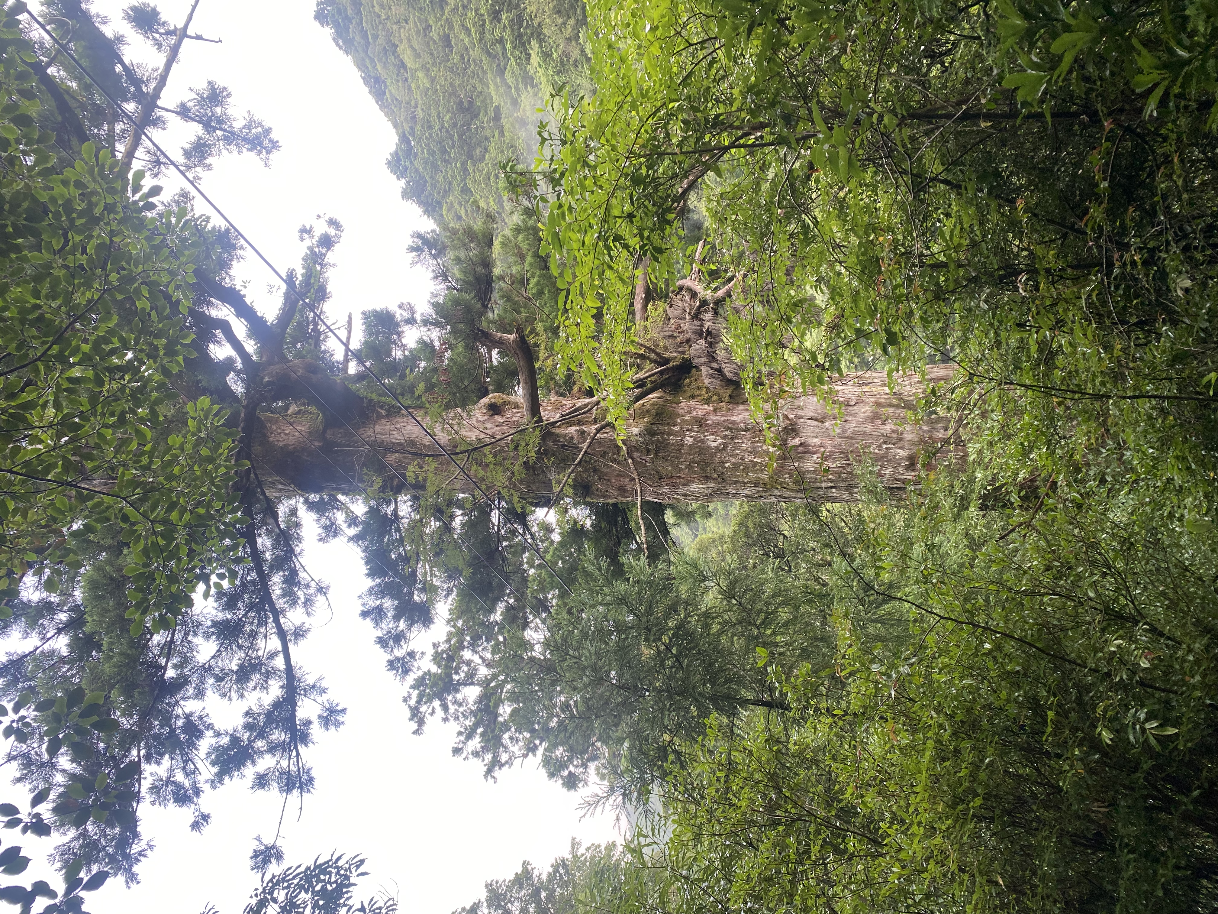
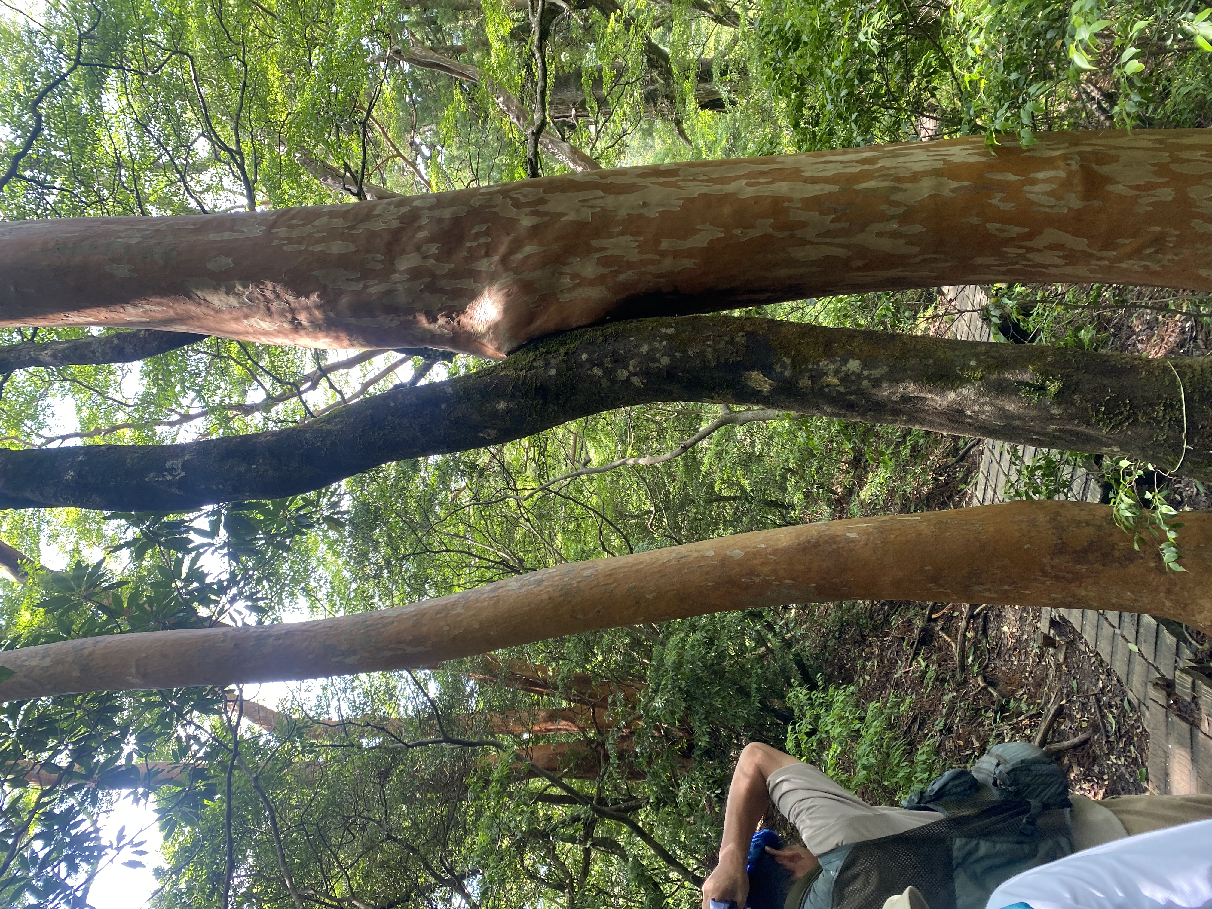
The first two hours: walking on a 100-year-old logging railway
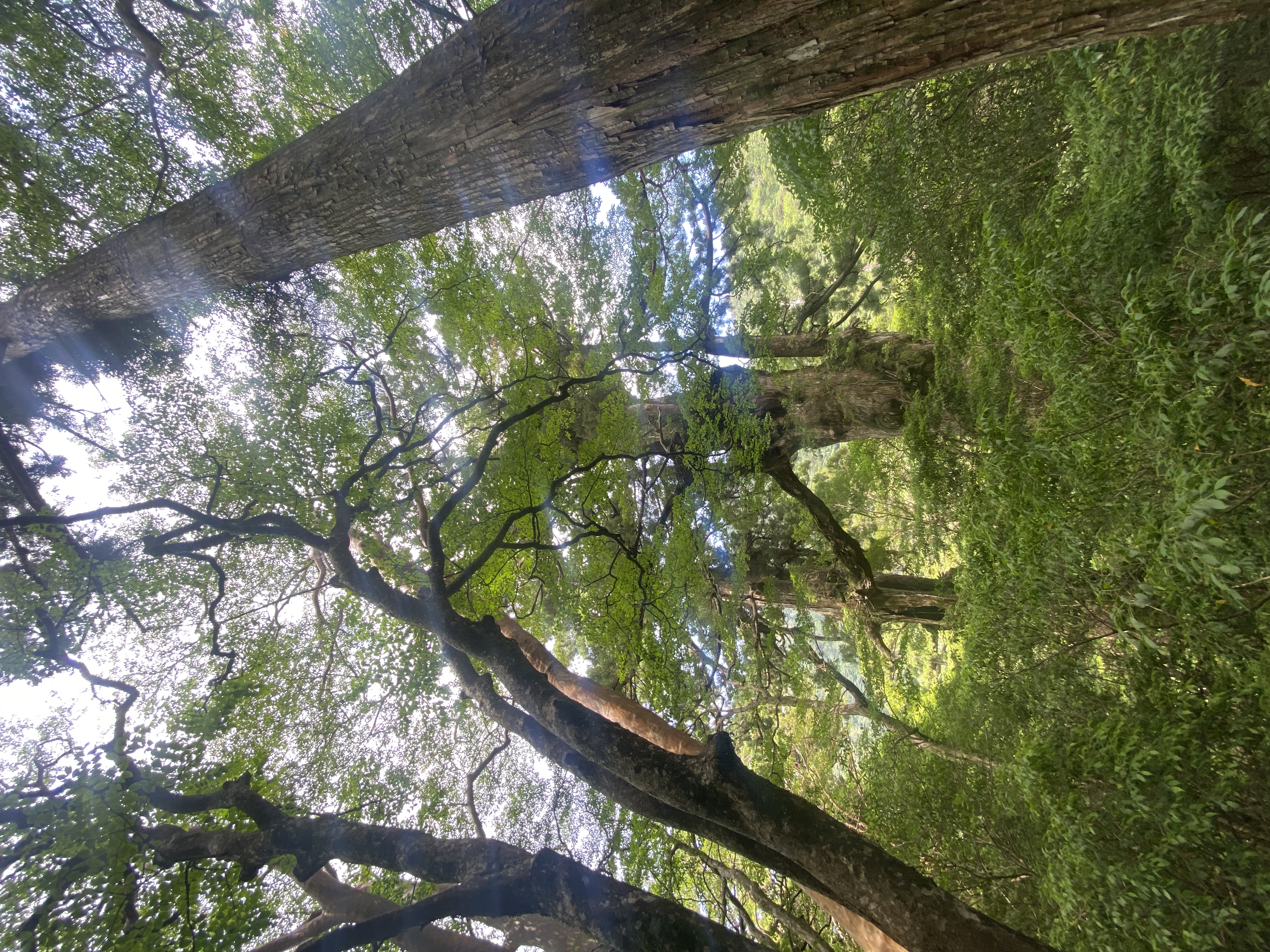
The first 8 kilometers of the Arakawa Trail aren’t a hiking trail at all. They’re a former narrow-gauge logging railway, the Kosugidani-sen, that was used to haul cedar timber out of the mountains until 1967. The rails are gone but the wooden ties are still there, with planks laid between them so you can walk without breaking an ankle. It is, geometrically, the easiest hike I’ve done in Japan: zero elevation change for the first two hours, just steady walking through a corridor of cedar so dense and so wet that the moss covers everything — trunks, fallen logs, even the railway ties under your feet.
This is also where you understand the Yakushima rain. There’s a saying on the island: it rains 35 days out of 30. I started in clear weather; by my second hour it was raining hard enough that I switched to my rain jacket and the trail had become a long, slow stream. The cedar canopy keeps most of it off you in the early sections, which is good, because there is nowhere to shelter and no way to dry out.
Wilson’s Stump: the heart in the forest
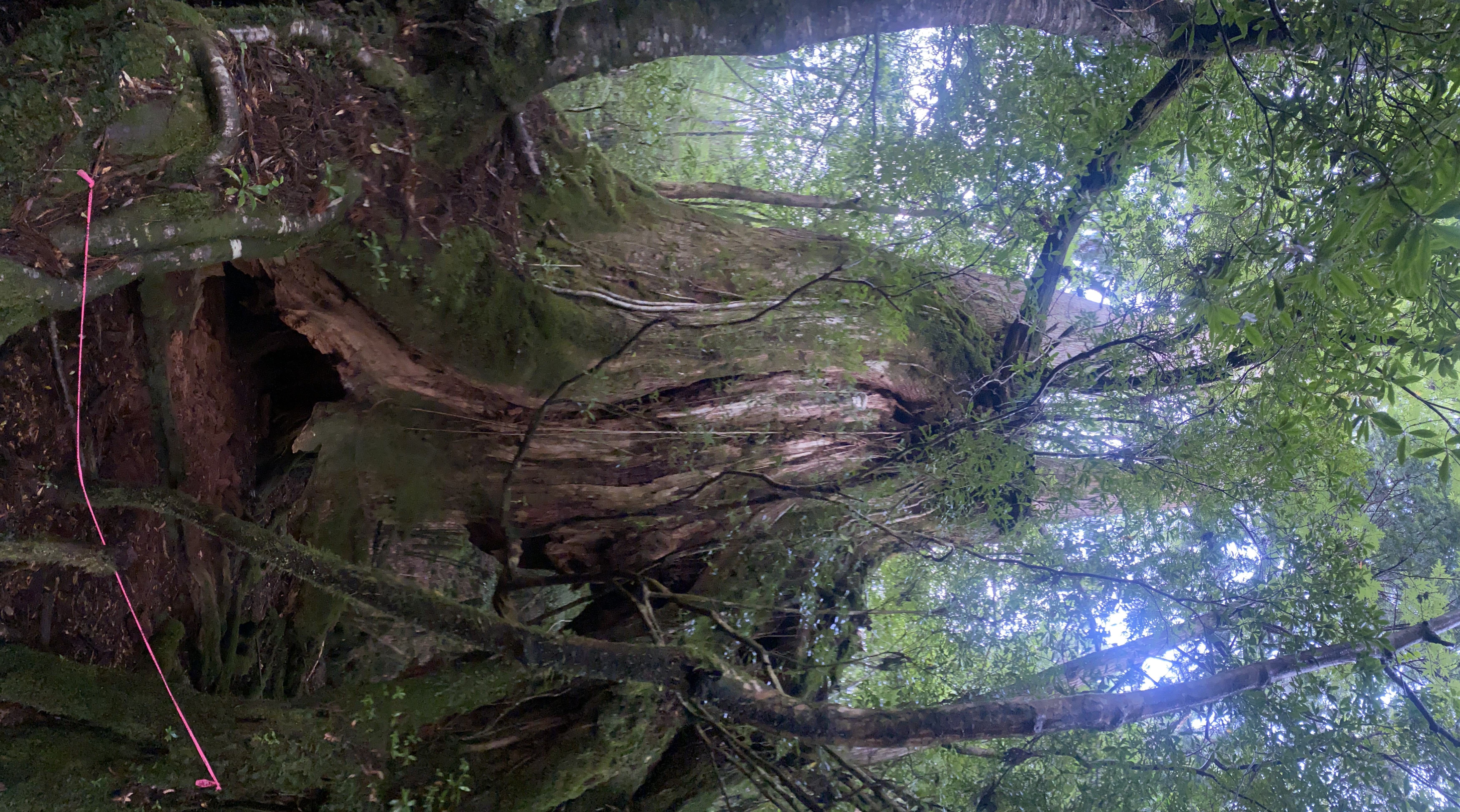
About three hours in, the boardwalk ends and the proper trail begins. The first thing it gives you is Wilson’s Stump — a hollow cedar stump 4.4 meters across, named for the British botanist Ernest Wilson who documented it in 1914. The tree it came from was felled in 1586 to build Hokoji temple in Kyoto, before Sekigahara, before Edo was Edo. What remains is a chamber you can step inside.
The reason everyone stops here is what happens when you stand inside, in the right spot, and look up: the opening becomes a heart. It’s not a coincidence of light or angle — it’s an actual heart-shaped notch in the upper rim of the stump that you can frame perfectly from one position about a meter inside. There’s usually a queue of three or four people waiting for the spot, and a small clearing carved into the moss where countless boots have stood. Worth the queue. Mine was the only photo of the day where the rain stopped for thirty seconds.
Past Wilson’s, the real climb begins
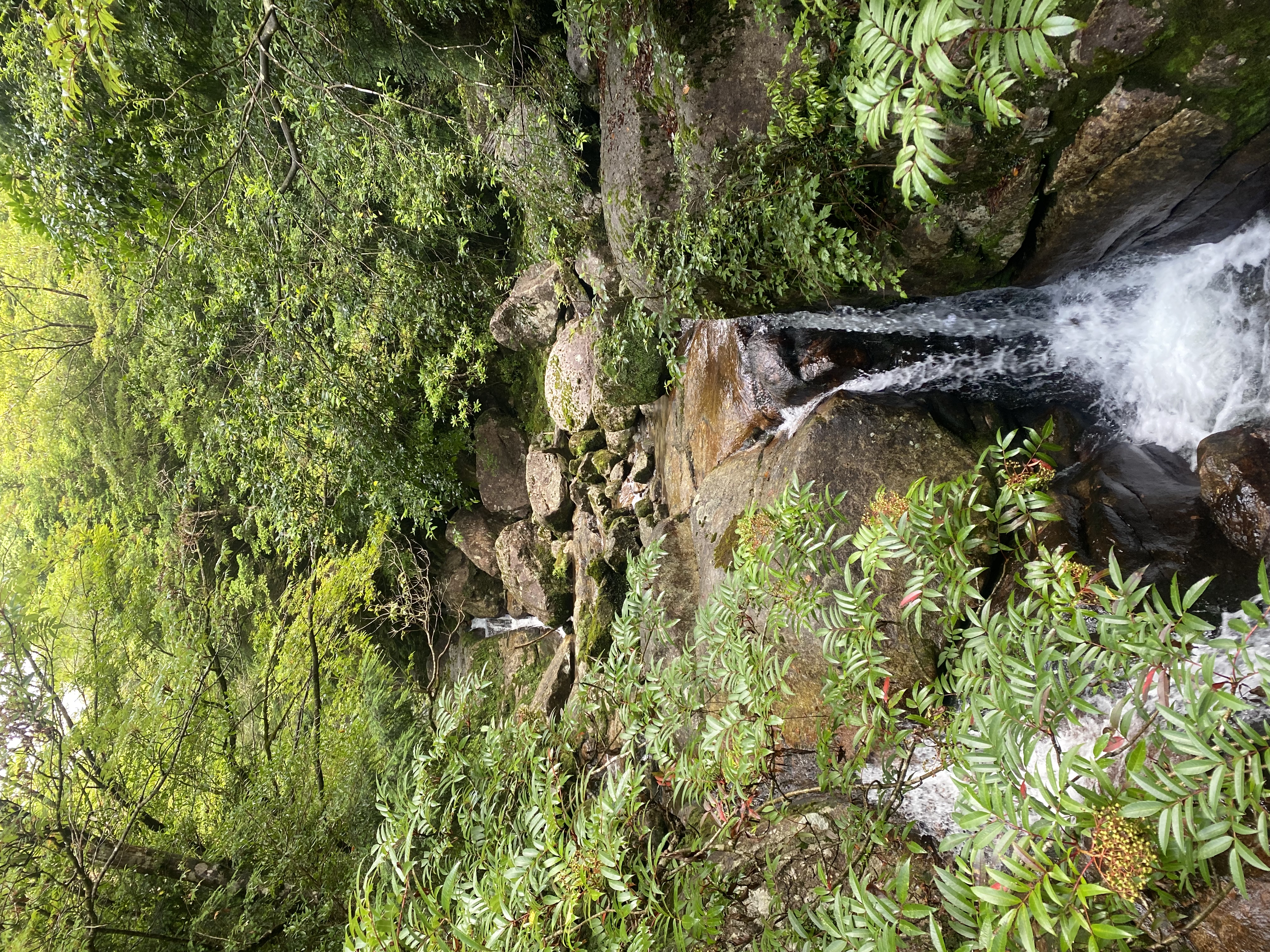
From Wilson’s Stump to Jomon Sugi is roughly three more kilometers, and it is where the trail earns its reputation. The flat boardwalk is gone. What replaces it is a steep stair of mossy roots, granite slabs, and wooden steps slick with rain. There are stretches where you’re using your hands. The stream crossings — six or seven of them, depending on the rain — are over wood-plank bridges that bounce a little under load.
This section is where most people get tired. The kilometer markers feel further apart. Take the small breaks the trail offers: there’s a wide stream around the 9-km mark with flat granite slabs you can sit on, and the cedar avenue just before Daiosugi opens up into a clearing where you can drop your pack and stretch. The water in the streams is drinkable; locals drink it, but most international hikers prefer to filter it.
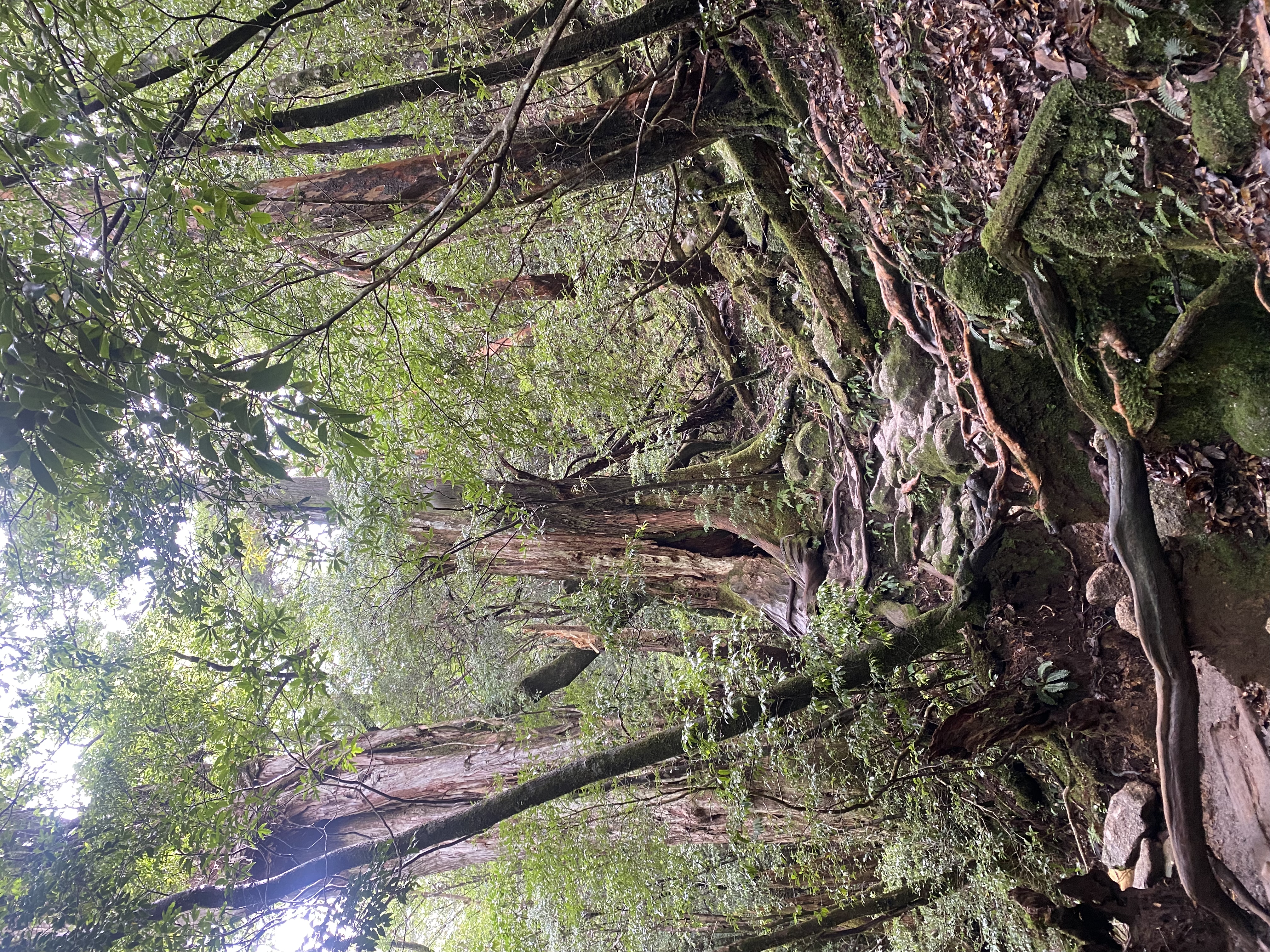
The named cedars: Daiosugi, Meotosugi, and the others
Yakushima’s ancient cedars — trees over 1,000 years old — are called yakusugi, and the most distinctive ones have names. The trail to Jomon Sugi passes several:
- Daiosugi (the Great King Cedar) — 24.7 meters, estimated 3,000 years old, with a trunk so thick the trail visibly bends to go around it.
- Meotosugi (the Husband-and-Wife Cedars) — two cedars whose branches have grown together about ten meters above ground, fused into a single living arch over the trail.
- Kuguri-sugi — a cedar so eroded at the base that the trail goes through the trunk in a kind of natural tunnel.
Each of these has a small wooden sign and a viewing platform; you don’t need to know they’re coming because the trail makes you stop and look up at them whether you’d planned to or not. Daiosugi was the one that broke me. I’d been walking for five hours, my legs were aching, and the tree just sat there, calm, six times my width, with rain dripping off its lowest branch into a moss bowl that probably hasn’t been dry in a hundred years. I sat for ten minutes and didn’t take a photo.
Lunch on a mossy root
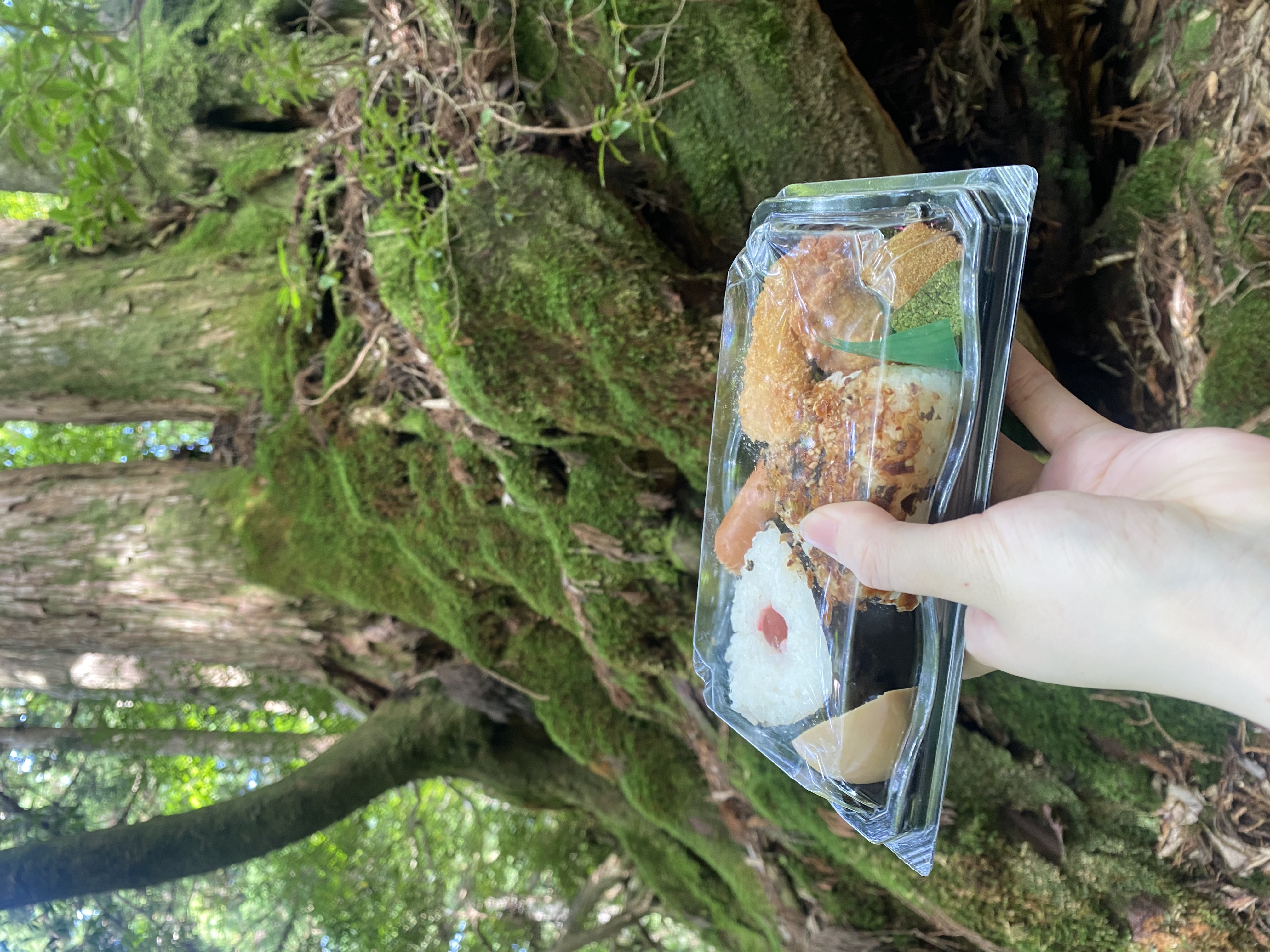
There’s no “rest area’’ on the second half of the trail, just a few wider sections where the moss is thick enough that two people can sit. I ate my onigiri standing up, leaning against a cedar root that was older than every building in Tokyo combined. The nori was a little soggy from condensation in my pack, and the fried chicken was cold. It was the best meal I had on Yakushima.
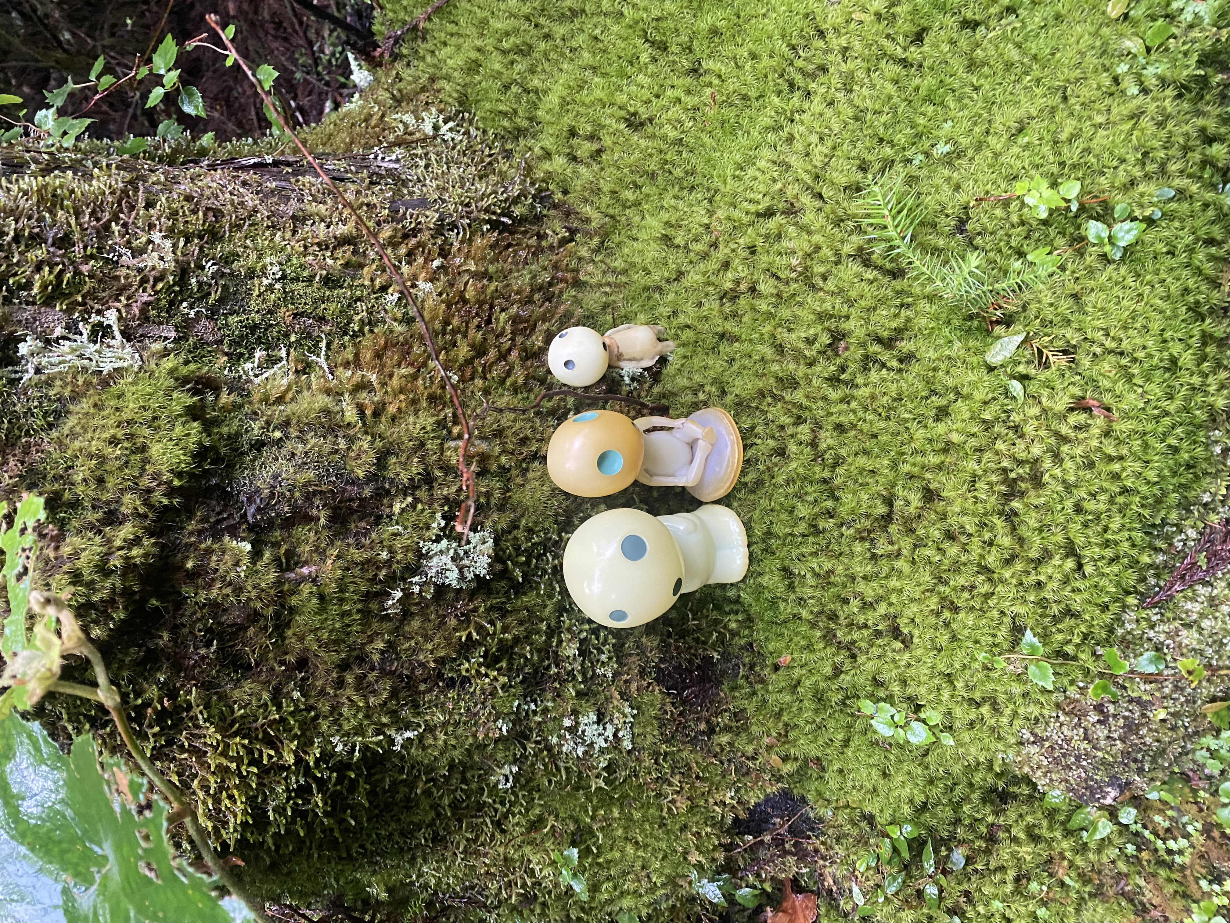
One detail I want to mention because it changed my understanding of the place: I saw three small kodama figurines that someone had set on a moss-covered log just past Daiosugi. Kodama are the white spirits from Princess Mononoke — Studio Ghibli used Yakushima’s forests as the visual reference for the film, and kodama have become a kind of unofficial mascot. Hikers leave them tucked into mossy stumps, in little troops. You’re supposed to take a photo and put them back exactly where you found them. I obeyed.
Standing in front of Jomon Sugi
You don’t see the tree until you’re very close. The trail makes a final tight switchback up wooden steps, the canopy thins to almost nothing, and then you’re on the platform — a curved wooden deck about thirty meters back from the tree, designed to keep human boots off the root system. There is a railing. You stay behind it. Park rangers gently enforce a thirty-minute maximum at peak times.
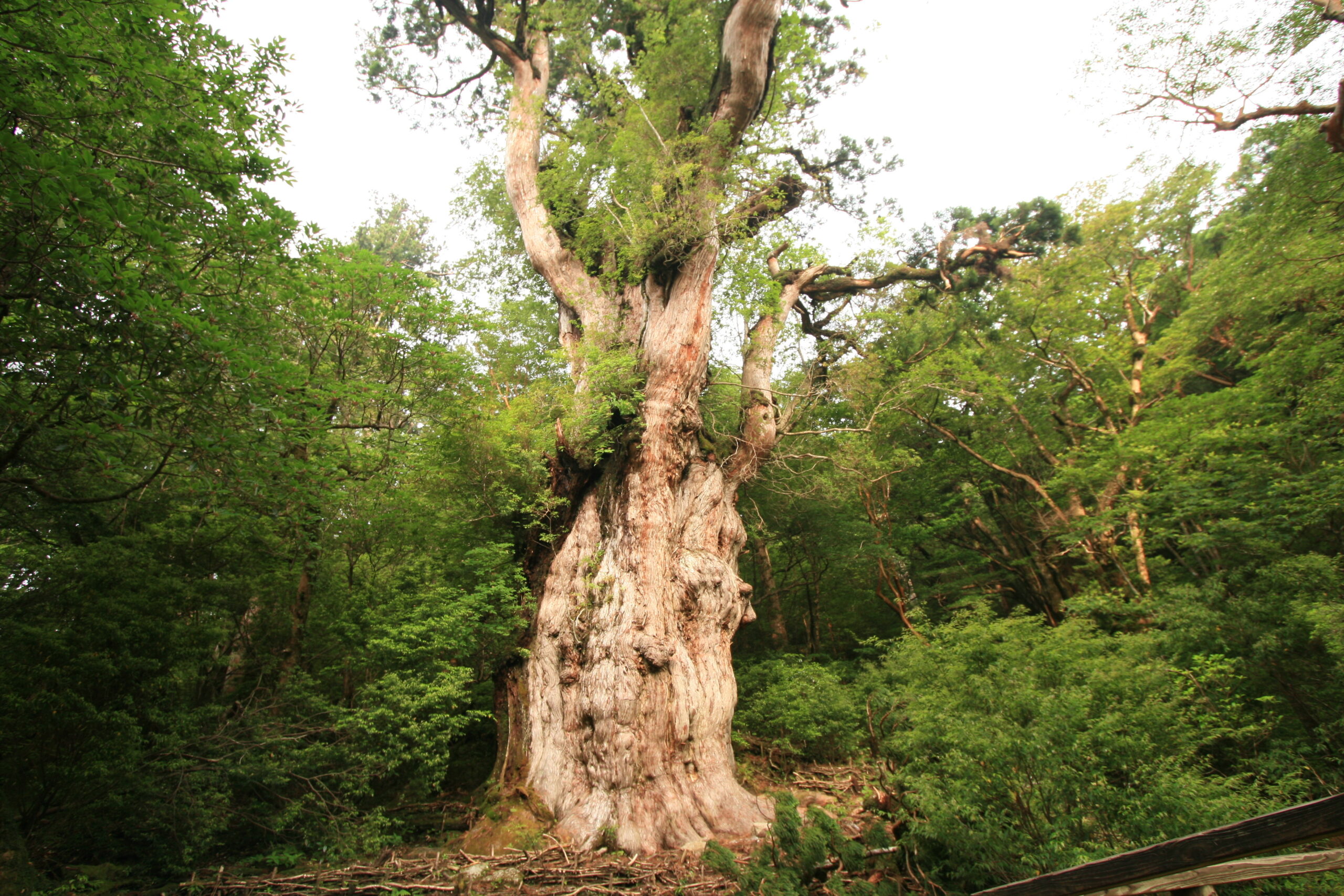
Jomon Sugi is 25.3 meters tall, with a trunk circumference of 16.4 meters and an estimated age between 2,170 and 7,200 years — the wide range comes from the fact that the heartwood is hollow, so radiocarbon dating is approximate. It survived because the bottom of the trunk is twisted into a knot the loggers couldn’t profitably cut, so when the cedar harvests took everything else in this forest in the 1600s, this one was left alone. There’s a moral in there about being lucky in the right way.
The platform was built in 1996 to protect the root zone, after decades of pilgrims walking right up to the trunk had compacted the soil. You can’t touch the tree. You shouldn’t want to. The thirty minutes on the platform are quiet — people whisper or just stand — and then you turn around and walk five hours back the way you came.
The walk back
The walk back is the same trail in reverse, and it is, somehow, harder. The downhill section past Daiosugi punishes your knees in a way the climb didn’t. The boardwalk that felt easy on the way in feels eight kilometers long on the way out. The shuttle bus stops running at 17:30 and you do not want to miss it — there’s no taxi service to the trailhead, and the closest accommodation is six road-kilometers away.
The trick: leave the platform by 12:30 at the latest. If you’re a slow walker, by 12:00. The trail return cut-off (the time after which rangers will turn you back) is 14:30 at Wilson’s Stump, and that’s a marker, not a target. I rolled into Yakusugi-shizen-kan at 16:50 and slept the entire ride down to Anbo.
What to actually pack
This is the gear list I wish I’d been given. Treat the bracketed items as non-negotiable; the rest is comfort.
- [required] Headlamp with fresh batteries — you start in the dark
- [required] Full-coverage rain jacket and rain pants — not a poncho. Yakushima rain is sideways
- [required] Trail shoes with grip — no white sneakers, no canvas. Granite + moss + water = ice
- [required] At least 1.5 L of water (the streams are drinkable but a filter or chlorine tablets help)
- [required] Onigiri or equivalent at least 600 kcal — no shops, no vending machines, nothing for 11 hours
- Wide-brim hat or buff — the rain runs into your eyes inside the canopy
- Quick-dry socks (one pair to wear, one pair to change at Wilson’s)
- Small first-aid kit, blister patches especially
- Trekking poles (optional but very useful on the wet stair section)
- Plastic bag for trash — the trail is leave-no-trace, no bins
- Phone with offline map (mobile signal is spotty past Wilson’s)
What you do not need: full backpacking food, a tent, or a stove. This is a single-day trek, not a backpacking expedition, unless you’re using the mountain hut option below.
The mountain hut overnight option
If you’d rather split the trek over two days, there are three free first-come-first-served mountain huts on the trail beyond Jomon Sugi: Takatsuka-goya, Shintakatsuka-goya, and Ishizuka-goya. They are unstaffed wooden shelters with a roof, a sleeping platform, and a long-drop toilet. No power, no water (you collect from the streams), no reservations, no fee. The forest cooperation fee jumps to ¥2,000 if you’re staying.
The advantage is sunrise from the higher summits (Miyanoura-dake, Yakushima’s tallest peak at 1,936 m, is reachable from these huts). The disadvantage is carrying a sleeping bag, mat, food, stove, and water for two days through wet weather. Most international visitors stick to the day-trip; the hut route is a serious alpine outing.
Anbo or Miyanoura, the night before
The 4 a.m. shuttle leaves Anbo and Miyanoura, so stay in either — not in the inland villages. Anbo is closer (the shuttle hub Yakusugi-shizen-kan is 25 minutes inland from town).
Find Yakushima hotels & ryokan →A sample day plan, hour by hour
| Time | Step |
|---|---|
| 04:00 | Wake, eat, pack the bento your guesthouse left out the night before. |
| 04:40 | Early bus from Anbo to Yakusugi-shizen-kan (35 minutes). |
| 05:30 | Pay shuttle (¥2,000 round trip) + forest fee (¥1,000) at the hub. Catch the shuttle to Arakawa Trailhead. |
| 06:00 | Arrive at Arakawa. Headlamp on, raincoat on, walk. |
| 09:00 | Wilson’s Stump — the heart photo. 15-minute break. |
| 11:30 | Jomon Sugi platform. Stay 30 minutes. |
| 12:00 | Start the descent. Lunch on the move. |
| 14:00 | Past Wilson’s on the way down. The boardwalk feels long. |
| 16:30 | Arakawa Trailhead. Last shuttle leaves around 17:30 — do not miss it. |
| 17:30 | Bus back to Anbo. Hot bath. Sleep. |
Frequently asked questions
Can I do Jomon Sugi as a day trip from Kagoshima?
No. The first ferry from Kagoshima arrives at 09:00, an hour after the trail’s last realistic start time, and the last return ferry leaves Yakushima at 17:00. You need at least one night on Yakushima — two is more comfortable. Stay in Anbo if your priority is the shuttle bus access; stay in Miyanoura if you want the bigger town and slightly cheaper rooms.
Do I need a guide?
Legally no, the trail is well-marked and on a Sunday in summer there are 200 people on it. But a guide is a real upgrade if you have any of these concerns: limited English on the trail, fitness uncertainty, single-day weather windows. Local Yakushima guides typically run ¥10,000–15,000 per person and include rain gear, lunch, and shuttle.
How wet does it actually get?
It will rain. The local saying is “35 days of rain in 30” — and Yakushima receives 4,000–10,000 mm of rain a year, more than three times Tokyo. Your rain jacket and rain pants are not optional. Quick-dry layers underneath, not cotton. Bring a dry shirt for the bus ride home.
What if I can’t finish the full 22 km?
Wilson’s Stump is a respectable turnaround at the 7-km mark — about 3 hours in, 3 hours back. Many international hikers do exactly this version when the weather is bad. You miss Jomon Sugi but you see the boardwalk forest and the heart-shaped stump, which is most of the visual. If you’re past Wilson’s on the climb, the rangers may turn you back if your pace is too slow to make the return cut-off.
Is Jomon Sugi worth the 22 km?
The honest answer: the tree itself is one quiet half-hour at the end of an 11-hour day. The thing that’s actually worth the walk is the eight kilometers of cedar and moss before Wilson’s Stump — it’s some of the most singular forest in Japan, and the only way to be in it is to walk through it. Jomon Sugi is the destination. The forest is the experience.
Last updated: May 2026 · Sources checked: Yakushima World Heritage Conservation Center, Toppy/Rocket schedules via DISCOVER KAGOSHIMA, Japan-Guide.com Yakushima access page, my own notes from August 2024 on the Arakawa Trail.
All photos by Nobutoshi.
Join 1,000+ travelers discovering Japan's hidden side
Weekly dispatches from off-the-beaten-path Japan — spots and stories you won't find in guidebooks.
No spam. Unsubscribe anytime.
Welcome aboard!
You're in. See you in your inbox soon.